From Lescun to Lhers via the Chemin de Petraube

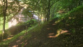
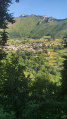
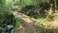
A circular walk to explore the old Lescun to Lhers path. These ancient paths are part of the valley’s history. By walking them, you are helping to preserve our heritage. A route mainly through woodland on the northern slope of the valley: ideal in hot weather.

Details

101033306
Creation:
Last update:
Last review:
  • Walking
    Activity: Walking
  • ↔
    Distance: 4.92 mi
  • ◔
    Average duration: 3h 15 
  • ▲
    Difficulty: Moderate

  • ⚐
    Back to start: Yes
  • ↗
    Ascent: + 1,145 ft
  • ↘
    Descent: - 1,152 ft

  • ▲
    Highest point: 3,415 ft
  • ▼
    Lowest point: 2,651 ft

Description of the walk

Start from the village of Lescun (or the Lauzart campsite).

(S/E) From the War Memorial, head due south along Rue d’Espagne (GR®10). At the very end, turn left onto Route de Lanedert for 50 m.

(1) Turn right onto the D340 and cross the Gave de Lescun via the Pont du Moulin.

(2) Continue left along the D340 until you reach a sharp right-hand bend.

(3) Leave the D340 and carry on straight ahead, due east, along the Chemin de Petraube (Lescun to Lhers).

(4) Join the D340 again – the Route du Col d’Ansabe – and follow it to the left for 300 metres, passing the Ferme du Rachou on your right.

(5) Turn right onto the track and, after 100 m, rejoin the old Chemin de Petraube (Lescun to Lhers) on the left. Cross the Torrent de Labrénère above the EDF water intake, then pass through the beautiful forest opposite the village. You will then reach the edge of the Lhers plateau

(6) Turn right, heading south-west, to climb up this plateau, and reach a junction with the GR®10.

(7) Turn right and follow the GR®10 all the way, then return to the road junction at Pont du Moulin.

(2) Carry on straight ahead. The return journey follows the GR®10 in the opposite direction to the outward route, back to the village (S/E).


Waypoints

  1. S/E : mi 0 - alt. 2,917 ft - Village square
  2. 1 : mi 0.25 - alt. 2,779 ft - Common junction for out-and-back route
  3. 2 : mi 0.59 - alt. 2,651 ft - Pont du Moulin. Common junction for out-and-back route
  4. 3 : mi 0.74 - alt. 2,736 ft - Start of the old path
  5. 4 : mi 1.08 - alt. 2,730 ft - D340
  6. 5 : mi 1.23 - alt. 2,720 ft - Junction. Return to the old path
  7. 6 : mi 2.15 - alt. 3,081 ft - Lhers Plateau
  8. 7 : mi 2.53 - alt. 3,320 ft - GR10 (return to Lescun)
  9. S/E : mi 4.92 - alt. 2,917 ft - Village Square

Notes

The first part of the path may be overgrown with ferns and brambles, particularly in spring: please feel free to bring a pair of secateurs to help with the maintenance.

Always be cautious and plan ahead when you're outdoors. Visorando and the author of this route cannot be held responsible for any accidents occurring on this route.

The GR® and PR® markings are the intellectual property of the Fédération Française de Randonnée Pédestre.

Other walks in the area

For more walks, use our search engine .

The GPS track and description are the property of this route's author. Please do not copy them without permission.