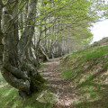
Col de Lagréou circular starting from Terrailh

A short, family-friendly half-day walk. The ascent is in the shade and the descent in the sun amongst the ferns. There is the option (not described here) to extend the walk with a route involving an elevation gain through the Belonce Valley to the huts at Hortassy or Lapassa.

Details

107712938
Creation:
Last update:
Last review:
  • Walking
    Activity: Walking
  • ↔
    Distance: 3.19 mi
  • ◔
    Average duration: 2h 20 
  • ▲
    Difficulty: Moderate

  • ⚐
    Back to start: Yes
  • ↗
    Ascent: + 958 ft
  • ↘
    Descent: - 955 ft

  • ▲
    Highest point: 4,783 ft
  • ▼
    Lowest point: 3,796 ft

Photos

Description of the walk

From Oloron-Sainte-Marie, follow the signs for Spain (Jaca, Col du Somport), pass Fort du Pourtalet, and before the bridge over the Gave d’Aspe, turn right (in fact, go straight on, as the A-road turns left to cross the bridge), towards Aubis. Park at the authorised terminus, at a place called Terrailh (two car parks).

(S/E) With your back to the car park, continue along the track to the left, upstream to the water intake.

(1) Carry on in the same direction along the track.

(2) Turn right before entering the Pyrenees National Park and head uphill through the woods to the Col de Lagréou.

(3) Take another path to the right to descend towards the Aspe Valley, take the hairpin bend to the right along the path, then return to the car park (S/E).

Waypoints

  1. S/E : mi 0 - alt. 3,888 ft - Car park – Terrailh
  2. 1 : mi 0.8 - alt. 3,967 ft - Water intake
  3. 2 : mi 1.05 - alt. 4,098 ft - Junction
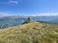
  4. 3 : mi 2.14 - alt. 4,754 ft - Col de Lagréou (1454 m)
  5. S/E : mi 3.19 - alt. 3,865 ft - Car park – Terrailh

Other walks in the area

For more walks, use our search engine .

The GPS track and description are the property of this route's author. Please do not copy them without permission.