Pic d’Ourtasse circular walk

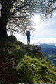
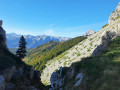
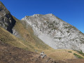
A stunning viewpoint over the Cirque de Lescun, easily accessible apart from the final gully. Suitable for paragliding take-off. Ideal for families as a round trip via the descent route. You can even stop at the plateau below the summit if the final thirty metres daunt you.

Details

n°107725988
Creation:
Last update:
Last review:
–
  • Walking
    Activity: Walking
  • ↔
    Distance: 3.70 mi
  • ◔
    Average duration: 3h 10 
  • ▲
    Difficulty: Difficult

  • ⚐
    Back to start: Yes
  • ↗
    Ascent: + 1,699 ft
  • ↘
    Descent: - 1,696 ft

  • ▲
    Highest point: 4,662 ft
  • ▼
    Lowest point: 2,949 ft

Photos

Description of the walk

From Oloron-Sainte-Marie, head towards Spain via Jaca and the Col du Somport, then towards Lescun; park wherever you can – there are several car parks.

(S/E) Head towards the kiosk, pass a cross and reach a Y-junction.

(1) Turn left and head up to the kiosk, then continue on to reach the Belvédère de l’Ourtasse.

(2) Follow the ridge for the most part, with some steep sections (where you’ll need to use your hands), generally staying on the Anitch side. After the first small hill, descend to the right, then traverse along a well-marked horizontal ledge and descend to the pass. Go round the small rocky outcrop to the right: climb a 2-metre wall and swing over onto the Anitch side. Via a descending traverse, rejoin the ridge and continue to a grassy descent. Cross the now easy slopes on the Lescun side, to the edge of the plateau. Carry on to reach the summit of the Pic d’Ourtasse.

(3) Descend back to the plateau and follow the wide path through the ferns to Maison Coumerilh.

(4) Here you’ll find the GR®10; turn left onto it and continue on to the hamlet of Espiaubot.

(5) Leave the road, keep to the right on the GR® and reach a crossroads with several directions.

(6) Continue along the GR®, following the red and white markings, and you’ll soon reach your chosen car park in Lescun (S/E).

Waypoints

  1. S/E : mi 0 - alt. 2,963 ft - Lescun car park - Gave de Lescun (cours d'eau) - Affluent du Gave d'Aspe
  2. 1 : mi 0.22 - alt. 3,022 ft - Kiosque crossroads
  3. 2 : mi 0.87 - alt. 3,999 ft - Ourtasse viewpoint
  4. 3 : mi 1.43 - alt. 4,409 ft - Pic d’Ourtasse
  5. 4 : mi 2.38 - alt. 3,924 ft - Coumerilh Farm
  6. 5 : mi 2.86 - alt. 3,537 ft - Espiaubot
  7. 6 : mi 3.39 - alt. 3,120 ft - Crossroads with several directions
  8. S/E : mi 3.7 - alt. 2,966 ft - Lescun car park

Worth a visit

Always be cautious and plan ahead when you're outdoors. Visorando and the author of this route cannot be held responsible for any accidents occurring on this route.

The GR® and PR® markings are the intellectual property of the Fédération Française de Randonnée Pédestre.

Other walks in the area

For more walks, use our search engine .

The GPS track and description are the property of this route's author. Please do not copy them without permission.