Country:

 City:
City:


It is recommended to park just above the Estaëns power station (access from Les Forges d’Abel), at the end of the tarmac road. It is also possible to park one hairpin bend further up, before the barrier.
Please drive very slowly so as not to disturb walkers and to prevent your vehicle from hitting the protruding rocks on the road.
(S/E) The starting point is marked at the barrier. Walk back down a little and take the path that branches off at the hairpin bend in the track, running alongside the Torrent d’Estaëns and a beautiful waterfall. A sign indicates that this path leads to the Arlet refuge; you will come across similar signs further on.
This path climbs through the woodland, zigzagging slightly, always close to the stream, then emerges from the forest into a pasture.
(1) As you emerge from the forest, leave the main path (temporarily) and immediately turn right onto a track that climbs straight up through the pasture (a grassy slope, heading west).
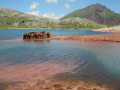
It’s easy to spot because the ground is a distinct red colour, which contrasts sharply with the green of the meadow!
An easier alternative: you can continue along the main path, which leads on towards the Espélunguère hut, until you reach a signpost marking a fork in the path labelled ‘Refuge d’Arlet’. From there, head up the slope and rejoin the same dirt track, which winds its way up the slope via four hairpin bends and takes you back into the woodland, considerably higher up.
(2) When you reach a forest track, cross it and continue along the same path, still climbing straight up. The path runs alongside the previous track twice more near its hairpin bends; carry on climbing along the path.
(3) You’ll finally reach the track (cairn) which leads into the woodland, then becomes a (good) mule track, climbing at a sometimes steep but always manageable gradient.
(4) You’ll eventually reach the 1611-metre mark, on a very distinct ridge which already offers a fine view. Shortly afterwards, you’ll come to a dirt track; take it to the left. Follow the track towards the bottom of the valley, then take the track branching off to the left (uphill) without crossing the Couecq stream. The dirt track winds its way uphill, very gradually, towards the Cabane de Caillabère.
(5) From this hut, you’ll need to look out for the path (marked by cairns) which climbs towards the Col de Couecq, keeping to the right-hand side (as you climb), but not too high up. There is another route further down the valley, but with fewer views.
(6) Reach the Col de Couecq, the border between Spain and France. From the pass, head due south up a slope (a path marked with cairns) leading to an area of small lakes; simply follow the lakes before veering south-west towards the 2,125-metre-high pass, which separates the ridge from a large rocky outcrop.
(7) This pass offers a good view and marks the start of an easy ridge walk (heading east), unless accumulated snow has formed a cornice.
(8) You will then reach a point five metres from the summit, which consists of a few red sandstone boulders that are fairly easy to climb. As an alternative to this short climb, you can walk about ten metres along an easy rocky ledge to the right (south-facing slope), leading directly onto the east face of the peak, just below the summit. Those who are very prone to vertigo should stop at the end of the grassy ridge.
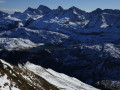
(9) The summit offers a magnificent view over the entire upper Aspe valley, the pyramidal summit of the Pic du Midi d’Ossau, the Somport, the Aspe mountains (Pic d’Aspe or Pic de la Garganta and neighbouring peaks), the Bisaurin, etc. Head back the way you came.
(8) At one point on the ridge, it appears possible to descend off-trail down the grassy south face, which has a moderate gradient. This initial descent leads to a flat area at the end of a secondary east-west-facing ridge. Continue descending due south, then gradually veer to the left (south-east), zigzagging to avoid a few steep sections. Pine trees appear here and there, often at the edge of the terraces. The descent continues in this way, moving from one terrace to the next without changing the general direction too much (see the route on the map).
(10) Join the main path linking the Aspe Valley and the Hecho Valley at the pass, just before the Pas de l’Escalé (around 1,630 m), the point where you re-enter France. All that remains is to follow this path down to the Cabanes d’Espelunguère, below which you’ll rejoin the route you took on the way up.
(2) Head back along the path you took on the way up, on the right – a handy shortcut; following the road would be possible, or even necessary, if your knees are tired. Continue to the (S/E).



 Visorando Member
 Moderate