


Refine your search for walks in Charancieu
Charancieu walks


 On the heights of Les Abrets
 Visorando Member
 9.70 mi
 +1,024 ft
 -1,020 ft
 5h 20
5h 20
 Moderate
 Departure from Charancieu (Isère)
A very pleasant walk, with no difficulties. Throughout the route, there are lovely views of the Chartreuse, the Bugey and the Vercors. Not too many tarmac roads, and mostly very pleasant paths.
Les Trois Chênes
 1.57 mi
+95 ft
-95 ft
0h 55
1.57 mi
+95 ft
-95 ft
0h 55
 Easy
Departure from Paladru (Isère)
Easy
Departure from Paladru (Isère)
Family walk along the edge of the woods and through the fields above Lake Paladru.
Circular around the Vivier Pond starting from Saint-Ondras
 7.65 mi
+774 ft
-758 ft
4h 10
Moderate
Departure from Saint-Ondras (Isère)
7.65 mi
+774 ft
-758 ft
4h 10
Moderate
Departure from Saint-Ondras (Isère)
This route alternates between paths and small roads, winding along the ridges and offering views of the Bourbre valley, the Dauphiné, and the Chartreuse and Vercors mountains.
Between Pressins and Saint-Jean-d'Avelanne
6.54 mi
+650 ft
-650 ft
3h 35
Moderate
Departure from Pressins (Isère)
This route first winds through woods and hillsides, then returns via the 'flat' part, avoiding tarmac roads where possible.
Tour of the pheasant aviaries in Saint-André-le-Gaz
 3.50 mi
+98 ft
-108 ft
1h 40
Easy
Departure from Saint-André-le-Gaz (Isère)
3.50 mi
+98 ft
-108 ft
1h 40
Easy
Departure from Saint-André-le-Gaz (Isère)
This is an easy family hike, accessible to all, in a varied setting where you can discover pheasant aviaries and landscapes near Saint-André-le Gaz.
Notre-Dame des Vignes, Lake Paladru and the Chapel of the Three Crosses
 9.32 mi
+1,191 ft
-1,175 ft
5h 20
Moderate
Departure from Valencogne (Isère)
9.32 mi
+1,191 ft
-1,175 ft
5h 20
Moderate
Departure from Valencogne (Isère)
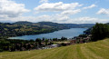
This is a pleasant walk with varied scenery. You will pass Notre-Dame des Vignes in Valencogne, Lake Paladru in Paladru and, on the heights, the charming Chapelle des Trois Croix in the Dauphinois style. There are no difficulties to be expected, apart from the distance. Halfway through the walk, if the weather is clear, you will have beautiful views of the mountains.
Circular route around Saint-Ondras
 10.01 mi
+820 ft
-840 ft
5h 20
Moderate
Departure from Saint-André-le-Gaz (Isère)
10.01 mi
+820 ft
-840 ft
5h 20
Moderate
Departure from Saint-André-le-Gaz (Isère)
A lovely walk with beautiful views of the Jura, the Bauges and Mont du Chat.
On the heights of Saint-Didier-de-la-Tour
 8.10 mi
+594 ft
-574 ft
4h 15
Moderate
Departure from Saint-André-le-Gaz (Isère)
8.10 mi
+594 ft
-574 ft
4h 15
Moderate
Departure from Saint-André-le-Gaz (Isère)
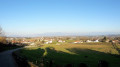
A pleasant little walk with some lovely views of the Chartreuse Mountains.
The Ravin des Gabelles
 10.62 mi
+755 ft
-768 ft
5h 30
Moderate
Departure from Saint-André-le-Gaz (Isère)
10.62 mi
+755 ft
-768 ft
5h 30
Moderate
Departure from Saint-André-le-Gaz (Isère)
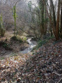
A lovely, easy hike.Varied paths, with a little road but no heavy traffic.
The ponds around Saint-André-le-Gaz
 6.81 mi
+351 ft
-371 ft
3h 25
Moderate
Departure from Saint-André-le-Gaz (Isère)
6.81 mi
+351 ft
-371 ft
3h 25
Moderate
Departure from Saint-André-le-Gaz (Isère)
Starting from Saint-André-le-Gaz station, this is an easy hike that winds its way around several ponds in the surrounding area.
The Servelongue tour
 4.63 mi
+768 ft
-755 ft
2h 50
Easy
Departure from Saint-Sulpice-des-Rivoires (Isère)
4.63 mi
+768 ft
-755 ft
2h 50
Easy
Departure from Saint-Sulpice-des-Rivoires (Isère)
This is an easy walk that still offers some beautiful views.
Circular route around Saint-Geoire-en-Valdaine
 4.67 mi
+686 ft
-656 ft
2h 45
Easy
Departure from Saint-Sulpice-des-Rivoires (Isère)
4.67 mi
+686 ft
-656 ft
2h 45
Easy
Departure from Saint-Sulpice-des-Rivoires (Isère)
A lovely little hike with beautiful, unobstructed views of the Chartreuse, Mont du Chat and Les Bauges.
On the hills above Bilieu and Montferrat
 6.82 mi
+840 ft
-840 ft
3h 50
Moderate
Departure from Bilieu (Isère)
6.82 mi
+840 ft
-840 ft
3h 50
Moderate
Departure from Bilieu (Isère)
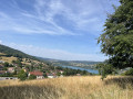
This walk offers a route starting from Bilieu town hall, taking in the village and La Véronnière (Montferrat). It is not at all difficult and offers a variety of landscapes (views of Lake Paladru as well as some of the Chartreuse massifs: La Grande Sure and Le Grand Som) and terrain (mainly forest paths, a walk through the Marais de la Véronnière, but also, unfortunately, a bit of tarmac).
Circular of the Hauts de Saint-Genix-sur-Guiers
 8.79 mi
+1,119 ft
-1,089 ft
5h 00
Moderate
Departure from Saint-Genix-sur-Guiers (Savoie)
8.79 mi
+1,119 ft
-1,089 ft
5h 00
Moderate
Departure from Saint-Genix-sur-Guiers (Savoie)
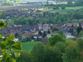
This walk allows you to discover the village of Saint-Genix and climb to its heights to cross a rural area offering beautiful views of the Chartreuse, then follow a section of the Way of St James leading back to the village after crossing a forest.
Around Bilieu
4.74 mi
+810 ft
-810 ft
2h 55
Easy
Departure from Bilieu (Isère)
An easy hike around the village of Bilieu with lovely views of Lake Paladru and the surrounding countryside.
Tour of the two castles in Virieu
 7.76 mi
+1,125 ft
-1,099 ft
4h 35
Moderate
Departure from Virieu (Isère)
7.76 mi
+1,125 ft
-1,099 ft
4h 35
Moderate
Departure from Virieu (Isère)
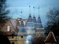
This walk allows you to discover the castles of Pupetière and Virieu. You first walk along the Bourbre valley on the hillside, then through the forest, passing the Croix du Moine Mort, and finally return to the hill towards Virieu.
The Grange Dimière loop
 6.03 mi
+413 ft
-387 ft
3h 10
Moderate
Departure from Le Pin (Isère) (Isère)
6.03 mi
+413 ft
-387 ft
3h 10
Moderate
Departure from Le Pin (Isère) (Isère)
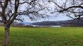
An easy walk around Lake Paladru, allowing you to discover some fascinating Carthusian buildings. The Grange Dimière is a listed building and, higher up, the former Carthusian monastery, which is now privately owned and not open to visitors.
The Via Gebennensis and Lake Paladru
 7.23 mi
+656 ft
-650 ft
3h 55
Moderate
Departure from Le Pin (Isère) (Isère)
7.23 mi
+656 ft
-650 ft
3h 55
Moderate
Departure from Le Pin (Isère) (Isère)
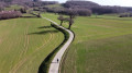
A magnificent circular route that follows theGR®65, better known as the Way of St James, on the way there and the paths above Lake Paladru on the way back.
Paladru Lake Villages Circular Tour
 5.83 mi
+810 ft
-807 ft
3h 25
Moderate
Departure from Le Pin (Isère) (Isère)
5.83 mi
+810 ft
-807 ft
3h 25
Moderate
Departure from Le Pin (Isère) (Isère)
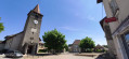
A walk starting from the village of Le Pin, now part of the commune of Villages du Lac de Paladru, passing through the hamlets of La Montagne and Brézin. Country lanes, forest tracks, woods and undergrowth. Views of the Chartreuse and the Vercors in the distance.
Circular walk through the woods around the Sylve Bénite at Le Pin
 6.53 mi
+883 ft
-879 ft
3h 45
Moderate
Departure from Le Pin (Isère) (Isère)
6.53 mi
+883 ft
-879 ft
3h 45
Moderate
Departure from Le Pin (Isère) (Isère)
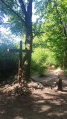
A circular route mainly through woods and undergrowth, passing a number of historic and religious buildings: Sylve Bénite (a Carthusian monk), the Croix de Moine Mort and the Croix d’Homnézy. Views of Lake Paladru and Mont Blanc (on a clear day).
Circular route around Le Pin and its surroundings via Chubins and Charpenne
 8.03 mi
+548 ft
-548 ft
4h 10
Moderate
Departure from Le Pin (Isère) (Isère)
8.03 mi
+548 ft
-548 ft
4h 10
Moderate
Departure from Le Pin (Isère) (Isère)
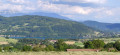
A countryside walk starting from Le Pin, a village within the “Villages de Lac de Paladru” municipality. Passing through Les Marais, Chubins and Charpenne. A easy route along wide farm tracks and a few small tarmac roads.
Avressieux Marshes Route
 3.11 mi
+167 ft
-144 ft
1h 35
Easy
Departure from Avressieux (Savoie)
3.11 mi
+167 ft
-144 ft
1h 35
Easy
Departure from Avressieux (Savoie)
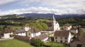
The Avressieux Marshes: an easy route to discover peace and nature along the water’s edge.
Around the Carabotin woods
 5.46 mi
+932 ft
-928 ft
3h 20
Easy
Departure from Merlas (Isère)
5.46 mi
+932 ft
-928 ft
3h 20
Easy
Departure from Merlas (Isère)
A pleasant, easy walk that alternates between spruce forest and open stretches with views of the Dauphiné hills or the Chartreuse mountains.
Around Saint-Sixte
 8.00 mi
+1,552 ft
-1,588 ft
5h 00
Moderate
Departure from Merlas (Isère)
8.00 mi
+1,552 ft
-1,588 ft
5h 00
Moderate
Departure from Merlas (Isère)
A lovely country walk around the hamlet of Saint-Sixte. This circular route offers beautiful views of the lake of the same name and the Étang des Chartreux.
Charavines circuit via the Croix des Cochettes
 5.54 mi
+1,148 ft
-1,171 ft
3h 35
Moderate
Departure from Charavines (Isère)
5.54 mi
+1,148 ft
-1,171 ft
3h 35
Moderate
Departure from Charavines (Isère)
It was a pleasant walk, mostly through the woods, looking for chestnuts in season. However, the return journey involved a fairly long stretch of tarmac road.
Tour of Lake Paladru via the Voie Verte
10.80 mi
+804 ft
-784 ft
5h 40
Moderate
Departure from Charavines (Isère)
This walk, which presents no particular difficulties, follows the pedestrian routes that have been successfully developed to facilitate walking around the lake, thereby minimising the elevation gain. In particular, the route takes the Voie Verte and the Chemin du Marais before joining the GR®65, the Geneva Way of St James – Le Puy-en-Velay, on the heights of Paladru and Le Pin. It passes through many pleasant spots where you can stop for a break. Enjoy the various views of the lake and the surrounding mountains, and the tranquillity of the walk, with a very low proportion of shared paths.
You can also walk it in the opposite direction for a different perspective.
Salérieu loop
4.49 mi
+167 ft
-194 ft
2h 15
Easy
Departure from La Chapelle-de-la-Tour (Isère)
A lovely loop if you fancy an easy, not too long, shady walk, starting from the Chapelle-de-la-Tour car park, with no special equipment required. You could potentially spot ponies, horses, cattle, etc. We went in May, so we recommend going in the morning for the shade and milder temperatures in summer.
The walk around Lake Paladru
 Tourist office13.39 mi
+1,703 ft
-1,693 ft
7h 40
Tourist office13.39 mi
+1,703 ft
-1,693 ft
7h 40
 Difficult
Departure from Charavines (Isère)
Difficult
Departure from Charavines (Isère)
This route will allow you to discover Lake Paladru in all its glory. A long hike (nearly 22 km) but without any technical difficulty. Best suited to experienced walkers or for tackling over two days.
Choose your starting point; the lake circuit can be started from four villages: Charavines, Bilieu, Le Pin or Paladru.
This large “Blue Lake”, exceptional for the beauty of its surroundings and its crystal-clear waters, was shaped by the mighty Rhône Glacier during the Ice Age. Situated at an altitude of 500 metres, nestled amongst wooded and agricultural hills, it is the fifth-largest natural lake in France. Its shores were home to one of the first human communities in Isère, dating back to 2700 BC (the Neolithic village of Les Baigneurs). Several sites are designated as “protected natural areas”.
Tour of Lake Paladru
 11.11 mi
+1,542 ft
-1,542 ft
6h 25
Moderate
Departure from Charavines (Isère)
11.11 mi
+1,542 ft
-1,542 ft
6h 25
Moderate
Departure from Charavines (Isère)
A day's walk, quite lovely and varied. You start by going through the Grand Platon Forest, then going along the south-east bank of the lake with beautiful views over the lake. You change banks and go along the Feydelière and Véronnière marshes ('Marais' - protected sites). The return is via the north-west bank of the lake with beautiful views over Chartreuse and, if the weather is clear, Mont Blanc.
 Circular around Lake Paladru from Charavines
18.39 mi
+774 ft
-768 ft
2 hrs
Moderate
Departure from Charavines (Isère)
The circular takes you around Lake Paladru via the greenway from Charavines.
Loop starting from Grésin
 7.39 mi
+1,549 ft
-1,532 ft
4h 45
Moderate
Departure from Gresin (Savoie)
7.39 mi
+1,549 ft
-1,532 ft
4h 45
Moderate
Departure from Gresin (Savoie)
This loop starting from the village of Grésin allows you to discover the site where the Italian engineer Galetti installed his harp antenna.
Today, the site on the edge of a cliff offers a beautiful view of the Rhône canalised between the departments of Savoie and Ain.
It then follows a section of the Way of St James.
The route is dotted with shells, of course, but also with stone and metal crosses.
Mont Tournier from Saint-Maurice
 8.33 mi
+1,155 ft
-1,145 ft
4h 50
Moderate
Departure from Saint-Maurice-de-Rotherens (Savoie)
8.33 mi
+1,155 ft
-1,145 ft
4h 50
Moderate
Departure from Saint-Maurice-de-Rotherens (Savoie)
A modest peak in the Savoyard foothills, Mont Tournier offers the opportunity for a pleasant hike to discover the vestiges of the past and the history of the Italian engineer Galetti.
Circular route via Mont Chaffaron from Saint-Maurice-de-Rotherens
 4.64 mi
+955 ft
-932 ft
3h 00
Moderate
Departure from Saint-Maurice-de-Rotherens (Savoie)
4.64 mi
+955 ft
-932 ft
3h 00
Moderate
Departure from Saint-Maurice-de-Rotherens (Savoie)
A circular loop mainly through woodland, venturing slightly off the beaten track and suitable for all seasons.
Circular route from La Lattaz to Mont Tournier from Saint-Maurice-de-Rotherens
 8.00 mi
+1,368 ft
-1,355 ft
4h 50
Moderate
Departure from Saint-Maurice-de-Rotherens (Savoie)
8.00 mi
+1,368 ft
-1,355 ft
4h 50
Moderate
Departure from Saint-Maurice-de-Rotherens (Savoie)
This circular route, suitable for all seasons, takes you along the ridge of the Montagne du Tournier, which runs from the Col de la Lattaz to Mont Tournier (877m), passing through various characteristic spots in the area, with unobstructed views of the surrounding mountain ranges.
Mont Tournier
6.80 mi
+1,201 ft
-1,194 ft
4h 10
Moderate
Departure from Saint-Maurice-de-Rotherens (Savoie)
The Mont Tournier hike is described several times on the site, and this circular route differs from previous descriptions in a few ways. Part of this route is on tarmac roads, but there is very little traffic.
Circular Mont Tournier hike via the Chemin de la Boissière
 5.40 mi
+1,030 ft
-1,010 ft
3h 25
Difficult
Departure from Saint-Maurice-de-Rotherens (Savoie)
5.40 mi
+1,030 ft
-1,010 ft
3h 25
Difficult
Departure from Saint-Maurice-de-Rotherens (Savoie)
The Mont Tournier area offers numerous combinations of forest trails, which are often signposted and relatively well-used. This circular path deviates from these paths in part to reveal an ancient passage between two levels of the cliff overlooking the Rhône, leading to the Trou de la Mule and the Grotte de Jean Gonet, known only to a select few and a handful of hunters.
Please note: the route is in poor condition and difficult to follow in places: see Practical Information
Rocharay Trail
5.68 mi
+1,122 ft
-1,112 ft
3h 35
Moderate
Departure from Miribel-les-Échelles (Isère)
This circular forest route, dotted with natural attractions and historic buildings, also offers, after a short round trip, a lovely view of the Grande Sure. A booklet dedicated to the heritage along this route is available.
Above Miribel-les-Échelles
 5.85 mi
+856 ft
-856 ft
3h 25
Easy
Departure from Miribel-les-Échelles (Isère)
5.85 mi
+856 ft
-856 ft
3h 25
Easy
Departure from Miribel-les-Échelles (Isère)
This circular forest loop is accessible in all seasons, even in snow, and takes you through several areas of the Miribel, Saint-Aupre and Rocharey forests, crossing two medium-altitude passes, the Mille Martyrs and the Pilori.
You can also enjoy some unobstructed views along the route.