Circular route via Mont Chaffaron from Saint-Maurice-de-Rotherens

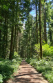
A circular loop mainly through woodland, venturing slightly off the beaten track and suitable for all seasons.

Details

4405189
Creation:
Last update:
Last review:
  • Walking
    Activity: Walking
  • ↔
    Distance: 4.64 mi
  • ◔
    Average duration: 3h 00 
  • ▲
    Difficulty: Moderate

  • ⚐
    Back to start: Yes
  • ↗
    Ascent: + 955 ft
  • ↘
    Descent: - 932 ft

  • ▲
    Highest point: 2,802 ft
  • ▼
    Lowest point: 1,985 ft

Photos

Description of the walk

Start from Saint-Maurice-de-Rotherens, car park in front of the town hall

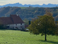
(S/E) Walk down through the village of Beyrin (the main village) to the cemetery, go round it and turn left onto the flat Chemin du Vernay. Pass the Platière farm and continue to the first bend.

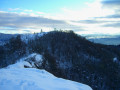
(1) Take the path on the right to continue south-eastwards on level ground. Before joining the tarmac road coming from Grenon, take a forest track that branches off to the left and heads back up into the woods. It turns right to climb up the hillside below a rocky outcrop (an easy passage but quite overgrown as it is not maintained).

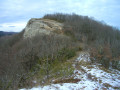
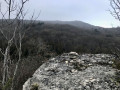
(2) At the end of the track, a path climbs to the left up to a rock. Beyond this, the route goes off-track: continue along faint ascending tracks towards the rocky outcrops of Les Chenevières and reach a small, rounded, non-rocky pass allowing you to cross the ridge and emerge onto a plateau planted with conifers, where you’ll find a path again.

Follow this path through the woods towards the south-east; it descends slightly and joins some better-marked paths. Continue straight on until you reach a signposted path, which you take to the right.

(3) When the signposted route descends towards Sainte-Marie-d’Alvey, turn left onto a forest track which climbs straight up the slope and leads directly to the Col de la Lattaz.

(4) Cross over to the western side and immediately head up to the right along the small tarmac road which climbs up to some radio masts. You’ll soon be able to see the summit of Mont Chaffaron at an elevation of 854.

(5) Take the ridge path to the north, which descends slightly before climbing again to a new, open summit at an elevation of 840.

(6) Continue along the ridge northwards: the path descends on the western slope and continues northwards to a track coming from Saint-Pierre-d’Alvey. Take this track to the left to join the Lattaz forest road at the same level.

(7) Cross over to the opposite side and continue straight on along a good path that leads to the edge of the meadows. At a junction, turn right and continue down towards Beauregard until you reach the small road leading to La Balme (GR® Chemin de Compostelle signposting).

(8) Head down to the left, cross the Route de la Lattaz and reach the first houses in Beyrin. Cross the CD 42 to reach the town hall and its car park (S/E).

Waypoints

  1. S/E : mi 0 - alt. 2,096 ft - Car park in front of the town hall - Église Saint-Maurice (Saint-Maurice-de-Rotherens)
  2. 1 : mi 0.45 - alt. 2,047 ft - Chemin du Vernay
  3. 2 : mi 1.2 - alt. 2,188 ft - End of forest track
  4. 3 : mi 1.68 - alt. 2,329 ft - Bois des Chenevières junction
  5. 4 : mi 2.08 - alt. 2,493 ft - Col de la Lattaz
  6. 5 : mi 2.54 - alt. 2,802 ft - Mont Chaffaron
  7. 6 : mi 2.81 - alt. 2,753 ft - Northern summit of the Crête du Chaffaron
  8. 7 : mi 3.49 - alt. 2,556 ft - Lattaz forest track
  9. 8 : mi 4.27 - alt. 2,343 ft - Beauregard
  10. S/E : mi 4.64 - alt. 2,096 ft - Car park in front of the town hall - Église Saint-Maurice (Saint-Maurice-de-Rotherens)

Notes

There are a few fairly short off-trail sections after (2) and after (3); the rest is on tracks or paths, though not always signposted.

(3) Alternative route: you can take a variant via the highest point of Les Chenevières: turn right halfway up the slope to join a level off-trail path following tracks ascending to the right at the foot of the rocks. Climb to the left towards a pass and, as soon as the rocks become less solid, climb to the right to the summit of the hill at elevation 763, then descend to the north-east to find a path at elevation 747; take this to the left to rejoin the Col de la Lattaz road.

As an aside, this route was devised to suit an outing during lockdown, limited to 3 hours.

Worth a visit

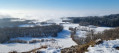
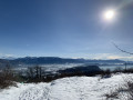
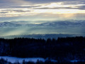
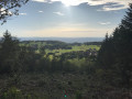
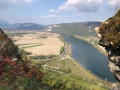
The view from Mont Chaffaron stretches towards Le Chat, L’Épine, the Chartreuse and the Jura.

Always be cautious and plan ahead when you're outdoors. Visorando and the author of this route cannot be held responsible for any accidents occurring on this route.

The GR® and PR® markings are the intellectual property of the Fédération Française de Randonnée Pédestre.

Reviews and comments

3.6 / 5
Based on 5 reviews

Reliability of the description
3.6 / 5
Ease of following the route
3.2 / 5
Route interest
4 / 5
User 25974791

Overall rating : 4 / 5

Date of your route : Sep 08, 2025
Reliability of the description : ★★★★☆ Good
Ease of following the route : ★★★☆☆ Average
Route interest : ★★★★★ Very good
Very busy route : No

A VERY BEAUTIFUL PARISH SPECIFIC TO BRETTAINE HIKE WITH LOTS OF WALKING IN THE FOREST AND UNDERGROUND, AND THEREFORE LITTLE ROAD TRAFFIC, WHICH IS VERY PLEASANT, with clear views in several places. However, without a map, it is impossible to follow the route as there are no signs on the circuit, so don't forget your phone or Visio Rando map. There are many crossroads in the forest, so be careful not to lose your way!

STILL RECOMMENDED

Machine-translated

Foune73
Foune73

Overall rating : 3.3 / 5

Date of your route : Jun 13, 2023
Reliability of the description : ★★★☆☆ Average
Ease of following the route : ★★★☆☆ Average
Route interest : ★★★★☆ Good
Very busy route : No

We walked this trail this afternoon, 13 June 2023, and we would have needed a machete just to get through it, the brambles had grown so thick. There were absolutely no signposts on this trail, so we had to consult our map, route plan and the detailed description at every junction. All in all, it took us 4 hours to cover the 7.5 km!
Luckily, we found kilos of wild strawberries to cheer us up
A few point-by-point comments:
There are errors in the description right from the start which are confusing: ‘Head down into the village of Beyrin (the main village) to the cemetery, go round it and turn left onto the Chemin du Vernay, which is on level ground.
CORRECTION: This is the village of St Maurice, not Beyrin, and you are not supposed to ‘go round’ the cemetery (in St Maurice) but to pass to its left.
(1) – “Before joining the ‘paved’ track coming from Grenon, take a forest track that branches off to the left and heads uphill into the woods” => What is a “paved” track? If it’s tarmac or gravel, that’s not the case here: there’s nothing but grass! And as for the forest track on the left, there are two of them, 100 metres apart!
(2) “At the end of the track, a path climbs up to the left to a rock” => We never saw any rock!
“Reach a small, rounded, non-rocky pass” => What’s a “rounded” pass? Never seen one! :-)
(3) “When the signposting heads down towards Sainte-Marie-d’Alvey, take a forest track on the left which climbs straight up the slope and leads directly to the Col de la Lattaz” => OK, we saw the signposting, but there are two forest tracks on the left. Which one? Neither of them points to the Col de la Lattaz
(4) “Cross over to the western slope and immediately head up the small tarmac road on the right, which climbs up to some aerial masts” => It should be noted that this road is signposted as a “private road” – you’ll have to be brave enough to go on anyway
“Follow the view to the summit of Mont Chaffaron at elevation 854.” => No view is possible due to the
vegetation; it should be specified that you should head left and pass by the two farm huts, otherwise you’ll be
be tempted to head off to the right
Magnificent vegetation on the ridge: a great variety of colourful flora today
(6) “Continue along the ridge northwards: the path descends the western slope and continues northwards until it meets a track coming from Saint-Pierre-d’Alvey. Take this on the left to reach the Lattaz forest road at the same level” => After the ridge (magnificent view), you enter the forest and immediately come to a fork signposted “La Combe” to the left and “St Pierre D’Alvey” to the right. You must follow the sign for “La Combe” to the left. And what does “at the same level” mean when it’s a steep descent?
(7) “Cross over opposite to continue straight on along a good path that leads to the edge of the meadows” => Opposite what? The location is not specified. “
“At a junction”, => which one? There are several in quick succession…
“Turn right to continue down towards Beauregard, until you reach the small road leading to La Balme (GR® Chemin de Compostelle signposting)” => The name Beauregard doesn’t appear on the IGN map, so we’d had enough and cut straight across (before the black arrow) onto a small path that took us straight to St Maurice, where we came out via the Chemin de La Côte

Two comments mention a plane wreck. We didn’t see anything like that along the way… Could you point it out?
THANK YOU for your corrections

Machine-translated

DDarko
DDarko

Overall rating : 4.3 / 5

Date of your route : Jan 13, 2022
Reliability of the description : ★★★★☆ Good
Ease of following the route : ★★★★☆ Good
Route interest : ★★★★★ Very good
Very busy route : No

It’s perfectly doable with a sat-nav, even if some sections are a bit of an adventure. We found the plane wreckage, but it’s impossible to find out any more about the crash by searching online. Does anyone have any information? Thanks for sharing.

Machine-translated

JCParavy
JCParavy

The description does indeed mention a hike “off the beaten track” and, between points (2) and (3), refers to an “ascending path” to follow, which normally means there is no path at that point.
To avoid any further mishaps, I have clarified the guide by clearly warning of this off-trail section beyond the rock that is bypassed: the pass in question corresponds to a gap in the rocky ridges of Les Chennevières, which allows you to climb easily onto the upper wooded plateau, without any danger.

Machine-translated

Déodat
Déodat

Overall rating : 1.7 / 5

Date of your route : Mar 21, 2021
Reliability of the description : ★★☆☆☆ Disappointing
Ease of following the route : ★★☆☆☆ Disappointing
Route interest : ★☆☆☆☆ Very disappointing
Very busy route : No

It’s impossible to complete the circular route, as there’s no path beyond the large rock. Whether there’s snow or not (we’ve been there twice), there’s no track to follow or even to make up. We went round the wreckage of the light aircraft (which isn’t signposted – it could serve as a landmark, as it’s not about to be cleared away!) and beyond that point it’s impossible, and even dangerous.

Machine-translated

margotdeotila
margotdeotila

Overall rating : 4.7 / 5

Date of your route : Jan 19, 2021
Reliability of the description : ★★★★★ Very good
Ease of following the route : ★★★★☆ Good
Route interest : ★★★★★ Very good
Very busy route : No

A brilliant outing. It snowed three days ago, so the whole trail was covered in snow. Because of that, it was a bit tricky to find the paths, but with the app, everything went smoothly
Points 2 and 3 were trickier to find, probably because of the snow. We had to climb straight up to reach the rocks.
From Mont Chaffaron, we followed the tracks of a doe as no one else had been there. Thanks to the doe, haha.
But it’s so worth it! The coniferous forest plateau is very peaceful and the 360-degree view from Mont Chaffaron is perfect!
The walk is well shaded, so we’re planning to come back in early summer.

Machine-translated

Other walks in the area

For more walks, use our search engine .

The GPS track and description are the property of this route's author. Please do not copy them without permission.