Country:

 City:
City:


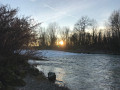
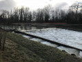
Head to the start of the Saint-Genix footpaths: opposite the Tourist Office (behind the town hall), follow the S-shaped road down to park in the large lay-by along the Route de la Glière.
(S/E) Follow the Route de la Glière on level ground towards the bridge over the Guiers. Pass under the bridge arch, then walk alongside the Guiers riverbank and the micro-power station. Just past the building, turn left onto the plane-tree-lined embankment and follow it past the boules courts.
(1) At the junction, carry on straight ahead along the Chemin de la Digue, then turn left (marked path) to reach the riverbank, which you follow more or less closely along a pleasant, shaded path that leads onto a country lane.
(2) Turn left to continue along the open embankment path to the confluence of the Guiers and the Rhône.
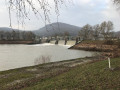
(3) After visiting the tip and the structures, take a wide path (with puddles) heading south-east along the Rhône: it crosses a submersible weir, then reaches the junction with Rue du Rhône at a place called Sainte-Anne, where it crosses the small concrete protective dyke.
(4) Take this road at the foot of the dyke heading due east. It runs alongside the Rhône then curves to the right until it reaches a bridge over the Truison.
(5) Turn left onto this bridge to take the Route de la Plaine, the access route to the ViaRhôna. It rejoins the dyke, running alongside the Rhône or a ‘lône’ (a stretch of the river) at times, until it reaches the Route du Barrage in Champagneux.
(6) Cross this road with care to join the cycle path running alongside it on the right, still at the foot of the embankment. Pass the “Guinguette” and continue to the start of the ViaRhôna. There, turn left to climb up onto the Brégnier-Cordon Dam on the Rhône.
(7) Cross the dam and, on the other side, avoid taking the cycle path on the right; instead, stay on the road for a few hundred metres. After rounding the old riverbed in a wide left-hand bend, halfway along the straight stretch that follows, cut across the road to take a country lane on the left, heading south-west, between the road and the river. This leads to a small sewage treatment plant.
Note: if you took the cycle path at the dam exit, you can rejoin the track by heading back towards the sewage treatment plant just after passing it.
(8) Turn left. The route continues through a poplar grove and soon runs alongside a backwater (a branch of the river set back from the main channel) on the right-hand side. Continue to a junction at a bridge, the only crossing point over the backwater. Turn right onto this bridge and carefully make your way up a good track to the D992.
(9) Follow this road to the left for 600 metres. Ignore the first path leading towards the Rhône, which heads for a floodplain, and take the second path on the left, which descends from the road through cultivated fields. It veers to the right (southwards) towards the river’s wooded banks, passes through plantations and then climbs steeply (you’ll need to dismount for this slope) onto Rue du Vieux Port at a place called Le Port.
Note: this section between the CD992 and the next point may not have been cleared of undergrowth: in that case, continue along the CD992 to the entrance to the hamlet of Cordon and turn left onto Rue du Vieux-Port at a small sewage treatment plant.
(10) Turn left onto Rue du Vieux Port, which crosses the hamlet and then runs alongside the Rhône before veering slightly westwards. Ignore the first few paths leading down towards the river, as they are dead ends; after passing the last houses, you’ll reach a three-way junction.
(11) At the junction, turn left onto a stony track which continues westwards, whilst the road heads north-west towards La Pierre. Carry on straight ahead and, when you come to a branch of the Rhône, turn right onto the north-west-facing track that winds its way between the Rhône and the water in a gravel pit (hidden by an embankment).
(12) When you reach the foot of the Cordon Bridge: do not go under its arch, but turn right towards an inn, then head left up the CD992 road (take care!) and follow this road up to the Cordon Bridge, which crosses the Rhône.
(13) Head back down on the other side of the bridge and immediately turn right onto the path that passes under the road again through one of the bridge’s arches, running alongside the river. Continue straight on along the left bank of the Rhône. When the path veers slightly to the right, take the track that cuts diagonally to the left, climbing a few metres up the Guiers embankment. You’ll reach the confluence, on the Isère side.
(14) After visiting the site and its structures, head south again along the path running along the crest of the dyke known as the ‘Autrichiens’. It continues straight on, makes a wide bend to the left at a place called L’Îlon, then continues straight on again with the Saint-Genix Bridge in sight.
(15) 200 metres before the bridge, a path with a gate leads down to the right: take this to reach the Impasse de l’Ancienne École. At the end of the cul-de-sac, do not join the busy Route des Savoie but turn immediately left onto Rue de la Douane, which passes in front of a former hotel and leads back up to the Route de Saint-Genix, which you take on the left.
Caution: dismount when you reach the junction with the road, due to the traffic and poor visibility!
Note: it is possible to continue straight on along the embankment as far as the bridge, but you will then need to carry your bike up the steps leading onto the bridge.
(16) Take the road that crosses the Pont de Saint-Genix. At the roundabout at Place du Pont, turn right, then immediately right again (after a cycle shelter) into the car park entrance, and head down the S-shaped lane on the left which leads back to the car park (S/E).


 Visorando Member
 Moderate
 Difficult