Circular walk through the woods around the Sylve Bénite at Le Pin

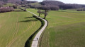
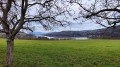
A circular route mainly through woods and undergrowth, passing a number of historic and religious buildings: Sylve Bénite (a Carthusian monk), the Croix de Moine Mort and the Croix d’Homnézy. Views of Lake Paladru and Mont Blanc (on a clear day).

Details

24612282
Creation:
Last update:
Last review:
  • Walking
    Activity: Walking
  • ↔
    Distance: 6.53 mi
  • ◔
    Average duration: 3h 45 
  • ▲
    Difficulty: Moderate

  • ⚐
    Back to start: Yes
  • ↗
    Ascent: + 883 ft
  • ↘
    Descent: - 879 ft

  • ▲
    Highest point: 2,375 ft
  • ▼
    Lowest point: 1,722 ft

Photos

Description of the walk

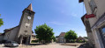
Park in the car park at the church in Le Pin.

Red and white markings, Santiago de CompostelaGR®65

(S/E) Opposite the church, take the Route de Chassigneux.

(1) At the fork in the road in Chassignieux, carry on straight ahead for about 400 m.

(2) Take the path leading uphill on the right (yellow markings). At the top of the climb, you’ll have a partial view of Lake Paladru. Carry on straight ahead and go round the Sylve Bénite enclosure to the left.
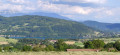
View of Mont Blanc (on a clear day) and Lake Paladru.

Yellow markings

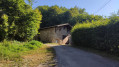
(3) Turn right onto the road, pass the Sylve Bénite and carry on straight ahead until you reach a fork in the road: clay pits.

(4) Turn left and follow the path uphill. Turn right then left (ignore several paths branching off to the left and right). Continue uphill until you reach a clearing.

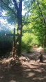
(5) Turn left and carry on straight ahead until you reach the Croix du Moine Mort.

(6) Turn onto the path leading uphill on the far right.

(7) Pass a crossroads at the 704-metre mark and carry on straight ahead.

(8) Pass Les Frênes and continue on to Ripaillon.

(9) Carry on to the left as far as the Croix d’Homnézy, then retrace your steps.

(9) At Rapaillon, turn left. Head straight up, then continue straight on along the path on the left. Then, stay on the path on the right to climb to a new fork.

(10) Take a path on the left, heading due east, go downhill between two fenced-off meadows, then turn right at the 655-metre mark. You’ll reach a road.

(11) Turn right and head downhill to the hamlet of Chassignieux.
Turn left onto the Chemin du Colomb until you reach the Chassignieux road.

(1) Turn left to reach the church at Le Pin (S/E).

Waypoints

  1. S/E : mi 0 - alt. 1,726 ft - Car park - Église Saint-Christophe (Le Pin)
  2. 1 : mi 0.24 - alt. 1,762 ft - Crossroads at the end of the circular loop
  3. 2 : mi 0.58 - alt. 1,768 ft - Climb towards Sylve Bénite
  4. 3 : mi 1.45 - alt. 1,955 ft - Sylve Bénite
  5. 4 : mi 1.73 - alt. 2,087 ft - Clay quarries
  6. 5 : mi 2.21 - alt. 2,283 ft - Clearing
  7. 6 : mi 2.88 - alt. 2,260 ft - Croix du Moine Mort (Oyeu)
  8. 7 : mi 3.81 - alt. 2,306 ft - Crossroads
  9. 8 : mi 4.07 - alt. 2,313 ft - Les Frênes
  10. 9 : mi 4.68 - alt. 2,123 ft - Rapaillon
  11. 10 : mi 5.19 - alt. 2,287 ft - Path on the left
  12. 11 : mi 5.61 - alt. 2,060 ft - Tarmac road towards Chassignieux
  13. S/E : mi 6.53 - alt. 1,726 ft - Car park - Église Saint-Christophe (Le Pin)

Worth a visit

(3) The Sylve Bénite is not open to visitors, but La Grange Dimière (turn left at Sylve Bénite) is open in summer and always hosts a very interesting contemporary art exhibition.

Always be cautious and plan ahead when you're outdoors. Visorando and the author of this route cannot be held responsible for any accidents occurring on this route.

The GR® and PR® markings are the intellectual property of the Fédération Française de Randonnée Pédestre.

Reviews and comments

3.5 / 5
Based on 6 reviews

Reliability of the description
3.5 / 5
Ease of following the route
2.8 / 5
Route interest
4.2 / 5
roro38
roro38

Overall rating : 4 / 5

Date of your route : May 17, 2026
Reliability of the description : ★★★★☆ Good
Ease of following the route : ★★★★☆ Good
Route interest : ★★★★☆ Good
Very busy route : No

A very pleasant walk with some lovely views

Machine-translated

RCT69
RCT69

Overall rating : 4.3 / 5

Date of your route : Aug 17, 2025
Reliability of the description : ★★★★☆ Good
Ease of following the route : ★★★★☆ Good
Route interest : ★★★★★ Very good
Very busy route : Yes

hello
On 17/08, during a heatwave, I did this route. It was wonderful to be out in the cool air.
a few comments and suggestions:
a) Sometimes the GPS is useful. I don't look at the instructions when I'm hiking
b) At the cross with the bench, it's a great place to picnic or take a break, but it's very crowded!
c) I went down to Notre Dame de Milin (picnic spot; there is also a meadow just before if you don't want to go down the rocky path for 50 metres)
however, I wanted to rejoin the circuit between points 6 and 7 via the IGN trails. Many of them have disappeared. However, there is a trail on the right. It could have taken me between points 6 and 7 or to the cross, but only the path to the cross is available
i think it's also possible to get to point 7 via the path I started but didn't try (at point 7, I saw a path on the left, so maybe that's the one)
d) At point 11, why not go down via point 11? It would be more pleasant
e) For the views, there's not much. You can see the lake a little. The main attraction of this route is the shade

Machine-translated

User 24878294

Overall rating : 4.3 / 5

Date of your route : Jul 30, 2025
Reliability of the description : ★★★★★ Very good
Ease of following the route : ★★★☆☆ Average
Route interest : ★★★★★ Very good
Very busy route : Yes

Enjoy the walk, which is refreshing in summer as it's in the woods.
No major difficulties along the route, although I understand the comments from other Visorando users about the imprecise directions. I was somewhat familiar with the area, so I was able to find my way around more easily

Machine-translated

Martine B4.
Martine B4.

Overall rating : 2.3 / 5

Date of your route : Jan 01, 2024
Reliability of the description : ★★☆☆☆ Disappointing
Ease of following the route : ★★☆☆☆ Disappointing
Route interest : ★★★☆☆ Average
Very busy route : No

A walk mainly through the woods
signposting is very sparse, or even non-existent at certain junctions
the view of the lake is indeed very fleeting
the view of the Alps is lovely
Disappointed

Machine-translated

Estellita76
Estellita76

Overall rating : 2 / 5

Date of your route : May 29, 2023
Reliability of the description : ★★☆☆☆ Disappointing
Ease of following the route : ★☆☆☆☆ Very disappointing
Route interest : ★★★☆☆ Average
Very busy route : No

A pleasant walk through the woods, but the signposting really leaves a lot to be desired – there were no markings for over an hour. We wandered about a bit at random before coming across a marking again....
I wouldn’t recommend it if you’re not used to finding your way.
A very fleeting view of the lake.
Moderate difficulty, with a few gentle climbs but nothing too challenging.
Pleasant if you want to go for a walk on a hot day, as three-quarters of the route is through the forest.

Machine-translated

Ansyl
Ansyl

Overall rating : 4 / 5

Date of your route : Feb 20, 2023
Reliability of the description : ★★★★☆ Good
Ease of following the route : ★★★☆☆ Average
Route interest : ★★★★★ Very good
Very busy route : No

After the ash trees,
we missed the path on the right that would have taken us back to the path we’d taken on the way up,
which led us back to the Dead Monk’s Cross.
A lovely walk.

Machine-translated

Other walks in the area

For more walks, use our search engine .

The GPS track and description are the property of this route's author. Please do not copy them without permission.