On the heights of Les Abrets

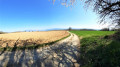
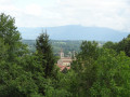
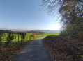
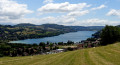
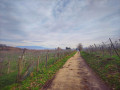
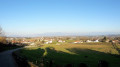
A very pleasant walk, with no difficulties. Throughout the route, there are lovely views of the Chartreuse, the Bugey and the Vercors. Not too many tarmac roads, and mostly very pleasant paths.

Details

7396832
Creation:
Last update:
Last review:
  • Walking
    Activity: Walking
  • ↔
    Distance: 9.70 mi
  • ◔
    Average duration: 5h 20 
  • ▲
    Difficulty: Moderate

  • ⚐
    Back to start: Yes
  • ↗
    Ascent: + 1,024 ft
  • ↘
    Descent: - 1,020 ft

  • ▲
    Highest point: 2,126 ft
  • ▼
    Lowest point: 1,457 ft

Photos

Description of the walk

By car, from the centre of Les Abrets, head towards Charancieu town hall. Carry on until you reach the cross.
From there, head right until you reach another cross. Walk a few more metres, then turn left onto the Montée du Riboulet. As the name suggests, the slope is steep. Climb to the top and continue to the transformer, which you’ll find on your right. You can park here. You are now on the Route du Bas Juvenin.
Moderator’s note added on 16/05/2021: Please note! This car park is now private. For an alternative starting point, see the review of this walk dated 16/05/2021

(S/E) Take the path heading west. Join theGR® 65. Walk down to the Ruisseau de Biôt, then head back up to the old village of Saint-Ondras.

(1) Follow the road that climbs to the left. Walk for about a hundred metres and follow theGR® which branches off to the right. Climb up this path to the first houses. You will then come to a tarmac road. At the next junction, turn right. Follow the red and white markings for the Way of St James. Immediately after crossing the Ruisseau du Combaud, you’ll come to a Fork in the road.

(2) Head up to the left. After about 700 metres, you’ll come to a road. Take this towards Valencogne, pass the telecoms masts, and carry on to the Croix du Brocard.

(3) Turn right towards the church.

(4) Opposite the church, head down the street on the left which heads east. Go to the left of the farm, along a path that climbs towards Gréhaut.
When you reach the road, turn right. Carry on straight ahead to the Croix Charpenne.

(5) Carry on walking along this road heading south. Pass the Route de la Croix Charpenne on your right, then turn left, leaving theGR® here, onto the path leading towards the forest.
Note: the path is no longer visible here, but it marks the boundary between two cultivated plots.
Enter the forest and walk alongside the pond. Pass two paths on your left and take thethird on the left. Keep heading north along this path until you reach the Route de Saint-Pierre.

(6) Turn left. After the first house, turn right onto a path leading to Le Pommeret. Follow it to reach this hamlet.

(7) At the road, immediately take the path branching off to the right. Walk alongside the Étang du Vivier, then turn left at the edge of the forest. Then take the road on the right until you reach the Carrefour des 3 Chênes.

(8) Turn left onto the Chemin des Trois Chênes. Walk all the way to the top, to the water reservoir. Turn right onto the path at the foot of the reservoir. Head down towards the south-east.
Near the hamlet of Jalamion, you’ll come to a path branching off to your left.

(9) Follow the path to Les Monins. At the tarmac road, carry on straight ahead towards the centre of the hamlet.
Carry on to the junction of the Chemin de Château Vieux and the Route du Monin.

(10) Take the path on the left. Continue along the edge of a woodland until you reach a road.

(11) Head uphill to the left until you reach the next junction. Then turn right onto the Route du Haut Juvenin. Walk to the château, turn left, and continue to the transformer station car park (S/E).


Waypoints

  1. S/E : mi 0 - alt. 1,640 ft - EDF substation
  2. 1 : mi 0.85 - alt. 1,519 ft - Old Saint-Ondras
  3. 2 : mi 1.6 - alt. 1,755 ft - Chemin des Fosges
  4. 3 : mi 2.51 - alt. 1,926 ft - Croix du Brocard (Valencogne)
  5. 4 : mi 2.82 - alt. 1,880 ft - Valencogne Church
  6. 5 : mi 3.78 - alt. 2,057 ft - La Croix Charpenne - Croix Charpenne (Valencogne)
  7. 6 : mi 4.79 - alt. 2,073 ft - Route de Saint-Pierre
  8. 7 : mi 5.59 - alt. 2,021 ft - Pommeret
  9. 8 : mi 6.5 - alt. 1,942 ft - The Three Oaks
  10. 9 : mi 7.32 - alt. 1,900 ft - Crossroads
  11. 10 : mi 8.03 - alt. 1,831 ft - Les Monins
  12. 11 : mi 8.85 - alt. 1,722 ft - Route de Pommaret
  13. S/E : mi 9.7 - alt. 1,640 ft - EDF substation

Always be cautious and plan ahead when you're outdoors. Visorando and the author of this route cannot be held responsible for any accidents occurring on this route.

The GR® and PR® markings are the intellectual property of the Fédération Française de Randonnée Pédestre.

Reviews and comments

3.8 / 5
Based on 4 reviews

Reliability of the description
3.8 / 5
Ease of following the route
3.5 / 5
Route interest
4.3 / 5
F. BECK
F. BECK
• Edited:

Overall rating : 3.7 / 5

Date of your route : Jul 30, 2023
Reliability of the description : ★★★★☆ Good
Ease of following the route : ★★★☆☆ Average
Route interest : ★★★★☆ Good
Very busy route : No

A really lovely walk, but:
- from the Charancieu cemetery car park to the start of the route, it’s all uphill along a road. It might be better to park in Valencogne and start the circular route from point 3.
- Between points 4 and 5: don’t hesitate to leave the road and cross the field (the wheat has just been harvested). Once you reach the edge of the field, you can make out the path through the vegetation. After that, make sure you don’t get lost in the forest and keep following the path.
- Between points 4 and 6: please note that this section crosses another route, so it’s more heavily used than the rest.

Machine-translated

dachrys
dachrys

Overall rating : 4.3 / 5

Date of your route : Mar 06, 2022
Reliability of the description : ★★★★☆ Good
Ease of following the route : ★★★★☆ Good
Route interest : ★★★★★ Very good
Very busy route : No

We’ve never actually found “La Garde” as the starting point, and the route starting from there adds about 2 km to the journey.Either park as indicated at the cemetery, then take Chemin de Vignay; turn right onto Chemin des Grillatières. When you reach the junction opposite you, take Montée du Château; at the next junction, carry on straight ahead along Route de Juvenin. Then, at the next junction, you’ll see signposts for the walk – carry on straight ahead along the dirt track and you’ll find yourself at the start of the walk.However, if there aren’t many of you, you can park on Route de Juvenin by the woods; there’s a small space there if you park tightly without obstructing traffic.Point 4 is difficult to find at this time of year; with the help of the app, you can manage it more or less, but I think the two plots have been merged – you could tell at this time of year because the maize had been cut and there was no separation between the rows, so once the crops have grown, it’s likely to be more complicated. We’ll have to see.Anyway, the walk is nice and enjoyable. Thanks to the author.

Machine-translated

Lire7lynx3
Lire7lynx3

Overall rating : 3 / 5

Date of your route : Oct 17, 2021
Reliability of the description : ★★★☆☆ Average
Ease of following the route : ★★★☆☆ Average
Route interest : ★★★☆☆ Average
Very busy route : No

From Charancieu cemetery, we had no trouble finding the Chemin du Vignay, but afterwards we found it difficult to follow the directions for joining the route from the ‘La Grillatière’ sign. We couldn’t see any signs for La Garde or the GR65. So we headed straight up (towards Juvenin) and then followed the road down to the right to reach the transformer (the original starting point before the path was closed). At this point, as at other junctions, without the GPX track we would never have managed this walk.
The route is very rural and follows sections of the Way of St James, which is pleasant, but the whole walk is quite long… we would have appreciated some information on the heritage or history of the villages we passed through…
For example, we went into the church at Valencogne to read about its history and find out more about the Way of St James.
There were no viewpoints overlooking Lake Paladru, but we enjoyed 360° views of the Jura, the Chartreuse and much further afield as we made our way along the route (not a cloud in the sky that day).

Machine-translated

GUNZBURGER
GUNZBURGER

Overall rating : 4.3 / 5

Date of your route : May 09, 2021
Reliability of the description : ★★★★☆ Good
Ease of following the route : ★★★★☆ Good
Route interest : ★★★★★ Very good
Very busy route : No

Hello,
The description of this walk mentions a possible parking spot at the start, next to a transformer. This is no longer available, as it is private land. It is very difficult to park in the area, and impossible if there are several cars.

The only option is the car park at Charencieu cemetery. In this case, the route from the start is slightly altered, but you’ll soon rejoin the planned path.

Behind the cemetery, heading due south, take the Chemin du Vignay; you’ll soon reach a small road at La Grillatière. At the junction, turn right (west) onto the road that passes through La Garde, and you’ll join the GR65 at point 498.

For the return journey at the end of the route, when you reach the road (Route du Pommaret), instead of going up to the left, go down to the right and you’ll return to La Grillatière and the path leading to the cemetery.
Yves

Machine-translated

Other walks in the area

For more walks, use our search engine .

The GPS track and description are the property of this route's author. Please do not copy them without permission.