Country:

 City:
City:


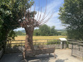
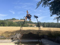
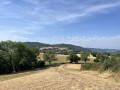
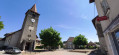
Easy parking in the car park at Bilieu Town Hall, but not much shade. EV charging points – see practical information.
(S/E) Head up the D50d Route de Savines, continuing past “Ma p’tite épicerie” (do pop in – friendly owners and local produce). At the end of the bend, turn left onto the road and carry on until you reach a track on the left (Chemin de Maljonnin).
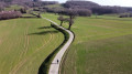
(1) Take this track towards the small wood above Bilieu. Keep left at the first junction and you’ll reach another track.
(2) When you reach a large fallen tree trunk – easily recognisable at the fork – turn right to reach the viewpoint over La Grande Sure (1,920 metres) – a round trip.
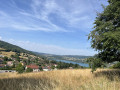
(3) Admire the view of Bilieu’s bell tower and the surrounding mountain passes from the bench. Retrace your steps.
(2) Continue along the original path, turning right. Carry on due north along the main path, keeping straight on until you cross the Route de Bilieu in the commune of Montferrat.
(4) Cross the tarmac road. Caution: dangerous road crossing. Continue downhill along the first path on the left (caution: large, rather dangerous stones at the start of the path). Keep going straight on until you reach the Chemin des Cochettes (tarmac). Carry on straight down the Chemin de la Croix until you reach the D90, the Route des Chevaliers de l’An Mil.
(5) Cross it carefully to the right and follow the cycle path marked in green (pedestrian crossing opposite the campsite entrance). Pass in front of the Camping Détente et Clapotis and continue along the path towards Paladru.
(6) Leave the cycle path to the left, onto the Chemin du Marais de la Véronnière, for a return trip to Paladru. An educational and entertaining nature trail with some lovely spots to stop (shade, information boards, games, sculptures). You can continue on to the village of Paladru and its MALP (Archaeological Museum of Lake Paladru).
(7) Turn back to rejoin the D90, the Route des Chevaliers de l’An Mil.
(6) Follow this road to the left with great care for about 300–400 metres (sorry, no alternative route found).
(8) Turn right onto the Route de La Marinière, heading towards a small castle-lodge.
(9) Opposite the entrance to the La Marinière lodge, turn right onto the Chemin de terre de la Turellaz, then onto the tarmac road, the Chemin du Sicaud, towards the hamlet of the same name.
(10) Carefully cross the tarmac Route de Bilieu once more and continue straight up the Montée du Sicaud opposite, towards La Haute-Véronnière.
(11) Throughout the Montée du Sicaud, keep well to the right and continue towards the Route de La Haute-Véronnière.
(12) At the top of the hill, when you reach the tarmac road, turn right towards Bilieu, heading for the hamlet of La Haute-Véronnière. From this stretch of road, you can first admire Le Grand Som on your left (to the east, 2,026 metres), then La Grande Sure (to the south-east, 1,920 metres).
(13) Leave the tarmac road by turning left onto the Chemin de Trallud. Continue along the Montée de Bilieu (dirt track) as it winds its way into the Bois de la Côte Girin (caution: large, rather dangerous stones in the middle of the track; keep well to the right to enter the woods). Carry on straight ahead until the end of the track, joining the Route de la Taillée, near the Maures de Bilieu neighbourhood.
(14) Turn right, heading back up towards the village centre, until you reach the fork from the outward leg.
(1) Follow the route back in the opposite direction to the outward journey, returning to the grocery shop and then Bilieu Town Hall (S/E).



 Visorando Member
 Easy
Easy 
 Tourist office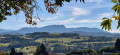
 Difficult