


Wingardium

 Visorando Member
 Premium user
 - Location: Saint-Ismier (38330)
- Gender: man
Sign up:
Published route(s)
 The Plateau des Lacs via La Barrière
 6.26 mi
 +1,545 ft
 -1,549 ft
 4h 15
4h 15
 Average
 Departure from Livet-et-Gavet (Isère)
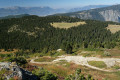
A very pleasant circular at the foot of Taillefer with beautiful views of the Oisans region.
This hike crosses a Natura 2000 site and is subject to specific regulations. Please respect them (see practical information).
From Col du Sabot to Col du Couard
 4.80 mi
+1,194 ft
-1,194 ft
3h 15
4.80 mi
+1,194 ft
-1,194 ft
3h 15
 Easy
Departure from Vaujany (Isère)
Easy
Departure from Vaujany (Isère)
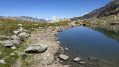
A short, peaceful walk on a good trail overlooking Lac de Grand-Maison with a 100m elevation gain between the two passes!
Lac de Brouffier via Combe Oursière
 3.67 mi
+1,647 ft
-1,647 ft
3h 05
Average
Departure from La Morte (Isère)
3.67 mi
+1,647 ft
-1,647 ft
3h 05
Average
Departure from La Morte (Isère)
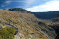
Access to Lac de Brouffier via the route with the least elevation gain.
Circuit via the Pas du Berlioz, the Brion Bridge and the Ébron footbridge
 5.39 mi
+1,322 ft
-1,316 ft
3h 40
Average
Departure from Treffort (Isère)
5.39 mi
+1,322 ft
-1,316 ft
3h 40
Average
Departure from Treffort (Isère)
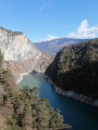
A short route to get your legs moving as soon as the weather turns fine. No particular difficulty and some lovely views of the mountains surrounding the Trièves!
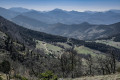
Route via the Porte de Barry, the Pas de Siara and the Grande Combe
 10.94 mi
+2,841 ft
-2,815 ft
7h 30
Average
Departure from Saou (Drôme)
10.94 mi
+2,841 ft
-2,815 ft
7h 30
Average
Departure from Saou (Drôme)
It’s a fairly long route but not particularly difficult, allowing you to discover all aspects of the Saoû Forest, starting with the Auberge des Dauphins and its grounds...
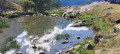
Route of Le Puy and Le Miroir des Fétoules with the orientation table
 4.26 mi
+2,379 ft
-2,356 ft
4h 00
Average
Departure from Saint-Christophe-en-Oisans (Isère)
4.26 mi
+2,379 ft
-2,356 ft
4h 00
Average
Departure from Saint-Christophe-en-Oisans (Isère)
This is a fairly simple, easy hike offering beautiful views of the Écrins massif and the Vénéon valley around Saint-Christophe-en-Oisans, with the option of an orientation table to help you find your way around.
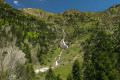
Plancol via the Vaunoire torrent valley
 5.59 mi
+2,142 ft
-2,142 ft
4h 25
Average
Departure from Lavaldens (Isère)
5.59 mi
+2,142 ft
-2,142 ft
4h 25
Average
Departure from Lavaldens (Isère)
A hike that begins in the atmosphere of the undergrowth and ends in a high mountain setting.
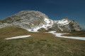
Le Pas des Chattons from La Coche
 11.51 mi
+1,752 ft
-1,752 ft
6h 50
Average
Departure from Saint-Agnan-en-Vercors (Drôme)
11.51 mi
+1,752 ft
-1,752 ft
6h 50
Average
Departure from Saint-Agnan-en-Vercors (Drôme)
A relatively easy hike across the Vercors highlands, culminating in a magnificent panorama of Mont Aiguille and the Trièves.
The route alternates between coniferous woodland and clearings bursting with flowers in spring, along easily accessible paths and tracks.
And as an almost constant backdrop, the Grand Veymont, an immense and majestic bare limestone dome, rising from the vegetation of the high plateaus like a Vercors version of Ayers Rock!
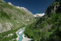
The Lanchâtra valley
 7.31 mi
+3,530 ft
-3,510 ft
6h 25
7.31 mi
+3,530 ft
-3,510 ft
6h 25
 Difficult
Departure from Saint-Christophe-en-Oisans (Isère)
Difficult
Departure from Saint-Christophe-en-Oisans (Isère)
A magnificent hike in the Oisans region starting from the Plan du Lac lodge, taking in a small mountain hamlet with its tightly packed houses and offering a magnificent panorama of Pointe Swan (3,294m), all whilst following the rushing torrent of La Pisse.
Temple-Écrins Refuge
 8.13 mi
+2,336 ft
-2,336 ft
5h 45
Average
Departure from Saint-Christophe-en-Oisans (Isère)
8.13 mi
+2,336 ft
-2,336 ft
5h 45
Average
Departure from Saint-Christophe-en-Oisans (Isère)
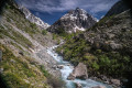
Treat yourself to one of the most beautiful views of the Écrins Massif and the Vénéon Valley by climbing up to the Refuge de Temple-Écrins. Your efforts will be richly rewarded with a 360-degree panorama of the highest peaks in the massif, including its highest point at 4,102 metres.
And as a bonus, you can enjoy a delicious omelette with bacon, potatoes and cheese on the terrace at an altitude of 2,410 metres!
The Cassini Cross
 4.03 mi
+1,804 ft
-1,795 ft
3h 25
Difficult
Departure from Le Freney-d'Oisans (Isère)
4.03 mi
+1,804 ft
-1,795 ft
3h 25
Difficult
Departure from Le Freney-d'Oisans (Isère)
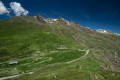
Hike on a historic site chosen by César-François Cassini in the18th century to map the Écrins Massif and other surrounding mountains.
Magnificent 360° viewpoint over the Grandes Rousses, Belledonne, Taillefer, Rochail, Muzelle, Mont de Lans Glacier, La Meije, Aiguilles d'Arves and even Mont Blanc in the distance!
And the resorts of Alpe d'Huez on one side and Les Deux Alpes on the other...
An easy climb but a more... "sporting" descent!
Lavey Refuge and Muande Valley from Le Clot
 10.95 mi
+2,749 ft
-2,746 ft
7h 25
Average
Departure from Saint-Christophe-en-Oisans (Isère)
10.95 mi
+2,749 ft
-2,746 ft
7h 25
Average
Departure from Saint-Christophe-en-Oisans (Isère)
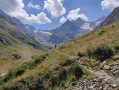
Admittedly a fairly long hike, but one that will allow you to discover the magnificent Muande valley, with the Lavey refuge halfway along, and, once you reach the end, its majestic peaks and glaciers.
No particular difficulty; the paths are always clearly visible and well signposted.
Several alternative routes are available: see the ‘Practical Information’ section.
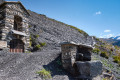
Route of the oratories, chapels and hamlets of Besse-en-Oisans
 5.90 mi
+1,959 ft
-1,939 ft
4h 25
Average
Departure from Besse (Isère) (Isère)
5.90 mi
+1,959 ft
-1,939 ft
4h 25
Average
Departure from Besse (Isère) (Isère)
A route, which can be done with the family, to discover the oratories built by the Bessats in the 19th century. The route follows a sunny slope and passes through two hamlets with typical houses and the village of Besse, which is worth a visit in its own right.
As a bonus, there are some magnificent panoramic views of the Grandes Rousses and Écrins massifs between La Meije and Le Rochail.
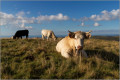
Puy Violent and Croix des Vachers
 4.13 mi
+1,109 ft
-1,106 ft
2h 50
Easy
Departure from Saint-Paul-de-Salers (Cantal)
4.13 mi
+1,109 ft
-1,106 ft
2h 50
Easy
Departure from Saint-Paul-de-Salers (Cantal)
This easy walk will take you to the summit of Puy Violent, where you can admire a superb 360° view of the Aurillac plain and Puy Mary.
Above the Croix des Vachers, an orientation table will tell you the name of each peak.
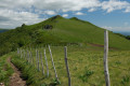
Élancèze from the Col du Pertus
 2.09 mi
+860 ft
-860 ft
1h 45
Easy
Departure from Mandailles-Saint-Julien (Cantal)
2.09 mi
+860 ft
-860 ft
1h 45
Easy
Departure from Mandailles-Saint-Julien (Cantal)
This is a fairly easy short hike to a beautiful promontory offering a panoramic view of the main Monts du Cantal and the Jordanne and Cère valleys.
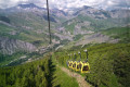
Lac de Puy Vachier and the viewpoint as seen from the Glaciers cable car
 3.58 mi
+1,257 ft
-1,270 ft
2h 45
Average
Departure from La Grave (Hautes-Alpes)
3.58 mi
+1,257 ft
-1,270 ft
2h 45
Average
Departure from La Grave (Hautes-Alpes)
To spare your calves, the hike begins with a cable car ride up from La Grave. At the midway station (the end of the first section), the majestic Meije and its glaciers come into view!
Then, for a bit of a walk, the path will take you to Lac de Puy Vachier with its midnight-blue waters, the Évariste Chancel mountain hut and a viewing platform from which the view takes in the upper Romanche valley, stretching from the Grandes-Rousses in the west to the Galibier and La Meije in the east.
Lac du Pontet and Aiguillon
 3.74 mi
+735 ft
-761 ft
2h 20
Easy
Departure from Villar-d'Arêne (Hautes-Alpes)
3.74 mi
+735 ft
-761 ft
2h 20
Easy
Departure from Villar-d'Arêne (Hautes-Alpes)
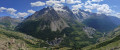
This route is more of a "stroll" than a "hike": first a beautiful little mountain lake that is easy to access, then a small peak with a magnificent view of the Meije massif to the south and the Goléon to the north.
This is the shortest and easiest route to discover these two tourist attractions.
La Pisse Waterfall and the Basse Pisse Valley
 6.82 mi
+1,870 ft
-1,870 ft
4h 45
Average
Departure from Valjouffrey (Isère)
6.82 mi
+1,870 ft
-1,870 ft
4h 45
Average
Departure from Valjouffrey (Isère)
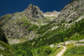
A hike to discover a magnificent, fairly well-known and easily accessible waterfall. Then, and above all, a short hanging valley, shaped like a glacial cirque, much more secluded and rather wild.
From the Col du Lautaret to the Col du Galibier by road
 10.08 mi
+1,683 ft
-1,677 ft
6h 05
Average
Departure from Le Monêtier-les-Bains (Hautes-Alpes)
10.08 mi
+1,683 ft
-1,677 ft
6h 05
Average
Departure from Le Monêtier-les-Bains (Hautes-Alpes)
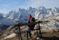
A unique hike, presenting no real difficulty, suitable for everyone and offering extraordinary scenery!
Best done in spring or autumn, when the Col du Galibier road is closed to traffic.
Mont Rachais via La Bastille and Mont Jalla, returning via La Tronche
 9.84 mi
+2,838 ft
-2,835 ft
7h 00
Average
Departure from Grenoble (Isère)
9.84 mi
+2,838 ft
-2,835 ft
7h 00
Average
Departure from Grenoble (Isère)
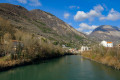
A “Town-to-Mountain” hike that takes you from the banks of the Isère to the summit of Mont Rachais. At 1,046 metres, its ridge overlooks the eastern part of the Grenoble conurbation, the Haut-Grésivaudan and the Belledonne range.
En route, you can visit the fortifications of the Bastille and the memorial to the Alpine troops on Mont Jalla.
No particular difficulty (apart from the cumulative elevation gain of around 900m) and as this slope is well exposed, the route can be tackled in winter as the snow melts very quickly there.
The hamlets of L'Escoulin and Eygluy
 6.89 mi
+1,752 ft
-1,752 ft
4h 40
Average
Departure from Eygluy-Escoulin (Drôme)
6.89 mi
+1,752 ft
-1,752 ft
4h 40
Average
Departure from Eygluy-Escoulin (Drôme)
A circular hike to discover the hamlets of L'Escoulin and Eygluy, formerly separate communes in two parallel valleys. In 1971, they merged to form Eygluy-Escoulin!
Along the route, there are beautiful views of the mountains and peaks of southern Vercors and you can discover the small local heritage of this region of Diois.
The route is easy, following either carriage roads or quiet country lanes.
Circular route around the three peaks of Conest
 10.90 mi
+2,953 ft
-2,979 ft
7h 35
Difficult
Departure from Notre-Dame-de-Vaulx (Isère)
10.90 mi
+2,953 ft
-2,979 ft
7h 35
Difficult
Departure from Notre-Dame-de-Vaulx (Isère)
This lovely circular route takes you to the Conest (or Conex or Connex) summit plateau, which is a vast area of pasture.Although the climb may seem a little long, it is very pleasant and a magnificent reward awaits the hiker once at the top: a 360° panorama offering views of the Belledonne, Taillefer, Grandes-Rousses, Dévoluy and Vercors mountain ranges.The ‘Difficult’ rating is due to the combination of distance and elevation gain, both of which are significant.
Allas loop via Les Cabanes du Breuil and Château de Puymartin
 5.67 mi
+692 ft
-666 ft
3h 10
Average
Departure from Saint-André-d'Allas (Dordogne)
5.67 mi
+692 ft
-666 ft
3h 10
Average
Departure from Saint-André-d'Allas (Dordogne)
The aim of this hike is to see a 13th-century chapel, admire an 18th-century château (Château du Roch), explore a group of dry stone huts (Cabanes du Breuil) and visit a magnificent, beautifully furnished château (Château de Puymartin), all along a walking route that takes you along forest paths and small country roads. A very pretty, easy walk that allows you to discover some of the treasures of the Périgord Noir.
The Vallon du Ferrand and Lac des Quirlies from the Sarenne road
 9.85 mi
+3,077 ft
-3,084 ft
7h 15
Difficult
Departure from Clavans-en-Haut-Oisans (Isère)
9.85 mi
+3,077 ft
-3,084 ft
7h 15
Difficult
Departure from Clavans-en-Haut-Oisans (Isère)
Lac des Quirlies (2,566 m) and its eponymous glacier are situated on the eastern slope of the Grandes Rousses massif, right at the far end of the Ferrand Valley.
This is a truly beautiful hike that passes through a lush, peaceful valley before reaching a much more rugged landscape around this glacial lake, surrounded by high peaks.
Magnificent panoramic views of the Arves and Écrins massifs and, in the distance, the Vanoise. No technical difficulty apart from the length and elevation gain.
Vallon du Bens circular
 10.78 mi
+2,956 ft
-2,963 ft
7h 30
Average
Departure from La Chapelle-du-Bard (Isère)
10.78 mi
+2,956 ft
-2,963 ft
7h 30
Average
Departure from La Chapelle-du-Bard (Isère)
This hike is certainly a little long in its entirety, but it can easily be broken down into shorter circular loops. In addition, the wide, shaded track along most of the route is well suited to family walks.And it offers a magnificent panorama at its highest point over the Allevard massif (Belledonne range).
Crêt du Poulet, Grand Rocher and Col du Merdaret circular loop
 9.59 mi
+1,982 ft
-1,988 ft
6h 10
Average
Departure from Theys (Isère)
9.59 mi
+1,982 ft
-1,988 ft
6h 10
Average
Departure from Theys (Isère)
A beautiful circular route on the ridge of the Grand Rocher, which acts as a balcony with a superb panorama of the Haut-Bréda valley, the Allevard massif and the Sept Laux massif. Easy access from the Barioz cross-country ski centre and an easy route to do in mid-spring when the peaks are still snow-covered.
Large and small waterfalls of Tendon in a loop
 8.42 mi
+1,122 ft
-1,109 ft
4h 50
Easy
Departure from Le Tholy (Vosges)
8.42 mi
+1,122 ft
-1,109 ft
4h 50
Easy
Departure from Le Tholy (Vosges)
An easy hike that passes by two pretty waterfalls, with trails through the woods and the Vosges countryside. The route follows the typical Club Vosgien signage, which may seem a little complex and confusing at first but, with a little practice, proves to be particularly effective, provided you have an IGN map to refer to.
Saint-Michel signal and Beaumont Canal circular loop
 9.15 mi
+2,031 ft
-2,028 ft
6h 00
Average
Departure from Saint-Laurent-en-Beaumont (Isère)
9.15 mi
+2,031 ft
-2,028 ft
6h 00
Average
Departure from Saint-Laurent-en-Beaumont (Isère)
A hike to discover this small natural region of Beaumont from one of its peaks, at 1,493 m, and its irrigation canal, which is over 150 years old. Beautiful views of the Écrins and Obiou massifs and the Matheysin plateau (when there is no fog!).
The route is very well signposted and marked, so it's impossible to get lost!
Circular route around the lakes of the Matheysin plateau and Pierre Percée
 9.03 mi
+1,270 ft
-1,273 ft
5h 15
Average
Departure from Saint-Théoffrey (Isère)
9.03 mi
+1,270 ft
-1,273 ft
5h 15
Average
Departure from Saint-Théoffrey (Isère)
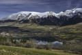
A fairly easy hike to discover three of the four lakes on the Matheysin plateau and one of the wonders of the Dauphiné, the Pierre Percée.
The route is well signposted and marked, partly in the shade and offering beautiful views of the Matheysin and the surrounding mountain ranges (Obiou, Vercors).
Panorama of Lake Solbjørn (Solbjørnvatnet)
 2.68 mi
+988 ft
-981 ft
2h 05
Easy
Departure from Norway
2.68 mi
+988 ft
-981 ft
2h 05
Easy
Departure from Norway
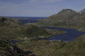
This is an easy hike that will allow you to discover a magnificent panorama of Lake Solbjørn and its cirque of steep mountains. Looking back, you will see other panoramas of the fjord, small hamlets, the coast of mainland Norway in the distance and all the peaks that make the Lofoten Islands famous!
Tour of Lake Nikka (Nikkavatnet rundt)
 1.32 mi
+121 ft
-121 ft
0h 45
Easy
Departure from Norway
1.32 mi
+121 ft
-121 ft
0h 45
Easy
Departure from Norway
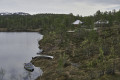
An easy hike around a small lake with beautiful views of the rounded mountains in the surrounding area.
Circular route via Chantesse and Poliénas starting from Cras
 9.69 mi
+1,191 ft
-1,191 ft
5h 30
Average
Departure from Cras (Isère)
9.69 mi
+1,191 ft
-1,191 ft
5h 30
Average
Departure from Cras (Isère)
A circular route through the Tullins region, passing through quiet little villages, beautiful walnut groves and the shade of pollarded chestnut trees. Lovely views over the Isère plain and the northern Vercors.
Murinais, Chambaran, Le Gollard circular loop
 9.61 mi
+1,473 ft
-1,473 ft
5h 40
Average
Departure from Murinais (Isère)
9.61 mi
+1,473 ft
-1,473 ft
5h 40
Average
Departure from Murinais (Isère)
This hike is a little long, but it offers beautiful views of the Chartreuse, the Vercors and the countryside of the Chambarans foothills.
For those who dislike tarmac, a quarter of the route is on country roads, which are paved but have very little traffic!
Brame-Farine ridges
 7.42 mi
+2,762 ft
-2,762 ft
5h 50
Difficult
Departure from Saint-Maximin (Isère) (Isère)
7.42 mi
+2,762 ft
-2,762 ft
5h 50
Difficult
Departure from Saint-Maximin (Isère) (Isère)
Hike starting from a small village in Isère (on the border with Savoie) to reach the summit that separates it from its neighbour Allevard-les-Bains. From the ridge, a superb panorama allows you to discover the latter at the foot of the massif of the same name.This hike is more athletic than recreational, with a long and fairly steep climb, mainly through sometimes damp undergrowth, which can make the descent quite slippery.