Country:

 City:


From the D526, which leads to the Glandon and Croix de Fer passes, turn right onto the D43a after the power station and the Hydrélec museum, heading towards Vaujany.
Pass through all the hamlets along the road and continue towards the Col du Sabot along a narrow track, either by following the signposts or the ‘dead end’ signs (the road ends at the Col du Sabot).
At a place called Cressin (large wooden sign reading ‘Vaujany communal forest, avalanche protection planting’), park your car in the hairpin bend (maximum 4 spaces).
(S/E) Next to the sign mentioned above, there is a signpost showing the hiking routes. At this signpost, follow the direction of the Grand Beau Rocher. The path, which is always clearly visible, climbs slightly at first and then winds its way up.
(1) At the signpost, take the path on the right, still heading towards the Grand Beau Rocher. The path climbs steeply up the slope to reach the summit in question.
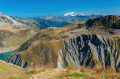
(2) Don’t look around for a ‘grand beau rocher’ – it’s right under your feet! Instead, admire the view of the Grandes Rousses massif opposite.
The return to the car park (S/E) follows the same route as the outward journey, but in the opposite direction.
 Visorando Member
 Difficult

 Easy
 Tourism professional
 Very difficult