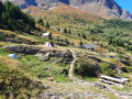
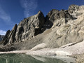
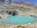
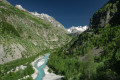
Lavey Refuge and Muande Valley from Le Clot

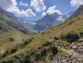
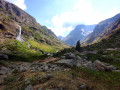
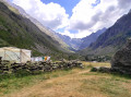
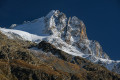
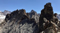
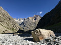
Admittedly a fairly long hike, but one that will allow you to discover the magnificent Muande valley, with the Lavey refuge halfway along, and, once you reach the end, its majestic peaks and glaciers.
No particular difficulty; the paths are always clearly visible and well signposted.
Several alternative routes are available: see the ‘Practical Information’ section.

Details

2669746
Creation:
Last update:
Last review:
  • Walking
    Activity: Walking
  • ↔
    Distance: 10.95 mi
  • ◔
    Average duration: 7h 25 
  • ▲
    Difficulty: Moderate

  • ⚐
    Back to start: Yes
  • ↗
    Ascent: + 2,749 ft
  • ↘
    Descent: - 2,746 ft

  • ▲
    Highest point: 6,476 ft
  • ▼
    Lowest point: 4,439 ft

Photos

Description of the walk

At the entrance to the village of Saint-Christophe-en-Oisans (hamlet of La Ville), take the road on the right at the first hairpin bend and follow the signs for Le Clot.
Just before the hamlet of Le Clot, park in the car park on the right. The trail starts from this car park.

(S/E) Take the path leading to the hamlet, which continues as a trail passing behind the few houses. Ignore the path climbing up to the left.
The path is fairly flat at first, then descends steeply towards the bed of the Vénéon, which you cross via a wooden bridge resting on stone pillars. Be careful, the path is very wet whatever the season!
Continue along the path on the other side of the bridge, climbing a fairly steep slope to the next junction.

(1) Take the path on the left signposted, amongst other things, Vallon de la Lavey. This path follows the course of the stream, gradually climbing.

(2) Take the path on the right, also signposted Vallon de la Lavey (the path on the left will be used for the return journey). A fairly steep climb then begins, continuing through the woodland until you reach the Souchey huts.

(3) The end of the toughest section and arrival at the Souchey huts. The path emerges from the forest and, at this point, the Vallon de la Lavey, criss-crossed by the Muande stream, really begins. Continue along the path to the next junction.

(4) Continue straight ahead (the path on the left, crossing the small stone bridge, will be taken on the return journey).
The path climbs gently up to the gate, behind which lies the Lavey refuge.

(5) The Lavey refuge is staffed in summer but remains open the rest of the year for hikers wishing to spend the night there.
Walk past the refuge and continue straight on, staying on the left bank of the Muande torrent.

(6) Continue straight on. A sign prohibits access to the path leading uphill to the right.

(7) There is no footbridge allowing easy crossing of the stream; so start now to look out for strategic crossing points to reach the other bank. The stream’s course varies greatly from year to year and from season to season.

(8) Once you have crossed the stream and rejoined the path, continue up the valley to pass the final barrier and discover the panorama of this glacial cirque.

(9) After taking in the stunning views, turn back and begin the descent.

(8) Continue along the right bank of the Muande torrent.

(10) Ignore the path on the right and continue straight down.

(11) Take the path on the left which leads to the (permanent) footbridge over the Muande, then to the Lavey refuge

(5) From the refuge, descend via the route taken on the way up.

(4) Take the path on the right which crosses the stream again via a magnificent little stone arch bridge.
Continue straight along this path, always heading downhill, ignoring all the paths coming in from the right.

(12) At the Raja huts, pass between the few alpine chalets and begin the steeper descent towards the Vénéon.

(13) Take the path on the left leading to the large stone bridge over the Vénéon.

(14) Just before the bridge (which you must not cross), take the path on the left which crosses the Muande torrent via a wooden footbridge and follows the Vénéon.
From there, the path climbs back up through the forest to the next junction, even though logic would suggest it should follow the course of the Vénéon on the descent...

(2) Return to the path taken on the way up and follow it downhill to the footbridge over the Vénéon, then to the hamlet of Le Clot and finally to the car park where you started (S/E).


Waypoints

  1. S/E : mi 0 - alt. 4,554 ft - Car park at the hamlet of Le Clot
  2. 1 : mi 0.29 - alt. 4,508 ft - Common junction A/R
  3. 2 : mi 0.55 - alt. 4,820 ft - Common junction A/R
  4. 3 : mi 1.07 - alt. 5,489 ft - Baraques du Souchey
  5. 4 : mi 2.46 - alt. 5,587 ft - Common junction A/R
  6. 5 : mi 3.37 - alt. 5,902 ft - Refuge de la Lavey
  7. 6 : mi 4.57 - alt. 6,306 ft - Continue straight ahead
  8. 7 : mi 4.94 - alt. 6,348 ft - Finding a crossing point to cross the torrent
  9. 8 : mi 5.12 - alt. 6,430 ft - Common junction A/R
  10. 9 : mi 5.3 - alt. 6,467 ft - Glacial cirque.
  11. 10 : mi 6.9 - alt. 5,938 ft - Continue straight ahead
  12. 11 : mi 7.12 - alt. 5,856 ft - Path on the left towards the footbridge
  13. 12 : mi 9.52 - alt. 5,112 ft - Chalets de la Raja.
  14. 13 : mi 9.8 - alt. 4,701 ft - Path on the left
  15. 14 : mi 9.85 - alt. 4,675 ft - Path on the left. Stone bridge over the - Vénéon (torrent) - Affluent de la Romanche
  16. S/E : mi 10.95 - alt. 4,557 ft - Car park at the hamlet of Le Clot

Notes

Firstly, bring walking poles and good footwear, preferably waterproof, as you may well get your feet wet when crossing a stream! Furthermore, the poles will be a great help when crossing the Muande stream at the point (7).

Water point at the refuge (+ drinks) when the refuge is manned. Otherwise, there are numerous springs and streams all along the route (be careful about the water’s potability during the summer grazing season).

As the paths between points (1) and (3) are on a north-facing slope and in woodland, they are often damp and can be a little slippery in places on the rocks and roots.

The paths are clearly visible throughout. When crossing the tributaries of the Muande, cairns help with navigation. The only tricky section is the crossing of the Muande itself between points (7) and (8), which is left to the discretion of each individual. If it proves impossible (or you decide to turn back!), head back to the Lavey refuge... I made this crossing after heavy rain and snowfall at higher altitudes, and it remains doable provided you have the patience to find the right route!

Visorando’s automatic route calculation indicates approximately 18km. This is a horizontal projection, and in reality this hike easily exceeds 20km with a total elevation gain of just over 800m!

Possible alternatives:
- Do the hike in the opposite direction.
- Turn back at the Lavey refuge (5), which can be a destination in itself. Admittedly, you won’t see everything, but the views up to that point will already be quite spectacular!
- Turn left at the point (4) and walk only the lower part of the Lavey valley.

You are hiking in the heart of the Écrins National Park.

The Écrins massif is an exceptional area, open to all, with a natural, cultural and scenic heritage that is truly unique. To protect these treasures, the heart of the park is marked by blue-white-red flags, where certain regulations must be observed. Please familiarise yourself with these regulations when planning your hike to help preserve this shared heritage, at https://www.ecrins-parcnational.fr.

Worth a visit

During the period when the refuge is staffed, the Lavey refuge offers drinks and snacks. Full details are available on the refuge’s website.
From this refuge, for those wishing to stay there, there are numerous hiking options: glaciers, Lake Muande or Lake Rouies, etc...

Along the route, do not hesitate to stop and look up at the peaks (snow-capped or not) or to admire the many waterfalls!

In Saint-Christophe, visit the cemetery next to the church. Many famous guides who helped build the reputation of the Écrins massif are buried there.

Reviews and comments

4.5 / 5
Based on 5 reviews

Reliability of the description
4.4 / 5
Ease of following the route
4.4 / 5
Route interest
4.8 / 5
Nonia
Nonia

Overall rating : 5 / 5

Date of your route : Jul 19, 2022
Reliability of the description : ★★★★★ Very good
Ease of following the route : ★★★★★ Very good
Route interest : ★★★★★ Very good
Very busy route : No

A magnificent hike, from start to finish! Above all, don’t hesitate to push on to the end – the ‘final’ view is spectacular! Unfortunately, we couldn’t find a way to cross the Muande at the indicated spot, or further on, but by continuing along the same bank, we got a superb view of the glacial cirque and the waterfall! It’s worth noting that we didn’t meet a single soul after passing the Lavey refuge.
We set off from the hamlet of Les Clots and really enjoyed the climb through the forest. Admittedly, it’s steep, but when the temperatures are high, it’s very refreshing!
We’d definitely do it again.

Machine-translated

Clo063
Clo063

Overall rating : 4.3 / 5

Date of your route : Sep 17, 2020
Reliability of the description : ★★★★☆ Good
Ease of following the route : ★★★★☆ Good
Route interest : ★★★★★ Very good
Very busy route : No

We set off from the car park at Champhorent and returned via Les Clots. The section between Les Clots and Le Souchey isn’t particularly interesting. You’re in the forest and the going is very steep. Via Champhorent, it’s less steep and more open.
The Lavey valley is a little gem that’s well worth the detour. The small sheepfold on the bank of the stream gives it a bucolic feel. The lone sheep guarding ‘the house’ amused us greatly. The flock is looked after by the shepherd and his border collies, no Patou dogs. We stopped at the refuge.
The climb back up to the car park is a bit of a slog. Note that the route via Les Clots involves a good 150 metres more climbing than the route via Champhorent.

Machine-translated

Wingardium
Wingardium

Hello zatops, and thank you for that very astute comment! Indeed, the route goes (back) up after crossing the footbridge at the point (14), then goes (back) down after the point (2). I’ll correct this detail in the route description.

Machine-translated

zatops
zatops

Overall rating : 5 / 5

Date of your route : Jul 30, 2020
Reliability of the description : ★★★★★ Very good
Ease of following the route : ★★★★★ Very good
Route interest : ★★★★★ Very good
Very busy route : No

A lovely hike, although we didn’t make it all the way to the end as we couldn’t find a safe enough route to cross the torrent, which was very swollen at this time of year with the snowfields and glaciers melting; the high-mountain landscape is magnificent.
For point 14, I’d suggest a small addition along the lines of: “......wooden footbridge and turn right, following the Vénéon upstream to reach point 2 of the ascent”. Indeed, the elevation data shows that you have to climb, but after point 14, when you’re absolutely knackered, you tend to think that following the Vénéon leads to a descent, as you’re heading from the headwaters to the mouth of the stream.
I noted that the route didn’t seem too busy, as only one couple overtook us, whilst we didn’t overtake anyone, and that the vast majority of hikers heading up to the Refuge de la Lavey set off from Champhorent

Machine-translated

Lachevri57V
Lachevri57V

Overall rating : 4.7 / 5

Date of your route : Jul 19, 2020
Reliability of the description : ★★★★★ Very good
Ease of following the route : ★★★★☆ Good
Route interest : ★★★★★ Very good
Very busy route : Yes

A brilliant day – everything was great

Machine-translated

Microbe123
Microbe123

Just before the little stone bridge, heading towards the mountain hut, about 100 metres above the Muande: a large scree slope of big boulders that looked to me like moraines.
Thank you for your reply.

Machine-translated

Wingardium
Wingardium

Which spot are you talking about? When I went there last year, the path was clearly visible on the ground and was easy to follow. It’s possible that an avalanche this winter may have altered the terrain.

Machine-translated

Microbe123
Microbe123

Overall rating : 3.7 / 5

Date of your route : Jun 17, 2020
Reliability of the description : ★★★☆☆ Average
Ease of following the route : ★★★★☆ Good
Route interest : ★★★★☆ Good
Very busy route : No

It’s worth mentioning, though, that we had to cross nearly 500 metres of moraines before reaching the little stone bridge, with no sign of a path whatsoever: which was quite a struggle. I can say for certain that I was on the right track (even if it was invisible!) thanks to my GPS.

Machine-translated

Wingardium
Wingardium
• Edited:

I should also point out that the Clot car park is quite small (in my opinion, it holds fewer than 10 cars). If you park a bus there, no one else will be able to park there...

Machine-translated

CONFLUENCE
CONFLUENCE

Hello Claude,
Thank you for your very quick reply. Like you, I find it difficult to get there by bus. I’ll look into other options. Best regards.
Maurice

Machine-translated

Wingardium
Wingardium
• Edited:

Hello Maurice from the Drôme, excellent choice of hike!
There are two possible starting points for this route:
- The hamlet of Le Clot, as mentioned in the description;
- The hamlet of Champhorent, a few kilometres past St Christophe on the road to La Bérarde.
I’m not at all convinced that a ‘grand tourisme’ coach could access either of these sites, if only because of traffic permit issues. Buses longer than 10 metres and taller than 4.10 metres are banned on the road to La Bérarde, and whilst getting to the hamlet of Le Clot is technically possible (the road is certainly narrow but has no sharp bends or tricky sections), I’m not sure if it’s permitted!
It would be best if you contacted the town hall of St Christophe en Oisans to get all the ‘legal’ details: 04.76.79.53.50 or mairie@saint-christophe-en-oisans.fr
There is also the option of setting off from Le Plan du Lac (a canyoning site), but that involves an extra few kilometres’ walk to reach Le Clot!
Claude

Machine-translated

CONFLUENCE
CONFLUENCE

Hello,
I am interested in this hike for a group in summer 2020. Can a coach access the “Le Clot” car park? If not, which starting point would you recommend? Thank you in advance. Kind regards, Maurice (DROME)

Machine-translated

Other walks in the area

For more walks, use our search engine .

The GPS track and description are the property of this route's author. Please do not copy them without permission.