Country:

 City:


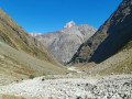
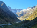


The walk starts from the hamlet of Le Clot in the commune of Saint-Christophe-en-Oisans.
From Le Bourg-d’Oisans, take the D1091 (formerly the RN 91) towards Briançon; then, at the hamlet of Le Clapier d’Auris, carry on straight ahead on the D530 towards Vénosc, Saint-Christophe-en-Oisans and La Bérarde.
In Saint-Christophe-en-Oisans, at the hairpin bend just below the village, go straight on towards Le Clot (signposted). The hamlet is located at the very end of the road (dead end), about 2.5 km away.
Park in the car park on the right before the first houses.
(S/E) From the car park, head to the right. A sign indicates the various directions, including the Vallon de la Mariande. Walk behind the few houses along a fairly flat path lined with numerous springs; ignore the path on the left, then tackle a short descent to the Torrent du Vénéon, which you’ll cross via a wide footbridge. Once on the other side, a fairly steep but short climb leads to the path coming from Plan du Lac (on the right) and heading towards La Bérarde (on the left) along the Vénéon (signposted).
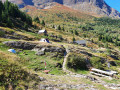
(1) Take this path on the right and, a few metres further on, take the path on the left which climbs due south towards La Gassaudière (signposted). The path, through the woodland, is quite steep but clearly visible and very easy to follow (well-maintained). You’ll reach the more or less derelict chalets at La Gassaudière and, once past the clearing, head back down towards the Torrent de la Mariande, which you’ll also cross via a footbridge. Climb back up the other side to the next junction.
(2) At the Côte Ursière junction (signposted), take the path on the left and continue climbing amongst the blueberry bushes and junipers. Along the way, ignore a path branching off to the right and carry on straight ahead to the next junction.
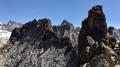
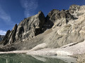
(3) When you reach the Sert de la Cochette (signposted), ignore the path on the right – which you’ll take on the way back – and head left, towards the ridge blocking the upper Mariande valley. Climb this ridge via a steep but fairly short path, take in the view, and then descend gently into the valley stretching out a little further down. Follow the more or less visible path to the end of the valley, at the foot of the Tour Rouge (on the right) and the Aiguille des Arias (opposite).
(4) From there, you can certainly go further, but there is virtually no visible path left. Turn back and return to the Sert de la Cochette.
(3) Continue straight on towards the Refuge de l’Alpe du Pin. The path is more or less level and the refuge is signposted about 80 m before you reach it. Follow the yellow markings on the rocks carefully.
(5) The Refuge de l’Alpe du Pin is open and staffed in season, with food available. Walk past the refuge and begin the descent towards the Vénéon. Initially gentle, the path becomes steeper as it winds its way into the forest via a series of fairly short hairpin bends. Towards the end, there are lovely views of the Waterfall de la Froide Pisse.
(6) You’ll reach the Plan du Lac–La Bérarde path; take it to the left (signposted). Then, a few metres further on, turn right (signposted) towards the footbridge over the Vénéon (you’ll need to go through a small gate). Cross the stream and begin the climb towards the hamlet of Les Granges.
(7) Walk uphill through the hamlet, going round the house facing the path first to the right, then to the left (signpost indicating the direction of La Bernadière) and then to the right again behind a final building. Follow the path, which is generally well-maintained, running alongside the road above. Pass behind a house, then behind a caravan. The path enters a tiny gorge, crosses a very small stream, then climbs back up to the road at the hamlet of La Bernadière.
(8) Follow this road to the right for just over 2 km to the Clot car park (S/E).

 Visorando Member
 Difficult


 Very difficult