From the Col du Lautaret to the Col du Galibier by road

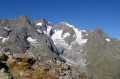
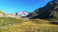
A unique hike, presenting no real difficulty, suitable for everyone and offering extraordinary scenery!

Best done in spring or autumn, when the Col du Galibier road is closed to traffic.

Details

4212920
Creation:
Last update:
Last review:
  • Walking
    Activity: Walking
  • ↔
    Distance: 10.08 mi
  • ◔
    Average duration: 6h 05 
  • ▲
    Difficulty: Moderate

  • ⚐
    Back to start: Yes
  • ↗
    Ascent: + 1,683 ft
  • ↘
    Descent: - 1,677 ft

  • ▲
    Highest point: 8,399 ft
  • ▼
    Lowest point: 6,752 ft

Photos

Description of the walk

From Grenoble, head towards Bourg d’Oisans and Briançon; from Briançon, head towards Grenoble via the D1091 (formerly the N91). This road passes through the Col du Lautaret. Park in one of the many lay-bys dotted around the Col du Lautaret area. There is one at the junction of the Nationale 91 and the Route du Galibier.
Normally, when the first snow falls, a barrier closes this road to all vehicles.

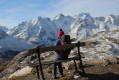
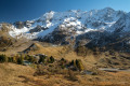
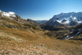
(S/E) Leave the car park and go through the barrier. Follow the road as it winds its way uphill through numerous hairpin bends. As you climb and round the bends, new, spectacular landscapes unfold before your eyes.

(1) Ignore the paths to the right and left and carry on straight ahead, staying on the road.

(2) Pass the start of the footpath on your left – which you’ll take on the way down – and carry on along the road.

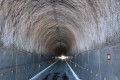
(3) After the monument dedicated to Henri Desgrange (founder of the Tour de France), you’ll reach the entrance to the tunnel.
If the gates are open, go through the tunnel (365 m long). The tunnel is unlit but runs in a straight line (you can see the other end); there are no obstacles or holes, and the road surface is in perfect condition.

If the gates are closed, take the road branching off to the right which climbs up to the Col du Galibier (the real one), provided it is passable. Otherwise, turn back.

(4) Assuming you can pass through the tunnel, you will arrive in Savoie on the Maurienne Valley side. Walk round the building on the promontory to admire the view, then return to the tunnel to pass through it in the opposite direction and begin the descent along the road.

(2) Just past an old building surrounded by protective fencing (dangerous ruins), take the path on the right (if passable) and follow it until it joins the road a little further down.

(1) Return to the road on the right, heading downhill, to reach the car park (S/E).

Waypoints

  1. S/E : mi 0 - alt. 6,752 ft - Car park at the - Col du Lautaret
  2. 1 : mi 4.17 - alt. 8,205 ft - Road–path junction
  3. 2 : mi 4.64 - alt. 8,340 ft - Road–path junction
  4. 3 : mi 4.8 - alt. 8,386 ft - Galibier Tunnel
  5. 4 : mi 5.08 - alt. 8,360 ft - Car park on the ‘Savoie’ side of the - Col du Galibier
  6. S/E : mi 10.08 - alt. 6,752 ft - Col du Lautaret car park

Notes

Check the opening and closing dates for the Col du Lautaret and the Col du Galibier before setting off. The Col du Lautaret is normally open all year round (except in the event of a snowstorm), but the Col du Galibier closes at the first sign of snow and rarely reopens before early June. Please note that in spring, there can be significant snow accumulation on the road in shaded areas!
Note that the final section of the road passing through the Col du Galibier is often impassable on the Savoie side due to the north-facing slope and heavy snow accumulation. Hence the advantage of using the tunnel to get to the other side...

The walk is classified as ‘moderate’ due to its length (16.5 km) and elevation gain (550 m), but presents no technical difficulties as you’re walking… on the road!

In principle, a simple pair of low-cut walking shoes should suffice, but you might want to bring higher, waterproof shoes in case of snow. You could also bring a torch for the tunnel section, though this isn’t essential!

There are no water points along the route, but there are two bar-restaurants at the Col du Lautaret (open almost all year round) and a small bistro on either side of the tunnel (closed out of season).

Worth a visit

The Col du Lautaret Alpine Garden, with practical information here.

There are some lovely walks in the area, such as the route to the Arsine Pass and lakes, starting from the Col du Lautaret.

A little further on, the villages of Villar-d’Arène and La Grave in the Romanche Valley, and the small town of Briançon, with its fortifications and old town at the end of the Guisane Valley.

Reviews and comments

4.7 / 5
Based on 2 reviews

Reliability of the description
5 / 5
Ease of following the route
5 / 5
Route interest
4 / 5
Eljay
Eljay

Overall rating : 4.7 / 5

Date of your route : Mar 28, 2022
Reliability of the description : ★★★★★ Very good
Ease of following the route : ★★★★★ Very good
Route interest : ★★★★☆ Good
Very busy route : No

A lovely walk. We did it at the end of the 2022 season, a year with little snow, so the route was visible beneath the snow. In heavy snowfall, the route is unlikely to be as easy to follow. We’d just like to point out that, after a break at the Galibier refuge, you can choose to head back down via the old road on the southern slope, which ends about 1 km below the pass.

Machine-translated

manu4x405
manu4x405

Overall rating : 4.7 / 5

Date of your route : Oct 25, 2020
Reliability of the description : ★★★★★ Very good
Ease of following the route : ★★★★★ Very good
Route interest : ★★★★☆ Good
Very busy route : No

We did the walk on 25 October, a week after you, but it was a circular walk, going up via the old Galibier road; the tunnel was firmly closed for the winter, which forced us to climb all the way up to the pass. It turned out to be a good thing – I’d forgotten the view from there: Mont Blanc, the Barre des Ecrins, La Meije in all its splendour, Mont Viso and Rochebrune, and so on…
Despite the icy wind, it was a lovely ride. Thank you for reminding us of it.

Machine-translated

Other walks in the area

For more walks, use our search engine .

The GPS track and description are the property of this route's author. Please do not copy them without permission.