The Lanchâtra valley

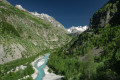
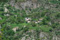
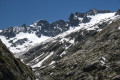
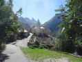
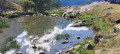
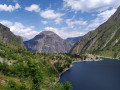
A magnificent hike in the Oisans region starting from the Plan du Lac lodge, taking in a small mountain hamlet with its tightly packed houses and offering a magnificent panorama of Pointe Swan (3,294m), all whilst following the rushing torrent of La Pisse.

Details

2167464
Creation:
Last update:
Last review:
  • Walking
    Activity: Walking
  • ↔
    Distance: 7.31 mi
  • ◔
    Average duration: 6h 25 
  • ▲
    Difficulty: Difficult

  • ⚐
    Back to start: Yes
  • ↗
    Ascent: + 3,530 ft
  • ↘
    Descent: - 3,510 ft

  • ▲
    Highest point: 7,303 ft
  • ▼
    Lowest point: 3,881 ft

Photos

Description of the walk

From Bourg-d'Oisans, head towards Saint-Christophe-en-Oisans and, at a place called "Plan du Lac", a few hundred metres past the dam, park in the car park on the right just after the lodge.

(S/E) At the end of the car park, take the double footbridge crossing the Vénéon torrent and walk a few metres to the crossroads.

(1) At the signpost, turn left onto the path that runs alongside the stream towards Saint-Christophe-en-Oisans. The path climbs slightly above the valley.

(2) At the signpost, turn right towards the Lanchâtra valley. A sign advises caution, but the path is perfectly passable and in good condition. The path climbs steadily to the start of the valley. Cross the Moulin footbridge over the Pisse stream.

(3) Follow the path on the left, which climbs steadily and runs alongside the stream for the rest of the route.

(4) Cross the stream via the footbridge and officially enter the Écrins National Park. Remember to close the gate behind you. Continue towards the Selle sheepfold.

(5) Arrival at the Selle sheepfold. Cattle and dogs present during the summer grazing season.
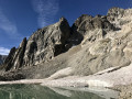
Continue the climb. Reach the highest point of the hike above the rocky outcrop to admire the cirque at the foot of Pointe Swan.

(6) Highest point and viewpoint. Turn back and descend via the same route to the crossroads at the Moulin footbridge.

(3) Continue straight on to the hamlet of Lanchâtra (well worth a visit).

(7) Continue along the path past the hamlet to begin the descent towards the Vénéon valley.

(8) At the junction, turn right. The path reaches the bottom of the valley and passes in front of the spectacular Lanchâtra waterfall. Continue along the path to return to the original junction.

(1) Turn left towards the footbridge over the Vénéon and head for the car park (S/E) .

Waypoints

  1. S/E : mi 0 - alt. 3,891 ft - Car park next to the Auberge du Plan du Lac
  2. 1 : mi 0.1 - alt. 3,885 ft - Crossroads of the circular loop
  3. 2 : mi 0.49 - alt. 4,016 ft - Turn right
  4. 3 : mi 1.5 - alt. 4,865 ft - Moulin Footbridge
  5. 4 : mi 2.02 - alt. 5,210 ft - Footbridge over the Pisse torrent
  6. 5 : mi 2.74 - alt. 5,932 ft - Bergerie de la Selle
  7. 6 : mi 3.88 - alt. 7,195 ft - Panoramic view of the Cirque des Cîmes and the glaciers
  8. 7 : mi 6.51 - alt. 4,731 ft - The hamlet of Lanchâtra
  9. 8 : mi 6.97 - alt. 4,045 ft - Turn right at the junction after the > - cascade de la pisse Lanchatra
  10. S/E : mi 7.31 - alt. 3,891 ft - Car park next to the Auberge du Plan du Lac

Notes

The route is recommended because the path on the right bank (of the Pisse torrent), whilst longer, is less steep and more ‘idyllic’ than the one on the left bank. The latter has a very steep, continuous gradient all the way to the hamlet and may be more strenuous on the ascent (300m elevation gain).
The route can, however, be taken in the opposite direction.

From late May onwards, sheep and lambs can be found roaming freely all along the route. Take great care, avoid sudden movements and shouting so as not to frighten them.

Two public fountains in the hamlet of Lanchâtra. Several spring-fed water sources along the route.

In June, there are a few patches of snow to cross, but these pose no real danger.

The location of point (6) is justified to enjoy the panoramic view of the cirque at the foot of Pointe Swan (3,294m). Indeed, the upper part of the valley is closed off by a rocky barrier that blocks all visibility unless you move forward and, above all, climb higher.

Note: For the less adventurous, there is the option of simply completing the circular route around the hamlet of Lanchâtra by turning right at point (3) to head for the hamlet and then descending back into the valley.

Finally, for photographers, the hamlet of Lanchâtra is particularly well lit by the morning sun as the house facades face east. So at point (3), you may wish to make a return trip to the hamlet for brighter shots.

You are hiking in the heart of the Écrins National Park.

The Écrins massif is an exceptional area, open to all, with a natural, cultural and scenic heritage that is truly unique. To protect these treasures, the heart of the park is marked by blue, white and red flags, where certain regulations must be observed. Please familiarise yourself with these regulations when planning your hike to help preserve this shared heritage, at https://www.ecrins-parcnational.fr.

Worth a visit

(8) The Lanchâtra waterfall opposite the lodge on the other side of Vénéon (easy access via the footbridge).
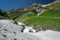
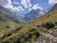
The mountain pastures, the torrent and the high-mountain scenery throughout the Lanchâtra valley.
(6) Enjoy the spectacular view of peaks over 3,000m high, still towering over a few glaciers. The climb may have been tough, but the view is well worth it.
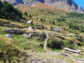
(7) Spend a few minutes in the hamlet of Lanchâtra to see the restored houses and, above all, the little chapel. Don’t hesitate to push open the door and take a look inside.

Not far from there, in Saint-Christophe-en-Oisans, lies the cemetery where many of the guides who built the reputation of the Écrins are buried.

And of course, there are plenty of other hikes, each more beautiful than the last, in the Oisans massif. But don’t shout it from the rooftops – it might attract too many people.

Reviews and comments

5 / 5
Based on 4 reviews

Reliability of the description
5 / 5
Ease of following the route
5 / 5
Route interest
5 / 5
B-ron
B-ron

Overall rating : 5 / 5

Date of your route : Jun 18, 2024
Reliability of the description : ★★★★★ Very good
Ease of following the route : ★★★★★ Very good
Route interest : ★★★★★ Very good
Very busy route : No

A lovely walk featuring a stream swollen by the melting snow, which makes the landscape even more spectacular.
I did the hike in the opposite direction, starting from the lake (dam car park) and going via the hamlet of Lanchâtra on the way there and back. In fact, when I reached the footbridge at the usual starting point, someone who was probably working on land development or something similar blocked my path, explaining that there had been a flood and access was temporarily prohibited.
In the end, on the way back I still made it as far as the Cascade de la Pisse and the path was very passable (still a bit of water here and there but no more than 3 cm deep).
The big downside, however, was the presence of the Patou dogs. On the way there I had no trouble as the herd was far from the path, but on the way back it was a nightmare; the herd had come down close to the path, so it was impossible to get past. I had to go down below and follow the stream to get round the herd, but despite that, one of the three sheepdogs wouldn’t leave me alone for 10–15 minutes, barking the whole time. Let’s be honest, it’s still quite stressful.

Machine-translated

RaphXR
RaphXR

Overall rating : 5 / 5

Date of your route : Sep 04, 2023
Reliability of the description : ★★★★★ Very good
Ease of following the route : ★★★★★ Very good
Route interest : ★★★★★ Very good
Very busy route : No

A lovely hike that takes you off the beaten track. It feels as though you’re at the end of the world.
On the way there, we went straight past the waterfall and the hamlet of Lanchâtra; it’s steep but not particularly difficult.
We spotted a few marmots in the distance as we passed by.

Machine-translated

pierre huraux
pierre huraux

Overall rating : 5 / 5

Date of your route : Aug 31, 2022
Reliability of the description : ★★★★★ Very good
Ease of following the route : ★★★★★ Very good
Route interest : ★★★★★ Very good
Very busy route : No

We followed the route as indicated: The climb between points 1 and 3 is quite tricky, particularly between 2 and 3: it is, in fact, marked as requiring caution, especially with children. Caution is advised, particularly as it had rained during the night, making certain sections tricky due to the slippery conditions.
From point 3 onwards, the route follows the valley without any difficulties;
For our part, we stopped at the Cabane de la Selle, at point 5: the presence of mountain dogs further on halted our progress.
The descent is gentle through the hamlet of Lanchâtra, before becoming steeper on a stony path, with views of the Vénéon. We passed the Pisse waterfall, which was magnificent that day (following heavy rain during the night).
A lovely hike to enjoy.

Machine-translated

JODIDO
JODIDO

Overall rating : 5 / 5

Date of your route : Jul 25, 2021
Reliability of the description : ★★★★★ Very good
Ease of following the route : ★★★★★ Very good
Route interest : ★★★★★ Very good
Very busy route : No

Last hike in Oisans before heading back to Avignon.
I climbed up in two hours, following the route description and taking the circular route indicated at the start.
Magnificent views of the Pic de Swan and the glaciers.
Return in 1 hour 20 minutes, including a visit to the charming hamlet of Lanchâtra.
The descent back to the car park must indeed be quite steep if you take this path from the start at Plan du Lac.
During the hike, I came across a flock of sheep accompanied by one or more Patou dogs. On the way up, no problem—the flock was higher up than the path. On the way back, some sheep were on the path, and I passed by, greeting the shepherdess. Then suddenly, a Patou came bounding up behind me and started sniffing me. I didn’t panic, and I could tell he wasn’t aggressive. He didn’t bark once, but followed me for about 500 metres. I wasn’t entirely reassured, but he eventually returned to his flock of sheep. And I was able to breathe a sigh of relief when I closed the gate of the footbridge over the Pisse stream.

Machine-translated

Other walks in the area

For more walks, use our search engine .

The GPS track and description are the property of this route's author. Please do not copy them without permission.