From Le Rosay to Huez via the Roman bridge

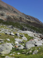
A short, unpretentious walk, offering beautiful views, a Roman bridge, the remains of mills linked to the mining village of Brandes, and a mountain village with beautifully renovated houses and narrow alleyways.

Details

n°3344064
Creation:
Last update:
Last review:
  • Walking
    Activity: Walking
  • ↔
    Distance: 3.02 mi
  • ◔
    Average duration: 1h 55 
  • ▲
    Difficulty: Easy

  • ⚐
    Back to start: Yes
  • ↗
    Ascent: + 627 ft
  • ↘
    Descent: - 640 ft

  • ▲
    Highest point: 4,997 ft
  • ▼
    Lowest point: 4,675 ft

Photos

Description of the walk

In Bourg-d’Oisans, head towards Alpe d’Huez.
After a few hairpin bends, in the village of La Garde-en-Oisans, take the road on the right in front of the church and the restaurant, which leads to various hamlets in the commune and to Auris-en-Oisans. Please note that from this point onwards, the roads are very narrow and visibility is poor.
Continue along this road for a few kilometres until you reach the hamlet of Armentier-le-Haut.
On leaving this hamlet and before the last house, take the road on the left signposted ‘Maronne’. This road passes through the hamlet of l’Armentier and then climbs up into the mountains. Carry on to the end of the road, which is the hamlet of Le Rosay, sometimes spelled Rosai.
Leave your car in the small car park at the entrance to the hamlet of Rosay, near the rubbish bin area.

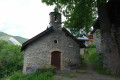
(S/E) Head north to cross this hamlet. Pass to the right of the small chapel and continue along the path. At the signpost just past the last house, carry on straight ahead towards Huez/Pont romain.
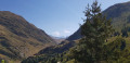
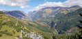
The path winds its way beneath tall trees and is very gently sloping. Reach the top of this climb, overlooking the Sarenne valley.

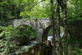
(1) Begin the descent towards the Sarenne Gorges. Continue along the path to the Roman bridge over the torrent.

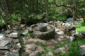
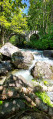
(2) Cross this bridge and take the first path on the right. This path winds its way amongst the ruins of two mills linked to the mining village of Brandes.

(3) Join the main path which climbs up through the gorges and follow it to the left (as you descend). At the signpost opposite the bridge, carry on straight ahead towards Huez.
At the next junction, you’ll reach a track; follow it to the left and ignore the path that branches off immediately to the right. Join the D211 road leading to Alpe d’Huez.

(4) Cross the road (with care) and enter the village of Huez. Explore the village via its various narrow streets. The route shown on the map is for guidance only.

After your visit, turn back and return to the starting point by following the same route via the Roman bridge, then the path towards the hamlet of Le Rosay to reach the car park at the entrance to the hamlet (S/E).


Waypoints

  1. S/E : mi 0 - alt. 4,892 ft - Car park at the entrance to the hamlet of Le Rosay
  2. 1 : mi 0.4 - alt. 4,957 ft - Start of the descent into the Sarenne Gorges
  3. 2 : mi 0.69 - alt. 4,682 ft - Roman Bridge - Sarenne (torrent) - Affluent de la Romanche
  4. 3 : mi 0.8 - alt. 4,741 ft - Ruins of mills
  5. 4 : mi 1.43 - alt. 4,760 ft - Arriving in the village of Huez
  6. S/E : mi 3.02 - alt. 4,892 ft - Car park at the entrance to the hamlet of Le Rosay

Notes

There is a water tank containing untested water in the hamlet of Le Rosay.
There is a fountain near the church in Huez and a wash house with drinking water in front of Huez Town Hall.
The paths are very easy to walk on throughout and present no particular danger.
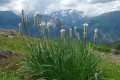
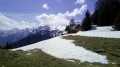
In the hamlet of Le Rosay and in Huez, there are panoramic views of the Grand Galbert, the Taillefer and the Rochail.

Worth a visit

At point (1), note the remains of the base of an old pylon that once supported a transport cable for the Herpie coal mines. Information board. A complete, similar pylon can be found on the other side of the valley.

(3) Remains of two mills. In the Middle Ages, these mills used the power of the torrent to grind grain and produce flour for the mining village of Brandes-en-Oisans. Unfortunately, there is no information board here.

At Alpe d’Huez, in the mining village of Brandes-en-Oisans. Head towards the aerodrome and then on to the Col de Sarenne. The site lies below the first hairpin bends. There are a few information boards, but there’s hardly anything left to see once you’re there. Climb up onto the rock to the south of the site, to the east of the church ruins, to get an overview and catch a glimpse of the various traces left by the houses, workshops and canals.

At the hamlet of L’Armentier, you can continue along the road towards the village and the resort of Auris-en-Oisans. It’s a rather dizzying road built into the side of the cliff.

Reviews and comments

5 / 5
Based on 1 review

Reliability of the description
5 / 5
Ease of following the route
5 / 5
Route interest
5 / 5
Bruno64
Bruno64

Hello – an easy walk starting from the hamlet of Le Rosay, or from the village of Alpes-Huez, then
the bend on the N6, the climb up to the Roman bridge is quite steep; the path is almost entirely in the shade. The hamlet of Rosay harbours a history linked to the Resistance; I really enjoy this walk

Machine-translated

ARIAJOE
ARIAJOE

Uncertain weather – hike cancelled

Machine-translated

Thermopyles
Thermopyles

Overall rating : 5 / 5

Date of your route : May 30, 2022
Reliability of the description : ★★★★★ Very good
Ease of following the route : ★★★★★ Very good
Route interest : ★★★★★ Very good
Very busy route : No

I did the walk in the opposite direction, which is much easier. If you’re staying in Alpe d’Huez, you need to drive down to Huez Village and take the path towards the Gorges de la Sarenne. Then cross the Roman Bridge and head up towards Le Rosay and Maronne. It’s a short, easy walk. After the Roman Bridge, don’t be put off by the slightly steep climb; it doesn’t last long! The hamlet of Rosay is wonderful, even if the locals seem a bit ‘reserved’. On the way back, at the Roman Bridge, walk 100 metres towards Le Gua to see the remains of three watermills, which are very interesting. Then head back to Huez Village.

Machine-translated

Other walks in the area

For more walks, use our search engine .

The GPS track and description are the property of this route's author. Please do not copy them without permission.