


nature25

 Visorando Member
 Premium user
 - Location: Doubs (25300)
- Gender: woman
Sign up:
Published route(s)
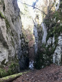
 The Dent de Vaulion via Vallorbe
 11.33 mi
 +2,671 ft
 -2,667 ft
 7h 30
7h 30
 Average
 Departure from L'Abbaye (Vaud)
The Dent de Vaulion, the iconic mountain of the Vallée de Joux and Vallorbe. A majestic peak overlooking the village of Le Pont, it rises to an altitude of 1,482 metres.
A 360° panorama unfolds before you once you reach the summit. On a clear day, you can admire up to eight distinct lakes: the lakes of Neuchâtel, Biel and Murten, Lake Geneva, Lakes Brenet and Ter, Lake Joux and Lake Rousses. The Alps, and in particular the Mont Blanc massif, complete this idyllic landscape.
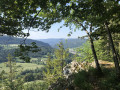
From Morbier to Bellefontaine via Sacré-Cœur
 11.71 mi
+1,854 ft
-1,860 ft
7h 00
Average
Departure from Morbier (Jura)
11.71 mi
+1,854 ft
-1,860 ft
7h 00
Average
Departure from Morbier (Jura)
Morbier forms part of the cultural and historical region of Franche-Comté. The village is renowned for its eponymous cheese, its cross-country skiing area and its clock-making industry. Indeed, around 1660, the Mayet brothers crafted their first clocks in this village and, in the 19th century, Morbier, along with Morez, was the capital of Comtois clock-making.
The village of Morbier overlooks the Morez gorge and forms part of the Haut-Jura Regional Nature Park.
The Areuse Gorges
 14.52 mi
+2,812 ft
-2,815 ft
9h 05
14.52 mi
+2,812 ft
-2,815 ft
9h 05
 Difficult
Departure from Noiraigue (Canton of Neuchâtel)
Difficult
Departure from Noiraigue (Canton of Neuchâtel)
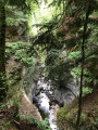
The small village of Noiraigue in the Val de Travers is the starting point for the magnificent Gorges de l’Areuse hike, the upper entrance to which is only about 1 km away.
The route runs alongside the railway line and the valley narrows considerably. The impressive gorge, with its idyllic old stone bridge, is at Saut de Brot. Continuing towards Champ-du-Moulin along a small road, you will find another crossing via a section of path that leads you back into the gorges. Gigantic rock faces soar skywards. The path takes you over small bridges and through tunnels. Then, a power station marks the end of the spectacle; just one last bridge to cross and head towards Champ-du-Moulin for the return journey along a forest road and a view of Le Creux du Van.
Les Rousses Circular Route
 11.36 mi
+1,926 ft
-1,923 ft
6h 55
Average
Departure from Les Rousses (Jura)
11.36 mi
+1,926 ft
-1,923 ft
6h 55
Average
Departure from Les Rousses (Jura)
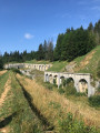
Les Rousses is a commune in the Jura department. Located in the Haut-Jura, on the border with Switzerland, it is the main commune of the Les Rousses ski resort, a major downhill skiing area comprising Les Rousses, Bois-d’Amont, Lamoura and Prémanon. The fort is open to visitors.
A lovely forest walk along pretty paths, with a short stretch along a road and a beautiful waterfall.
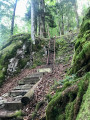
Circular route via “Chez le Bolé” to Goumois
 7.51 mi
+2,369 ft
-2,343 ft
5h 30
Difficult
Departure from Goumois (Canton du Jura) (Canton of Jura)
7.51 mi
+2,369 ft
-2,343 ft
5h 30
Difficult
Departure from Goumois (Canton du Jura) (Canton of Jura)
Circular hike starting from Goumois for a short but intense hike, mainly through woodland.
As you cross the bridge, look out for the Rocher du Singe on your left – it’s incredible.
The climb up to “Chez le Bolé” follows a challenging (but not dangerous) path – expect chains and ladders along the way!
Return via Muriaux, along lovely paths and some lovely, steep descents!
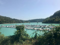
Lake Vouglans, Tour de Meix and Belvédère
 13.52 mi
+1,512 ft
-1,519 ft
7h 30
Difficult
Departure from La Tour-du-Meix (Jura)
13.52 mi
+1,512 ft
-1,519 ft
7h 30
Difficult
Departure from La Tour-du-Meix (Jura)
A very pleasant circular route along Lake Vouglans with views of the Pont de la Pyle bridge. A long ribbon winding between wooded hills, Lake Vouglans is 35 km long. Located in the heart of the Jura, it is one of the region's aquatic gems and one of the best-preserved large lakes in France. There are no roads running alongside it, and a few beaches and ports are widely open to visitors. The paths are very well marked. Discover the ruins of the Château de la Tour de Meix.
Memorial to the Mirage crash and pond at the start of Froidefontaine
 9.45 mi
+436 ft
-440 ft
4h 45
Average
Departure from Mignovillard (Jura)
9.45 mi
+436 ft
-440 ft
4h 45
Average
Departure from Mignovillard (Jura)
A peaceful walk in the Mignovillard area. You will be on the Haute Joux GRP® trail until Essart Bassand. Head towards the Seigne des Barbouillons Regional Nature Reserve, where you will pass the memorial to the crash on 9 January 2019. This memorial was erected here following the crash of a Mirage aircraft from Nancy-Ochey Air Base 133, near the site of the accident in which two soldiers were killed.Take a break at the Fontaine Carrée pond, then return via the hamlet of Petit Villard and the Moulin du Martinet.
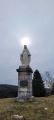
View of the top of the Chaux-Neuve ski jump and the Bief Bridaux waterfall
 5.67 mi
+873 ft
-869 ft
3h 20
5.67 mi
+873 ft
-869 ft
3h 20
 Easy
Departure from Chaux-Neuve (Doubs)
Easy
Departure from Chaux-Neuve (Doubs)
This loop will take you to the Roche Blanche viewpoint with its statue of the Virgin Mary. Enjoy a 360° panorama: to the east, Châtelblanc and the Val de Mouthe; to the west, the Val de Foncine; to the south, the vast Noirmont forest; and to the north, Les Cabouilles, La Combette, La Vernouge and Mont Croz. Then the leat Bridaux waterfall via a very narrow path (caution required), and the top of the Chaux-Neuve ski jump via beautiful paths. Return to the forest.
Banks of the Doubs, two magnificent viewpoints and the Grotte des Moines
 10.88 mi
+2,697 ft
-2,697 ft
7h 20
Difficult
Departure from Charquemont (Doubs)
10.88 mi
+2,697 ft
-2,697 ft
7h 20
Difficult
Departure from Charquemont (Doubs)
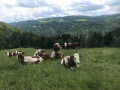
Set off to explore the banks of the Doubs, an old mill, the ruins of the Chapelle des Essarts Cuenot and two superb viewpoints: the Vieilles Femelles and the Échelles de la Mort. To finish, a lovely climb up to the Bois de la Biche to discover the Grotte des Moines and its ‘hidden’ box where you can leave a little note to say you’ve been there! Return via a magnificent path running alongside the banks of the Doubs.
The wild Biaufond valley with ladders, steps and footbridges
 11.21 mi
+3,261 ft
-3,248 ft
8h 00
Difficult
Departure from Fournet-Blancheroche (Doubs)
11.21 mi
+3,261 ft
-3,248 ft
8h 00
Difficult
Departure from Fournet-Blancheroche (Doubs)
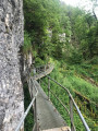
Set off to explore the Combe de Biaufond (in Switzerland) with its series of metal ladders, wooden staircases, fixed footbridges and bridges. Magical! Not recommended for those prone to vertigo. A mountain trail, therefore, difficult in places.
Then the Cerneux-Godat viewpoint and the Moulin de la Mort on the banks of the Doubs.
From a natural perspective, Biaufond’s main feature is its lake, which makes it a key wintering spot for the region’s waterbirds. But for everyone else, it is above all a magnificent destination for a walk and a meal by the water’s edge, at the crossroads of borders steeped in history.
Saint-Colombe and its chapel, La Planée and its memorial stone
 13.93 mi
+1,329 ft
-1,352 ft
7h 35
Average
Departure from Granges-Narboz (Doubs)
13.93 mi
+1,329 ft
-1,352 ft
7h 35
Average
Departure from Granges-Narboz (Doubs)
A pleasant walk through the forests of Les Granges-Dessus, Saint-Colombe and La Planée.
Discover the Chapel of Notre-Dame de Bon Secours in Saint-Colombe and the memorial to Marie-Hélène Wuilleumier: a member of the Resistance executed by the Nazis on 13 July 1944.
An easy walk along lovely paths, though, unfortunately, with a few forest tracks.I recommendusing the Visorando app or a GPS for peace of mind.
The Devil's Bridge, the Lison spring and waterfall and the Sarrazine Cave
 10.18 mi
+2,254 ft
-2,228 ft
6h 40
Difficult
Departure from Crouzet-Migette (Doubs)
10.18 mi
+2,254 ft
-2,228 ft
6h 40
Difficult
Departure from Crouzet-Migette (Doubs)
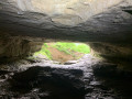
A lovely loop along beautiful paths, discovering the Pont du Diable, the Creux Billard, the Grotte Sarrazine, the Source and the Cascade du Lison. At the start of this beautiful walk, you'll cross the protected natural area of the marl pits and the Bois de Château-Renaud stream. Then head for Crouzet-Migette to reach the Source du Lison site, with a steep descent into the Combe Fagot. Before arriving at the site, you'll passthe Gros Chêne, presumed to be 300 years old, with a circumference of 5.5 m, an imposing sight. On arrival at the site: a return trip to the Creux Billard (unfortunately the Source path is off-limits), then a break at the Cascade du Lison, and a return trip to the Grotte Sarrazine (headlamp required). Then back along the Lison, a nice rest before a steep climb to Crouzet-Migette.
Le Chasseron and the Saut de l'Eau
 10.56 mi
+3,323 ft
-3,314 ft
7h 45
Difficult
Departure from Sainte-Croix (Canton de Vaud) (Vaud)
10.56 mi
+3,323 ft
-3,314 ft
7h 45
Difficult
Departure from Sainte-Croix (Canton de Vaud) (Vaud)
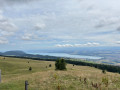
This is a fairly challenging hike with some wild sections and steep climbs, between forest and pastureland. There is a magnificent 360° view of Lake Neuchâtel and Lake Geneva from the Chasseron (altitude 1,607 m). You can also discover the Pierre de Paix (energy stone). There arefootbridges and steps at the Saut de l'Eau.
The wind turbines of Sainte-Croix and the Sentier des Bornes trail
 11.49 mi
+1,175 ft
-1,194 ft
6h 20
Difficult
Departure from Les Fourgs (Doubs)
11.49 mi
+1,175 ft
-1,194 ft
6h 20
Difficult
Departure from Les Fourgs (Doubs)
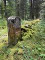
Set off to explore the two wind farm sites in Sainte-Croix, passing through hamlets, pastures, undergrowth and forest. You will pass Mont de la Chèvre, Mont des Cerfs (1,280 m) and its rural lodge, then make a round trip to see the Creux des Neiges chasm. The return journey is via the Sentier des Bornes trail.
Roche Moron and Tour Jurgensen at the start of the Col des Roches
 11.60 mi
+3,885 ft
-3,891 ft
8h 45
Difficult
Departure from Le Locle (Canton of Neuchâtel)
11.60 mi
+3,885 ft
-3,891 ft
8h 45
Difficult
Departure from Le Locle (Canton of Neuchâtel)
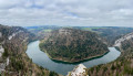
Set off to explore this magnificent trail, from La Roche and Côte de Moron, including the "Pillichody" trail (a high-altitude path, not suitable for children, impassable in winter) – sure-footedness is essential! The path is very narrow in places, with cables in place to secure the tricky sections.
The Jurgensen Tower, which is often open, is located along the route. There is a panoramic view of Villers-le-Lac, Les Brenets and the valley.
Do not attempt this hike in wet weather.
Circular walk around the Rochers de Naye starting from Caux
 9.73 mi
+4,334 ft
-4,314 ft
8h 15
9.73 mi
+4,334 ft
-4,314 ft
8h 15
 Very difficult
Departure from Montreux (Canton de Vaud) (Vaud)
Very difficult
Departure from Montreux (Canton de Vaud) (Vaud)
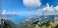
Les Rochers de Naye (2,042 m): A unique panoramic view of the Swiss and French Alps, from the Eiger to Mont Blanc and Lake Geneva. In particular, you can see the neighbouring peaks of the Dent de Jaman and Cape aux Moines, the French-speaking Jura, much of the Fribourg Pre-Alps and the Vaud Alps, including the Diablerets massif; the Bernese Oberland with the Eiger-Mönch-Jungfrau trio; as well as Mont Dolent and the Aiguille Verte in the Mont Blanc massif.
The Aiguilles de Baulmes, passing above Baulmes
 8.45 mi
+2,753 ft
-2,756 ft
6h 15
Difficult
Departure from Baulmes (Vaud)
8.45 mi
+2,753 ft
-2,756 ft
6h 15
Difficult
Departure from Baulmes (Vaud)
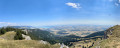
The Aiguilles de Baulmes form a range of ridges over 4 km long, running generally north-east to south-west between Mont de Baulmes and the Col de l’Aiguillon. The French-Swiss border runs 700 metres to the west of the western end of the Aiguilles. The altitude of the ridge varies between 1,080 and 1,560 metres. A wooden cross has stood on the summit since 1935. From there, one can enjoy a magnificent panorama stretching out to the south: Baulmes, the Swiss Plateau, Lake Neuchâtel and the Alps. This hike offers the opportunity to explore the ‘Cave Noire’ cave. Access is secured by chains (a head torch is essential).
The banks of the Doubs, Les Chapelles and the Corniche de Goumois viewpoint
 13.42 mi
+2,320 ft
-2,320 ft
8h 10
Difficult
Departure from Damprichard (Doubs)
13.42 mi
+2,320 ft
-2,320 ft
8h 10
Difficult
Departure from Damprichard (Doubs)
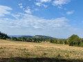
Set off to explore these magnificent trails, which are very pleasant along the River Doubs. The Leat d’Étoz and its Notre-Dame-des-Ermites Chapel, steeped in history and legend. Magnificent wooden sculptures in Urtière and its Saint-Roch Chapel. A walk through woodland, forest and meadows.
The Mont Tendre circular walk starting from Lac de Joux
 16.40 mi
+2,516 ft
-2,516 ft
9h 45
Difficult
Departure from L'Abbaye (Vaud)
16.40 mi
+2,516 ft
-2,516 ft
9h 45
Difficult
Departure from L'Abbaye (Vaud)
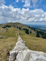
Mont Tendre is the highest peak in the Swiss Jura, in the canton of Vaud, at an altitude of 1,679 m. It is situated within the municipality of Montricher.From its summit, you can enjoy a magnificent 360-degree panorama. You can admire the Alps from the Eiger to Mont Pourri (the Vanoise massif), Lake Geneva and Lake Neuchâtel, as well as the majestic Mont Blanc massif. A leisurely return via Lake Joux.
La Dent de Vaulion via the Grotte aux Fées
 12.25 mi
+2,989 ft
-2,969 ft
8h 15
Very difficult
Departure from Vallorbe (Vaud)
12.25 mi
+2,989 ft
-2,969 ft
8h 15
Very difficult
Departure from Vallorbe (Vaud)
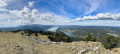
La Dent de Vaulion is the iconic mountain of the Vallée de Joux and Vallorbe, offering a magnificent 360° panorama. A majestic peak overlooking the village of Le Pont, it rises to an altitude of 1,483 metres. Its distinctive shape and location at the far end of Lake Joux earn it a prominent place in many photographs of the region. On a clear day, it is possible to see up to eight distinct lakes: the lakes of Neuchâtel, Biel and Murten, Lake Geneva, Lakes Brenet and Ter, Lake Joux and Lake des Rousses in neighbouring France. The Alps, and in particular the Mont Blanc massif, complete this idyllic landscape.
Le Cul, the Nozon Valley and the Source of the Diaz
 11.08 mi
+2,165 ft
-2,165 ft
7h 00
Average
Departure from Vaulion (Vaud)
11.08 mi
+2,165 ft
-2,165 ft
7h 00
Average
Departure from Vaulion (Vaud)
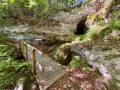
Set off to explore the “Cul du Nozon” site towards Vaulion. There are no signposts, which is a shame, as the spot is superb. There are small bridges, a path along the rock face and a waterfall. It is a truly wild and stunning place. Then head for the former Cluniac Abbey (fortified priory) of Romainmôtier, which is now a Protestant church. It is the oldest monastery in Switzerland. It was founded in the mid-5th century by the Fathers of the Jura, Saint Romain and his brother Saint Lupicin. The door is always open and entry is free. Next comes a visit to the Source de la Diaz and, to finish, the Vallon du Nozon: this site has also remained very unspoilt and is a magnificent place. There are several bridges, waterfalls and information boards about the area.