Country:

 City:
City:



Start at Le Pont, in the hamlet of L’Abbaye. Free car park below the church.
The route is very well signposted.
(S/E) Opposite the church, head left towards the signposts. Take the road heading due east to join a footpath. Join another road heading south and follow it.
(1) At the information signs for “De Sagne-Vuagnard à la Dent de Vaulion”, take the road that climbs for about 200 metres to a fork.
(2) Ignore the sign directing you to turn right up towards the Dent de Vaulion and carry on straight ahead towards Vallorbe. You’ll come to a quiet road, then a forest track leading to Vallorbe. You’ll reach a junction at Saigne Geret Dessus.
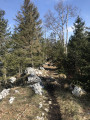
(3) Carry on straight ahead, following the sign for “Grottes de l’Orbe – Vallorbe”. As you walk along the path, do look back: you’ll see the Dent de Vaulion high up on your right, and to your left, a view of Vallorbe. You’ll reach a road (elevation 900).
(4) Leave this road and take the uphill path to the right until you reach the Revinnoz junction (elevation 774).
(5) Head towards the Dent de Vaulion, on your right. Gradually begin a lovely climb along a quiet road. Take care 200 m after the right-hand bend.
(6) Leave this road and take a signposted path on the left. You’ll reach the open hut at Pré du Creux, on your left (elevation 1076).
(7) Carry on straight ahead; a yellow sign with a hiker on it shows you the way. You’ll reach a quiet road (elevation 1156).
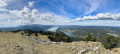
(8) Turn right onto this road. ‘Dent de Vaulion’ signposts show you the way. Enjoy the magnificent view. You’ll come to a farmhouse-chalet (elevation 1204); head up through the pasture, veering slightly to the left; in the distance, the Dent de Vaulion will help guide you. You’ll reach a road.
(9) Cross it. Look for a marker on a tree on your left, and continue straight along this path until you reach a fork at an altitude of around 1,360 metres.
(10) Be careful: take the path on your right, towards the ridges. There is a sign on a tree saying ‘trial vallée de Joux’. Tackle the final climb and reach the summit (elevation 1,483).
(11) After taking in the beautiful scenery, head down, due south, towards the chalet-refreshment bar (elevation 1,409).
(12) Head due south along a road, following the sign for “La Breguette, l’Abbaye, Le Pont 1h 25”.
''(You can shorten the walk by heading towards Le Pont (1h 10)’’
(13) At the left-hand bend, leave the road, head to the right and start descending along some lovely paths. You’ll reach a fork at an altitude of around 1,235 metres.
(14) At this point, there are two options:
- either take the Yellow Trail shown on the map.
- or you head up to the left, south-east (route of your choice). A lovely descent and quite a few fallen trees await you as you make your way back to the path.
(15) Continue down this good path to the junction near the road.
(16) Turn sharp right onto the road leading down towards a bunker, heading towards Le Pont. Join a road and follow it to the left for about 150 metres.
(17) Leave the road and turn right to cut across the bend. Cross the road further down and, across the field, you’ll reach the original fork in the path.
(2) Turn left and retrace your steps along the path you took on the way there until you reach the right-hand bend and its signposts.
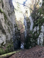
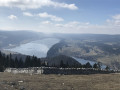
(1) Head slightly to the left along a magnificent path running parallel to the road, where you’ll come across some ruins, a viewpoint over Lake Joux and a beautiful fault line. Continue towards the Grand Hôtel du Lac de Joux.
(18) From there, turn right, then take a small path to the left and head towards the closed church. You will then reach the car park below (S/E).

 Visorando Member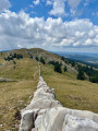
 Difficult
 Easy
Easy 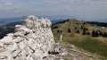
 Very difficult