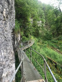
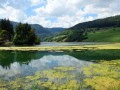
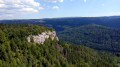
Banks of the Doubs, two magnificent viewpoints and the Grotte des Moines

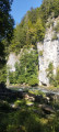
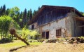
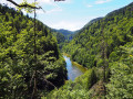
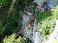
Set off to explore the banks of the Doubs, an old mill, the ruins of the Chapelle des Essarts Cuenot and two superb viewpoints: the Vieilles Femelles and the Échelles de la Mort. To finish, a lovely climb up to the Bois de la Biche to discover the Grotte des Moines and its ‘hidden’ box where you can leave a little note to say you’ve been there! Return via a magnificent path running alongside the banks of the Doubs.

Details

53929081
Creation:
Last update:
Last review:
  • Walking
    Activity: Walking
  • ↔
    Distance: 10.88 mi
  • ◔
    Average duration: 7h 20 
  • ▲
    Difficulty: Difficult

  • ⚐
    Back to start: Yes
  • ↗
    Ascent: + 2,697 ft
  • ↘
    Descent: - 2,697 ft

  • ▲
    Highest point: 3,009 ft
  • ▼
    Lowest point: 1,762 ft

Photos

Description of the walk

Car park at the Échelles de la Mort site. Very narrow road – please take care.

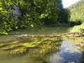
(S/E) Look out for the signs and continue straight on towards “La Roche aux Chevaux”. You’ll pass the Refrain power station. You’ll walk alongside the River Doubs on a lovely path. Just before crossing a small bridge, if it has rained, you’ll be able to see a waterfall on your left.

(1) At a place called Bas du sentier du Chevreuil, take the path on your right, still heading towards La Roche aux Chevaux.

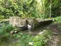
(2) At a place called Charbonnière du Bas, keep to the right, still heading towards La Roche aux Chevaux. You’ll pass the ruins of the Charbonnière du Bas mill. A little further on, you’ll cross a small bridge.

(3) After passing a large fir tree, take the steps towards Les Essarts Cuenot.

(4) At the hamlet of Les Champs du Doubs, you’ll join theGR®5Jura –GR®509. Take the path on the right, still heading towards Les Essarts Cuenot.

(5) Look out for a path leading down to the right which takes you to the hamlet of La Verrerie de La Goule. Then take the path leading uphill, still heading towards Les Essarts Cuenot.

(6) At a fork in the road, continue uphill to the left. You’ll pass La Roche du Midi and carry on uphill.

(7) At the hamlet known as Côte de la Verrerie, turn left towards the Belvédère des Vieilles Femelles. Stay on the main path. You’ll pass the ruins of the Chapelle des Essarts Cuenot. Continue uphill to the next signpost.

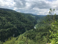
(8) Head towards the viewpoint for a round trip of approximately 500 m. Magnificent view over the valley.

(9) Retrace your steps.

(8) Take the path opposite, towards Château de Paille. Stay on this forest track until you reach the small road at a place called Le Sas Durain.

(10) Take the small road on your left, towards Le Boulois, until you reach this farm.

(11) Take a path leading down to the left, towards La Piolotte. Keep an eye out a little further on for a barely visible path on the left (yellow/blue markings on the trees). It becomes better marked further on. You’ll come to a forest track; continue downhill until you reach a red marker.

(12) Follow the edge of the forest until the next junction on your right. Then cross the small bridge on your left and continue along the path: be careful from here on, as the markings are not very visible.

(13) At the signpost, take the path leading uphill to the right, towards Échelles de la Mort via La Couleuse aux Loups. After the farm shed, take the middle path; you’ll find the markings again. Take the path leading downhill.

(14) Carry on straight ahead, ignoring the signpost directing you towards the Refuge de Vaudey.
A little further on, climb a few metres to spot a path leading down to your left. Continue downhill until you find the signposting again.

(15) At the hamlet of La Couleuse aux Loups, head towards Échelles de la Mort. You’ll pass a lovely spot to take a break. At the hamlet of Chez France, follow the signs for the Belvédère des Échelles de la Mort for a 100-metre round trip.

(16) Return to the hamlet of Chez France and head left towards Le Bois de la Biche. The signposts are clearly visible.

(17) When you reach the signpost, turn left towards Usine du Refrain and Grotte des Moines via the Gorges du Doubs. The sign indicates a narrow mountain path, but don’t worry – it’s perfectly passable and even pleasant. You’ll reach the cave halfway along (where you’ll need to look for the ‘box’ to leave a message saying you’ve been there). Then carry on down to the road.

(18) Carry on downhill along this small road to the left and, a little further on, look out for the signpost on your left directing you to head down into the forest until you reach the next road junction.

(19) Carry on for a few metres along this small road on your left, then leave it to follow the signposting on your right. You’ll come back to the River Doubs.

(20) You don’t have to do this 700-metre round trip; the Antre du Loup is just a rock.

(21) Then retrace your steps.

(20) Carry on straight ahead, following the river Doubs. A magnificent path, where you’ll have several opportunities to walk right down to the riverbank. You’ll reach the road.

(22) Follow the road carefully, following theGR®5Jurasignposts, until you reach the car park (S/E).

Waypoints

  1. S/E : mi 0 - alt. 1,824 ft - Échelles de la Mort car park
  2. 1 : mi 1.14 - alt. 1,864 ft - Bottom of the Chevreuil trail - Doubs (rivière)
  3. 2 : mi 1.34 - alt. 1,795 ft - Lower Charbonnière
  4. 3 : mi 1.64 - alt. 1,772 ft - Staircase
  5. 4 : mi 1.79 - alt. 2,031 ft - Les Champs du Doubs
  6. 5 : mi 2.35 - alt. 1,909 ft - Downhill path
  7. 6 : mi 2.72 - alt. 1,903 ft - Fork
  8. 7 : mi 3.4 - alt. 2,470 ft - Côte de la Verrerie
  9. 8 : mi 3.81 - alt. 2,677 ft - Crossroads – Access to the viewpoint
  10. 9 : mi 3.96 - alt. 2,595 ft - Belvédère des Vieilles Femelles (Damprichard)
  11. 10 : mi 4.76 - alt. 2,976 ft - Le Sas Durain
  12. 11 : mi 5.37 - alt. 3,009 ft - Forest track
  13. 12 : mi 5.69 - alt. 2,694 ft - La Piolotte
  14. 13 : mi 6.2 - alt. 2,638 ft - Uphill path
  15. 14 : mi 6.57 - alt. 2,815 ft - Junction
  16. 15 : mi 7.27 - alt. 2,178 ft - La Couleuse aux Loups
  17. 16 : mi 7.44 - alt. 2,067 ft - Viewpoint
  18. 17 : mi 8.61 - alt. 2,769 ft - Refrain Mill - Grotte des Moines (Fournet-Blancheroche)
  19. 18 : mi 8.87 - alt. 2,382 ft - Route
  20. 19 : mi 9.31 - alt. 2,057 ft - Route
  21. 20 : mi 9.46 - alt. 1,942 ft - Junction – Access to a shelter
  22. 21 : mi 9.63 - alt. 1,972 ft - The Wolf’s Lair
  23. 22 : mi 10.26 - alt. 1,870 ft - Route
  24. S/E : mi 10.88 - alt. 1,824 ft - Échelles de la Mort car park

Notes

Yellow/blue signposting.
Between points (2) and (3), at the Roche des Chevaux: picnic table.
At point (9): at the Belvédère des Vieilles Femelles, there is a picnic table.
From point (13), be very careful, as the signposting is poor and the path isn’t very visible! Use your GPS for guidance.
After the point (14): a magnificent spot to take a break, with a picnic table.

Worth a visit

The Belvédère des Échelles de la Mort: the valley opening up before you is in fact an impressive natural canyon. Its rather ominous names bear witness to the fear these places may once have inspired: Désert de la Mort, Moulin de la Mort, Aiguille de la Mort, and even Couleuse de la Mort. Very often, air currents trapped within the gorges swirl round the steep walls, producing a distinctive sound – hence the name ‘Orgues de la Mort’ (Organs of Death) given to these immense limestone cliffs.

You can tackle the Échelles de la Mort from its viewing point.
There is a via ferrata route at the Échelles de la Mort site.

A hike taking 6 hours (at a leisurely pace)

Always be cautious and plan ahead when you're outdoors. Visorando and the author of this route cannot be held responsible for any accidents occurring on this route.

The GR® and PR® markings are the intellectual property of the Fédération Française de Randonnée Pédestre.

Reviews and comments

5 / 5
Based on 2 reviews

Reliability of the description
5 / 5
Ease of following the route
5 / 5
Route interest
5 / 5
nature25
nature25
• Edited:

Thanks for the feedback.
Alas, as is so often the case, the loggers cause a lot of damage in the forest!!
Luckily, you managed to get back onto the path.
Sylvie (nature25)

Machine-translated

christv
christv

Overall rating : 5 / 5

Date of your route : Aug 23, 2026
Reliability of the description : ★★★★★ Very good
Ease of following the route : ★★★★★ Very good
Route interest : ★★★★★ Very good
Very busy route : No

A lovely walk, mostly in the shade. There are no particular difficulties, apart from finding the path at point 11. After walking through the woods for a few metres, you’ll find yourself on a logging track, which you need to cross to spot a very narrow, barely visible path that leads onto the signposted route. Thanks to the author for sharing this.

Machine-translated

User 14338503

Overall rating : 5 / 5

Date of your route : Oct 30, 2025
Reliability of the description : ★★★★★ Very good
Ease of following the route : ★★★★★ Very good
Route interest : ★★★★★ Very good
Very busy route : No

To be completed in early October

Machine-translated

Other walks in the area

For more walks, use our search engine .

The GPS track and description are the property of this route's author. Please do not copy them without permission.