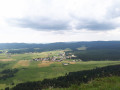
From Morbier to Bellefontaine via Sacré-Cœur

Morbier forms part of the cultural and historical region of Franche-Comté. The village is renowned for its eponymous cheese, its cross-country skiing area and its clock-making industry. Indeed, around 1660, the Mayet brothers crafted their first clocks in this village and, in the 19th century, Morbier, along with Morez, was the capital of Comtois clock-making.
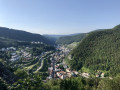
The village of Morbier overlooks the Morez gorge and forms part of the Haut-Jura Regional Nature Park.

Details

34818159
Creation:
Last update:
Last review:
  • Walking
    Activity: Walking
  • ↔
    Distance: 11.71 mi
  • ◔
    Average duration: 7h 00 
  • ▲
    Difficulty: Moderate

  • ⚐
    Back to start: Yes
  • ↗
    Ascent: + 1,854 ft
  • ↘
    Descent: - 1,860 ft

  • ▲
    Highest point: 3,770 ft
  • ▼
    Lowest point: 2,648 ft

Photos

Description of the walk

Start from the church; there is a car park nearby.

(S/E) Walk round the back of the church, heading towards the viaduct.

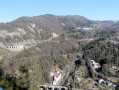
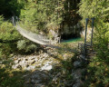
(1) From the viaduct, head uphill towards the hamlet of Les Crottes on your left. You can admire Morbier as you climb.

(2) At the hamlet of Les Crottes, head straight on towards Les Trois Commères. Take care, as you’ll be walking along the edge of the cliffs, keeping to the right-hand side at all times. Continue through the forest along some lovely paths until you reach the road.

(3) Walk up the (quiet) road to the left for 200 m until you reach the hamlet of Les Trois Commères.

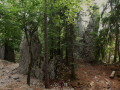
(4) Turn right towards Roche Devant and carry on along lovely paths with views over the valley. On your left, you can admire the Trois Commères (rock formations). You’ll come to a fork in the path.

(5) Turn right and carry on until you reach the start of a path on the right.

(6) Take a short round trip to the right towards the La Roche Devant viewpoint. The direction is not signposted.
On your return, continue to the right, towards Bellefontaine, until you reach a house and its farm

(7) Turn right onto the road (which has little traffic).

(8) At a place called Chaux Mourant, carry on along the road to the left until you reach a three-way junction. Turn right across the field; after about a hundred metres, you’ll reach Sacré-Cœur, where you can enjoy a magnificent view of the valley.

(9) Return to the junction, ignore the entrance to the house and turn right to reach the three-way junction at Sous le Chalet.

(10) Turn left onto Route du Chalet, heading towards Les Vignes, and quickly take the forest track on the right. At the next junction, turn left, enter the forest and, after about 200 metres, turn right.

(11) At the meadow, keep to the right and continue through the woodland. Turn left at the next two junctions and you’ll come out onto a road.

(12) Carry straight on along the road and, 100 m further on, leave it and take a grassy path on the left.

(13) At a place called Les Vignes, carry on straight ahead towards Stade des Marais, still following lovely paths. Walk past the Chalet Pécaud, then turn right about a hundred metres further on. Carry on until you find an inconspicuous path on the right once you reach the edge of the woods at a place called Le Matin du Chemin.

(14) Follow this path to the right, heading towards Les Préhez (1.1 km). Continue downhill; at the next junction, turn left and head slightly uphill. The path turns right along the edge of the woodland. Cross a track leading to the pastures, then carry on straight ahead until you emerge from the woodland at Stade des Marais.

(15) At the Stade des Marais, you can take a break (picnic table). Take the road opposite, then the path on the left, back into the forest. Follow the yellow markings. As you leave the woods, walk along the edge for a few metres, then be careful: as soon as you see the campsite, take the path on your left that leads down to it.

(16) Do not enter the campsite, but go round it on the left and take the faintly marked path on the left at the clearing in the trees. Cross the meadow and then head into the woodland opposite. The path climbs, veers to the left, then bends to the right and reaches a fork at a place called ‘le Réservoir’. Turn right towards Morbier. Walk down to the houses.

(17) Ignore them and carry on straight on until you reach the viaduct.

(2) Cross the viaduct again, heading in the opposite direction to your outward journey.

(1) Turn left towards Le Belvédère after 300 m.

(18) Retrace your steps, then, after about 100 m, take a path on the left leading to the Route Blanche, where you can admire the viaduct on your right. Turn right and you’ll come back to the church (S/E).


Waypoints

  1. S/E : mi 0 - alt. 2,687 ft - Car park near the church
  2. 1 : mi 0.13 - alt. 2,726 ft - The viaducts
  3. 2 : mi 0.17 - alt. 2,779 ft - Les Crottes
  4. 3 : mi 1.04 - alt. 3,268 ft - Col de la Bucle
  5. 4 : mi 1.28 - alt. 3,422 ft - The Three Gossips
  6. 5 : mi 1.9 - alt. 3,560 ft - Junction
  7. 6 : mi 2.55 - alt. 3,734 ft - Viewpoint
  8. 7 : mi 3.49 - alt. 3,615 ft - Chaux Mourant Farm
  9. 8 : mi 3.97 - alt. 3,481 ft - Chaux Mourant
  10. 9 : mi 4.27 - alt. 3,586 ft - Sacré-Cœur
  11. 10 : mi 4.47 - alt. 3,589 ft - Beneath the Chalet
  12. 11 : mi 5.09 - alt. 3,655 ft - Meadow
  13. 12 : mi 6.41 - alt. 3,425 ft - Junction
  14. 13 : mi 6.71 - alt. 3,337 ft - Les Vignes
  15. 14 : mi 7.66 - alt. 3,340 ft - Le Matin du Chemin
  16. 15 : mi 9.04 - alt. 3,054 ft - Stade des Marais
  17. 16 : mi 10.15 - alt. 2,871 ft - Campsite
  18. 17 : mi 10.74 - alt. 2,890 ft - Sous la Bucle
  19. 18 : mi 11.39 - alt. 2,782 ft - Former viewpoint
  20. S/E : mi 11.71 - alt. 2,687 ft - Car park near the church

Notes

Parking near the church is limited but free.
Picnic table at the Stade des Marais.

(16) The path is poorly signposted, so please be careful and follow the GPS track closely.

(18) You can return to the viaduct and then to the starting point by following the route in reverse.

This route passes through a protected area, which may be subject to special regulations:

Worth a visit

The Sacré-Cœur in Bellefontaine.

Reviews and comments

4.6 / 5
Based on 3 reviews

Reliability of the description
4.7 / 5
Ease of following the route
4.7 / 5
Route interest
4.3 / 5
MINOMICHEL
MINOMICHEL

Overall rating : 4 / 5

Date of your route : Jun 07, 2026
Reliability of the description : ★★★★☆ Good
Ease of following the route : ★★★★☆ Good
Route interest : ★★★★☆ Good
Very busy route : No

A lovely walk with stunning views of Morez; the route along the ridges is very pleasant through the woodland, and the return leg is excellent too – an interesting walk

Machine-translated

cuzcodom
cuzcodom

Overall rating : 4.7 / 5

Date of your route : Jul 13, 2025
Reliability of the description : ★★★★★ Very good
Ease of following the route : ★★★★★ Very good
Route interest : ★★★★☆ Good
Very busy route : No

Nice hike. Very varied, especially the first part.
There are many logging sites along the route, but with the app you can get around them.
However, I would classify it as "difficult" given the length and elevation gain.
Thanks for this hike, which was nice and cool compared to the plains.

Machine-translated

Cathy21200
Cathy21200

Overall rating : 5 / 5

Date of your route : Sep 09, 2023
Reliability of the description : ★★★★★ Very good
Ease of following the route : ★★★★★ Very good
Route interest : ★★★★★ Very good
Very busy route : No

A lovely walk.
The route is clearly marked with a yellow line. The start point behind Morbier church is easy to find.
The route offers a variety of terrain, ranging from woodland to mountain pastures.
We covered 21.6 km on this lovely walk in 5 hours, with 568 metres of elevation gain.
We took a wrong turn on the way back down to the Bucle campsite.
So we retraced our steps and spotted the little path branching off to the left along the fence in the meadow.
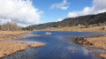
This final climb adds nothing to the route, as you immediately head back down towards the Bruyères lake.
I think there might be a way to go straight on?

Machine-translated

nature25
nature25

Just for your information, the hike took 5 hours (I’m the author)!!

Machine-translated

Other walks in the area

For more walks, use our search engine .

The GPS track and description are the property of this route's author. Please do not copy them without permission.