Country:

 City:
City:


Paid car park at the foot of the church, on Rue du Lac.
(S/E) From the car park, opposite the church, follow the pavement on your left to find the signposts for the Mont Tendre route. Shortly afterwards, cross the road carefully and take the road leading uphill; you are now on the Chemin des Crêtes du Jura. When you reach the top of this, look out for the signposting and take the path leading slightly uphill to the left. When you reach the road, continue uphill to the next signpost.
(1) Turn into the field on your right and continue uphill. A little further on, cross the road carefully and take the path opposite. You will then reach another small road; continue along this for a few metres to the right, then take the path on your right, heading due south. Continue uphill to the next signpost. The signposting is clearly visible.
(2) Turn right to cross the field to the road. Caution: there is no pedestrian crossing, so cross the road carefully and take the path leading uphill, slightly to the left. Continue uphill and stay on this path.
(3) After passing through the gate, turn left into the field and carry on straight ahead.
(4) When you reach the road, look out for a path on your left a little further on. Continue through the field to rejoin the road a little further on. Carry on straight ahead until you reach the next sign, at a place called ‘Les Croisette’. Then leave the road and take the path on your left. Ignore all other paths and continue uphill. The signposting is always clearly visible.
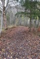
(5) You’ll come to a road; carry on straight ahead, then at the Pré de l’Haut junction, turn right. Carry on straight ahead; the road turns into a forest track. Do not go to the farm; at the crossroads, turn right and take the path leading uphill. Stay on this forest track, ignoring all other paths, until you reach the 1417 high point.
(6) Leave the track and turn left. Head up through the field and look out for a small patch of undergrowth with stones, just to the right. Head in that direction and continue climbing across the fields. The path is rather overgrown. There is a long stretch with few markings before you reach Chalet Pierre.
(7) Carry on across the fields until you reach the track, then take the forest track leading uphill to the left to Chalet du Mont Tendre.
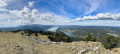
(8) Go round the back of the chalet and carry on straight ahead to the summit of Mont Tendre. At the summit, carry on straight ahead; you’ll be heading down towards Les Bioux.
(9) Take the path on your right; be careful, as this section is very stony. You’ll pass the Chalet de Yens and continue straight on until you reach the next signpost.
(10) From there, take the path leading down to the right. At the next ‘passage’, look just to the right, in the field, for the signpost and continue down to the road.
(11) You’ll arrive at a place called Bois de la Rippe. Cross the road carefully and take the path opposite through the woodland. When you reach the road again, continue along the fence on a lovely narrow path. When you reach the road, cross it carefully and take the path opposite into the field.
(12) You’ll arrive near the Chalet des Saules. Turn right to walk past it. Continue along this main path, which descends gently. Further on, you’ll have a magnificent view of Lake Neuchâtel towards a farm. From there, carry on straight ahead until you reach the sign for the hamlet known as “Les Pièces”. You’ll arrive at a road.
(13) Take the path leading down to the right across the field to the road. Continue along this descending road and, after the bend, turn right onto the path leading down to a house. Walk past it and, immediately afterwards, turn right to continue downhill to the hamlet known as Bioux-dessus.
(14) Continue down this path to reach Les Bioux. Then turn right to visit the chapel, then keep left until you reach the Fork in the road. Cross it carefully and head towards the lake.
(15) Turn right to reach Le Pont. Walk leisurely along the lake.
(16) You’ll arrive at L’Abbaye; continue along this path and cross the bridge. At the road, take the path on the left to walk along the lake (S/E).
 Visorando Member
 Moderate
 Easy
Easy 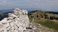
 Very difficult