Country:

 City:
City:


Start at the Nidau bus stop just before Vaulion. Unpaved car park, free of charge.
(S/E) From the car park, take the path on the far left which climbs into the forest, following the yellow markings. Enjoy a magnificent view of the Alps. There will be some branches on the path and a fallen tree. Pass through the gap (turnstile) at the edge of the forest and head uphill towards the wind turbines (without going right up to them) to stay on the path. Continue until you reach a road.
(1) Leave the yellow markings and take the road leading downhill to the left, following the orange dot markings. Open the two successive gates to pass in front of Suchaud Farm. The road turns into a forest track.
(2) Take the path going uphill, continuing to follow the orange dot markings. Then head down to the road and keep to the right on the stony path to avoid the road.
(3) Cross the road carefully and carry on straight ahead to reach Vaulion. Walk through the village following the yellow signposts
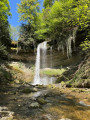
(4) On leaving the village, turn left onto the road leading uphill, which turns into a forest track. You are now on the Chemin des Vyneuves. Walk past the fountain and, a little further on, look out for the path leading down to the left with a sign saying ‘Beware of rocks’. Start this magnificent trail through the Cul du Nozon area, with several small bridges and waterfalls. Climb the steps and leave the yellow markings behind.
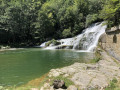
(5) Head straight on along the narrow, descending path. Then further down, at the junction of the paths (tree with blue arrows), take the path on the right to reach the Cul du Nozon waterfall. The waterfall is just past the Au Vieux Moulin bridge. This section is very wild and the path is barely visible. Carry on until you reach a large clearing. Take a round trip to the ‘Roue du Vieux Moulin’ waterwheel, crossing the bridge (picnic table). Cross the bridge again and carry on straight ahead (Chemin du Cul du Nozon).
(6) At the junction, carry on straight ahead along the Chemin du Bas de la Côte (marked with a pink dot). Further on, pass a picnic table and a large Swiss flag. Carry on until you reach the road.
(7) Follow the yellow markings again. Head up the road to the right, which turns into a forest track (Chemin de la Fourmilière), and continue along this main track. An arrow pointing towards a tree indicates you should turn left onto the Chemin des Planets.
(8) You’ll come to a forest road; turn right and head up it. The signposting is clearly visible.
(9) Leave this track and head down into the woods on the left (arrow on a tree). Leave the woods, go through the gate (which needs lifting) and continue down towards the farm. Pass between the buildings and carry on straight on until you reach the road.
(10) Leave the bridge and the return path on your left. Carry on straight ahead along the road (about 500 metres) to join the Sentier de l’Eau et du Vallon du Nozon. Look out for the path leading down to the left and carry on to the large bridge.
(11) Leave the yellow markings and take the inconspicuous path on the right to join a forest track. Then turn left and stay on this main track, which alternates between track and road (no markings). At the junction with the descending forest track, continue along the road to the right.
(12) Leave the road and take the path leading downhill to the left. At the crossroads, carry straight on for a short while and look out for a path leading downhill to the left. Carry on downhill until you reach a grassy path and a bridge. You are now in Romainmôtier. Cross the bridge to reach the Passage du Barrage and the Route de Juriens. Turn left and head towards the main gate of the abbey site.
(13) Walk around it and visit the interior (the door is always open, free of charge). If the small door to the Chapelle Saint-Michel is open, do go inside.
Then return to Route de Juriens.
(13) Follow the yellow signposts and turn right, then left (Rue du Collège). Carry on straight ahead to reach the Chemin du Canal. Leave the signposted route at the bridge, cross it on the left-hand side and head uphill. At the junction of the paths, keep right to reach the Source de la Diaz. Walk to the spring and back, then cross the bridge and continue along this path.
(14) At the junction, turn right onto the Chemin de la Diaz as far as the cemetery, then turn left onto the Chemin du Stand. At the junction, turn left to reach the Vallon.
(15) You’ll enter the Vallon site. The route is well signposted. There are several bridges and some narrow paths in places. Head uphill to reach the junction from the outward leg.
(11) Turn right, heading in the opposite direction to the outward journey, along the footpath and then the road, until you reach a fork near a bridge you passed on the outward journey.
(10) Turn right, cross the bridge over Le Nozon to reach the car park (S/E).
 Visorando Member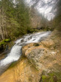


 Difficult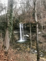
 Easy
Easy 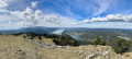
 Very difficult