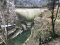
Châtelot Dam, Forges du Pissoux and Grotte du Grenier

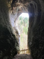
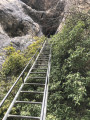
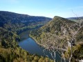
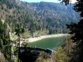
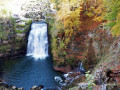
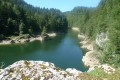
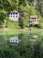
A magnificent walk along the Doubs, passing through Les Forges du Pissoux. A climb towards Le Sapelot via the Sentier des Graviers before descending to the Grotte du Grenier. There’s a viewpoint just before it, ideal for a break. A very steep ladder awaits you as you enter the cave (no need for a head torch!). A gentle walk back to the “Chez Nemorin” junction, then on to the dam. The return to the car park is via a flight of steps.

Details

n°46810117
Creation:
Last update:
Last review:
  • Walking
    Activity: Walking
  • ↔
    Distance: 9.99 mi
  • ◔
    Average duration: 7h 20 
  • ▲
    Difficulty: Difficult

  • ⚐
    Back to start: Yes
  • ↗
    Ascent: + 3,123 ft
  • ↘
    Descent: - 3,140 ft

  • ▲
    Highest point: 3,297 ft
  • ▼
    Lowest point: 2,034 ft

Photos

Description of the walk

Car park at the top of the Châtelot Dam, at the bottom of the hamlet of Pissoux.

(S/E) Walk up the road to join the path leading down.

(1) Take the path down towards “Forges du Pissoux”.

(2) Turn left towards “Forges du Pissoux” along an uphill path.

(3) Take the beautiful path on your right and you’ll arrive at Chez Némorin.

(4) Continue to the right until you reach a fork in the path.

(5) Head towards “Forges du Pissoux” on the right. Walk alongside the River Doubs. In places, you’ll pass through narrow paths classified as “mountain trails”, then down some steps. Stay alert.

(6) Walk past the Abri du Torret (which was open when we were there) and take the path leading down to the right, towards “Les Graviers”. There’s a lovely spot by the water at “L’abri des pécheurs”. You are now on theGR®5Jura.

(7) Take the path leading uphill on the left, towards “Le Sapelot”. Stay alert.

(8) Elevation 702. Continue climbing to the left. A little further on, ignore the path on the right and carry on until you reach the next sign for “Sentier du Moulin”. Magnificent view over the valley.

(9) Take the path leading uphill on your right, towards “Ville Basse”, and cross a field before reaching a road.

(10) Turn left, towards “Grotte du Grenier”. Walk carefully along the road until you reach the “Les Planots” junction.

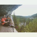
(11) Take the path leading down to your left. When you reach the hamlet of Les Planots, continue towards “La grotte” along this lovely path. The route to the cave is clearly signposted. There’s a lovely viewpoint just before you reach the cave.

(12) A steep, impressive ladder allows you to make a return trip to the cave.

(13) Carry on towards “Châtelot Parking” along the descending path. Ignore all the paths on your right and head back to the junction you passed on the way there.

(5) Carry on straight ahead along the path you took on the way out and you’ll reach another fork you passed on the way out. You’ll pass Chez Némorin again.

(4) Walk up the path and look for the sign on a tree pointing towards “Le Pissoux”.

(14) Leave theGR®5Jura on your left to take this lovely path until you reach a junction, which you also passed on the way there.

(3) Carry on straight ahead in the opposite direction to your outward journey until you reach the original fork.

(2) Take the path on your left, towards “Écluse”. You’ll see the dam. Further down, follow the Doubs along some magnificent paths: on the other side lies Switzerland. You’ll reach a fork in the path (elevation 684).

(15) You can take a detour to see the dam up close, then climb this stony path up to the steps.

(16) Turn back.

(15) Turn left and you’ll reach the start of a flight of steps.

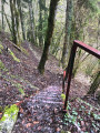
(17) Climb these steps to the car park (S/E). Halfway up, you can head down to the viewpoint to see the dam.

Waypoints

  1. S/E : mi 0 - alt. 2,543 ft - Châtelot car park - Belvédère du Châtelard
  2. 1 : mi 0.03 - alt. 2,546 ft - Head towards Forges du Pissoux
  3. 2 : mi 0.27 - alt. 2,431 ft - Junction of the circular dam loop
  4. 3 : mi 0.3 - alt. 2,441 ft - Common junction for the out-and-back route
  5. 4 : mi 0.68 - alt. 2,303 ft - At Némorin. Common junction (out and back)
  6. 5 : mi 0.81 - alt. 2,323 ft - Junction for the second circular loop. Follow the - Doubs (rivière)
  7. 6 : mi 2.47 - alt. 2,044 ft - Abri du Torret. Head towards Les Graviers.
  8. 7 : mi 3.64 - alt. 2,037 ft - Uphill path
  9. 8 : mi 3.91 - alt. 2,316 ft - Uphill path.
  10. 9 : mi 5.09 - alt. 2,490 ft - Head towards Ville Basse.
  11. 10 : mi 5.97 - alt. 3,199 ft - D211. Towards Grotte du Grenier.
  12. 11 : mi 6.67 - alt. 3,278 ft - Place known as: Les Planots.
  13. 12 : mi 7.54 - alt. 2,703 ft - Towards the cave
  14. 13 : mi 7.83 - alt. 2,320 ft - Grotte du Grenier (Grand'Combe-des-Bois)
  15. 14 : mi 9 - alt. 2,484 ft - Leave the GR5 Jura.
  16. 15 : mi 9.65 - alt. 2,247 ft - Junction. Return trip to the viewpoint
  17. 16 : mi 9.71 - alt. 2,297 ft - Barrage du Châtelot
  18. 17 : mi 9.83 - alt. 2,349 ft - A series of steps - Barrage du Châtelot
  19. S/E : mi 9.99 - alt. 2,539 ft - Châtelot car park - Belvédère du Châtelard

Notes

Please note: the start is on the French side, heading towards Villers-le-Lac then Le Pissoux; the car park is at the Châtelot dam. I’m unable to change the route description, which states that the start is at Canton de Neuchâtel and Les Planchettes.

A walk for confident walkers who are not daunted by narrow, slippery paths. Some sections are secured with ropes.
I wouldn’t recommend it for children.

At (6), there’s the option to eat at the Abri du Torret.
Between (5) and (6), there is a picnic table.
After the (10), before reaching the Grotte du Grenier, there is a magnificent viewpoint. Ideal for a break.
On the way back, at the (2), if you turn right, you can head straight back to the car park.

Worth a visit

The walk took 5 hours 20 minutes, taking our time at the Grotte du Grenier.

Always be cautious and plan ahead when you're outdoors. Visorando and the author of this route cannot be held responsible for any accidents occurring on this route.

The GR® and PR® markings are the intellectual property of the Fédération Française de Randonnée Pédestre.

Reviews and comments

4.5 / 5
Based on 2 reviews

Reliability of the description
4.5 / 5
Ease of following the route
4 / 5
Route interest
5 / 5
User 22671647

Overall rating : 4.7 / 5

Date of your route : Sep 24, 2026
Reliability of the description : ★★★★★ Very good
Ease of following the route : ★★★★☆ Good
Route interest : ★★★★★ Very good
Very busy route : No

A lovely day, from Maison Monsieur to Les Brenets station: a 7-hour walk with four stops – the first at Les Graviers, the Châtelot refreshment bar, Lake Moron and the
Saut du Doubs. I passed six people on foot and two cyclists.

Machine-translated

jeom5670
jeom5670

Overall rating : 4.3 / 5

Date of your route : Mar 18, 2026
Reliability of the description : ★★★★☆ Good
Ease of following the route : ★★★★☆ Good
Route interest : ★★★★★ Very good
Very busy route : No

a beautiful, undulating landscape

Machine-translated

Other walks in the area

For more walks, use our search engine .

The GPS track and description are the property of this route's author. Please do not copy them without permission.