Country:

 City:


Start the walk on the French side, at the Les Taillards car park at the top of Villers-le-Lac, heading towards Saut du Doubs.
(S/E) Walk down to the ‘Les Vions’ junction.
(1) Take the path on your left heading down towards “Embarcadère”. When you reach a small road, follow it on your left and look out for a path leading down on your right.
(2) Take this path, despite the cross marking it, and you’ll arrive near the sewage treatment works.
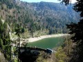
(3) Follow the path downwards. You’ll have a magnificent view of the Saut du Doubs restaurant and the footbridge. Take the road on your left to reach the “Embarcadère” junction.
(4) Head towards the footbridge and cross it.
(5) You are now on the Swiss side. Turn right, heading towards “Les Brenets” along a small road. Ignore the path on your left.
(6) Turn left onto a path leading uphill towards “Tête de Calvin”.
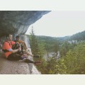
(7) You can take a short round trip to see a magnificent viewpoint (unsecured). Then continue towards “Les Brenets” until you reach a small road.
(8) Follow it to the left, still heading towards “Les Brenets”. Viewpoint over Les Brenets.
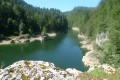
(9) Take the path leading down to the right, towards “Pré du Lac”, and walk alongside the River Doubs as far as Les Brenets.
(10) Walk past the restaurant “Les Rives de Doubs” and take the road going uphill on your right, towards “Les Combolles”. At the “Les Pargots” junction, turn right and walk past the car park.
(11) Cross the road, head downhill and pass the “Les Brenets” customs post.
(12) On your left, turn off onto Chemin des Marais. You can see the Jurgensen Tower in the distance. Stay on this main path.
(13) Continue uphill towards “La Caroline” and, a little further on, look out for the same sign on a tree. Turn onto this path leading uphill to the left until you reach a road.
(14) Follow the sign for “La Caroline” to the left again and take a path leading uphill to the right a little further on. You’ll arrive at a place called La Caroline, with a magnificent view to your left, before heading uphill to the right at the junction towards the Jurgensen Tower.
(15) Take a round trip to the Jurgensen Tower on your left (when I was there, I couldn’t open the door!!). Then come back and head towards “Le Châtelard” on your left, continuing to the road whilst ignoring the side paths.
(16) Cross the road carefully (no pedestrian crossing) and head up the road towards “Les Brenets”.
(17) At the junction, take the path leading uphill towards “La Saignotte”; this section is a bit unsettling as you’re entering private property (there are signs there to reassure you!). Look out for a small flight of steps leading up through the garden, go up them, carry on straight ahead and climb up to a road.
(18) Take the road leading uphill on your right.
(19) After this rather unpleasant stretch, turn left towards “Les Brenets”. Walk past a farm and continue along a lovely path through the meadow (ignore the path on your right).
(20) At the junction, head down to the left, into the woods, towards “Les Recrettes”, and you’ll reach a small road.
(21) Cross it carefully. Go straight on, then follow the signs for the “Les Recrettes” viewpoint on your right.
(22) At the viewpoint, head up the “L’Escarpineau” path on your right until you reach the road. Follow it uphill to the left until you reach the next sign, at a place called Bois du Dard.
(23) Head towards the “Belvédère de l’Escarpineau”, taking the path on your left marked “Serville Perjean”.
(24) Walk to the viewpoint and back, then follow the Chemin de Choudens towards “Roches de Moron”.
(25) Follow the path down to the left, still heading towards “Roches de Moron”. You’ll arrive at the Roches de Moron Restaurant. There’s a magnificent view on your left.
(26) Carry on straight ahead.
(27) Take the path leading down towards “Le Saut du Doubs”. A steep descent! Ignore all the paths on your right.
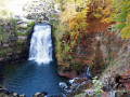
(28) At the end of this lovely descent, keep to the left and, a little further on, look out for a path leading down to the right. A magnificent path runs alongside the River Doubs all the way to the Saut du Doubs.
(29) Cross the picnic area to head down to the Saut du Doubs. As the path is blocked further on (due to fallen trees), head back up and take the path on the right until you reach the footbridge.
(5) Cross the River Doubs.
(4) Take the path leading uphill to the right to reach the Belvédère du Haut du Saut du Doubs viewpoint. Magical. Continue to the next junction.
(30) Take the path leading uphill towards “Le Châtelard”.
(31) At the next junction, ignore the sign for “Le Châtelard” and carry on uphill until you reach the forest track. Keep to the left to reach the road, then carry on straight ahead until you come to the junction you passed earlier on the footpath.
(2) Follow the route you took on the way there in the opposite direction to return to the car park (S/E).
 Visorando Member

 Moderate
 Association / Club / Walk leader
 Easy