Country:

 City:
City:


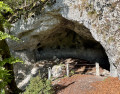
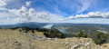
Start at a place called Gouille à l’Ours, on the road leading up to Mont d’Orzeires (unpaved car park, free).
(S/E) Head north and cross the road with care. Descend along a lovely, well-signposted path to join the Route de la Vallée.
(1) Follow the road to the right for about 200 metres.
(2) Just before a car park (another possible starting point), turn right towards the Grotte aux Fées and continue downhill.
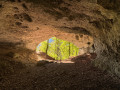
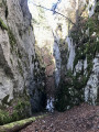
(3) Visit the Grotte aux Fées. A head torch is essential.
(3) Continue down the main, well-signposted path.
(4) Turn left onto a wilder, stony path. Further on, rejoin the wider, signposted path and follow it to the left.
(5) At another fork, turn right, cross the River Orbe and you’ll immediately arrive at the Orbe springs and their cave (entrance fee applies).
(6) Turn left and walk alongside the River Orbe, which flows below on your left. Do not go down to the car park; continue straight on until you reach the Route de la Raz and follow it to the right for about 150 m.
(7) Take a path on the right (covered in bark) which turns immediately left and runs parallel to the road. Then turn right and leave the road behind, following the Chemin de La Puyaz. Walk up the Pouette Combe, following the Epoisats stream.
(8) At a fork in the road, carry on straight ahead (ignore the path on the right leading up to L’Oursière). Then head diagonally right towards the signposts and pass through Seignerets-Dessous and then Seignerets-Dessus to reach a road.
(9) Follow the road as it continues uphill. Cross the railway line carefully at the level crossing, follow the signs for “Les Epoisats” and carry on straight ahead.
(10) Turn left onto a path climbing towards the Dent de Vaulion. The climb is quite steep along a well-marked path that winds several times. Be careful just before you emerge from the forest; make sure you follow the signposted path (it’s tempting to go straight on just before the exit, but there’s barbed wire!). You’ll leave the forest via a passageway with two iron posts, painted yellow. Walk along the edge of the woodland on your left and continue along the ascending path.
(11) At the signpost, carry on climbing to the left. Shortly afterwards, take the (hard-to-spot) path furthest to the left (ignore a wide track that is circular and goes to the right). Further on, rejoin the wide track and follow it to the left. After a hairpin bend to the right followed by one to the left, you’ll arrive at a place called La Petite Dent.
(12) The wide path gives way to a track through meadows. Climb up to the Chalet-Buvette de La Dent de Vaulion.
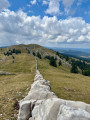
(13) Turn left, leaving the chalet on your right. Continue due north to quickly reach the summit of La Dent de Vaulion (spectacular 360° view).
(14) Head back down a stony path to the Chalet Buvette.
(15) Walk down a road for a short while towards Pétra Félix. Shortly afterwards, take an inconspicuous path on the right that runs parallel to the road. When the road bends to the left, carry on straight ahead, heading due south, following the path. Continue downwards until you reach a stony path through the forest. The signposting is still clearly visible. Stay on this main path and continue downwards until you reach a wider track.
(16) Continue down this track, heading south, until you reach the road and the Col de Pétra Félix.
(17) Then turn sharply right and take a path leading down towards the bridge.
(18) You’ll come out onto a road; follow it to the left. At the Fork in the road immediately ahead, head slightly to the left. Shortly afterwards, leave the road and take a path on the right. Cross the road carefully and continue straight on (west) between the fields and meadows.
(19) You’ll come out onto a small road; follow it to the left.
(20) At a left-hand bend, leave the road and take a path on the right with steps. Go downhill, cross a small road and continue straight ahead until you reach a road running alongside Lac de Joux.
(21) Cross the road carefully, follow it to the right and walk along the lake on your left. Pass the landing stage at the hamlet of Le Pont and continue for a further 150 m or so along the lake. You will see ‘La Pégase’, a winged horse.
(22) Then turn right and cross the road with care. Continue straight ahead (westwards) along a path between the fields.
(23) At a fork in the road, head slightly to the right and walk alongside Lac Brenet on your right. After about 250 m, turn left. Pass between two small sports grounds and turn right.
(24) Turn right, then follow Rue des Chappes to the left to join Route de Mouthe. Then continue to the right. Cross the road carefully to reach the signposts.
(25) Turn left and stay on the road as it climbs. Turn right along this road and pass the Replats cemetery. At the junction immediately ahead, cross carefully and carry on straight ahead. After about a hundred metres, you’ll reach a crossroads.
(26) Turn right and climb gently (the signposting is clear). Pass the Épine farm, carry on straight ahead and pass the Petites Cernies farm. The road then gives way to a path.
(27) At the Fork in the road shortly afterwards, head slightly to the right. Climb steadily along a lovely path through open countryside until you reach the forest. Look out for the signpost on the left to go uphill, then the path on the right to enter the forest. Signposting is clear all the way to Juraparc (wildlife park; Chalet Buvette opposite).
(28) Follow the road to the left. After about a hundred metres, turn left onto a descending path that starts running parallel to the road. Follow this path back to the starting point (S/E).
 Visorando Member
 Difficult
 Easy
Easy 
 Moderate
 Association / Club / Walk leader