Country:

 City:


Free car park near the casino.
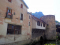
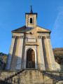
(S/E) Head towards the casino via Allée Jules Marcou, then turn left. At the signpost, follow ‘Fort Saint André 1.5 km’ to pass by the town hall and then the Church of Notre-Dame Libératrice. Continue straight on along Rue des Bains and then Rue des Barres to reach the bridge over the Furieuse.
(1) Turn left to cross the bridge and walk briefly up Rue du Paradis on the right. Look out for a path leading up into the forest, marked with white, red and yellow signs, on the left, and follow it. Further on, at the “Cicon” junction, continue up this main path to Fort Saint-André.
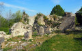
(2) Turn right towards “Acrobatic Park”, go round the fort and walk alongside the treetop adventure park. There are llamas in the park. Keep to your left at the junction.
(3) Follow the signposts to the viewpoint for a round trip.
(3) Then head down the road towards “Côte Saint-André” and stay on the road.
(4) At the junction with the D271, turn left towards Salins-les-Bains and continue for about 200 metres.
(5) Look out for a small path leading down to the right and follow it to the road (Chemin des Grands Vergers) to reach “Bracon”.
(6) Walk down the road (Rue de Fort Bracon) to the right and pass a memorial stone. At the junction, take Rue du Dieu de Pitié to the left (signposted on a gutter). Walk down to Rue de la Mairie and take the road leading uphill to the right until the next junction.
(7) Keep left and head down the road (Rue Saint-Claude), passing a statue. Turn left shortly afterwards and cross the bridge, then cross the D472 carefully to reach the signposts opposite. Head up Rue des Tours Bénites, towards “La Beline”; at the sign, continue uphill. The road turns into a track. At the end, turn right and walk a few metres.
(8) Turn right onto a path and take the path leading uphill (unmarked) on the right after a tennis court. When you reach the car park of an indoor tennis centre, continue uphill to the right.
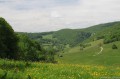
(9) At the junction, carry on uphill to the right to reach Fort Belin, then continue along the path to the left. Magnificent views on both sides over the valley, Fort Saint-André and Salins-les-Bains. Go through the tunnel and over the bridge, then carry on straight ahead along Chemin Touillon, then Rue du Fort Belin to reach Clucy.
(10) Carry on straight ahead past the Chêne de la Liberté and take the Route de Géraise. (The signposting is clear.) At the junction, take the left-hand road and, a little further on, keep left again. When you reach the path marked ‘La Chaux’, turn right, then further on take the path marked ‘au Clos’ to the left.
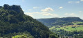
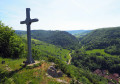
(11) At the cross, turn left onto this path to reach another cross (superb view of Mont Poupet) and the lieutenant’s memorial stone. Stay on this main descending path. You’ll come to some houses and a road; continue downhill (Chemin des Marnes). At the sign for “L’Ermitage”, carry on downhill for a few metres to join the Chemin de l’Ermitage.
(12) Take the path on the right just after the house (unmarked section) and head down to the cemetery. Turn right, then, before passing the cemetery, go between the houses on the left to continue downhill.
(13) Carry on to the left along Ruelle Saint-Pierre, which is grassy (with a view of the Church of Notre-Dame Libératrice). Then take the steps leading down to the old church. Be careful, and turn left straight away to take the Escaliers du Petit Michel. You’ll feel as though you’re walking into people’s homes, but it’s just an impression. Once at the bottom, first turn left then right to take another flight of steps leading down to Rue de la Liberté.
(14) Turn left and cross the road carefully. You can go through the Passage Thermal to reach Place de la Mairie and its monument. Continue straight on to the car park (S/E).
 Visorando Member
 Easy


 Difficult
 Association / Club / Walk leader