Country:

 City:


Park in the free car park at Bretonvillers Church, located on Impasse du Stade.
(S/E) Return to Rue du Fondereau and follow it to the right until you reach the junction by the war memorial. Turn left onto Rue de Pierrefontaine les Varans and continue to the first three-way junction.
(1) Turn left onto Rue des Frênes and head straight up towards the cemetery. Go round the cemetery on the right and continue along this small road until you reach the next signpost: blue-and-yellow markings.
(2) Leave the road and take the path on the right. Further on, cross the small side road and continue along the path opposite to reach the next road.
(3) Head down it to the left, look out for the sign saying “Circular Loop 11, 60 mins”. Head up to the left to reach the hamlet of Le Sauvage, then head down to the next junction: sign for “Gigot Circular Loop 11”. Turn right.
(4) Quickly take the path on the right to head a little further into the forest and carry on to the next four-way junction. Head downhill to the right.
(5) Head to the right. Further on, on the left, ignore the path that completes the circular route and continue almost along the contour line. You’ll come to another junction; continue straight down, then tackle a short, steep climb: the signposting is clear. Stay on this main path until you reach the Memorial.
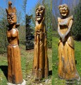
(6) Turn right to explore the magnificent sculptures at the Ferme de Niveau. A lovely spot to discover.
(7) Turn back.
(6) Take the road leading downhill on the right and follow it until you reach the start of the large bend to the right.
(8) Take the path leading uphill to the left: there are no signposts. Make a wide bend to the right and you’ll reach a three-way junction. Take the middle fork, which leads onto a forest track, and continue downhill to the right.
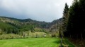
(9) Take the path on the left across the meadow, despite the crossed-out Blue Cross on the blue-and-yellow signposting. Follow cycle route no. 44, keeping to the left-hand side by the fence: there’s a lovely view over the valley. Stay on the main path.
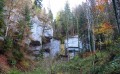
(10) Take the hairpin bend to the left, continuing to follow signpost no. 44. Further on, ignore the path leading uphill to the left and carry on along the main path until you reach the sign for the Grotte de la Glacière du Roi. Head left to get there: be careful, there’s no sign indicating the entrance to the cave! Look out for a crack on the left, a small clearing with a stone.
(11) Head back down to the junction and continue along the path: blue-and-yellow markings. At the hairpin bend, turn left and stay on the main path.
(12) Carry on along the forest track heading uphill to the left. When you reach the crossroads, turn right onto the track leading down towards Vautran du Haut: there is no signpost.
(13) Take the path leading uphill to the left to climb up the Combe du Frêne.
(14) You’ll need to be carefulhere as you’ll be tempted to carry on straight ahead, but there’s a cross marked on a tree. Look out for the small path on the left to rejoin the starting point of the circular route. Follow it to the right, in the opposite direction to the outward journey, and you’ll reach the start of the Memorial circular route.
(5) Carry on straight ahead to reach a forest track: the old purple route on the IGN map no longer exists. At the crossroads, carry on straight ahead. (The signposting is clearly visible; this is a new route, 2026.) Then, once you reach the forest track, turn right
(15) Continue down the forest track to the left: as before, the purple route on the IGN map no longer exists. A little further down, carry on straight ahead ( unmarked path) to rejoin a forest track.
(16) Turn right, then left, and carry on along the main track.
(17) Keep right onto the path leading downhill.
(18) At the junction, carry on to the right.
(19) Look out for the red markings on a tree on your right and take the path leading downhill – it isn’t shown on the map, but it is definitely there. Take extreme care: it’s a steep, slippery descent. You’ll reach a road; continue carefully along it in the same direction, cross the junction to reach the hamlet of Gigot. Cross the bridge over the Dessoubre and follow the road to the right for safety.
(20) Cross the road carefully and take the forest track on the left which runs high above the Dessoubre.
(21) Take a short round trip along a discreet path on your left to get a closer look at the Moulin de Belvoir, situated on the opposite bank. Then continue along the forest track. Cross the small bridge over the river to reach the hamlet of Le Val.
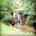
(22) Cross the road carefully and head towards the signposts on the right: as before, the purple route on the map is no longer accessible, but new signposting is in place. Take the path uphill, passing a mill wheel as you follow this narrow, unspoilt path. Further up, cross the stream and continue climbing to the right: the GPX track may be slightly off, but the path is clearly visible.
(23) Follow the signposting again to reach Bretonvillers by first turning left then right. Pass the sewage treatment plant and keep going in the same direction to return to the church car park (S/E).
 Visorando Member
 Moderate

 Association / Club / Walk leader


 Easy