


Franck D

 Visorando Member
 Premium user
 - Gender: man
Sign up:
Published route(s)
 Around Ganagobie Priory
 2.56 mi
 +344 ft
 -344 ft
 1h 30
1h 30
 Easy
Easy
 Departure from Ganagobie (Alpes-de-Haute-Provence)
A short walk with lots to discover: the priory, of course, as well as an old millstone quarry and the oppidum known as Villevieille.
Crête de Géruen
 9.30 mi
+2,247 ft
-2,241 ft
6h 15
9.30 mi
+2,247 ft
-2,241 ft
6h 15
 Moderate
Departure from Le Castellard-Melan (Alpes-de-Haute-Provence)
Moderate
Departure from Le Castellard-Melan (Alpes-de-Haute-Provence)
The view from the summit is spectacular, with a 360° panorama where only the Monges mountains hide the Oisans. You can see south all the way to the Basse-Provence, passing by the Lure mountain, Mont Ventoux, Dévoluy with the Pic de Bure, the Blanche valley near Digne, and more.
Contrast between the Mediterranean climb facing south and the colder ridge.
Around Valcroissant Abbey
 6.72 mi
+2,067 ft
-2,073 ft
4h 55
Moderate
Departure from Die (Drôme)
6.72 mi
+2,067 ft
-2,073 ft
4h 55
Moderate
Departure from Die (Drôme)
Leave the Die road and, at the mouth of a narrow gorge, you’ll find yourself facing a welcoming valley that ends at the gigantic rocky outcrop of the Glandasse. Seclusion, abundant water, forests and farmland framed by limestone cliffs: you may well be in raptures... just like those Cistercian monks who settled in November 1188 at Vallis Crescens, the starting point of the hike.
⚠️ 21/04/2026: 2 km before the Abbey, the road is closed due to a rockslide; it is not currently possible to reach the start of this hike.
The 3 Peaks
 6.33 mi
+2,100 ft
-2,077 ft
4h 45
6.33 mi
+2,100 ft
-2,077 ft
4h 45
 Difficult
Departure from Gap (Hautes-Alpes)
Difficult
Departure from Gap (Hautes-Alpes)
Pic de Gleize, Pic de Chaudin and Pic de l'Aiguille: three peaks and three panoramas with beautiful views of Dévoluy, with the forgotten domain of Chaudin at its feet, Les Écrins, Champsaur and the Gap conurbation.
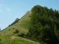
Pic de la Greysinière and Brèche de Charance
 6.68 mi
+1,818 ft
-1,831 ft
4h 40
Difficult
Departure from Gap (Hautes-Alpes)
6.68 mi
+1,818 ft
-1,831 ft
4h 40
Difficult
Departure from Gap (Hautes-Alpes)
Much of this hike takes place on a ridge with aerial passages, offering numerous panoramic views.
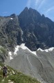
Font Turbat refuge at the foot of Olan
 12.56 mi
+4,081 ft
-4,085 ft
9h 20
Difficult
Departure from Valjouffrey (Isère)
12.56 mi
+4,081 ft
-4,085 ft
9h 20
Difficult
Departure from Valjouffrey (Isère)
Magnificent view of the north face of Olan (3,563 m), accessed via a typical trough-shaped glacial valley. First, you pass the Pisse waterfall, then you enter this valley deeply carved out by glaciers before reaching the only refuge in the valley. You are facing the Olan with its 1,000-metre vertical wall, but there are still 300 metres to climb to reach the Col des Lauvets with its viewpoints.
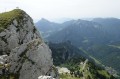
Petit Som and Grand Som as seen from Les Riondettes
 9.70 mi
+4,065 ft
-4,072 ft
8h 00
Difficult
Departure from Saint-Christophe-sur-Guiers (Isère)
9.70 mi
+4,065 ft
-4,072 ft
8h 00
Difficult
Departure from Saint-Christophe-sur-Guiers (Isère)
Two stunning panoramic views in the heart of the Chartreuse, a well-balanced walk combining fairly steep sections with pastures and beautiful forests.
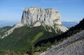
Views of Mont Aiguille from the high plateaus of the Vercors
 11.68 mi
+3,386 ft
-3,386 ft
8h 20
Difficult
Departure from Chichilianne (Isère)
11.68 mi
+3,386 ft
-3,386 ft
8h 20
Difficult
Departure from Chichilianne (Isère)
A hike with different viewpoints on three sides of Mont Aiguille and the Queyrie plain, known for its ancient Roman quarry and famous pruned tree.
Le Goutaroux from Trézanne
 5.25 mi
+2,159 ft
-2,136 ft
4h 20
Easy
Departure from Saint-Martin-de-Clelles (Isère)
5.25 mi
+2,159 ft
-2,136 ft
4h 20
Easy
Departure from Saint-Martin-de-Clelles (Isère)
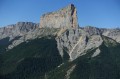
The tour of Mont Aiguille remains a classic, but to appreciate this "ocean liner", what could be better than gaining some height? The view is not only of Mont Aiguille, as from the summit of Goutaroux you have a 360° view: from Grenoble to Trièves, as far as Dévoluy on one side. From the Vercors ridges to the Chartreuse on the other side.
A Poil!
 8.87 mi
+1,788 ft
-1,768 ft
5h 40
Moderate
Departure from Senez (Alpes-de-Haute-Provence)
8.87 mi
+1,788 ft
-1,768 ft
5h 40
Moderate
Departure from Senez (Alpes-de-Haute-Provence)
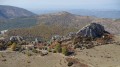
A journey to the end of the world, ideal for lovers of nature and tranquillity. And yet we are in the PACA region, in the heart of Haute-Provence, in a wild environment where you can discover the ancient village of Le Poil (in the 19th century, the commune had 350 inhabitants, including more than a hundred in the village).
The Vautubière mountain
 5.55 mi
+896 ft
-909 ft
3h 20
Easy
Departure from Jouques (Bouches-du-Rhône)
5.55 mi
+896 ft
-909 ft
3h 20
Easy
Departure from Jouques (Bouches-du-Rhône)
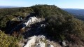
Despite a slight elevation gain, this is a scenic hike with 360° views of the Luberon and, behind, Mont Ventoux, the Lure mountain, the upper and lower Verdon, and the Dévoluy. On the other side, you can see Sainte-Victoire, Sainte-Baume, and Mont Olympe.
Mirail Spring and the Bastide du Bois
 5.70 mi
+1,017 ft
-1,017 ft
3h 30
Moderate
Departure from Peypin-d'Aigues (Vaucluse)
5.70 mi
+1,017 ft
-1,017 ft
3h 30
Moderate
Departure from Peypin-d'Aigues (Vaucluse)
Start from the Mirail Spring and climb to the foot of the Luberon to enjoy a beautiful view at the Bastide du Bois. The panorama in an anti-clockwise direction offers views of:
- mourre Nègre.
- the Bonde lake.
- the Pays d'Aigues and Pertuis.
- the Étoile mountain range and Sainte-Victoire.
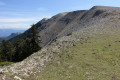
The ridges of the Lure mountain
 8.35 mi
+2,152 ft
-2,182 ft
5h 45
Moderate
Departure from Saint-Étienne-les-Orgues (Alpes-de-Haute-Provence)
8.35 mi
+2,152 ft
-2,182 ft
5h 45
Moderate
Departure from Saint-Étienne-les-Orgues (Alpes-de-Haute-Provence)
The hike quickly reaches a superb viewpoint offering a clear view of the mountains of south-eastern France:- Sainte-Baume and Sainte-Victoire (Bouches-du-Rhône)- Le Lubéron or Mont Ventoux (Vaucluse)- Le Verdon (Var/Alpes de Haute Provence)- Les Trois Becs (Drôme)- Le Dévoluy or Les Écrins (Hautes Alpes)- Mont Aiguille and Grand Veymont (Isère).Then we set off to explore the resort's old ski lifts, finally returning via the old coal mines.
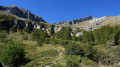
Tour de Planure
 8.12 mi
+3,232 ft
-3,202 ft
6h 35
Moderate
Departure from Champoléon (Hautes-Alpes)
8.12 mi
+3,232 ft
-3,202 ft
6h 35
Moderate
Departure from Champoléon (Hautes-Alpes)
The Tour de Planure is a hike that starts at the bottom of the valley, following the Tourond torrent, and ends in a magnificent cirque where you can discover a pastoral environment in a high mountain atmosphere.
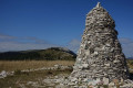
The Cairn 2000 via the Lure ridges
 6.44 mi
+1,407 ft
-1,411 ft
4h 10
Moderate
Departure from Saint-Étienne-les-Orgues (Alpes-de-Haute-Provence)
6.44 mi
+1,407 ft
-1,411 ft
4h 10
Moderate
Departure from Saint-Étienne-les-Orgues (Alpes-de-Haute-Provence)
This is a short hike along the ridge of Lure Mountain, with guaranteed 360° panoramic views, to Cairn 2000, which commemorates the transition tothe third millennium.
Even though this is a round trip, the advantage of a ridge is that the landscape is completely different on each side
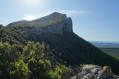
Tour of Pic Saint-Loup from Saint-Mathieu-de-Tréviers
 9.31 mi
+2,759 ft
-2,762 ft
6h 40
Difficult
Departure from Saint-Mathieu-de-Tréviers (Hérault)
9.31 mi
+2,759 ft
-2,762 ft
6h 40
Difficult
Departure from Saint-Mathieu-de-Tréviers (Hérault)
Pic Saint-Loup is a classic spot with a superb panorama: on one side, the view stretches as far as Mont Aigoual, which rises above the Cévennes, and on the other, the plain stretches to the blue Mediterranean. Starting from Saint-Mathieu-de-Tréviers, this route begins in the opposite direction, allowing you to enjoy more peace and quiet and follow the sun's path.
Some sections are vertiginous, see reviews
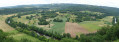
Panoramic view of the Vézère
 10.86 mi
+1,030 ft
-1,027 ft
5h 55
Moderate
Departure from Peyzac-le-Moustier (Dordogne)
10.86 mi
+1,030 ft
-1,027 ft
5h 55
Moderate
Departure from Peyzac-le-Moustier (Dordogne)
This hike takes you up to a higher elevation with a beautiful view of the Vézère River, and also allows you to discover two sites:
- La Roque Saint-Christophe, troglodyte dwellings in a limestone cliff one kilometre long and sixty metres high,
- and the village of Saint-Léon-sur-Vézère, listed as one of the Most Beautiful Villages in France.
Pointe Côte de l'Âne
 9.93 mi
+3,340 ft
-3,337 ft
7h 30
Difficult
Departure from Entraunes (Alpes-Maritimes)
9.93 mi
+3,340 ft
-3,337 ft
7h 30
Difficult
Departure from Entraunes (Alpes-Maritimes)
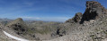
Enjoy the Roche Trouée tour with its mineral universe where erosion has left a unique landscape, then climb to reach Pointe Côte de l'Âne, where you will be rewarded with a beautiful panorama.
The Estrop Lakes
 9.63 mi
+2,549 ft
-2,536 ft
6h 40
Moderate
Departure from Entraunes (Alpes-Maritimes)
9.63 mi
+2,549 ft
-2,536 ft
6h 40
Moderate
Departure from Entraunes (Alpes-Maritimes)
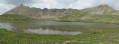
The Col de Gialorgues is a crossing point between the upper Var and upper Tinée regions, offering views of a glacial valley with the Lacs de l'Estrop lakes in a cirque.
Col de Rabou via the Sentier des Bans
 11.71 mi
+4,580 ft
-4,570 ft
10 hrs
11.71 mi
+4,580 ft
-4,570 ft
10 hrs
 Very difficult
Departure from Rabou (Hautes-Alpes)
Very difficult
Departure from Rabou (Hautes-Alpes)
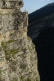
A varied hike offering beautiful views of the Pic de Bure, or from the Col de Rabou, as well as a walk through an old hamlet with the Chapel of La Crotte. Not to mention the spectacular Sentier des Bans, which you will have the chance to walk along twice.
Please note: see the comments on the cliff-top path in the ‘Practical information’ section.
Tête de Rame (or Tête des Chétives) via Lac de Labarre
 9.51 mi
+4,823 ft
-4,846 ft
10 hrs
Very difficult
Departure from Valjouffrey (Isère)
9.51 mi
+4,823 ft
-4,846 ft
10 hrs
Very difficult
Departure from Valjouffrey (Isère)
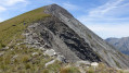
To enjoy an unbroken panorama stretching from the Pic de Bure to Mont Aiguille, taking in all the peaks of the Vercors as well as the Trièves plateau, and on the other side the Taillefer and several peaks of the Écrins.
You’ll also pass by the turquoise-green Lac Labarre, at the foot of the Lauvitel signal.
The Orgues de Valsenestre and return via the Combe Oursière
 7.98 mi
+3,632 ft
-3,609 ft
6h 50
Difficult
Departure from Valjouffrey (Isère)
7.98 mi
+3,632 ft
-3,609 ft
6h 50
Difficult
Departure from Valjouffrey (Isère)
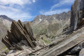
A hike in several stages:- The Orgues de Valsenestre (or the ‘great library’), a geological curiosity featuring a multitude of perfectly aligned vertical strata.- The Col de Côte Belle, offering panoramic views over the Font Turbat valley.- A return via the balcony path to the small hanging valley of Combe Oursière.- Finally, you’ll cross a forest of ‘crooked’ larch trees (larch trees bent by the weight of the snow).... Not forgetting the Hobbit house
Important: please read the practical information carefully.
La route des Jas et l'Abbey Church of Notre-Dame de Lure
 10.72 mi
+2,516 ft
-2,510 ft
7h 05
Moderate
Departure from Cruis (Alpes-de-Haute-Provence)
10.72 mi
+2,516 ft
-2,510 ft
7h 05
Moderate
Departure from Cruis (Alpes-de-Haute-Provence)
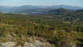
A route following in the footsteps of Giono to discover a few sheepfolds (jas), before entering the forest to reach the former Abbey of Notre-Dame de Lure.
 The Belvédère and Lake Sainte-Marguerite
 6.35 mi
+2,310 ft
-2,283 ft
5 hrs
Difficult
Departure from Les Orres (Hautes-Alpes)
6.35 mi
+2,310 ft
-2,283 ft
5 hrs
Difficult
Departure from Les Orres (Hautes-Alpes)
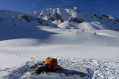
The first section follows the “Plein les yeux” route through a larch forest to reach a viewpoint offering views of the Tête de la Mazelière with its ice falls. Then, via an ascent along a wide forest track, reach the wild Eyssalette valley where, beneath the ice, lies the Lac de Sainte-Marguerite, surrounded by numerous peaks.
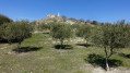
Panoramic view of the Durance Valley from Le Puy-Sainte-Réparade
 8.34 mi
+833 ft
-830 ft
4h 35
Moderate
Departure from Le Puy-Sainte-Réparade (Bouches-du-Rhône)
8.34 mi
+833 ft
-830 ft
4h 35
Moderate
Departure from Le Puy-Sainte-Réparade (Bouches-du-Rhône)
Discover La Quille (or Quiho in Provençal), an ancient abandoned village, topped by an oppidum and the ruins of a castle. With panoramic views of the Trevaresse mountain range, Sainte-Victoire, the Durance valley, the Provence canal, the Alpilles, Le Grand Luberon, the Pre-Alps... and beyond.
A little further on is the Sainte-Réparade Chapel, before climbing a little higher up the hill.
This route offers numerous viewpoints over the Durance valley.
The Combes de Curnier and Malaval
 8.88 mi
+2,949 ft
-2,969 ft
6h 40
Difficult
Departure from Bédoin (Vaucluse)
8.88 mi
+2,949 ft
-2,969 ft
6h 40
Difficult
Departure from Bédoin (Vaucluse)
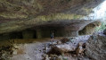
This is a multifaceted hike: the mysterious Combe Curnier with its narrow, winding canyon; the Combe Malaval with its spectacular caves; and between these two valleys, a mountain trail offering magnificent views over the Comtat Venaissin plain and the Dentelles de Montmirail massif.
The chapels of the hamlets of Beaumont-du-Ventoux
 6.76 mi
+1,591 ft
-1,585 ft
4h 30
Moderate
Departure from Beaumont-du-Ventoux (Vaucluse)
6.76 mi
+1,591 ft
-1,585 ft
4h 30
Moderate
Departure from Beaumont-du-Ventoux (Vaucluse)
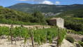
Discover an interesting heritage with chapels scattered throughout the mountains and the many hamlets that make up Beaumont-du-Ventoux. Not to mention the ancient Roman quarry.
The ridges of Grand Puy
 5.05 mi
+1,322 ft
-1,312 ft
3h 30
Moderate
Departure from Seyne (Alpes-de-Haute-Provence)
5.05 mi
+1,322 ft
-1,312 ft
3h 30
Moderate
Departure from Seyne (Alpes-de-Haute-Provence)
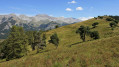
A fairly easy hike starting from the Grand Puy ski resort with a beautiful panorama along the ridge: from Montagne de la Blanche in the east to Les Monges in the west, via Pic de Bure.
Le Grand Brisou via the Crête des Alleyrons
 5.30 mi
+1,742 ft
-1,752 ft
3h 55
Moderate
Departure from Gresse-en-Vercors (Isère)
5.30 mi
+1,742 ft
-1,752 ft
3h 55
Moderate
Departure from Gresse-en-Vercors (Isère)
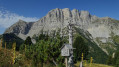
This is a fairly easy hike that takes you to the foot of the Grand Veymont. Beautiful views: from Mont Aiguille to the cliffs of the Vercors barrier.
Grand Veymont via the Pas du Fouillet
 11.08 mi
+4,833 ft
-4,813 ft
10 hrs
Very difficult
Departure from Gresse-en-Vercors (Isère)
11.08 mi
+4,833 ft
-4,813 ft
10 hrs
Very difficult
Departure from Gresse-en-Vercors (Isère)
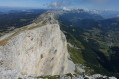
The Grand Veymont (the highest peak in the Vercors at 2,341 m) from Gresse-en-Vercors is a classic route.This longer route offers a better opportunity to explore the landscapes of the Vercors high plateaus.Note added on 16 August 2026 following a user’s comment.‼️ WARNING: THE PAS DE FOUILLET IS NO LONGER PASSABLE AS THE HANDRAIL HAS BEEN REMOVED. VERY STEEP, RUGGED AND SLIPPERY SECTION – TAKE THE PAS DE HOLLOWED-OUT TREE TRUNK SERVING AS A DRINKING TRUFFLE INSTEAD‼️
Chapel of Sainte-Anne de Goiron and the Côtes mountain range
 9.82 mi
+1,470 ft
-1,470 ft
5h 50
Moderate
Departure from La Roque-d'Anthéron (Bouches-du-Rhône)
9.82 mi
+1,470 ft
-1,470 ft
5h 50
Moderate
Departure from La Roque-d'Anthéron (Bouches-du-Rhône)
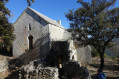
A varied hike between the Romanesque chapel of Saint-Anne de Goiron and the ridge line of the Côtes mountain range, which offers beautiful panoramic views: from Mont Ventoux to the Massif de l'Étoile and beyond to the Étang de Berre, passing through the mountains of the Haut Verdon.
Le Gros Têt: another viewpoint overlooking La Meije above the Emparis plateau
 10.80 mi
+3,205 ft
-3,209 ft
7h 45
Difficult
Departure from La Grave (Hautes-Alpes)
10.80 mi
+3,205 ft
-3,209 ft
7h 45
Difficult
Departure from La Grave (Hautes-Alpes)
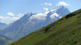
A hike offering superb views of the Meije glaciers as well as the Emparis plateau.
Whilst the Emparis plateau is renowned for its views of the Meije, it is naturally very busy. This hike allows you to enjoy the same views whilst walking in a wilder setting.
Message from the moderators: You are in a Sensitive Natural Area (Natura 2000), which is subject to specific regulations (see practical information).
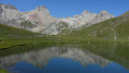
To take in the full spectrum of colours from the Pont de l’Alpe
 10.73 mi
+3,816 ft
-3,799 ft
8h 15
Difficult
Departure from Le Monêtier-les-Bains (Hautes-Alpes)
10.73 mi
+3,816 ft
-3,799 ft
8h 15
Difficult
Departure from Le Monêtier-les-Bains (Hautes-Alpes)
This is a walk that will take you through a whole range of colours. From the green and blue of the lakes – the Grand Lac, Lac de la Ponsonnière, Lac de la Mine, etc. – to the green, red, grey and white of the Pic de la Moulinière, and the black of the old graphite mine. Panoramic views of the Écrins and Cerces massifs.This route is a variation on the ‘Lac et Col de la Ponsonnière’ hike via the Grand Lac, which we have extended.
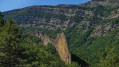
Tour of the Lame de Facibelle
 8.87 mi
+3,051 ft
-3,061 ft
6h 45
Difficult
Departure from La Javie (Alpes-de-Haute-Provence)
8.87 mi
+3,051 ft
-3,061 ft
6h 45
Difficult
Departure from La Javie (Alpes-de-Haute-Provence)
A hike in the heart of the Haute Provence Geological Reserve: to cross the Esclangon Velodrome, then find yourself at the foot of the Lame (or sail) de Facibelle: a marvel of delicacy.
But also to step back in time with the old Orthodox hermitage of Saint-Jean du Désert, not forgetting the abandoned hamlets and villages such as Tanaron and Pudoyer
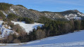
Clot des Étables via the ridges from the Col du Fanget
 6.27 mi
+1,135 ft
-1,119 ft
4 hrs
Moderate
Departure from Seyne (Alpes-de-Haute-Provence)
6.27 mi
+1,135 ft
-1,119 ft
4 hrs
Moderate
Departure from Seyne (Alpes-de-Haute-Provence)
Snowshoe hike in the Fanget nature reserve, a site that lives up to its name. Ideal for those who want to enjoy nature in a peaceful environment: it feels like you're walking at the end of the world.The site offers six snowshoe trails, but the location allows for many variations: this one uses part of the Crête et Bois de Méarzes snowshoe trail.
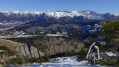
Moure Bouchard via the Col de la Bournée
 6.92 mi
+1,309 ft
-1,293 ft
4 hrs
Moderate
Departure from Seyne (Alpes-de-Haute-Provence)
6.92 mi
+1,309 ft
-1,293 ft
4 hrs
Moderate
Departure from Seyne (Alpes-de-Haute-Provence)
Snowshoe hike in the Fanget nature reserve, a site that lives up to its name. Ideal for those who want to enjoy nature in a peaceful environment: it feels like you're walking at the end of the world.
The site offers six snowshoe trails, but there are many variations possible: this one uses part of snowshoe trail No. 5: Négron.
Les Costes ridge and return via the castle
 9.23 mi
+1,808 ft
-1,804 ft
5h 50
Moderate
Departure from Beauvoisin (Drôme)
9.23 mi
+1,808 ft
-1,804 ft
5h 50
Moderate
Departure from Beauvoisin (Drôme)
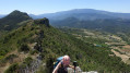
A hike with guaranteed panoramic views, whether of Mont Ventoux to the south or the Provençal Pre-Alps, part of the hike runs along the ridgeline of the Montagne de Beaume-Noire.On the way back, discover the ruins of an ancient castle that you would never suspect were there.
Variation on Jacky Anx's hike: https://www.visorando.com/randonnee-beau...
Pic Queyrel via the Col du Viallet
 10.95 mi
+3,176 ft
-3,153 ft
7h 50
Difficult
Departure from Saint-Michel-de-Chaillol (Hautes-Alpes)
10.95 mi
+3,176 ft
-3,153 ft
7h 50
Difficult
Departure from Saint-Michel-de-Chaillol (Hautes-Alpes)
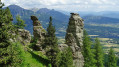
On this hike, nature is the artist, offering us geological formations carved into the sandstone, each one as astonishing as the next.
Not to mention Pic Queyrel with its extensive panorama from the horizontal ridge line that connects the two high points.
At the end of the hike, you can discover the remains of the Malcros Canal. A somewhat crazy project which, from 1881 to 1923, supplied water to the valleys from a... glacier.
Col de la Pisse from Chaillol 1600
 9.42 mi
+2,766 ft
-2,743 ft
6h 45
Difficult
Departure from Saint-Michel-de-Chaillol (Hautes-Alpes)
9.42 mi
+2,766 ft
-2,743 ft
6h 45
Difficult
Departure from Saint-Michel-de-Chaillol (Hautes-Alpes)
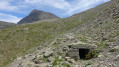
A hike mostly along a balcony path in a sort of cirque, before reaching the foot of the Vieux Chaillol with a lovely panorama. This hike also offers the chance to discover the remains of the Malcros Canal. A somewhat crazy project which, from 1881 to 1923, ensured the water supply to the valleys from a... glacier! Despite the elevation gain, the route involves ascending and descending fairly gentle and very even slopes.
Le Puy via Vieil Aiglun
 4.36 mi
+1,253 ft
-1,243 ft
3h 05
Moderate
Departure from Aiglun (Alpes-de-Haute-Provence)
4.36 mi
+1,253 ft
-1,243 ft
3h 05
Moderate
Departure from Aiglun (Alpes-de-Haute-Provence)
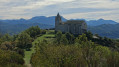
This hike takes you through the old village of Aiglun, allows you to see an exhibition of fossilised leaves in the heart of nature, and finally offers a lovely view of the Bléone Valley, with all the mountain ranges surrounding Digne.
Gorges and chapel of Baudinard-sur-Verdon
 8.03 mi
+1,545 ft
-1,529 ft
5h 00
Moderate
Departure from Baudinard-sur-Verdon (Var)
8.03 mi
+1,545 ft
-1,529 ft
5h 00
Moderate
Departure from Baudinard-sur-Verdon (Var)
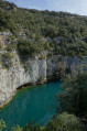
Hike along the Baudinard-sur-Verdon Gorges, on cliffs 100 to 150 m high plunging into turquoise blue water. Then return via the Museau de la Colline, offering numerous breathtaking views of the Lac de Sainte-Croix-du-Verdon, to finally arrive at the Chapelle Notre-Dame de Baudinard with its belvedere overlooking the lake. Not to mention a visit to the village of Baudinard-sur-Verdon.
Around the Costeplane Waterfall
 5.98 mi
+2,067 ft
-2,044 ft
4h 35
Moderate
Departure from Le Lauzet-Ubaye (Alpes-de-Haute-Provence)
5.98 mi
+2,067 ft
-2,044 ft
4h 35
Moderate
Departure from Le Lauzet-Ubaye (Alpes-de-Haute-Provence)
A variation on the Lauzet hike
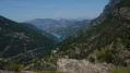
The first section takes you along the route of a railway line that was never completed, then on to the Costeplane waterfalls. The second section, via mule tracks, allows you to explore the work of our ancestors: the terraced fields, the old sheepfold at Falalo, and the hamlet of Dramonasc with its chapel.
The summit of Lure as seen from the Abbey of Notre-Dame de Lure
 7.83 mi
+2,178 ft
-2,195 ft
5h 30
Moderate
Departure from Saint-Étienne-les-Orgues (Alpes-de-Haute-Provence)
7.83 mi
+2,178 ft
-2,195 ft
5h 30
Moderate
Departure from Saint-Étienne-les-Orgues (Alpes-de-Haute-Provence)
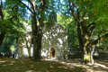
Starting from the former abbey, founded in the 12th century and situated in the forest on Lure Mountain, the route first climbs through the forest and then along the ridges, offering a superb 360° panorama
At the foot of the Cadières de Brandis via the Chapelle Saint-Jean
 7.54 mi
+1,535 ft
-1,542 ft
4h 50
Moderate
Departure from Castellane (Alpes-de-Haute-Provence)
7.54 mi
+1,535 ft
-1,542 ft
4h 50
Moderate
Departure from Castellane (Alpes-de-Haute-Provence)
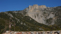
Chasteuil, like Villars-Brandis, is a hamlet nestled at the foot of the Cadières de Brandis cliffs. Initially abandoned in the early 20th century, it has been revitalised since the 1970s.
This walk stays at a high altitude, following a path that runs almost entirely along a ledge above the Verdon.
The tiny Saint-Jean Chapel offers a magnificent view of the Cadières de Brandis, and rumour has it that the Templars’ treasure can be found there.
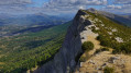
Barre des Dourbes via the Pas de Labaud and Pas de la Faye
 8.08 mi
+2,444 ft
-2,438 ft
5h 50
Moderate
Departure from Digne-les-Bains (Alpes-de-Haute-Provence)
8.08 mi
+2,444 ft
-2,438 ft
5h 50
Moderate
Departure from Digne-les-Bains (Alpes-de-Haute-Provence)
A magnificent ridge trail with superb views over the Bléone valley and Digne-les-Bains, as well as the Asse valley. Its long limestone cliff stretches from south to north for nearly seventeen kilometres, with the Pic de Couard (1,988 metres) at its northern end.
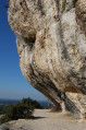
Rocher de Baude via the Colombier valley
 7.74 mi
+1,844 ft
-1,837 ft
5h 10
Moderate
Departure from Taillades (Vaucluse)
7.74 mi
+1,844 ft
-1,837 ft
5h 10
Moderate
Departure from Taillades (Vaucluse)
Hike on the famous Baude rocks, climbing up the winding and charming Colombier valley. At the end, you can visit the old village of Taillades.
All in all, a multifaceted hike.
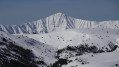
Clot de Bouc from Le Fanget
 7.82 mi
+2,067 ft
-2,047 ft
4h 51
Difficult
Departure from Seyne (Alpes-de-Haute-Provence)
7.82 mi
+2,067 ft
-2,047 ft
4h 51
Difficult
Departure from Seyne (Alpes-de-Haute-Provence)
Snowshoe hike in the Fanget wilderness area, a site that lives up to its name. Ideal for those who want to enjoy nature in a peaceful environment: it feels like you're walking at the end of the world.The site offers six snowshoe trails, but there are many other routes you can take: this one is a variation of Moure Bouchard via the Col de la Bournée with a steeper climb, offering magnificent 360° panoramic views.
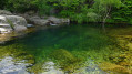
At the source (or nearly so) of the Tarn
 9.29 mi
+561 ft
-548 ft
4h 45
Moderate
Departure from Le Pont-de-Montvert (Lozère)
9.29 mi
+561 ft
-548 ft
4h 45
Moderate
Departure from Le Pont-de-Montvert (Lozère)
This walk will allow you to experience the atmosphere of the Haut Tarn plain, one of the iconic landscapes of agropastoralism. Along the way, you’ll discover a blend of nature, heritage and local history.