Country:

 City:
City:


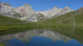
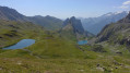
Take the Col du Lautaret road (D1091) to the hamlet of Pont de l’Alpe, next to the village of Le Lauzet
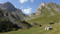
(S/E) From the car park by the roadside, near the bridge, take theGR®® 50, which runs along the left bank of the Torrent du Rif, and follow the path uphill to the small hamlet of Alpe du Lauzet. The path cuts across, then becomes a track suitable for vehicles.
(1) Keep to the left and continue along the track until you reach the chalets at Alpe du Lauzet.
(2) Head left towards the footbridge crossing the Torrent du Rif. Leave theGR®®. At the three-way junction just after this, leave the Chemin du Roy on your left and take the path on the right which climbs up the valley of the Torrent du Plan Chevalier, then climbs more steeply at the bottom of this valley. You’ll reach a slightly technical section equipped with cables.
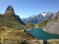
(3) Cross this section and, in two stages, reach a small pass leading out onto the Grand Lac.
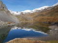
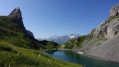
(4) Go round the Grand Lac on the right, heading to the far end of the lake. It is possible to climb straight up, but by staying on the banks, the views are more scenic and the climb is less steep. You’ll come out onto theGR®® 57.
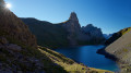
(5) Turn left, heading due north, onto theGR®® 57 towards the Cabane à Graul (shepherd’s hut), then continue to Lac de la Ponsonnière.
(6) Go round the lake on the right, then continue along theGR®® 57 to the Col de la Ponsonnière.
(7) Leave theGR®® 57, which descends towards the Cerces massif, and head completely to the right, eastwards, onto a balcony path that follows a very gently descending contour line. This path heads towards the Col des Béraudes / Col du Chardonnet. Pass by the Lacs des Crouserocs and arrive at the foot of the Pic de la Moulinière, easily recognisable by its vibrant colours.
(8) Leave the path on the left which climbs to the Col des Béraudes, and continue to the right along the balcony path.
You’ll pass through a south-facing scree slope where sturdy footwear is advisable.
(9) Start climbing again through the scree, this time quite steeply. A little further up, look out for the entrance to the old mine with the large cable wheel that was used to haul graphite wagons down to the Guisane valley.
(10) From the mine, continue climbing up to the Col du Chardonnet Nord. You’ll reach a plateau with Lac de la Mine and, slightly further down, the Col du Chardonnet Sud, where you’ll join theGR®®57.
(11) Turn right onto theGR®®, which descends via numerous hairpin bends.
(12) Leave theGR®®57, which heads off to the right, and continue downwards by turning left, heading towards the Chalets de l’Alpe du Lauzet, where you rejoin theGR®®50.
(13) Carry on straight ahead to cross the hamlet; a little further down, the path joins the track.
(1) Carry on straight ahead to the car park (S/E).

 Visorando Member
 Moderate
 Very difficult