Grand Veymont via the Pas du Fouillet

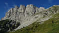
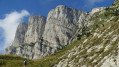
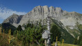
The Grand Veymont (the highest peak in the Vercors at 2,341 m) from Gresse-en-Vercors is a classic route.
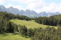
This longer route offers a better opportunity to explore the landscapes of the Vercors high plateaus.
Note added on 16 August 2026 following a user’s comment.
‼️ WARNING: THE PAS DE FOUILLET IS NO LONGER PASSABLE AS THE HANDRAIL HAS BEEN REMOVED. VERY STEEP, RUGGED AND SLIPPERY SECTION – TAKE THE PAS DE HOLLOWED-OUT TREE TRUNK SERVING AS A DRINKING TRUFFLE INSTEAD‼️

Details

3832454
Creation:
Last update:
Last review:
  • Walking
    Activity: Walking
  • ↔
    Distance: 11.08 mi
  • ◔
    Duration according to the author: 10 hrs 
  • ▲
    Difficulty: Very difficult

  • ⚐
    Back to start: Yes
  • ↗
    Ascent: + 4,833 ft
  • ↘
    Descent: - 4,813 ft

  • ▲
    Highest point: 7,618 ft
  • ▼
    Lowest point: 4,075 ft

Photos

Description of the walk

Park in the large car park at the Odyssée Verte.

(S/E) Take the Sentier des Fleurs, to the right of the main track, towards the park with the footbridges in the trees.

(1) Just before the park, continue along this path, turning right. The path descends to the resort car park. Cross the Gresse.

(2) Take the path opposite the car park that leads to the Pas de la Ville. Very quickly, the climb becomes steep; the path winds its way up through a forest (and is therefore in the shade) before emerging into mountain pastures directly below the Grand Veymont.

(3) Continue climbing straight on to the Pas de la Ville.

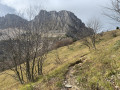
(4) Turn left. The path is less clearly marked as it is rockier; however, as it is heavily used, the rocks are quite slippery and smooth.
Take care: some sections are a bit exposed.
Pass through a gully to reach a small flat area.
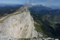
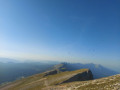
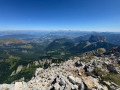
From there, looking back, you’ll have a magnificent view of the Vercors mountain range.
All that remains is the final section leading to the summit

(5) From the Grand Veymont (2,341 m), begin the descent. Once on the plateau, cross it heading eastwards to the edge of the ridge.
Stay along the edge until you reach the Pas du Fouillet. Keep to the right (south), pass the Aiguillettes hut and head for the Pas de Bachassons.
Turn completely to the left and pass through the Ravin des Serres and the Ravin du Maupas to reach the (7).

(6) The pass is quite narrow; fortunately, a rope has been fixed in place for safety.

(7) Continue downwards, heading off to the left.

(8) Turn left (Yellow Cross and Green Cross on a tree) at a hairpin bend to find yourself skirting a ravine. You’ll soon come across another yellow and green marker.
Shortly afterwards, there are three dry streams to cross; you’ll need to climb up to cross them, using a rope for the last one (useful but not essential).

Please note: there will be three more dry streams to cross further on. The banks of these streams have been eroded, so it is important to spot where the path resumes on the opposite side. You will often need to climb up or down to cross.
Ropes are provided to assist with these sections.
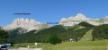
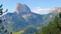
At each exit from the ravines, the view opens up, offering fine views of Mont Aiguille.
Reach the junction after the Barri ravine at around 1,400 m.

(9) Continue straight on, following the contour line.
Stay on this balcony-like path until you reach the Col de l’Allimas at an elevation of 1,354 metres.

(10) Continue straight on, following the contour line.

(11) Continue straight on, following the contour line.

(12) At the Col de l’Allimas, turn left and stay by the roadside for about a hundred metres, then head left into the forest to return to the Parc de l’Odyssée Verte car park (S/E).

Waypoints

  1. S/E : mi 0 - alt. 4,272 ft - Odyssée Verte car park
  2. 1 : mi 0.22 - alt. 4,275 ft - The Odyssée Verte in the Vercors
  3. 2 : mi 1 - alt. 4,094 ft - Gresse-en-Vercors car park
  4. 3 : mi 2.43 - alt. 5,669 ft - Crossroads
  5. 4 : mi 3 - alt. 6,332 ft - Pas de la ville
  6. 5 : mi 4.08 - alt. 7,612 ft - Le Grand Veymont - Le Grand Veymont
  7. 6 : mi 5.5 - alt. 6,142 ft - Fouillet Pass
  8. 7 : mi 5.72 - alt. 5,774 ft - The route then continues downhill
  9. 8 : mi 6.62 - alt. 4,541 ft - Turn left at a hairpin bend
  10. 9 : mi 8 - alt. 4,564 ft - Straight ahead on level ground
  11. 10 : mi 8.11 - alt. 4,469 ft - Straight ahead on level ground
  12. 11 : mi 9.33 - alt. 4,547 ft - Straight ahead on level ground
  13. 12 : mi 10.24 - alt. 4,423 ft - Col de l'Allimas
  14. S/E : mi 11.08 - alt. 4,268 ft - Odyssée Verte car park

Notes

Alternative route:
- It is possible to set off from the large car park at the Gresse-en-Vercors ski resort (2).
Starting from the Odyssée Verte car park allows you to warm up and thus avoids beginning the walk with an immediate climb.
- You can also set off from the Col de l’Allimas (11). Note: There are few parking spaces.

Note that the section from (9) to (11) is quite long but less tiring as it’s on level ground: that’s just as well, as it’s the end of the walk.

This route passes through a protected area, which may be subject to special regulations:

Worth a visit

Right next to the starting point: the Odyssée Verte is a treetop adventure course, up to 10 metres above the ground.

Reviews and comments

4.4 / 5
Based on 3 reviews

Reliability of the description
4.7 / 5
Ease of following the route
4 / 5
Route interest
4.7 / 5
lemarcheur65
lemarcheur65 ★

Hello, emilie.357
Thank you for your message.
A warning has been added to the introduction and the description has been amended, pending an update from the author!

Machine-translated

emilie.357
emilie.357

Overall rating : 4.3 / 5

Date of your route : Aug 16, 2026
Reliability of the description : ★★★★☆ Good
Ease of following the route : ★★★★☆ Good
Route interest : ★★★★★ Very good
Very busy route : Yes

‼️ WARNING: THE PAS DE FOUILLET IS NO LONGER PASSABLE AS THE HANDRAIL HAS BEEN REMOVED. THIS SECTION IS VERY STEEP, RUTTED AND SLIPPERY – PLEASE USE THE PAS DE HOLLOWED-OUT TREE TRUNK SERVING AS A DRINKING TRUFFLE INSTEAD ‼️

We undertook this hike in August 2026, passing via the Saint Jean hut (Baraque du Veymont) as the ascent is more gradual and the scenery is more interesting. This adds a few kilometres to the route, but takes roughly the same amount of time. We camped at the foot of the Grand Veymont, near the Pas de Bachassons, where we were able to fill our water bottles from the spring. Marmots and ibex were out and about.
The descent via the Pas du Fouillet is very technical, with some dangerous sections. The ONF has removed the handrail from this naturally slippery and eroded section. The path is no longer passable.
I recommend descending via the Pas de Bachassons; this adds very little to the hike’s length and avoids this dangerous section. The descent through the woods is less interesting, with a few technical sections due to up-rooted tree stumps.

Machine-translated

damJ38
damJ38

Overall rating : 4.3 / 5

Date of your route : May 08, 2023
Reliability of the description : ★★★★★ Very good
Ease of following the route : ★★★★☆ Good
Route interest : ★★★★☆ Good
Very busy route : No

A day’s hike for two; the climb up to the Pas de la Ville is quite steep but easily manageable, followed by an easy path to the Grand Veymont and then the Pas du Fouillet.
One slight downside is that once you enter the forest, the path becomes rather monotonous for the remaining 8–9 km, as the woodland is quite dense.
Overall, a fairly physically demanding and energy-sapping hike, but a good circular route starting from Gresse.

Machine-translated

xaviers
xaviers
• Edited:

Overall rating : 4.7 / 5

Date of your route : Jul 24, 2021
Reliability of the description : ★★★★★ Very good
Ease of following the route : ★★★★☆ Good
Route interest : ★★★★★ Very good
Very busy route : No

Circular walk completed in two days, setting off at 2.00 pm on day 1 to camp near the meadow above the Pas du Fouillet
Beautiful scenery, varied slopes; marmots and chamois were spotted
Lovely view of Mont Aiguille

PS: If you’re doing this as a day trip, set off early and make sure you’re in good shape

Machine-translated

Other walks in the area

For more walks, use our search engine .

The GPS track and description are the property of this route's author. Please do not copy them without permission.