At the foot of the Cadières de Brandis via the Chapelle Saint-Jean

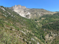
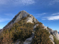
Chasteuil, like Villars-Brandis, is a hamlet nestled at the foot of the Cadières de Brandis cliffs. Initially abandoned in the early 20th century, it has been revitalised since the 1970s.
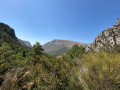
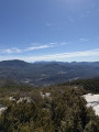
This walk stays at a high altitude, following a path that runs almost entirely along a ledge above the Verdon.
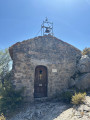
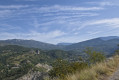
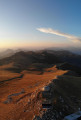
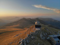
The tiny Saint-Jean Chapel offers a magnificent view of the Cadières de Brandis, and rumour has it that the Templars’ treasure can be found there.

Details

66048251
Creation:
Last update:
Last review:
  • Walking
    Activity: Walking
  • ↔
    Distance: 7.54 mi
  • ◔
    Average duration: 4h 50 
  • ▲
    Difficulty: Moderate

  • ⚐
    Back to start: Yes
  • ↗
    Ascent: + 1,535 ft
  • ↘
    Descent: - 1,542 ft

  • ▲
    Highest point: 3,504 ft
  • ▼
    Lowest point: 2,795 ft
  • ⚐ Country: France
  • ⚐
    Area: Alps
  • ⚐ City: Castellane (04120)
  • ⚑
    Start/End: N 43.836089° / E 6.423623°
  • ❏
    IGN map(s): Ref. 3442OT, 3442OTR, 3542OT
  • Hour-by-hour weather

Photos

Description of the walk

Park in the car park located about 200 m before the village of Chasteuil.

(S/E) Continue along the road; atthe first hairpinbend , you have two options:
- take the direct path straight ahead to reach the Ravin de la Font crossroads,
- stay on the road (this is the route shown on the map), cross the village via the small square by the church. Turn right towards the signposts to rejoin the road. You’ll reach theGR®4junction. Turn right onto it and follow the red and white markings to reach the Ravin de la Font junction.

(1) Cross the bridge and continue on to quickly reach the ‘Carrefour de Colle Basse’ signpost.

(2) Keep straight ahead on theGR®, walking on almost level ground along this ancient Roman road. Then enjoy this balcony path with lovely views over Chasteuil. Walk along a cliff face to reach the foot of the climb.

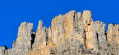
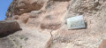
(3) Begin this climb and you’ll soon come across the dolomite cliffs of Les Cadières de Brandis. Carry on to reach a small pass with a wayside shrine and a telecoms relay station.

(4) Turn right onto a fairly steep and narrow path to reach the Chapelle Saint-Jean, perched on a rocky outcrop.
Please note: in winter, this side does not get any sun, which makes the path slippery.

(5) Return to the previous crossroads.

(4) Continue to the right, following theGR®4and the Roman road downhill, crossing streams where the paths have been cleared. You’ll reach the signpost at the junction with the path leading to Brandis.

(6) Continue to the right, along the path which descends slightly whilst remaining on a ledge above the Verdon. After a short climb, you’ll reach a tarmac road.

(7) Leave theGR®4here and head up to the left towards the hamlet of Villars Brandis, passing in front of the old church. Continue uphill, keeping to the left of a concrete track (private) until you reach a water intake.

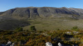
(8) Turn left onto the yellow-marked path. Enjoy this scenic path and the superb view of Les Cadières de Brandis. Reach the Brandis crossroads.

(9) Please note: the IGN map shows a route to the ruins of the hamlet of Brandis, but it is no longer possible to pass through these ruins as they are on private property.
Turn left to reach the Brandis signpost junction, which you passed earlier.

(6) Follow the route you took on the way there in the opposite direction to return to the Chasteuil car park (S/E).

Waypoints

  1. S/E : mi 0 - alt. 2,812 ft - Car park before the village of Chasteuil
  2. 1 : mi 0.33 - alt. 2,831 ft - Ravin de la Font
  3. 2 : mi 0.5 - alt. 2,867 ft - Colle Basse crossroads
  4. 3 : mi 0.86 - alt. 2,867 ft - Change in gradient
  5. 4 : mi 1.81 - alt. 3,232 ft - Chapel junction
  6. 5 : mi 1.93 - alt. 3,281 ft - Chapelle Saint-Jean (Castellane)
  7. 6 : mi 2.42 - alt. 3,094 ft - Brandis signpost
  8. 7 : mi 3.56 - alt. 2,854 ft - Road
  9. 8 : mi 4.41 - alt. 3,392 ft - Villars Brandis
  10. 9 : mi 5.12 - alt. 3,399 ft - Brandis crossroads
  11. S/E : mi 7.54 - alt. 2,795 ft - Car park before the village of Chasteuil

Notes

Access by car to Chasteuil is via a very narrow road with sharp hairpin bends. Not recommended for large and long vehicles, such as large motorhomes.
(S/E) and (1) Water is available here.
(1) Very shortly after the bridge, you cross asecond bridge where, on the left, you’ll notice folded rocks.
Between (4) and (5) access to the chapel can be tricky with children.
(7) The road leading up to Villars Brandis has little or no traffic.

Worth a visit

(S/E) Chasteuil is small but full of charm; do take a stroll through the village.
The legend of the Verdon treasure: nine chapels named after saints are situated around the Valcros commandery: Saint-Trophime, Saint-Étienne, Saint-Maur, Saint-Pierre, Saint-Laurent, Sainte-Anne, Saint-Roch, Saint-Jean and Saint-Julien.
Coincidence or not, if you take the initials of the nine chapels, you get the word TEMPLARII – meaning the Knights Templar.

Always be cautious and plan ahead when you're outdoors. Visorando and the author of this route cannot be held responsible for any accidents occurring on this route.

The GR® and PR® markings are the intellectual property of the Fédération Française de Randonnée Pédestre.

Reviews and comments

5 / 5
Based on 2 reviews

Reliability of the description
5 / 5
Ease of following the route
5 / 5
Route interest
5 / 5
Thomas Jacques
Thomas Jacques

Overall rating : 5 / 5

Date of your route : Apr 07, 2025
Reliability of the description : ★★★★★ Very good
Ease of following the route : ★★★★★ Very good
Route interest : ★★★★★ Very good
Very busy route : No

A lovely, fairly easy walk, with stunning views, two charming villages and a beautiful chapel.

Machine-translated

JMB06
JMB06

Overall rating : 5 / 5

Date of your route : Jan 15, 2025
Reliability of the description : ★★★★★ Very good
Ease of following the route : ★★★★★ Very good
Route interest : ★★★★★ Very good
Very busy route : No

A pleasant route that enjoys plenty of sunshine, even in winter.

Machine-translated

Other walks in the area

For more walks, use our search engine .

The GPS track and description are the property of this route's author. Please do not copy them without permission.