


 Country:
 City:
City:


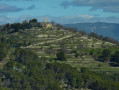

To get to the car park, take a small road in the middle of the hamlet of La Cride which climbs up to a large platform that was once used as a wheat threshing floor.
(S/E) Head north, passing in front of a ruin (an old bakery dating from the 17th century) in the village and start climbing.
(1) Follow the fitness trail on the left, which goes around the hill, crossing terraced land that was once cultivated.
Pass in front of the village ruins (caution: dangerous ruins: access is prohibited and protected by a fence). About twenty drawings show a possible reconstruction of the site
(2) Once you have gone around the hill, climb up to the oppidum towards a section of wall (the remains of an ancient castle).
(3) At the top, there is a lookout tower for forest fire prevention and an orientation table. Descend.
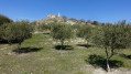
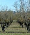
(4) Head left towards the olive grove and continue downhill along a few hairpin bends until you reach a fork in the path.
(5) Follow the path to the left to climb up to the chapel.
(6) From the Sainte Réparade Chapel, retrace your steps to the fork.
(5) Continue straight ahead to the car park.
(S/E) Cross the car park and head south through the forest. Stay on the main path where you will see marks in the rock left by ploughs. You will come to a fork in a clearing.
(7) Keep left and continue along the wide, flat path towards the south-east.
(8) Leave the path that descends to the left and continue climbing the steep slope for a few dozen metres to the right, before arriving at a flat area at a Y-junction.
(9) Do not take the path that branches off to the right. Continue straight ahead on the wide DFCI track for about 250 metres.
(10) Before the DFCI track begins a 90° turn, leave it and take the small path (marked yellow and orange) that climbs to the right, heading south. Stay on the wider path that continues to climb through the forest on the shaded north side until you reach a fork. You will eventually come back to a track that leads to a few houses.
(11) Leave the yellow-orange marked trail by turning right, west, and continue climbing on a well-defined trail (probably an old mule track).
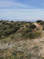
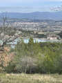
(12) At a hairpin bend, turn left onto a wider path. Leave the forest and you will find yourself on a path slightly above the ridge. Pass below a house. The view is unobstructed
(13) When you reach a fence separating a private hunting ground, turn right, staying on the ridge but on the forest side, and follow the fence, which has been damaged. There is not much left of it and it is now "open", encouraging you to continue straight ahead. You must turn right to avoid walking on private property and a hunting reserve. Very quickly, you will re-enter the woods.
(14) After a fairly steep descent, take the path on the left and join a wider path at a fork.
(15) Descend to the right, heading north, and you will come to the fork you passed on the way there.
(7) Turn left and follow the same route as on the way there to return to the car park (S/E).





 Visorando Member
 Easy
Easy 
 Tourist office
