


Bertrand LEPERE

 Visorando Member
 Premium user
 - Gender: man
Sign up:
Published route(s)
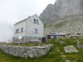
 Tour of the Göscheneralpsee - Ascent to the Dammahütte
 3.25 mi
 +2,687 ft
 -584 ft
 3h 50
3h 50
 Difficult
 Departure from Göschenen (Canton of Uri)
The first stage of this two-day circuit involves climbing up to the Damahütte via a path on the southern shore of the lake.
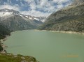
Tour of the Göscheneralpsee via Damahütte
 7.23 mi
+3,199 ft
-3,215 ft
2 days
Difficult
Departure from Göschenen (Canton of Uri)
7.23 mi
+3,199 ft
-3,215 ft
2 days
Difficult
Departure from Göschenen (Canton of Uri)
If you’re looking to hike in the high mountains and discover a beautiful Swiss glacial lake, here’s what you need: a walk around the Göscheneralpsee (a lake with a dam) and an overnight stay at the “Dammahütte”, a small, friendly mountain hut with 20 beds at an altitude of 2,440 metres..
Tour of the Göscheneralpsee - Descent via the Panorama trail
3.98 mi
+512 ft
-2,657 ft
2h 15
 Average
Departure from Göschenen (Canton of Uri)
Average
Departure from Göschenen (Canton of Uri)
The second stage of this circuit starts at the Dammahütte and follows a "Panorama" trail through a glacial cirque, then continues along the northern shore of the lake.
Les Brézouard
 7.56 mi
+1,194 ft
-1,191 ft
4h 30
Average
Departure from Le Bonhomme (Haut-Rhin)
7.56 mi
+1,194 ft
-1,191 ft
4h 30
Average
Departure from Le Bonhomme (Haut-Rhin)
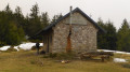
If you want to go on a beautiful hike starting from the Col des Bagenelles, between the valleys of Sainte-Marie-aux-Mines and Kaysersberg, the Petit and Grand Brezouard tour is for you. Here is the Tour des Petit and Grand Brezouard, which offers views of these two valleys, the Alsace plain and, in the distance, the Black Forest. Very well marked by the Club Vosgien, it is suitable for all types of hikers, including children.
20/08/2024: Hike modified to avoid the Grand Brézouard, which has been unmarked to reinforce the quiet zone.
The Three Countries Poets' Trail
 4.12 mi
+30 ft
-30 ft
1h 55
4.12 mi
+30 ft
-30 ft
1h 55
 Easy
Departure from Huningue (Haut-Rhin)
Easy
Departure from Huningue (Haut-Rhin)
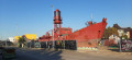
This short walk takes you through three countries on foot and enriches the mind as you read the texts by French, Swiss and German poets displayed on the boundary stones.You will pass from France to Switzerland and then back through Germany.No need to take your passport to travel, an identity card will suffice.
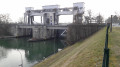
 The Rhine and its locks
 21.08 mi
+52 ft
-52 ft
2 hrs
Easy
Departure from Huningue (Haut-Rhin)
21.08 mi
+52 ft
-52 ft
2 hrs
Easy
Departure from Huningue (Haut-Rhin)
A short cycle ride along both banks of the Rhine, exploring hydroelectric and river engineering structures.
An easy cycle ride on a virtually flat route.
Tour of the Feldberg via the Feldsee
 7.03 mi
+1,339 ft
-1,325 ft
4h 25
Average
Departure from Feldberg (Regierungsbezirk Freiburg)
7.03 mi
+1,339 ft
-1,325 ft
4h 25
Average
Departure from Feldberg (Regierungsbezirk Freiburg)
Discover the Feldberg (1,493 m), the highest peak in the Black Forest, via the Feldsee, a small glacial lake at the foot of the mountain.
Most of the hike follows the "Feldbergsteig" route
The Belchen
 4.02 mi
+1,125 ft
-1,135 ft
2h 50
Average
Departure from Aitern (Regierungsbezirk Freiburg)
4.02 mi
+1,125 ft
-1,135 ft
2h 50
Average
Departure from Aitern (Regierungsbezirk Freiburg)
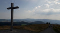
A short hike to admire the view from the second highest peak in the Black Forest
The hills of Basel, Hörnli, Saint-Chrischona and Inzlingen Castle
 9.42 mi
+955 ft
-951 ft
5h 10
Average
Departure from Riehen (Basel-Stadt)
9.42 mi
+955 ft
-951 ft
5h 10
Average
Departure from Riehen (Basel-Stadt)
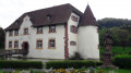
A walk straddling the Swiss and German border on the hills above Basel (Basel in German).
You’ll cross from Switzerland into Germany almost without realising it. You’ll know you’ve crossed when you see the border markers on whichever side you’re on.
The route takes you past the Saint-Chrischona telecoms tower and its church, then on to the pretty castle at Inzlingen, surrounded by lovely moats.
Above Soultzmatt
 10.40 mi
+1,224 ft
-1,230 ft
5h 50
Average
Departure from Soultzmatt (Haut-Rhin)
10.40 mi
+1,224 ft
-1,230 ft
5h 50
Average
Departure from Soultzmatt (Haut-Rhin)
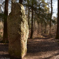
A lovely hike in the Alsatian foothills of the Vosges mountains, passing through Wintzfelden and Osenbach.
Very well marked by the Club Vosgien.
Towards Lac des Rousses
 2.94 mi
+236 ft
-213 ft
1h 35
Easy
Departure from Les Rousses (Jura)
2.94 mi
+236 ft
-213 ft
1h 35
Easy
Departure from Les Rousses (Jura)
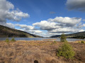
This short route allows you to discover Lac des Rousses, the only lake in Franche-Comté located in the basin that flows towards Switzerland and the Rhine. It is surrounded by peat bogs and you can discover remarkable flora and fauna
. In summer, you can swim in its clear, shallow waters, enjoy the water sports centre or contemplate the beauty of the surrounding landscapes, and in winter, watch the skaters and iceboats when the lake is frozen .
Above Arlesheim
 7.21 mi
+1,460 ft
-1,470 ft
4h 35
Average
Departure from Arlesheim (Basel-Landschaft)
7.21 mi
+1,460 ft
-1,470 ft
4h 35
Average
Departure from Arlesheim (Basel-Landschaft)
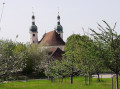
A route allowing you to see the heights of Arlesheim via several castles, the Kirschenland (cherry country), the Schartenflue (with its panoramic tower) as well as the Goetheanum and quaint picturesque houses in Dornach.
In the Black Forest, above Marzell
 4.55 mi
+404 ft
-387 ft
2h 25
Easy
Departure from Malsburg-Marzell (Regierungsbezirk Freiburg)
4.55 mi
+404 ft
-387 ft
2h 25
Easy
Departure from Malsburg-Marzell (Regierungsbezirk Freiburg)
If you’re feeling too hot in the lowlands, come and enjoy a stroll in the cool air, amongst the fir trees of the Black Forest and their scent. A short, unpretentious hike, suitable for the whole family and all ages.
Neuenweg to Belchen circular route
 7.68 mi
+2,323 ft
-2,313 ft
5h 35
Difficult
Departure from Kleines Wiesental (Regierungsbezirk Freiburg)
7.68 mi
+2,323 ft
-2,313 ft
5h 35
Difficult
Departure from Kleines Wiesental (Regierungsbezirk Freiburg)
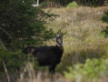
A route to explore the Belchen (the second-highest peak in the Black Forest), accessible only on foot. Those less adventurous can take a cable car or cycle along a road closed to motor vehicles, starting from Aitern.
A magnificent landscape with superb views, featuring patches of scrub and fir trees that have made this forest famous. Depending on the season, you can enjoy wild berries (blueberries, wild strawberries, wild raspberries and blackberries) along this route.
Circular Alfeld Lake by Ballon d'Alsace
 8.34 mi
+2,313 ft
-2,313 ft
5h 50
Difficult
Departure from Sewen (Haut-Rhin)
8.34 mi
+2,313 ft
-2,313 ft
5h 50
Difficult
Departure from Sewen (Haut-Rhin)
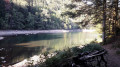
If you want an alternative between several circuits between Lac d'Alfeld and the summit of Ballon d'Alsace, here is one that combines routes ranging from easy to difficult and takes you past the old farm ruins that dotted the massif before the Second World War.
Here is one that combines routes ranging from easy to difficult and allows you to discover the old ruined farms that dotted the mountains before the Second World War.
Hochblauen from Marzell
 5.36 mi
+1,562 ft
-1,558 ft
3h 50
Average
Departure from Malsburg-Marzell (Regierungsbezirk Freiburg)
5.36 mi
+1,562 ft
-1,558 ft
3h 50
Average
Departure from Malsburg-Marzell (Regierungsbezirk Freiburg)
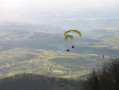
PLEASE NOTE (May 2025): the hotel is currently undergoing renovation and work is not due to be completed any time soon. The upper car park is congested and it is impossible to eat or watch the paragliders; to reach the tower, you must walk around the summit
You will discover the southernmost peak of the Black Forest, which rises to 1,165 m.From up there, you can see the start of the Rhine Plain to the west, the Vosges Mountains to the south and the Jura Mountains to the south. In fine weather, the Swiss Alps and, to the north, the peaks of the Black Forest complete the panorama.
The Platzerwaesel Pass from Markstein
 9.43 mi
+1,073 ft
-1,050 ft
5h 15
Average
Departure from Fellering (Haut-Rhin)
9.43 mi
+1,073 ft
-1,050 ft
5h 15
Average
Departure from Fellering (Haut-Rhin)
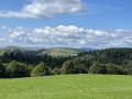
Route des Crêtes: discovery route of the Vosges mountain peaks starting from Markstein and heading north.
From the Cabane du Vélan to Bourg-Saint-Pierre
 4.57 mi
+282 ft
-3,471 ft
2h 20
Difficult
Departure from Bourg-Saint-Pierre (Valais)
4.57 mi
+282 ft
-3,471 ft
2h 20
Difficult
Departure from Bourg-Saint-Pierre (Valais)
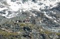
The second stage of this hike starts at the Cabane du Vélan and follows the right bank of the Valsorey torrent.
The Cabane du Vélan from Bourg-Saint-Pierre
 3.93 mi
+3,192 ft
-10 ft
4h 35
Difficult
Departure from Bourg-Saint-Pierre (Valais)
3.93 mi
+3,192 ft
-10 ft
4h 35
Difficult
Departure from Bourg-Saint-Pierre (Valais)
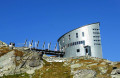
The Cabane du Vélan (2,642 m) is nothing like a traditional Swiss hut. Its bold, futuristic architecture, adorned with solar panels (inaugurated in 1993), makes it look more like a ship than a refuge and has earned it the Ligue de Protection du Patrimoine award. It enjoys an exceptional location above moraines and glaciers, with magnificent views of the Grand Combin massif (4,312 m) and Mont Vélan (3,727 m).
At the foot of the Grand Combin
 8.51 mi
+3,451 ft
-3,465 ft
2 days
Difficult
Departure from Bourg-Saint-Pierre (Valais)
8.51 mi
+3,451 ft
-3,465 ft
2 days
Difficult
Departure from Bourg-Saint-Pierre (Valais)
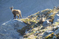
Two-day circuit with a night in a mountain hut and exploration of the Combe de Valsorey, at the foot of the Grand Combin (4,312 m) and Mont Vélan (3,727 m).
Spectacular high mountain scenery guaranteed.
The Schlumpf and the Fennematt as seen from Dolleren
 5.91 mi
+1,772 ft
-1,762 ft
4h 15
Average
Departure from Dolleren (Haut-Rhin)
5.91 mi
+1,772 ft
-1,762 ft
4h 15
Average
Departure from Dolleren (Haut-Rhin)
Come and explore the hills on the right bank of the Doller Valley.
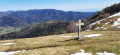
At the top of the Schlumpf, you can admire the landscape and enjoy views of the Vosges, from the Ballon d’Alsace to the Grand Ballon, and beyond the Alsace plain, the foothills of the Black Forest.
Le Drumont from the Col d'Oderen
 7.21 mi
+1,729 ft
-1,726 ft
4h 50
Average
Departure from Fellering (Haut-Rhin)
7.21 mi
+1,729 ft
-1,726 ft
4h 50
Average
Departure from Fellering (Haut-Rhin)
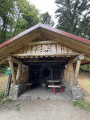
Straddling the Haut-Rhin and the Vosges (or Alsace and Lorraine), come and discover this original hike starting from the Col d'Oderen.
The fairly steep start is compensated for by the landscapes and superb panoramic views from the Tête de Fellering, as well as the Drumont orientation table.
Ruschbachtal and Saint-Chrischona starting from Wyhlen
 6.54 mi
+1,198 ft
-1,194 ft
4h 05
Average
Departure from Grenzach-Wyhlen (Regierungsbezirk Freiburg)
6.54 mi
+1,198 ft
-1,194 ft
4h 05
Average
Departure from Grenzach-Wyhlen (Regierungsbezirk Freiburg)
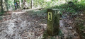
Discover the Ruschbachtal (Nature Reserve) with its pretty wild stream and waterfalls to reach Saint-Chrischona, a small hamlet in the Swiss canton of Basel-Stadt. It is situated at the highest point in the canton, 522 metres above sea level, and is home to Switzerland’s tallest television tower (250 m). From there, you’ll have a superb view of the Jura and the Alps.
Reigoldswil and Wasserfallen
 5.80 mi
+2,152 ft
-2,149 ft
4h 30
Average
Departure from Reigoldswil (Basel-Landschaft)
5.80 mi
+2,152 ft
-2,149 ft
4h 30
Average
Departure from Reigoldswil (Basel-Landschaft)
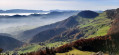
A pleasant walk from a typical village in Basel-Landschaft. From Reigoldswil to Wasserfallen, there are green hills, idyllic forests, waterfalls, flower-filled fields, giant objects, llamas and even the highest point in this Swiss canton, with a magnificent view of the Alps.
Belvédère des Maquisards, Pont Perroud and leat de la Chaille in Prémanon
 5.47 mi
+1,017 ft
-1,027 ft
3h 25
Easy
Departure from Prémanon (Jura)
5.47 mi
+1,017 ft
-1,027 ft
3h 25
Easy
Departure from Prémanon (Jura)
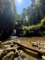
Explore the surroundings of Prémanon. From the Belvédère des Maquisards, above the Morez cluse, to the coolness of the leat de la Chaille gorges, this is a fairly easy and varied route with a mix of forest, geology and history.
Obertüllingen and Burg Rötteln
 8.43 mi
+1,027 ft
-1,027 ft
4h 45
Average
Departure from Lörrach (Regierungsbezirk Freiburg)
8.43 mi
+1,027 ft
-1,027 ft
4h 45
Average
Departure from Lörrach (Regierungsbezirk Freiburg)
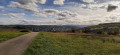
Discover the southern tip of the Black Forest, with the hill overlooking the beginning of the Alsace plain to the west, the town of Lörrach and Germany to the east, and the city of Basel and Switzerland to the south. You can also visit the magnificent Burg Rötteln, a 14th-century fortified castle, the most south-westerly in Germany.
Towards the Blaueberg
 4.33 mi
+988 ft
-981 ft
2h 50
Easy
Departure from Hofstetten-Flüh (Canton of Solothurn)
4.33 mi
+988 ft
-981 ft
2h 50
Easy
Departure from Hofstetten-Flüh (Canton of Solothurn)
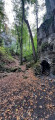
A short walk in the hills of Basel-Landschaft, starting with a climb up the Chälegraben stream, then along the ridge to the Blauepass to take in the view of the Alsace plain on one side and the Swiss Jura hills on the other.
The Chastelbach and Ibach streams from Grellingen
 5.09 mi
+771 ft
-761 ft
3h 00
Easy
Departure from Grellingen (Basel-Landschaft)
5.09 mi
+771 ft
-761 ft
3h 00
Easy
Departure from Grellingen (Basel-Landschaft)
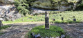
Discover two small streams full of waterfalls and karst cliffs in Baselland (Basel-Landschaft). Coolness and humidity are guaranteed under the trees and cliffs bordering these small, steep-sided valleys.