Towards the Blaueberg

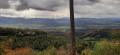
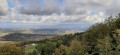
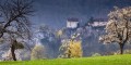
A short walk in the hills of Basel-Landschaft, starting with a climb up the Chälegraben stream, then along the ridge to the Blauepass to take in the view of the Alsace plain on one side and the Swiss Jura hills on the other.

Details

41456451
Creation:
Last update:
Last review:
  • Walking
    Activity: Walking
  • ↔
    Distance: 4.33 mi
  • ◔
    Average duration: 2h 50 
  • ▲
    Difficulty: Easy

  • ⚐
    Back to start: Yes
  • ↗
    Ascent: + 988 ft
  • ↘
    Descent: - 981 ft

  • ▲
    Highest point: 2,730 ft
  • ▼
    Lowest point: 1,762 ft

Photos

Description of the walk

Park at the Radmer car park, which you reach via a small tarmac road on the left as you leave Hofstetten (signposted ‘Berg699’)

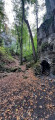
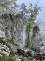
(S/E) Follow the tarmac road as it climbs to the left towards Bergmatten for about 100 metres. You’ll come to a red bench, a carved tree trunk and a hiking signpost. Turn right onto the path leading uphill towards Bergmatten and Blauepass. Follow the Chälegraben, a small stream rushing through a steep-sided gorge. Keep following the Yellow Diamond signs. Alternate between the left and right banks via small wooden bridges and steps. Signposted ‘Spielwiese Bergmatte’. When you emerge onto a large clearing, continue along the edge of the forest until you reach some wooden log steps.

(1) Continue through the woods. When you reach a tarmac road, head up to the right to reach the Bergmatten restaurant or Berg699.

(2) Head towards the red bench and go through a small gate into a pasture – don’t forget to close it behind you. Walk straight up through the meadow. At the end, go through another gate.

(3) Turn left, following the Yellow Diamond (do not take the steps on the left). Once back in the forest, continue uphill to reach the Blauepass.

(4) Head off to the right, towards Mätzerlechrüz. Stay on the ridge path until you reach a crossroads.

(5) Leave the ridge briefly to stay on the path, which veers slightly to the right: to do this, follow the Yellow Diamond markings carefully. Return to the ridge and continue to the Mätzerlechrüz junction.

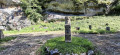
(6) Head off to the right towards Metzerlen and Rodersdorf. As you emerge from the forest onto a gravel track, turn right and continue for about a hundred metres until you reach the edge of the woodland and a crossroads marked by a stone cross.

(7) Turn left, skirting the edge of the forest, then head downhill into the woods. You’ll reach another crossroads with several routes.

(8) Take thesecond path on the right towards Mariastein. You’ll reach a tarmac road at the edge of the woods.

(9) Turn right onto the stony track. Enter the forest again and continue on to return to the Radmer car park (S/E).

Waypoints

  1. S/E : mi 0 - alt. 1,768 ft - Radmer car park
  2. 1 : mi 0.5 - alt. 2,178 ft - Wooden steps
  3. 2 : mi 0.65 - alt. 2,316 ft - Bergmatten Restaurant
  4. 3 : mi 0.71 - alt. 2,333 ft - Gate
  5. 4 : mi 1.02 - alt. 2,680 ft - Blauepass
  6. 5 : mi 1.37 - alt. 2,717 ft - Ridge junction
  7. 6 : mi 2.26 - alt. 2,618 ft - Mätzerlechrüz
  8. 7 : mi 2.41 - alt. 2,516 ft - Stone cross
  9. 8 : mi 2.64 - alt. 2,388 ft - Crossroads with several directions
  10. 9 : mi 3.61 - alt. 1,978 ft - Gravel path
  11. S/E : mi 4.33 - alt. 1,762 ft - Radmer car park

Notes

There are plenty of benches along this walk, and there are often spots where you can light a small fire and barbecue areas.

Worth a visit

(9) If you turn left, after about 500 m, you can visit the Rotberg, a magnificent medieval castle which also serves as a youth hostel.

Reviews and comments

5 / 5
Based on 2 reviews

Reliability of the description
5 / 5
Ease of following the route
5 / 5
Route interest
5 / 5
Biocat
Biocat

Overall rating : 5 / 5

Date of your route : Jul 15, 2024
Reliability of the description : ★★★★★ Very good
Ease of following the route : ★★★★★ Very good
Route interest : ★★★★★ Very good
Very busy route : No

A lovely walk, especially in the first part where it crosses a small gorge. A little more and you'd think you were in Salazie ...

Machine-translated

Marlyse et Gilbert
Marlyse et Gilbert

Overall rating : 5 / 5

Date of your route : Feb 06, 2024
Reliability of the description : ★★★★★ Very good
Ease of following the route : ★★★★★ Very good
Route interest : ★★★★★ Very good
Very busy route : No

This was a very fine walk, despite the weather being a little mixed, with the sun making rare appearances.
The route is very well detailed and it took us exactly the time indicated to complete the whole circuit.
We particularly enjoyed the start of the route in the gorges and then the many viewpoints on the ridges, even if the summits were not very visible at times because of the clouds.
We intend to do this tour again in the spring to take full advantage of the superb views along the way...

Machine-translated

Other walks in the area

For more walks, use our search engine .

The GPS track and description are the property of this route's author. Please do not copy them without permission.