


Matt91

 Visorando Member
 Premium user
 - Location: Longjumeau (91160)
- Gender: man
Sign up:
Published route(s)
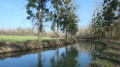
 From La Ferté-Milon to Crouy-sur-Ourcq following the Canal de l'Ourcq
 11.22 mi
 +174 ft
 -203 ft
 5h 20
5h 20
 Moderate
 Departure from La Ferté-Milon (Aisne)
Fifteenth stage of the Grand Tour of Île-de-France via the GR®11, between La Ferté-Milon station in Aisne and Crouy-sur-Ourcq station in Seine-et-Marne. A relatively easy stage that follows the towpath of the canalised Ourcq River to Mareuil-sur-Ourcq, then the Ourcq Canal, which separates from the river at that point.A short detour is suggested at the start of the stage to the Château de La Ferté-Milon on the heights of the town, offering a magnificent view of the surrounding area. Similarly, at the end, the GR® offers a short detour through the woods to the oratory and then the Chapelle Notre-Dame du Chêne before reaching Crouy-sur-Ourcq station.
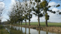
From Crouy-sur-Ourcq to Isles-lès-Meldeuses between Ourcq and Marne
 13.16 mi
+325 ft
-325 ft
6h 20
Moderate
Departure from Crouy-sur-Ourcq (Seine-et-Marne)
13.16 mi
+325 ft
-325 ft
6h 20
Moderate
Departure from Crouy-sur-Ourcq (Seine-et-Marne)
Sixteenth stage of the Grand Tour of Île-de-France via the GR®11, between Crouy-sur-Ourcq and Isles-Armentières-Congis stations in Seine-et-Marne. This stage, which is still relatively easy, continues the descent of the Canal de l'Ourcq - with a detour to the Multien plateau and the village of May-en-Multien - and continues along the Marne.
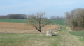
From Isles-lès-Meldeuses to La Ferté-sous-Jouarre via the Dhuys Aqueduct
 17.33 mi
+794 ft
-791 ft
8h 40
17.33 mi
+794 ft
-791 ft
8h 40
 Very difficult
Departure from Isles-les-Meldeuses (Seine-et-Marne)
Very difficult
Departure from Isles-les-Meldeuses (Seine-et-Marne)
Seventeenth stage of the Grand Tour of Île-de-France via the GR®11, between the Isles-Armentières-Congis and La Ferté-sous-Jouarre stations in Seine-et-Marne. This stage consists of a climb up the Marne valley, following its southern plateau (foothills of Brie). In addition, for more than half of the route, the GR® follows the route of the Dhuys Aqueduct, ensuring a well-levelled and therefore relatively easy path.
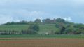
From La Ferté-sous-Jouarre to Coulommiers, from Petit Morin to Grand Morin
 16.29 mi
+1,247 ft
-1,217 ft
8h 35
Very difficult
Departure from La Ferté-sous-Jouarre (Seine-et-Marne)
16.29 mi
+1,247 ft
-1,217 ft
8h 35
Very difficult
Departure from La Ferté-sous-Jouarre (Seine-et-Marne)
Eighteenth stage of the Grand Tour of Île-de-France via the GR®11, between La Ferté-sous-Jouarre and Coulommiers stations. This stage, running roughly north-south, begins the crossing of Brie, culminating in the ascent of the Butte de Doue, which dominates the plateau. It also connects the two rivers named Morin, the Petit to the north and the Grand to the south.
From Coulommiers to Chartronges through Brie
 17.83 mi
+374 ft
-105 ft
8h 30
Very difficult
Departure from Coulommiers (Seine-et-Marne)
17.83 mi
+374 ft
-105 ft
8h 30
Very difficult
Departure from Coulommiers (Seine-et-Marne)
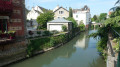
Nineteenth stage of the Grand Tour of Île-de-France via the GR®11, entirely in Brie, and first stage of a series of three necessary to connect Coulommiers station to Provins station, with two nights on site.
As accommodation options are limited in the middle of Brie, it is suggested for this stage to head to La Ferté-Gaucher aerodrome, which is slightly off the GR® route, near which there is a hotel-restaurant where it is possible to spend the night. Although this adds several kilometres to the stage, it offers a good compromise between the length of this stage and the following ones, the longest possible route on the GR® and the proximity to Provins. But this is not the only option, of course: see the Practical Information section for other suggestions.
From Chartronges to Champcenest through Brie
 18.50 mi
+279 ft
-535 ft
8h 45
Very difficult
Departure from La Ferté-Gaucher (Seine-et-Marne)
18.50 mi
+279 ft
-535 ft
8h 45
Very difficult
Departure from La Ferté-Gaucher (Seine-et-Marne)
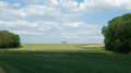
The twentieth stage of the Grand Tour of Île-de-France via the GR®11, the second of three stages through Brie between Coulommiers and Provins, with two nights' accommodation in each place to make the most of the region. The stage is long but not difficult, with very little elevation gain.The stage is designed to follow directly on from the one coming from Coulommiers and precede directly the one going to Provins. But of course, there is nothing to stop you from dividing the route differently.
From Champcenest to Provins through Brie
 17.12 mi
+200 ft
-417 ft
8h 05
Very difficult
Departure from Champcenest (Seine-et-Marne)
17.12 mi
+200 ft
-417 ft
8h 05
Very difficult
Departure from Champcenest (Seine-et-Marne)
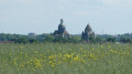
This is the twenty-first stage of the Grand Tour of Île-de-France via the GR®11, and the last of the three stages through Brie between Coulommiers and Provins. It is still quite long but without any real difficulty.This stage completes the crossing of Brie, reaching Provins, whose iconic monuments (Caesar's Tower and the dome of the Collegiate Church of Saint-Quiriace) can be seen from afar in good weather, marking the destination of the stage!
From Provins to Longueville between the Voulzie and Méances valleys.
 11.67 mi
+653 ft
-679 ft
5h 55
Moderate
Departure from Provins (Seine-et-Marne)
11.67 mi
+653 ft
-679 ft
5h 55
Moderate
Departure from Provins (Seine-et-Marne)
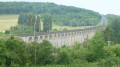
Twenty-second stage of the Grand Tour of Île-de-France via the GR®11. A short stage connecting Longueville to Provins, allowing you to rest after the long previous stages crossing Brie. As the stage is short, we suggest starting with a short circular loop through the old town of Provins to discover its rich heritage.
Paris Pont d'Austerlitz - Massy
 14.65 mi
+361 ft
-180 ft
7h 05
14.65 mi
+361 ft
-180 ft
7h 05
 Difficult
Departure from Paris
Difficult
Departure from Paris
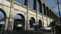
First stage of the Grand Tour of Île-de-France via the GR® 11, starting from the former confluence of the Bièvre and the Seine at the Pont d'Austerlitz in Paris, to the Massy-Palaiseau station in Essonne. It consists of climbing up the lower part of the Bièvre valley, where the river flows mainly underground but is sometimes exposed to the open air following rehabilitation programmes.
From Longueville to Donnemarie-Dontilly through the Montois
 14.37 mi
+951 ft
-876 ft
7h 25
Difficult
Departure from Longueville (Seine-et-Marne) (Seine-et-Marne)
14.37 mi
+951 ft
-876 ft
7h 25
Difficult
Departure from Longueville (Seine-et-Marne) (Seine-et-Marne)
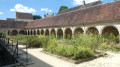
Twenty-third stage of the Grand Tour of Île-de-France via the GR®11, and the first of a series of two stages, including this one, needed to connect the Longueville and Montereau stations, through the Montois and the Seine Valley.For this first stage of the diptych, we suggest spending the night in a bed and breakfast in Donnemarie-Dontilly, roughly halfway between the two stations, after a beautiful crossing of the Montois, in a landscape that is a little more varied and hilly than the Brie just to the north.
From Donnemarie-Dontilly to Montereau-Fault-Yonne in Bassée-Montois
 16.56 mi
+669 ft
-850 ft
8h 10
Difficult
Departure from Donnemarie-Dontilly (Seine-et-Marne)
16.56 mi
+669 ft
-850 ft
8h 10
Difficult
Departure from Donnemarie-Dontilly (Seine-et-Marne)
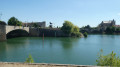
Twenty-fourth stage of the Grand Tour of Île-de-France via the GR®11, starting from Donnemarie-Dontilly after spending the night there at the end ofthe previous stage. This stage connects the Montois region to the Seine Valley and Montereau-Fault-Yonne, the confluence of the Seine and Yonne rivers. It thus transitions from an agricultural landscape to a marshland landscape in the valley, ending in a more urban environment.
From Montereau-Fault-Yonne to Moret-sur-Loing, from one confluence to another.
 15.76 mi
+492 ft
-456 ft
7h 40
Difficult
Departure from Montereau-Fault-Yonne (Seine-et-Marne)
15.76 mi
+492 ft
-456 ft
7h 40
Difficult
Departure from Montereau-Fault-Yonne (Seine-et-Marne)
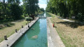
This is the twenty-fifth stage of the Grand Tour of Île-de-France via the GR®11, starting from Montereau station, not far from the confluence of the Seine and the Yonne, and ending at Moret-Veneux-les-Sablons station, not far from the confluence of the Seine and the Loing. The stage, entirely on the GR®11, follows a route on the left bank of the Seine, joining the Orvanne valley a little further south, and returns to Moret-sur-Loing and its beautiful historic centre, following the Canal du Loing on its towpath.
From Moret-sur-Loing to Fontainebleau through the forest
 17.27 mi
+640 ft
-617 ft
8h 30
Very difficult
Departure from Veneux-les-Sablons (Seine-et-Marne)
17.27 mi
+640 ft
-617 ft
8h 30
Very difficult
Departure from Veneux-les-Sablons (Seine-et-Marne)
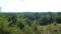
Twenty-sixth stage of the Grand Tour of Île-de-France via the GR®11, connecting the Moret-Veneux-les-Sablons and Fontainebleau-Avon stations through the Fontainebleau Forest, bypassing the town of Fontainebleau. During this crossing of the forest, we will walk along wide shaded paths, steep trails through sandstone blocks, and a few interesting viewpoints.
From Massy to Saint-Cyr-l'École via the Bièvre Valley
 15.09 mi
+476 ft
-233 ft
7h 20
Difficult
Departure from Massy (Essonne) (Essonne)
15.09 mi
+476 ft
-233 ft
7h 20
Difficult
Departure from Massy (Essonne) (Essonne)
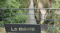
Second stage of the Grand Tour of Île-de-France via the GR®11, from Massy to Saint-Cyr l'École, behind Versailles.This stage, more bucolic than the previous one, consists of continuing up the Bièvre river in its valley, where it is almost entirely in the open air. Arriving near its source in Guyancourt, the GR® leaves the valley and continues towards Saint-Cyr-l'École.
From Saint-Cyr-l'École to Villiers-Saint-Frédéric through the Yvelines
 14.23 mi
+705 ft
-961 ft
7h 10
Difficult
Departure from Saint-Cyr-l'École (Yvelines)
14.23 mi
+705 ft
-961 ft
7h 10
Difficult
Departure from Saint-Cyr-l'École (Yvelines)
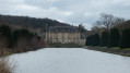
This is the third stage of the GR® 11 Grand Tour of Île-de-France. It continues through the Yvelines, between Saint-Cyr station and Villiers-Neauphle-Pontchartrain station. This stage completes the 'radial' part of the GR® starting from Paris and joins the circular loop that circles the region from Villiers-Saint-Frédéric. The route passes through increasingly large wooded areas as you approach the countryside.
From Villiers-Saint-Frédéric to Orgerus in the heart of the Yvelines
 13.88 mi
+499 ft
-348 ft
6h 50
Difficult
Departure from Villiers-Saint-Fréderic (Yvelines)
13.88 mi
+499 ft
-348 ft
6h 50
Difficult
Departure from Villiers-Saint-Fréderic (Yvelines)
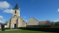
Fourth stage of the Grand Tour de l'Île-de-France on the GR® 11 and start of the clockwise circular section.This stage takes place entirely in the Yvelines department, connecting Villiers-Neauphle-Pontchartrain station to Orgerus-Béhoust station, crossing the Beynes forest and the agricultural landscapes of the Yvelines.
The route runs alongside the Avre aqueduct, which supplies drinking water to western Paris.
From Orgerus to Mantes-la-Jolie following the Vaucouleurs
 14.10 mi
+413 ft
-725 ft
6h 50
Difficult
Departure from Orgerus (Yvelines)
14.10 mi
+413 ft
-725 ft
6h 50
Difficult
Departure from Orgerus (Yvelines)
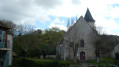
Fifth stage of the Grand Tour of Île-de-France on the GR®11, connecting Orgerus-Béhoust station to Mantes-Station, still through the Yvelines. This is a northbound route that joins the Seine valley at Mantes-la-Jolie, descending the valleys of the Flexanville and then the Vaucouleurs rivers. The route follows both paths at the bottom of the valley and paths on the adjacent plateaus.
From Mantes-la-Jolie to Genainville through the French Vexin
 13.56 mi
+725 ft
-564 ft
6h 50
Difficult
Departure from Mantes-la-Ville (Yvelines)
13.56 mi
+725 ft
-564 ft
6h 50
Difficult
Departure from Mantes-la-Ville (Yvelines)
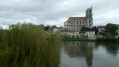
Sixth stage of the Grand Tour de l'Île-de-France on the GR® 11, linking Mantes-Station railway station in the Yvelines to the village of Genainville in the Val d'Oise, in the heart of the French Vexin. This stage is the first part of a two-day route, the aim of which is to connect Mantes-Station railway station to Chars railway station, further north-east in the Val d'Oise.The stage begins in Mantes-la-Jolie in the Seine valley and heads north through the south-western part of the Vexin Français Regional Nature Park, quickly passing from one of the lowest points in the region (crossing the Seine, at ~18 m) to one of the highest points (the beech forest at Villiers-en-Arthies, at 205 m).The French Vexin, with its unspoilt agricultural and wooded landscapes, is a magnificent region where it is very pleasant to hike.
From Genainville to Chars in the heart of the French Vexin region.
 18.42 mi
+988 ft
-1,040 ft
9h 20
Very difficult
Departure from Genainville (Val-d'Oise)
18.42 mi
+988 ft
-1,040 ft
9h 20
Very difficult
Departure from Genainville (Val-d'Oise)
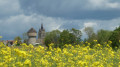
Seventh stage of the Grand Tour of Île-de-France on the GR®11, starting from the village of Genainville, in the heart of the French Vexin, and heading towards Chars station further east. This stage goes hand in hand with the previous Mantes-Genainville stage, with a night in Genainville or the surrounding area necessary to walk between Mantes and Chars stations. This beautiful stage continues the crossing of the equally magnificent French Vexin Regional Nature Park, heading generally eastwards. It joins andthen climbs up the Aubette de Magny valley, crosses a series of agricultural plateaus between Oise and Val d'Oise before descending into the Viosne valley to reach Chars.
From Chars to Bornel via the Rosne hills
 21.42 mi
+1,191 ft
-1,257 ft
10h 55
Very difficult
Departure from Chars (Val-d'Oise)
21.42 mi
+1,191 ft
-1,257 ft
10h 55
Very difficult
Departure from Chars (Val-d'Oise)
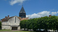
This is the eighth stage of the Grand Tour de l'Île-de-France on the GR®11, starting from Chars station in the Val d'Oise and heading towards Bornel-Belle-Église station in the Oise, through the north-eastern part of the French Vexin and the borders of the Pays de Thelle. This stage is unique in that it runs along the border between the Val d'Oise and Oise departments, with roughly 50% of the route on each side. The proposed itinerary passes through the Buttes de Rosne, the highest natural point in Île-de-France, although it deviates slightly from the GR® for this.
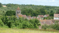
From Bornel to Cires-lès-Mello through the Pays de Thelle
 14.29 mi
+915 ft
-932 ft
7h 20
Difficult
Departure from Bornel (Oise)
14.29 mi
+915 ft
-932 ft
7h 20
Difficult
Departure from Bornel (Oise)
The ninth stage, entirely in the Oise department, of the Grand Tour of Île-de-France on the GR®11, between the stations of Bornel-Belle-Église in the Esches Valley and Cires-lès-Mello in the Thérain Valley. It consists of a crossing of the Pays de Thelle, from west to east, in the south of the department, and always through magnificent varied landscapes, between woods and fields.
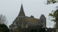
From Cires-lès-Mello to Chantilly via Saint-Leu d'Esserent
 12.36 mi
+459 ft
-390 ft
6h 05
Difficult
Departure from Cires-lès-Mello (Oise)
12.36 mi
+459 ft
-390 ft
6h 05
Difficult
Departure from Cires-lès-Mello (Oise)
Tenth stage of the Grand Tour of Île-de-France via the GR®11, connecting the Cires-lès-Mello railway station to the Chantilly-Gouvieux railway station, around the River Oise and two of its tributaries, the Thérain and the Nonette. The built heritage here is remarkable, between the abbey church of Saint-Leu d'Esserent and, of course, the town and estate of Chantilly.
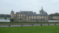
From Chantilly to Borest via Senlis through the Massif des Trois-Forêts
 19.92 mi
+302 ft
-269 ft
9h 25
Very difficult
Departure from Chantilly (Oise)
19.92 mi
+302 ft
-269 ft
9h 25
Very difficult
Departure from Chantilly (Oise)
Eleventh stage of the Grand Tour of Île-de-France via the GR®11, connecting Chantilly-Gouvieux station to the village of Borest, reached by crossing the Chantilly estate, the Chantilly and Ermenonville forests, with a detour through the historic centre of Senlis and, optionally, a moment of reflection in front of the memorial to the victims of the March 1974 plane crash. The route follows, more or less closely, the Nonette River, which is crossed several times. The route for this stage is almost entirely in the forest, with little elevation gain, making it a very pleasant hike, and the crossings of Chantilly and Senlis add a rich touch of heritage. This stage requires an overnight stay to avoid laborious car manoeuvres. It is therefore the first of two consecutive stages, both entirely within the Oise department, between the Chantilly-Gouvieux and Crépy-en-Valois railway stations.
From Borest to Crépy-en-Valois through the Valois
 16.95 mi
+492 ft
-394 ft
8h 15
Very difficult
Departure from Borest (Oise)
16.95 mi
+492 ft
-394 ft
8h 15
Very difficult
Departure from Borest (Oise)
Twelfth stage of the Grand Tour of Île-de-France via the GR® 11, connecting the village of Borest to Crépy-en-Valois station, both in the Oise department. This long stage consists of crossing the Valois region to Crépy-en-Valois, mainly through agricultural plains and wooded areas.
From Crépy-en-Valois to Villers-Cotterêts via the Automne valley.
 18.45 mi
+768 ft
-653 ft
9h 10
Very difficult
Departure from Crépy-en-Valois (Oise)
18.45 mi
+768 ft
-653 ft
9h 10
Very difficult
Departure from Crépy-en-Valois (Oise)
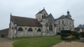
Thirteenth stage of the Grand Tour of Île-de-France via the GR® 11, linking Crépy-en-Valois station in the Oise to Villers-Cotterêts station in the Aisne. It passes through the wooded areas separating these two towns and part of the Automne river valley, which it follows for several kilometres, on the border between the departments of Oise and Aisne.
From Villers-Cotterêts to La Ferté-Milon through the Forest of Retz
 12.42 mi
+558 ft
-761 ft
6h 10
Difficult
Departure from Villers-Cotterêts (Aisne)
12.42 mi
+558 ft
-761 ft
6h 10
Difficult
Departure from Villers-Cotterêts (Aisne)
The fourteenth stage, entirely within the Aisne department, of the Grand Tour of Île-de-France via the GR® 11, between Villers-Cotterêts and La Ferté-Milon stations. During this stage, we cross over to the eastern side of Île-de-France, leaving the Oise basin to reach the Ourcq valley and the Marne basin.As this stage is short, a short (optional) circular route through Villers-Cotterêts is suggested as a prelude, to explore the magnificent grounds of its equally magnificent château. This circular route could also be undertaken following the previous stage completed the day before, with an overnight stay in Villers-Cotterêts.
Grand tour of Île-de-France in 34 stages on the GR®11
528.35 mi
+22,037 ft
-22,156 ft
34 days
Difficult
Departure from Paris
This marked GR® route around the Île-de-France region (with a few forays into neighbouring departments and regions) complements its "little brother", the GR®1, by forming a circular route around Paris, generally with a slightly larger radius.
It follows the same overall pattern: first, a radial section starting from Paris (more precisely from the Pont d'Austerlitz, near the former confluence of the Bièvre and the Seine), going up the entire Bièvre valley, then continuing to Villiers-Saint-Frédéric, in the Yvelines. From there, it is a circular route that loops around the Île-de-France region, close to its borders with neighbouring regions.
The route passes through beautiful regions, often untouched by intensive urbanisation, regional nature parks and other protected natural areas, and takes in some architectural wonders.
From Fontainebleau to Milly-la-Forêt through the forest.
 17.60 mi
+794 ft
-823 ft
8h 45
Very difficult
Departure from Avon (Seine-et-Marne)
17.60 mi
+794 ft
-823 ft
8h 45
Very difficult
Departure from Avon (Seine-et-Marne)
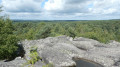
Twenty-seventh stage of the Grand Tour of Île-de-France via the GR®11, connecting Fontainebleau-Avon station to Milly-la-Forêt, after crossing the forests of Fontainebleau and Trois Pignons due west, via Arbonne-la-Forêt between the two massifs. This stage requires an overnight stay in Milly-la-Forêt or the surrounding area before reaching Ballancourt the next day. There are a few hotels and guesthouses available in the vicinity.
From Milly-la-Forêt to Ballancourt-sur-Essonne through the Gâtinais region.
 20.81 mi
+758 ft
-781 ft
10h 15
Very difficult
Departure from Milly-la-Forêt (Essonne)
20.81 mi
+758 ft
-781 ft
10h 15
Very difficult
Departure from Milly-la-Forêt (Essonne)
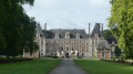
This is the twenty-eighth stage of the Grand Tour of Île-de-France via the GR®11, connecting Milly-la-Forêt to the Ballancourt-sur-Essonne train station after crossing the French Gâtinais region. It is designed to follow on fromthe previous stage coming from Fontainebleau, after a night's stay there.This stage begins in the École valley, which boasts a rich heritage: Milly-la-Forêt, Moigny-sur-École, Courances and its château, and Dannemois, dear to Claude François. It continues through the fields of the Gâtinais, then the ridges and sandstone plateaus of the Grands Avaux forest, ending at Ballancourt-sur-Essonne in the valley of the same name.The stage is very beautiful but very long, and undoubtedly the most physically demanding of all those on the GR®11, especially in its second part. However, it is possible to split it in two by staying overnight and/or shorten it in several places by simplifying it.
Circular route around Les Grands Avaux
 9.72 mi
+459 ft
-466 ft
4h 50
Difficult
Departure from Mondeville (Essonne) (Essonne)
9.72 mi
+459 ft
-466 ft
4h 50
Difficult
Departure from Mondeville (Essonne) (Essonne)
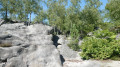
A circular loop through the fields and woodlands between Champcueil, Soisy-sur-École and Nainville-les-Roches, following part of the GR®11 trail. It nevertheless includes some beautiful terrain, such as the Grand Tertre and the Crête des Rochers du Duc in the Grands Avaux forest, offering stunning views of the surrounding area and even as far as Paris on a clear day.
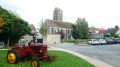
From Ballancourt-sur-Essonne to La Ferté-Alais via Mondeville
 12.27 mi
+663 ft
-630 ft
6h 15
Difficult
Departure from Ballancourt-sur-Essonne (Essonne)
12.27 mi
+663 ft
-630 ft
6h 15
Difficult
Departure from Ballancourt-sur-Essonne (Essonne)
Twenty-ninth stage of the Grand Tour of Île-de-France via the GR®11, linking Ballancourt-sur-Essonne to La Ferté-Alais. Although both towns are located in the Essonne valley, the proposed route passes through the plateau overlooking the valley on the east side, in the Gâtinais Français Regional Nature Park, to the charming village of Mondeville. The GR® then winds its way between valleys, forests dotted with sandstone boulders and agricultural plateaus. This stage is shorter than the previous ones but is not without its difficulties as it still covers steep sections of terrain similar to the Fontainebleau forest, particularly around Mondeville. The route also allows you to discover some unusual sights, such as the Roches du Père La Musique in Ballancourt.
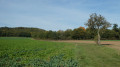
From La Ferté-Alais to Étréchy, from Essonne to Juine
 12.26 mi
+827 ft
-791 ft
6h 20
Difficult
Departure from La Ferté-Alais (Essonne)
12.26 mi
+827 ft
-791 ft
6h 20
Difficult
Departure from La Ferté-Alais (Essonne)
Thirtieth stage of the Grand Tour of Île-de-France via the GR®11, linking La Ferté-Alais, in the Essonne valley, to Étréchy, in the Juine valley, through the western part of the Gâtinais Français Regional Nature Park. It consists of continuing the crossing of the Essonne, between agricultural landscapes, small forest ranges and more imposing valleys. A relatively short stage without any major difficulties, before the next two, which will be a little longer.
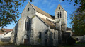
From Étréchy to Saint-Chéron, from the Juine to the Orge through the Hurepoix
 15.96 mi
+955 ft
-971 ft
8h 10
Difficult
Departure from Étréchy (Essonne) (Essonne)
15.96 mi
+955 ft
-971 ft
8h 10
Difficult
Departure from Étréchy (Essonne) (Essonne)
Thirty-first stage of the Grand Tour of Île-de-France via the GR®11, linking Étréchy in the Juine Valley to Saint-Chéron in the Orge Valley, via the Renarde Valley. It winds its way through the Hurepoix and the southern edge of the Beauce, offering varied landscapes, from plateaus to valleys and fields to forests. It is notable for its numerous ascents and descents between plateaus and valleys.
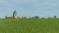
From Saint-Chéron to Saint-Rémy-lès-Chevreuse, from the Orge to the Yvette
 16.45 mi
+814 ft
-784 ft
8h 15
Very difficult
Departure from Saint-Chéron (Essonne) (Essonne)
16.45 mi
+814 ft
-784 ft
8h 15
Very difficult
Departure from Saint-Chéron (Essonne) (Essonne)
Thirty-second and penultimate stage of the Grand Tour of Île-de-France via the GR®11. It starts in Saint-Chéron in the Orge Valley and ends in Saint-Rémy-lès-Chevreuse in the Yvette Valley, thus completing the crossing of the Essonne via its main valleys. After starting off towards the west, the route heads due north across the Hurepoix plateaus.
From Saint-Rémy-lès-Chevreuse to Coignières in the Upper Chevreuse Valley
 14.57 mi
+1,112 ft
-846 ft
7h 40
Difficult
Departure from Saint-Rémy-lès-Chevreuse (Yvelines)
14.57 mi
+1,112 ft
-846 ft
7h 40
Difficult
Departure from Saint-Rémy-lès-Chevreuse (Yvelines)
Thirty-third and penultimate stage of the Grand Tour of Île-de-France via the GR®11, almost entirely in the Yvelines department.It starts in Saint-Rémy-lès-Chevreuse and reaches Coignières after climbing up the Yvette valley and crossing the Haute Vallée de Chevreuse Regional Nature Park with its rich natural and architectural heritage, just a stone's throw from Paris and its inner suburbs.
From Coignières to Villiers-Saint-Frédéric through the Yvelines
 11.61 mi
+466 ft
-751 ft
5h 45
Moderate
Departure from Coignières (Yvelines)
11.61 mi
+466 ft
-751 ft
5h 45
Moderate
Departure from Coignières (Yvelines)
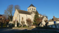
This is the thirty-fourth and final stage of the Grand Tour of Île-de-France via the GR®11. It starts in Coignières and ends in Villiers-Saint-Frédéric, where the radial section of the GR® coming from Paris meets the circular section, which will therefore be completed here. The route follows, more or less closely, the course of the Mauldre River, passing through Bazoches-sur-Guyonne, Mareil-le-Guyon and Neauphle-le-Vieux.