Refine your search for walks in Plounévez-Moëdec
Plounévez-Moëdec walks


 Tour of the paper mill valley in Plounévez-Moëdec
 Visorando Member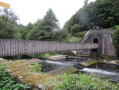
 4.33 mi
 +466 ft
 -456 ft
 2h 25
2h 25
 Easy
Easy
 Departure from Plounévez-Moëdec (Côtes-d'Armor)
The tour of the paper mill valley is a short hike through the forest that runs alongside the Léguer river and passes by the ruins of an old factory and a dam.
In the forest of Coat an Noz
 9.21 mi
+745 ft
-738 ft
4h 55
9.21 mi
+745 ft
-738 ft
4h 55
 Moderate
Departure from Belle-Isle-en-Terre (Côtes-d'Armor)
Moderate
Departure from Belle-Isle-en-Terre (Côtes-d'Armor)
To the south of Belle-Île-en-Terre, a forest hides many secrets. It comprises two parts separated by the Léguer river: to the east, the Coat an Hay State Forest (Le Bois du Jour) and to the west, the Coat an Noz State Forest (Le Bois de la Nuit). In the latter, with a 19th-century castle undergoing restoration and a former ironworks site (lead mine), the route follows wide paths that are sometimes poorly lit by daylight.
La Forêt de Coat an Noz à partir de Loc-Envel
 7.25 mi
+732 ft
-732 ft
4h 00
Moderate
Departure from Loc-Envel (Côtes-d'Armor)
7.25 mi
+732 ft
-732 ft
4h 00
Moderate
Departure from Loc-Envel (Côtes-d'Armor)
The Breton heritage is rich in monuments and landscapes. This walk in the forest, which, when linked to another circuit, allows you to discover part of this rich heritage, includes old ironworks, manor houses, a castle and chapels.
From Vieux-Marché to Sept-Saints
 9.29 mi
+656 ft
-653 ft
4h 50
Moderate
Departure from Le Vieux-Marché (Côtes-d'Armor)
9.29 mi
+656 ft
-653 ft
4h 50
Moderate
Departure from Le Vieux-Marché (Côtes-d'Armor)
This walk, suitable for walkers of all ages, takes you through wooded, shaded areas along sunken paths as well as fields and meadows. It features three remarkable sites: the centuries-old beech tree, the Chapel of the Seven Saints and the Saint-Éturien stream, where the lucky ones may find amethyst crystals.
To the west of Vieux-Marché
 8.30 mi
+846 ft
-837 ft
4h 35
Moderate
Departure from Le Vieux-Marché (Côtes-d'Armor)
8.30 mi
+846 ft
-837 ft
4h 35
Moderate
Departure from Le Vieux-Marché (Côtes-d'Armor)
The Trégor region boasts a rich religious heritage. This walk allows you to discover several examples, which, whilst not exceptional, are classic in their beauty and aesthetic appeal.
This walk also allows you to enjoy the lush countryside and the Breton bocage.
Moments of tranquillity and exertion are always welcome in this mild climate.
From Plouaret to Lannion along the Léguer
 16.39 mi
+994 ft
-1,375 ft
8h 25
16.39 mi
+994 ft
-1,375 ft
8h 25
 Difficult
Departure from Plouaret (Côtes-d'Armor)
Difficult
Departure from Plouaret (Côtes-d'Armor)
The aim is to follow the course of the Saint-Éturien stream and then the Léguer river from Plouaret-Trégor station to Lannion station. Plan to return by train.
Walk in the Beffrou Forest
6.52 mi
+692 ft
-702 ft
3h 35
Moderate
Departure from Loguivy-Plougras (Côtes-d'Armor)
The Beffrou Departmental Forest is a beautiful 611-hectare area! During this hike, which includes a few challenging climbs, you will only see tarmac when crossing roads. A pond, a covered walkway, a high point offering a view of the Monts d'Arrée and a chance to discover the local flora and fauna: here, everything grows in peace and tranquillity.
The Pergat Menhirs and the Koad Bré Wood
4.89 mi
+240 ft
-233 ft
2h 25
Easy
Departure from Louargat (Côtes-d'Armor)
This short, easy walk takes you through the Louargat countryside to discover the two menhirs of Pergat, one of which is among the largest in Europe. You’ll follow the Ruisseau du Frout through its valley, which can be quite damp in places, before reaching the hamlet of Manaty. From there, you’ll head into the Koad Bré Forest at the foot of Ménez Bré before reaching Louargat via some lovely forest paths.
From Saint-Éloi to the Pergat Menhir, returning along the banks of the Guindy
 7.15 mi
+200 ft
-200 ft
3h 30
Moderate
Departure from Louargat (Côtes-d'Armor)
7.15 mi
+200 ft
-200 ft
3h 30
Moderate
Departure from Louargat (Côtes-d'Armor)
There is virtually no elevation gain on this route, which follows small forest paths alongside a river and stream, allowing you to enjoy the sound of the water and the birdsong.
There is no answer to the mystery of the menhirs when faced with this colossus weighing several tonnes, which has stood in this small clearing for over 5,000 years.
Les Sept-Saints and the Léguer Valley
 7.62 mi
+643 ft
-656 ft
4h 05
Moderate
Departure from Le Vieux-Marché (Côtes-d'Armor)
7.62 mi
+643 ft
-656 ft
4h 05
Moderate
Departure from Le Vieux-Marché (Côtes-d'Armor)
Forest paths and sunken lanes lead walkers along the "Sentier des Améthystes" (Amethyst Trail) alongside the Léguer and then the Saint-Éturien stream, before arriving at a centuries-old beech tree.
The walk starts and ends at the Chapelle des Sept-Saints: a place of great significance for the friendship between Islam and Christianity.
Circular route around Plougonver
6.37 mi
+358 ft
-358 ft
3h 15
Moderate
Departure from Plougonver (Côtes-d'Armor)
This easy, short walk takes you through the countryside around the village of Plougonver. You will follow pretty forest and farm tracks, passing through typical hamlets. You will discover magnificent landscapes, particularly after Kermaçonnet as you head towards Ménez Kerespers. In the village, you can also visit the Museum of Old Trades (free admission) next to the entrance to the famous Menou biscuit factory.
The Léguer on the outskirts of Le Danot
 7.12 mi
+682 ft
-699 ft
3h 50
Moderate
Departure from Pluzunet (Côtes-d'Armor)
7.12 mi
+682 ft
-699 ft
3h 50
Moderate
Departure from Pluzunet (Côtes-d'Armor)
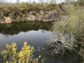
A walk through the Trégor forest, where you’ll follow the Léguer coastal river, as well as passing chapels and cave dwellings.
Option to take a shortcut, reducing the distance to 8 km; classified as ‘Easy’.
The Trégor countryside in Pluzunet
 7.40 mi
+197 ft
-200 ft
3h 35
Moderate
Departure from Pluzunet (Côtes-d'Armor)
7.40 mi
+197 ft
-200 ft
3h 35
Moderate
Departure from Pluzunet (Côtes-d'Armor)
The Trégor countryside, always rich in peaceful scenery, is at its best during this walk, which presents no difficulty.
Around Guerlesquin
 10.74 mi
+781 ft
-774 ft
5h 35
Moderate
Departure from Guerlesquin (Finistère)
10.74 mi
+781 ft
-774 ft
5h 35
Moderate
Departure from Guerlesquin (Finistère)
Guerlesquin, a small town full of character, was known in the 11th century for its fairs. From the 17th century, beautiful buildings remain in the town centre: the Présidial, the Market Halls and the Church. The town is close to the Étang du Guic, where two fine sandy beaches await walkers.After walking around the lake, we explore the nearby forest, moving in turn from Finistère into Côtes-d’Armor before returning to Finistère. Indeed, it is the river ‘Le Guic’ that forms the departmental boundary.
Tonquédec Forest
3.10 mi
+213 ft
-180 ft
1h 35
Moderate
Departure from Tonquédec (Côtes-d'Armor)
A refreshing walk through the woods and along the Léguer.
From Tonquédec to the castle ruins via the Léguer
7.26 mi
+371 ft
-381 ft
3h 40
Moderate
Departure from Tonquédec (Côtes-d'Armor)
There is virtually no elevation gain on this walk in the Trégor forest. Just magnificent scenery, starting with paths through chestnut trees, then a walk along the banks of the Léguer, ending with a visit to the imposing ruins of Tonquédec Castle. At the end of the walk, don't forget to visit the village church.
To the east of Tonquédec
 7.15 mi
+236 ft
-236 ft
3h 30
Moderate
Departure from Tonquédec (Côtes-d'Armor)
7.15 mi
+236 ft
-236 ft
3h 30
Moderate
Departure from Tonquédec (Côtes-d'Armor)
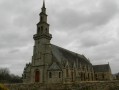
We are not inviting you to hike towards Tonquédec Castle, which was dismantled around 1626 on the orders of Richelieu and is situated to the north-west of the village of the same name, but rather to the south-east of this village. There we will find the Guindy, a river dear to the people of Trégor, as well as green sunken paths in lush countryside.
Castles and chapels in the Trégor
7.14 mi
+587 ft
-617 ft
3h 50
Moderate
Departure from Tonquédec (Côtes-d'Armor)
The chapels of Kerrivoalan and Saint-Gildas on the one hand; but also Kergrist Castle (a private residence open to visitors only in summer) and, of course, the ruins of Tonquédec Castle and its oratory on the other; and finally the mills at Traoumorvan, Kergrist and Kergrot bear witness, throughout this route, to a Brittany that was once warlike, devout and agricultural, but has now become a tourist destination.
Tro Ménez Bré
 6.46 mi
+574 ft
-600 ft
3h 30
Moderate
Departure from Pédernec (Côtes-d'Armor)
6.46 mi
+574 ft
-600 ft
3h 30
Moderate
Departure from Pédernec (Côtes-d'Armor)
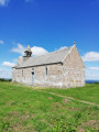
This walk offers nothing less than the chance to climb the highest point in the Côtes d’Armor and enjoy a completely unobstructed 360° view. On a clear day, it’s even said that you can see the sea!
Tonquédec Castle and Kerfons Chapel
 4.90 mi
+643 ft
-633 ft
2h 50
Easy
Departure from Tonquédec (Côtes-d'Armor)
4.90 mi
+643 ft
-633 ft
2h 50
Easy
Departure from Tonquédec (Côtes-d'Armor)
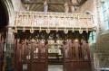
Two historic sites along this walk: Tonquédec Castle with its walls and restoration work, and the magnificent little Chapel of Kerfons. All this is complemented by a relaxing stroll along the Léguer.
Along the Donant
 7.67 mi
+361 ft
-361 ft
3h 50
Moderate
Departure from Bégard (Côtes-d'Armor)
7.67 mi
+361 ft
-361 ft
3h 50
Moderate
Departure from Bégard (Côtes-d'Armor)
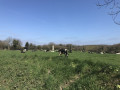
The Donant and the Kerogan Stream flow into the Jaudy, one of the many coastal rivers of the Trégor.
This route allows you to discover peaceful, leafy landscapes as you walk along both sunken paths and tarmac roads where, at times, you can forget about civilisation.
If you’d rather not go hiking, you can spend the day at the amusement park, which serves as the starting point.
Rosanbo Castle
7.46 mi
+449 ft
-423 ft
3h 50
Moderate
Departure from Tréduder (Côtes-d'Armor)
Winding through the Trégor countryside, this route will take you past the most imposing castle in Brittany. Built between the 14th and 18th centuries, it has belonged to the same family for several generations. It is furnished with period pieces and open to the public.
Tréduder and its streams
 6.15 mi
+673 ft
-643 ft
3h 25
Moderate
Departure from Tréduder (Côtes-d'Armor)
6.15 mi
+673 ft
-643 ft
3h 25
Moderate
Departure from Tréduder (Côtes-d'Armor)
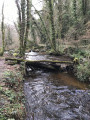
The commune of Tréduder is bounded by three streams: to the west, the Roscoat; to the south, the Dour Plat, which flows into the Yar, marking the commune’s eastern boundary. This walk takes you along these streams, but numerous small streams feed into them, making certain sections very wet in spring.
Reach the heights of Saint-Michel-en-Grève to admire the bay.
6.89 mi
+751 ft
-755 ft
3h 50
Moderate
Departure from Saint-Michel-en-Grève (Côtes-d'Armor)
The Bay of Saint-Michel-en-Grève is one of the most beautiful in Trégor, despite the major cleaning problems caused by the presence of green algae. At low tide, the sea recedes so far that it is barely visible. At high tide, the waves break on the coastal road.
The Grand Rocher and the Pointe de l'Armorique
 8.90 mi
+823 ft
-810 ft
4h 50
Moderate
Departure from Plestin-les-Grèves (Côtes-d'Armor)
8.90 mi
+823 ft
-810 ft
4h 50
Moderate
Departure from Plestin-les-Grèves (Côtes-d'Armor)
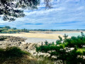
Discovering Grève Saint-Michel: a bay where the sea recedes more than 2 km; first by climbing the Grand Rocher for a breathtaking panorama, then, up close, by walking along the beach, and finally, by admiring it from across the bay on the famousGR®®34. You’ll continue to admire Lannion Bay as you round the Pointe de l’Armorique and, in particular, the Pointe de Plestin, before following the Douron estuary, admiring the chapel and fountain, and returning to Saint-Efflam.
From Poulloguer Pond to Coatascorn
 6.98 mi
+469 ft
-479 ft
3h 35
Moderate
Departure from Prat (Côtes-d'Armor)
6.98 mi
+469 ft
-479 ft
3h 35
Moderate
Departure from Prat (Côtes-d'Armor)
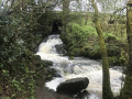
Although this walk uses a few tarmac roads, priority has been given here to forest paths and tracks open to farm machinery. In return, it offers magnificent scenery both around Poulloguer Pond and along the stream of the same name, with a very pleasant walk through the village of Coatascorn, a quintessential Trégor village with all its stone houses.
Circular route in Plestin-les-Grèves from Saint-Efflam to Sainte-Barbe and the Grand Rocher.
8.21 mi
+830 ft
-814 ft
4h 30
Moderate
Departure from Plestin-les-Grèves (Côtes-d'Armor)
This beautiful circular walk is divided into two parts.
The first part follows the customs officers' path and runs along the seafront, passing numerous viewpoints, headlands and beaches until it reaches the banks of the Douron estuary.
The second part winds through the countryside of valleys and hamlets, revealing pretty manor houses before reaching its climax at the seaside, at an altitude of 84 metres, at the top of the Grand Rocher, which offers an exceptional view of almost the entire bay of Lannion and the Plestinaise countryside.
Circular route from Saint-Michel-en-Grève to Locquémeau
7.80 mi
+574 ft
-564 ft
4h 05
Moderate
Departure from Trédrez-Locquémeau (Côtes-d'Armor)
This circular route starting from Toul ar Villin will take you to the Port of Locquémeau and Pointe de Séhar via rural paths in the bocage countryside around Trédrez-Locquémeau. Take the time to stroll around the harbour and walk around Pointe de Séhar. If the tide allows, venture onto the sharp rocks and climb up to the place known as "Le Château". The return journey is via the GR® 34 coastal path, passing through Beg an Evned, the cliffs of Trédrez and Beg ar Forn.
There are no particular difficulties on this excursion between land and sea, except for the hilly terrain of the coastline.
Pointe de l’Armorique from Saint-Efflam
5.25 mi
+344 ft
-341 ft
2h 45
Easy
Departure from Plestin-les-Grèves (Côtes-d'Armor)
A circular walk starting from Saint-Efflam, initially through the countryside, dotted with fountains and a few pretty houses, before reaching the Douron estuary and continuing along the coastal path beside the Douron cove, then along the Pointe de l’Armorique cliff-top path, between the headlands of Plestin and Beg Douar. You’ll pass by the ancient Roman baths at Hogolo and have the option of heading down to some small beaches.
The Grand Rocher of Saint-Efflam
3.69 mi
+469 ft
-476 ft
2h 05
Moderate
Departure from Plestin-les-Grèves (Côtes-d'Armor)
The Grand Rocher towers 84 m above the Lieue de Grève and offers stunning views in all directions. You’ll climb to the top during this walk, which also takes you along the beach and through the countryside, past beautiful country houses and the Saint-Efflam Fountain.
Countryside and coastal path around Trédrez
 3.21 mi
+351 ft
-351 ft
1h 45
Moderate
Departure from Trédrez-Locquémeau (Côtes-d'Armor)
3.21 mi
+351 ft
-351 ft
1h 45
Moderate
Departure from Trédrez-Locquémeau (Côtes-d'Armor)
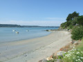
From the small village of Trédrez, where the memory of Saint-Yves still lingers, shaded paths lead to the GR®34 near Saint-Michel-en-Grève. The route then follows a section of the Trédrez Cliffs route before, after a fairly steep climb, joining a small country road and arriving opposite the imposing Church of Notre-Dame-de-Trédrez.