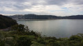
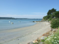
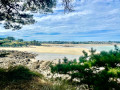
Reach the heights of Saint-Michel-en-Grève to admire the bay.

The Bay of Saint-Michel-en-Grève is one of the most beautiful in Trégor, despite the major cleaning problems caused by the presence of green algae. At low tide, the sea recedes so far that it is barely visible. At high tide, the waves break on the coastal road.

Details

523798
Creation:
Last update:
Last review:
  • Walking
    Activity: Walking
  • ↔
    Distance: 6.89 mi
  • ◔
    Average duration: 3h 50 
  • ▲
    Difficulty: Moderate

  • ⚐
    Back to start: Yes
  • ↗
    Ascent: + 751 ft
  • ↘
    Descent: - 755 ft

  • ▲
    Highest point: 361 ft
  • ▼
    Lowest point: 33 ft

Description of the walk

Parking below the Town Hall and follow the signs.

(S/E) Leave the car park via the access road and cross Rue de la Côte des Bruyères using the pedestrian crossing.
Head downhill to the right towards the bay, staying on the left-hand pavement.

Red and whiteGR®34markings

(1) Turn left and immediately follow the path that climbs to the left.
As you approach the houses, cross Route de Bellevue and continue along the path that climbs uphill. At the end, it becomes a carriage road. Continue to the crossroads.

(2) Take the road on the right for 50 metres, then take the path on the left.
At the end of the path, the passage is often difficult due to mud and water. Continue left on the road, then follow the path on the right a few dozen metres further on. This ends at a road, which you should follow to the left.

TheGR®34turns right, theGR®34Bstarts on the left

(3). Continue left until you reach Route de Plouzelambre. Turn left and, at the fork with a calvary, continue right.
Continue along the path that extends from the road. Initially heading north-east, it turns north-north-west as it approaches the Kerdu stream, then returns to north-north-east, ending at a wide path.

(4) Turn right. After 100 metres, follow the road to the left. Cross the D30 and continue north to Toull ar C'harenn.

(5) Follow the path to the left and, at the end, continue to the left (theGR® continues straight ahead then turns left. This passage is only a shortcut without leaving theGR®).
After 50 metres, take the path on the right, heading north-west then north, until you reach the crossroads.

No markings

(6) Turn left onto the road. TheGR®34Bcontinues straight ahead
In the left-hand bend, take the path on the right. Continue right on Route de Kervocu, which leads to Route de Morlaix at the hamlet of Landebouc'h.
Follow Route de Morlaix on the right for 80 metres, then, after crossing, take the road on the left towards Kervourdon.

(7) At the crossroads, continue slightly to the left towards Kernévez. Descend to the bottom of the valley, then climb back up towards the restaurant. Cross the road and continue opposite.
When you reach Kerbiriou, take the road on the right. At the calvary, continue on the left for 250 m and take the path on the left that descends towards the sea.

Red and white markings forthe GR®34

(8) Follow the coastal path on the left. It continues along Rue de Toul ar Vilin. Continue on the right along Rue de Kervoal, then turn right again into Rue de la Voie Romaine.

No markings

(9) Turn left onto Rue de l'École. In front of the school entrance, turn right to cross the small bridges and reach the car park (S/E).


Waypoints

  1. S/E : mi 0 - alt. 49 ft - Town hall car park
  2. 1 : mi 0.14 - alt. 39 ft - Turn left, then take the path on the left.
  3. 2 : mi 1.06 - alt. 256 ft - Road on the right
  4. 3 : mi 1.82 - alt. 308 ft - Leave the GR34 and follow the GR34B.
  5. 4 : mi 2.68 - alt. 243 ft - Path on the right
  6. 5 : mi 3.19 - alt. 341 ft - Shortcut from the GR on the left
  7. 6 : mi 3.78 - alt. 354 ft - Road on the left
  8. 7 : mi 4.62 - alt. 226 ft - 5-way intersection
  9. 8 : mi 5.95 - alt. 72 ft - Coastal path: Customs officers' path
  10. 9 : mi 6.78 - alt. 33 ft - Street on the left towards the school
  11. S/E : mi 6.89 - alt. 49 ft - Town hall car park

Always be cautious and plan ahead when you're outdoors. Visorando and the author of this route cannot be held responsible for any accidents occurring on this route.

The GR® and PR® markings are the intellectual property of the Fédération Française de Randonnée Pédestre.

Reviews and comments

4.5 / 5
Based on 9 reviews

Reliability of the description
4.6 / 5
Ease of following the route
4.6 / 5
Route interest
4.4 / 5
Planeu
Planeu

Overall rating : 2.7 / 5

Date of your route : Jul 08, 2024
Reliability of the description : ★★★☆☆ Average
Ease of following the route : ★★★☆☆ Average
Route interest : ★★☆☆☆ Disappointing
Very busy route : No

Too much flat terrain, poorly maintained coastal path, only point of interest is St Michel Bay.

Machine-translated

Nana la motarde
Nana la motarde

Overall rating : 4.7 / 5

Date of your route : Sep 21, 2023
Reliability of the description : ★★★★★ Very good
Ease of following the route : ★★★★☆ Good
Route interest : ★★★★★ Very good
Very busy route : No

A pleasant hike that allowed us to climb to higher ground and admire the bay of Saint Michel en Grève.

Machine-translated

Géraud de BOISSET
Géraud de BOISSET

Overall rating : 4.7 / 5

Date of your route : Jul 21, 2023
Reliability of the description : ★★★★★ Very good
Ease of following the route : ★★★★★ Very good
Route interest : ★★★★☆ Good
Very busy route : No

A walk taken on a beautiful summer morning.
A very pretty route with beautiful views of the bay at the start and end of the walk. No topographical difficulties. After point 2, the short detour to the Sainte Geneviève chapel (about 200 metres north of the path) is well worth the effort: a beautiful granite calvary and a charming chapel. And at the end of the route, a visit to the church of Saint Michel (with its beautiful Breton altarpiece) and its adjoining marine cemetery is, in my opinion, a must.

Machine-translated

NADDIE
NADDIE

Overall rating : 5 / 5

Date of your route : Jul 28, 2021
Reliability of the description : ★★★★★ Very good
Ease of following the route : ★★★★★ Very good
Route interest : ★★★★★ Very good
Very busy route : No

A very beautiful short walk. A steep climb to a breathtaking viewpoint in the middle of the immense bay of Saint-Michel en Grève!

Machine-translated

elway22
elway22
• Edited:

Overall rating : 4 / 5

Date of your route : Jul 18, 2020
Reliability of the description : ★★★☆☆ Average
Ease of following the route : ★★★★☆ Good
Route interest : ★★★★★ Very good
Very busy route : No

A beautiful hike away from the crowds.
A few points to add to the description:
- the end of (2) (3) is across fields with at least four animal barriers to open and close.
- After crossing the stream at the end of (3)(4), the deep muddy path between the two embankments is replaced by a trail on the left.
- If some of your companions are less fit than you, have them cut across at (7).
- When you see the finish line banner, if the tide is low, you might as well walk on the beach and go down the stairs.

The bar next to the beach hotel is a well-deserved reward.

Machine-translated

capali
capali

Overall rating : 5 / 5

Date of your route : Sep 17, 2019
Reliability of the description : ★★★★★ Very good
Ease of following the route : ★★★★★ Very good
Route interest : ★★★★★ Very good

It's a magnificent route. You arrive at St Michel en Grève bay, and if the tide is low, you can see the cross in the middle of the bay, still partially submerged if the tidal range is small, and completely visible if the tidal range is large!
Then you park in the car park and walk up a very pretty, well-maintained path to the top of the "big rock".
From there, you can enjoy a 360-degree view of St Michel Bay. When you turn around, you can see a farm, a manor house and often
horses in the meadows! I do this route two or three times a year, because the light is never the same!
A very, very pleasant route.
Best regards
Edith Bernard (Capali)

Machine-translated

annaig67
annaig67

Overall rating : 5 / 5

Date of your route : Sep 12, 2019
Reliability of the description : ★★★★★ Very good
Ease of following the route : ★★★★★ Very good
Route interest : ★★★★★ Very good

A very beautiful hike!

Machine-translated

mariedaniel
mariedaniel

Overall rating : 4.7 / 5

Date of your route : Jul 27, 2018
Reliability of the description : ★★★★★ Very good
Ease of following the route : ★★★★★ Very good
Route interest : ★★★★☆ Good

-Pleasant hike in good weather. Some sections (sunken paths) can be very muddy after heavy rain.

Machine-translated

capali
capali

Overall rating : 5 / 5

Date of your route : Apr 09, 2018
Reliability of the description : ★★★★★ Very good
Ease of following the route : ★★★★★ Very good
Route interest : ★★★★★ Very good

This route around Lanvellec and Rosambo Castle is magnificent. At this time of year, the paths are covered in flowers
time of year and it is very pleasant to walk there. And of course, the castle is very, very beautiful. You can also
visit it, which is very interesting.
Best regards
Édith Bernard

Machine-translated

Other walks in the area

For more walks, use our search engine .

The GPS track and description are the property of this route's author. Please do not copy them without permission.