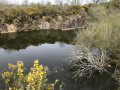
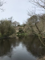
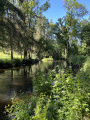
The Léguer on the outskirts of Le Danot

A walk through the Trégor forest, where you’ll follow the Léguer coastal river, as well as passing chapels and cave dwellings.
Option to take a shortcut, reducing the distance to 8 km; classified as ‘Easy’.

Details

592018
Creation:
Last update:
Last review:
  • Walking
    Activity: Walking
  • ↔
    Distance: 7.12 mi
  • ◔
    Average duration: 3h 50 
  • ▲
    Difficulty: Moderate

  • ⚐
    Back to start: Yes
  • ↗
    Ascent: + 682 ft
  • ↘
    Descent: - 699 ft

  • ▲
    Highest point: 335 ft
  • ▼
    Lowest point: 82 ft

Photos

Description of the walk

Car park at the Danot road junction, where there is a small picnic area.

(S/E) Leave the “Danot junction” heading north-east and join the D30 local road, which you should follow to the left.
To avoid a stretch of tarmac, take the track on the left towards Convenant Sidaner, then turn right to rejoin the D30.
After 20 metres, take the track on the left which, after a bend to the right, becomes a footpath heading north.

(1) Cross the D30 and continue straight ahead along a path that isn’t shown on maps.
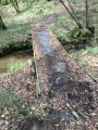
Cross a stream and head uphill to reach a country road.

(2) Turn left, then carry on straight ahead at the junction.
When the track turns sharply left, carry on straight ahead along a path heading north,
Continue along this path until you reach Kerrivoalan.

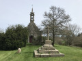
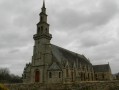
(3) Carry on straight ahead, towards the chapel. It will be on your left.
Pass a waterhole on your right – the remains of an old quarry – and head downhill to reach a wider path, which you should follow to the left.
As it descends, the path makes a 180° bend and then runs alongside the Léguer.
Continue along the river and, after going round a building on your right, cross it via the two footbridges provided.

Red and white markings forthe GR®34A

(4) Turn left and then immediately right to go round the oppidum and reach Saint-Fiacre. Continue southwards.

(5) Take the path on the left (often damp due to a stream).
At the next hamlet (Komanat an Hern), turn left. The path follows, more or less closely, the D30 as it curves widely.
When you reach a building called ‘Le Losser’ (the name is still visible on the façade), the path joins the D30. Cross the bridge over the Léguer and then take the path on the left.
After about a hundred metres, the path joins the D30, which takes a left-hand bend

(6) Cross the D30 and follow the path to the right, which makes two 90° bends to the right.

No signposting

(7) Take a small path on the right leading downhill. Join the Léguer and follow it against the current.
Note: at this point, if you turn round, you can see, through the foliage, a huge rock standing vertically: this is a cave dwelling that is occupied all year round.
Continue along this path, which leads to a road.

(8) Turn left. Pass the lodge on your left, then, at the right-hand bend, take the path (not shown on maps) to the left. Heading north-east at first, it veers off, then turns north; after crossing a stream, it heads north-west and joins a track heading west.
Continue westwards.

Red and white markings forthe GR®34A

(9) Turn right, heading north, and carry on until you reach a three-way junction.

No markings

(10) Take the path on the right (the one on the left leads back to (7)).
The path becomes a track and then a road as it passes through the hamlet of Danot. Continue eastwards to return to the starting point (S/E).


Waypoints

  1. S/E : mi 0 - alt. 328 ft - Danot road junction
  2. 1 : mi 0.5 - alt. 285 ft - Crossing the D30
  3. 2 : mi 0.83 - alt. 266 ft - Kerdouca – road on the left
  4. 3 : mi 1.44 - alt. 236 ft - Kerrivoalan – straight on towards the chapel
  5. 4 : mi 2.18 - alt. 98 ft - GR34A – Left, then right - Léguer (le)
  6. 5 : mi 2.61 - alt. 243 ft - To the left – damp path
  7. 6 : mi 3.73 - alt. 197 ft - Cross the D30, then turn right
  8. 7 : mi 4.27 - alt. 157 ft - Path on the right – Alternative route = straight ahead
  9. 8 : mi 5.28 - alt. 125 ft - Turn left onto the road
  10. 9 : mi 6.27 - alt. 220 ft - Path on the right
  11. 10 : mi 6.61 - alt. 171 ft - Three-way junction: path on the right
  12. S/E : mi 7.12 - alt. 328 ft - Danot road junction

Notes

Although some paths do not appear on the 1:25,000 maps, the route shown has been mapped using a GPS. It therefore guarantees a trouble-free journey.

Between (4) and (7), the route follows theGR®34Amarkings (red and white), as it does at (9) and (10), but in the opposite direction.

(6) Alternative route: by continuing straight on, i.e. following theGR®34A, you reach (10), 50 metres away. From there, turning left, you can reach Danot and then the starting point. This shortens the route by more than three kilometres.

Worth a visit

CAUTION: On several occasions, the route runs alongside the D30 local road. Drivers tend to drive quite fast at times as they are unaware that this is a walking route

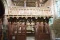
Notre-Dame de Kerivoalan Chapel

Kerchrist Castle.

The Chapel of the Seven Saints.

Always be cautious and plan ahead when you're outdoors. Visorando and the author of this route cannot be held responsible for any accidents occurring on this route.

The GR® and PR® markings are the intellectual property of the Fédération Française de Randonnée Pédestre.

Reviews and comments

4.3 / 5
Based on 3 reviews

Reliability of the description
4.3 / 5
Ease of following the route
4.3 / 5
Route interest
4.3 / 5
phil2129
phil2129

Overall rating : 4 / 5

Date of your route : Mar 27, 2026
Reliability of the description : ★★★★☆ Good
Ease of following the route : ★★★★☆ Good
Route interest : ★★★★☆ Good
Very busy route : No

Hello,

I did this very pleasant route with my walking group, but at point 7 there are large signs telling us that it is private property and to follow the signposts, which is what we did.
Unfortunately for us, we didn’t see the cave house, walked along the Léguer and also cut our hike short.

Thanks for the route anyway

Phil2129

Machine-translated

Olive22140
Olive22140

Overall rating : 4 / 5

Date of your route : Apr 10, 2022
Reliability of the description : ★★★★☆ Good
Ease of following the route : ★★★★☆ Good
Route interest : ★★★★☆ Good
Very busy route : No

A lovely walk along the banks of the Léguer, through the forest – very peaceful – with a small church and a cave dwelling we’d never seen before. We were familiar with some sections of this route as they overlap with other walks. Starting from the picnic area might be a good option for a family wanting to eat beforehand – but be aware there’s only one table. only one section was muddy despite the rain over the previous few days; you’re practically walking in the stream. It’s easy to follow the route, though two or three paths have disappeared under the vegetation – but there’s usually another path not far away. All in all, a lovely walk – I’ve included a few photos.

Machine-translated

capali
capali

Overall rating : 5 / 5

Date of your route : Jun 05, 2017
Reliability of the description : ★★★★★ Very good
Ease of following the route : ★★★★★ Very good
Route interest : ★★★★★ Very good

I absolutely loved this valley floor, and in spring it’s even more beautiful because along the paths at the bottom of the valley
there are white bell-shaped flowers… and purple ones… then low-growing yellow flowers… and so on… absolutely, absolutely brilliant… Edith

Machine-translated

Other walks in the area

For more walks, use our search engine .

The GPS track and description are the property of this route's author. Please do not copy them without permission.