


Refine your search for walks in Wincrange
Wincrange walks


 Around the Asselborn Mill
 Visorando Member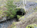
 12.51 mi
 +1,076 ft
 -1,089 ft
 6h 40
6h 40
 Difficult
 Departure from Wincrange (Luxembourg (Country))
A truly beautiful walk that’s hard to capture in just a few photos! It forms a figure-of-eight, with a long circular loop to the east of Asselborn followed by a slightly shorter circular loop to the west of Asselborn.
Around the Bernistap Canal
 11.96 mi
+860 ft
-886 ft
6h 15
11.96 mi
+860 ft
-886 ft
6h 15
 Average
Departure from Houffalize (Province de Luxembourg)
Average
Departure from Houffalize (Province de Luxembourg)
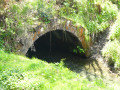
The Bernistap Canal is a section of the canal that the Dutch had planned to build to link the Rhine to the Meuse via the Moselle and the Ourthe. Begun in 1827 during the reign of WilliamI, King of the Netherlands, work was suspended in 1830 during the Belgian revolution and finally abandoned when the Grand Duchy of Luxembourg gained independence. This canal has an underground section, the entrance to which on the Belgian side is still visible at km 1, if you are feeling adventurous. A few information panels are located along the canal between km 1 and km 2, as well as on the Luxembourg side (except for the section leading to the village of Hoffelt).
Clervaux and the Irbich Valley
 6.25 mi
+1,060 ft
-1,050 ft
3h 50
Average
Departure from Clervaux (Luxembourg (Country))
6.25 mi
+1,060 ft
-1,050 ft
3h 50
Average
Departure from Clervaux (Luxembourg (Country))
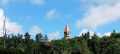
A climb from Clervaux to a superb view of the abbey bell tower and the valley, then a route mainly through forest, finally returning along the Irbich river on country roads or dirt tracks.
You can shorten the walk by continuing from (6) to Drauffelt station (6 km in total) and returning by train (free on the GDL).
From station to station: from Drauffelt to Wiltz
12.51 mi
+1,617 ft
-1,594 ft
7h 10
Difficult
Departure from Munshausen (Luxembourg (Country))
Signposted by the CFL in both directions as part of the ‘Hike & Rail’ scheme, this walk starts from Drauffelt. It offers a wonderful variety of panoramic views of this part of the Luxembourg Ardennes, as well as sections through woodland and villages, including Enscherange, Knaphoscheid, Eschweiler, Erpeldange and Weidingen.
The Luxembourg Ardennes between Troisvierges and Drauffelt
 11.92 mi
+1,460 ft
-1,804 ft
6h 45
Average
Departure from Troisvierges (Luxembourg (Country))
11.92 mi
+1,460 ft
-1,804 ft
6h 45
Average
Departure from Troisvierges (Luxembourg (Country))
Set off to explore the north of the Grand Duchy of Luxembourg and, in particular, Clervaux Abbey.
Please note: this hike is not circular and is based on the concept of walks from station to station. We chose to leave our vehicle at the free P+R car park at Drauffelt station, from where the train takes hikers to Troisvierges free of charge (1 train per hour on track 1).
Passeurs Trail
 7.31 mi
+719 ft
-738 ft
4h 00
Average
Departure from Troisvierges (Luxembourg (Country))
7.31 mi
+719 ft
-738 ft
4h 00
Average
Departure from Troisvierges (Luxembourg (Country))
Follow in the footsteps of fugitives and resistance fighters who used the forest paths, trails and little-used country roads along this route. A few information panels and, above all, the Kléngelbaach stream, a key point of passage between the two countries, await you along the way.
Discovering Cinqfontaines
 8.52 mi
+1,296 ft
-1,319 ft
5h 05
Average
Departure from Troisvierges (Luxembourg (Country))
8.52 mi
+1,296 ft
-1,319 ft
5h 05
Average
Departure from Troisvierges (Luxembourg (Country))
From Troisvierges station, set off to explore the Cinqfontaines convent, an iconic site of the Second World War in Luxembourg. Continue this pleasant circular route towards Maulesmillen, taking in the panoramic views of the Luxembourg countryside.
Via Limerlé from Steinbach
 4.53 mi
+394 ft
-420 ft
2h 25
4.53 mi
+394 ft
-420 ft
2h 25
 Easy
Departure from Gouvy (Province de Luxembourg)
Easy
Departure from Gouvy (Province de Luxembourg)
The route passes through the Ourthe Orientale nature reserve. Here, in particular, you can admire the typical flora and fauna.Steinbach is a charming Ardennes village with an agricultural heritage, featuring numerous farms and small farmhouses built of schist stone and roofed with slate (cherbins = local slate). Its historical past is evident in the presence of castle-like farms and enclosed farmsteads dating back to the 17th and 18th centuries, which have been carefully restored.
 Circular route to Luxembourg from Hardigny
 Association / Club / Walk leader35.79 mi
+1,959 ft
-1,962 ft
5 hrs
Average
Departure from Bastogne (Province de Luxembourg)
Association / Club / Walk leader35.79 mi
+1,959 ft
-1,962 ft
5 hrs
Average
Departure from Bastogne (Province de Luxembourg)
This ride takes you into Luxembourg. It starts in Hardigny, passing through Haut-Bellain in Luxembourg, as well as Huldange, Wilwerdange, Drinklange, Binsfeld, Troisvierges and Hachiville, before returning to Belgium to rejoin the RAVEL...
Rachamps
5.84 mi
+404 ft
-433 ft
3h 00
Easy
Departure from Bastogne (Province de Luxembourg)
Between the three villages of Rachamps, Hardigny and Neufmoulin, nestled between woods and countryside
Wiltz Castle and its surroundings
 8.19 mi
+1,175 ft
-1,165 ft
4h 45
Average
Departure from Wiltz (Luxembourg (Country))
8.19 mi
+1,175 ft
-1,165 ft
4h 45
Average
Departure from Wiltz (Luxembourg (Country))
Wiltz, the capital of the Luxembourg Ardennes, has a beautiful Renaissance-style castle and is an ideal starting point for hiking.Numerous marked trails (circular or not) allow you to explore the region in complete safety.
Benonchamps – Sterpigny
 15.60 mi
+1,020 ft
-1,040 ft
8h 05
Difficult
Departure from Bastogne (Province de Luxembourg)
15.60 mi
+1,020 ft
-1,040 ft
8h 05
Difficult
Departure from Bastogne (Province de Luxembourg)
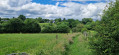
This route takes us through wide open landscapes alternating with paths and tracks through the woodland. The surfaces are either tarmac or dirt, and the paths are often still overgrown with grass given the time of year and the fact that they are probably not used very often. That’s the charm of these moments spent in direct contact with nature.
Walk around Houffalize
 11.24 mi
+1,079 ft
-1,070 ft
6h 05
Average
Departure from Houffalize (Province de Luxembourg)
11.24 mi
+1,079 ft
-1,070 ft
6h 05
Average
Departure from Houffalize (Province de Luxembourg)
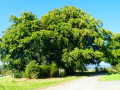
The countryside around Houffalize town centre is open and hilly, offering beautiful views of this lush green region.The eastern Ourthe and its tributaries are (still) fairly wild streams with sometimes rushing waters. The forests are mainly fir forests... there are not many deciduous forests in this area.
Circular Ardennes route between Brisy, Taverneux, Alhoumont and Cetturu
 10.85 mi
+1,227 ft
-1,257 ft
6h 05
Average
Departure from Gouvy (Province de Luxembourg)
10.85 mi
+1,227 ft
-1,257 ft
6h 05
Average
Departure from Gouvy (Province de Luxembourg)
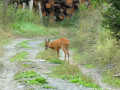
Typical of the Ardennes, alternating between countryside (fields and pastures) and woodland (deciduous and coniferous), this circular walk through the valley and across the hills of the eastern Ourthe, to the east of Houffalize, is a wonderful experience to be enjoyed in all seasons.
The Eastern Ourthe between Taverneux and Cetturu
 10.10 mi
+1,079 ft
-1,066 ft
5h 35
Average
Departure from Houffalize (Province de Luxembourg)
10.10 mi
+1,079 ft
-1,066 ft
5h 35
Average
Departure from Houffalize (Province de Luxembourg)
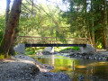
Starting from the viewpoint overlooking the village of Tarverneux, the route heads east at first, then north-east as far as the Sommerain stream.After crossing it, the route heads out into the countryside on the heights of Brisy. A long descent towards the Ourthe follows… here it is the river’s eastern branch; the western branch flows successively through the communes of Libramont-Chevigny, Sainte-Ode, Tenneville and Bertogne before joining the main river at the Nisramont dam. The long climb that follows reaches the outskirts of Cetturu before descending again towards the Tavigny Stream. The next highest point of the walk is at a place known as ‘Les Deux Hêtres’. From there, the route descends towards the Ourthe, passing the Blancs Bois picnic shelter and barbecue area. Near the confluence of the Eastern Ourthe and the Cowan Stream, a little further upstream along the latter, stands the Moulin de l’Ermitage, which gave its name to the locality known as l’Hermitage. All that remains is to head back up to the starting point.
Around the eastern Ourthe and a few of its tributaries from Sommerain onwards
 13.55 mi
+1,152 ft
-1,165 ft
7h 15
Difficult
Departure from Houffalize (Province de Luxembourg)
13.55 mi
+1,152 ft
-1,165 ft
7h 15
Difficult
Departure from Houffalize (Province de Luxembourg)
Running through woodland on both the northern and southern sides, this long walk on the heights of the eastern Ourthe is predominantly rural and offers lovely views of the surrounding countryside as well as, in the distance, the villages of the Gouvy area.
Starting from Kautenbach, a village in the canton of Wiltz
 10.20 mi
+2,034 ft
-2,044 ft
6h 30
Difficult
Departure from Kiischpelt[2] (Luxembourg (Country))
10.20 mi
+2,034 ft
-2,044 ft
6h 30
Difficult
Departure from Kiischpelt[2] (Luxembourg (Country))
Explore the Wiltz Valley via a section of the Escapardenne Lee Trail.
From the Wiltz Valley to the Clerve Valley
 8.79 mi
+1,670 ft
-1,663 ft
5h 30
Average
Departure from Kiischpelt[2] (Luxembourg (Country))
8.79 mi
+1,670 ft
-1,663 ft
5h 30
Average
Departure from Kiischpelt[2] (Luxembourg (Country))
From one side to the other, circular walk from Kautenbach in the Our Nature Park.
Schuttbourg Castle in Kautenbach
 6.46 mi
+1,381 ft
-1,381 ft
4h 10
Average
Departure from Kiischpelt[2] (Luxembourg (Country))
6.46 mi
+1,381 ft
-1,381 ft
4h 10
Average
Departure from Kiischpelt[2] (Luxembourg (Country))
Head to Schuttbourg Castle via three national trails: the Escapardenne Eisleck Trail, the Sentier du Nord and finally the Escapardenne Lee Trail.
Nature getaway in Sterpigny
 14.68 mi
+1,214 ft
-1,227 ft
7h 50
Difficult
Departure from Gouvy (Province de Luxembourg)
14.68 mi
+1,214 ft
-1,227 ft
7h 50
Difficult
Departure from Gouvy (Province de Luxembourg)
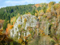
Crossed by the Ourthe Orientale, Gouvy boasts magnificent landscapes to discover as you follow the river, with countryside and forests alternating between deciduous and coniferous trees. In autumn, it is of course the deciduous trees that leave the greatest impression!
Cherain - Rettigny et la vallée de l' Ourthe
8.46 mi
+846 ft
-827 ft
4h 40
Average
Departure from Gouvy (Province de Luxembourg)
This is a reposing walk between the fields and along small rivers. Recommend for people who love the country and nature.
Sterpigny – Rodt Sankt-Vith
 14.25 mi
+840 ft
-587 ft
7h 15
Difficult
Departure from Gouvy (Province de Luxembourg)
14.25 mi
+840 ft
-587 ft
7h 15
Difficult
Departure from Gouvy (Province de Luxembourg)
Here we are in the Eastern Cantons. This region isn’t part of Wallonia, but I’ve included it in my ‘Parkin’son tour of Wallonia’ all the same. Through a succession of climbs, some of which are quite steep, as are the descents, we gradually make our way towards the highest altitudes in Belgium. Mainly via paths, tracks and back roads, we link up the various villages and small towns situated between Sterpigny and Rodt, namely Gouvy, Aldringen, Maldingen and Crombach.
From Gouvy station to Vielsalm station
12.32 mi
+1,112 ft
-1,457 ft
6h 40
Average
Departure from Gouvy (Province de Luxembourg)
From Gouvy to Vielsalm, skirting Courtil and Provèdroux, the route is quintessentially Ardennes and serene. It alternates between peaceful forest stretches and open countryside, with gently rolling hills. The terrain becomes more undulating as you approach Vielsalm. The walk through the hamlet of La Comté, followed by the climb over the next ridge with its magnificent views, is a real treat. This is followed by the typical descent towards Vielsalm, where you’ll find it all: schist, the Bonalfa forest, blueberry bushes… and the ‘macralles’ (witches)!
A few markers on the Ourthe side
 10.93 mi
+620 ft
-597 ft
5h 35
Average
Departure from Gouvy (Province de Luxembourg)
10.93 mi
+620 ft
-597 ft
5h 35
Average
Departure from Gouvy (Province de Luxembourg)
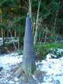
You’ll cover almost 18 kilometres and will also come across two other very different types of boundary markers: two stone ones marking the former Belgian-Prussian border and two metal ones, still very much in use, between Belgium and the Grand Duchy of Luxembourg.The Eastern Ourthe, meanwhile, is not very prominent, but towards the end of the route you’ll walk alongside a beautiful nature reserve on the banks of its tributary, known as the Fooschtbaach in the Grand Duchy and the Pihon in Belgium.
Short walk from Wahlhausener Dickt to La Sapinière
2.41 mi
+180 ft
-151 ft
1h 15
Easy
Departure from Hosingen (Luxembourg (Country))
Much of the walk takes place through the woods, with the option to extend the walk via the arboretum. It is an easy walk suitable for everyone, though there is a slight incline. The path is wide and suitable for pushchairs.
In the heart of one of our Ardennes forests around Montleban
6.40 mi
+564 ft
-564 ft
3h 25
Average
Departure from Gouvy (Province de Luxembourg)
As a resident of the pretty little village of Montleban, I’d like to suggest a route to my fellow walkers and/or joggers that consists of 90% wooded paths and 10% quiet, unpaved roads.
Throughout the walk, you may be lucky enough to encounter a family of wild boars or deer.
Éislek circular pad starting from Hoscheid
6.97 mi
+1,549 ft
-1,549 ft
4h 35
Average
Departure from Hoscheid (Luxembourg (Country))
This path winds through the Schlindertal valley. A slight detour will take you to its memorial. The isolated Saint-Michel chapel is a remnant of an ancient village that is now uninhabited. The highlight of the hike is the Molberlee, an exposed slate ridge offering spectacular views of the valley.
Route in Hoscheid
 8.27 mi
+1,965 ft
-1,952 ft
5h 30
Difficult
Departure from Hoscheid (Luxembourg (Country))
8.27 mi
+1,965 ft
-1,952 ft
5h 30
Difficult
Departure from Hoscheid (Luxembourg (Country))
Route in Hosingen Park, taking part of the Escapardenne Lee Trail and the Hoscheid sound trail, which can be enjoyed at any time.
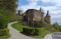
From Dirbach to Bourscheid Castle
 7.46 mi
+1,736 ft
-1,745 ft
4h 55
Difficult
Departure from Heiderscheid (Luxembourg (Country))
7.46 mi
+1,736 ft
-1,745 ft
4h 55
Difficult
Departure from Heiderscheid (Luxembourg (Country))
Circular route in the Our Nature Park, taking part of the Escapardenne Lee Trail. Route can be done in all seasons.
From Goebelsmühle station to Michelau station via Bourscheid Castle
9.05 mi
+2,096 ft
-2,175 ft
6h 00
Average
Departure from Bourscheid (Luxembourg) (Luxembourg (Country))
This walk takes us up above the meanders of the Sûre into the heart of the Éislek, following part of the Escapardenne Lee Trail, a hiking trail linking Ettelbruck to Kautenbach. Once we’ve reached Luxembourg’s largest fortified castle, we can walk around the next bend and head uphill to reach a remarkable viewpoint before descending towards Michelau station. If you’re short on time or energy, you can reach the station more directly by taking the Haute Sûre path down from the castle.
It was designed to be accessible by train (free in Luxembourg since March 2020).