


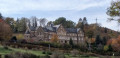
(S/E) Starting from the charming Asselborn Mill – step under the porch and take a look into the inner courtyard of this building, which currently houses a rather renowned hotel and restaurant – the walk first follows the course of the Trëtterbaach before veering away from it and reaching the village of Boxhorn (2) which you cross briefly on your way to the forest overlooking Maulesmillen and the Woltz.
The route passes the SRA memorial (an Allied aircraft shot down in 1944) (5) then branches off and rejoins the Trëtterbaach near the village of Sassel (7) after another stretch through the countryside.
The return journey to the Asselborn Mill follows this stream more closely, allowing you to discover its rather wild character. (9) There is a picnic table on this stretch.
The second part of the walk takes you through the Vallée de la Paix (10) – featuring monuments explaining the key stages in the construction of Europe and expressing the hope that the region will never again see armed conflict – before climbing up to the Wincrange plateau and reaching the former Emeschbaach slate quarry (12). There is a picnic table on the hill.
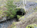
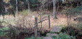
This is followed by a stretch through the countryside towards the second mill on the Trëtterbaach, the Leeresmillen (13), which is in a much poorer state of repair. Here you’ll find an educational trail on wooden walkways and the stream’s numerous marshy meanders at this point.
The final section of the walk follows a wonderfully idyllic little valley back to the starting point (S/E).
As well as the obvious option of doing just one of the two circular loops, it is quite easy to shorten the eastern circular loop: turn left at (1) at the first houses in the village of Boxhorn and follow the WN 2-marked path down to the road at point (8).
Around the Asselborn Mill


A truly beautiful walk that’s hard to capture in just a few photos! It forms a figure-of-eight, with a long circular loop to the east of Asselborn followed by a slightly shorter circular loop to the west of Asselborn.
Details
Creation:
Last update:
Last review:
–
–
-
 Activity: Walking
 -
 Distance: 12.51 mi
 -
 Average duration: 6h 40
 -
 Difficulty: Difficult
 -
-
 Back to start: Yes
 -
 Ascent: + 1,076 ft
 -
 Descent: - 1,089 ft
 -
-
 Highest point: 1,667 ft
 -
 Lowest point: 1,332 ft
-
 Country:
Luxembourg (Country)
Country:
Luxembourg (Country)
-
 Area: Massif des Ardennes
 -
 City:
Wincrange
City:
Wincrange -
 Start/End: N 50.087781° / E 5.964785°
 -


 Hour-by-hour weather
Photos
Description of the walk
Waypoints
- S/E : mi 0 - alt. 1,381 ft - Asselborn Mill
- 1 : mi 1.44 - alt. 1,519 ft - Possible shortcut
- 2 : mi 1.65 - alt. 1,555 ft - Boxhorn
- 3 : mi 2.64 - alt. 1,654 ft - Elevation 504
- 4 : mi 3.34 - alt. 1,588 ft - Elevation 482
- 5 : mi 3.67 - alt. 1,542 ft - SRA monument
- 6 : mi 4.87 - alt. 1,529 ft - Fork
- 7 : mi 5.59 - alt. 1,358 ft - Fork in the road towards Sassel
- 8 : mi 6.42 - alt. 1,427 ft - End of the shortcut
- 9 : mi 6.89 - alt. 1,355 ft - Picnic bench
- 10 : mi 7.92 - alt. 1,385 ft - Valley of Peace
- 11 : mi 8.82 - alt. 1,473 ft - N12
- 12 : mi 9.83 - alt. 1,391 ft - Former slate quarry
- 13 : mi 11.18 - alt. 1,371 ft - Leeresmillen
- S/E : mi 12.5 - alt. 1,381 ft - Asselborn Mill
Other walks in the area
The Luxembourg Ardennes between Troisvierges and Drauffelt
 Visorando Member
 11.92 mi
+1,460 ft
-1,804 ft
6h 45
11.92 mi
+1,460 ft
-1,804 ft
6h 45
 Average
 Departure from Troisvierges (Luxembourg (Country))
Set off to explore the north of the Grand Duchy of Luxembourg and, in particular, Clervaux Abbey.
Please note: this hike is not circular and is based on the concept of walks from station to station. We chose to leave our vehicle at the free P+R car park at Drauffelt station, from where the train takes hikers to Troisvierges free of charge (1 train per hour on track 1).
Passeurs Trail
 7.31 mi
+719 ft
-738 ft
4h 00
Average
Departure from Troisvierges (Luxembourg (Country))
7.31 mi
+719 ft
-738 ft
4h 00
Average
Departure from Troisvierges (Luxembourg (Country))
Follow in the footsteps of fugitives and resistance fighters who used the forest paths, trails and little-used country roads along this route. A few information panels and, above all, the Kléngelbaach stream, a key point of passage between the two countries, await you along the way.
Discovering Cinqfontaines
 8.52 mi
+1,296 ft
-1,319 ft
5h 05
Average
Departure from Troisvierges (Luxembourg (Country))
8.52 mi
+1,296 ft
-1,319 ft
5h 05
Average
Departure from Troisvierges (Luxembourg (Country))
From Troisvierges station, set off to explore the Cinqfontaines convent, an iconic site of the Second World War in Luxembourg. Continue this pleasant circular route towards Maulesmillen, taking in the panoramic views of the Luxembourg countryside.
Clervaux and the Irbich Valley
 6.25 mi
+1,060 ft
-1,050 ft
3h 50
Average
Departure from Clervaux (Luxembourg (Country))
6.25 mi
+1,060 ft
-1,050 ft
3h 50
Average
Departure from Clervaux (Luxembourg (Country))
A climb from Clervaux to a superb view of the abbey bell tower and the valley, then a route mainly through forest, finally returning along the Irbich river on country roads or dirt tracks.
You can shorten the walk by continuing from (6) to Drauffelt station (6 km in total) and returning by train (free on the GDL).
Around the Bernistap Canal
 11.96 mi
+860 ft
-886 ft
6h 15
Average
Departure from Houffalize (Province de Luxembourg)
11.96 mi
+860 ft
-886 ft
6h 15
Average
Departure from Houffalize (Province de Luxembourg)
The Bernistap Canal is a section of the canal that the Dutch had planned to build to link the Rhine to the Meuse via the Moselle and the Ourthe. Begun in 1827 during the reign of WilliamI, King of the Netherlands, work was suspended in 1830 during the Belgian revolution and finally abandoned when the Grand Duchy of Luxembourg gained independence. This canal has an underground section, the entrance to which on the Belgian side is still visible at km 1, if you are feeling adventurous. A few information panels are located along the canal between km 1 and km 2, as well as on the Luxembourg side (except for the section leading to the village of Hoffelt).
Via Limerlé from Steinbach
 4.53 mi
+394 ft
-420 ft
2h 25
4.53 mi
+394 ft
-420 ft
2h 25
 Easy
Departure from Gouvy (Province de Luxembourg)
Easy
Departure from Gouvy (Province de Luxembourg)
The route passes through the Ourthe Orientale nature reserve. Here, in particular, you can admire the typical flora and fauna.Steinbach is a charming Ardennes village with an agricultural heritage, featuring numerous farms and small farmhouses built of schist stone and roofed with slate (cherbins = local slate). Its historical past is evident in the presence of castle-like farms and enclosed farmsteads dating back to the 17th and 18th centuries, which have been carefully restored.
A few markers on the Ourthe side
 10.93 mi
+620 ft
-597 ft
5h 35
Average
Departure from Gouvy (Province de Luxembourg)
10.93 mi
+620 ft
-597 ft
5h 35
Average
Departure from Gouvy (Province de Luxembourg)
You’ll cover almost 18 kilometres and will also come across two other very different types of boundary markers: two stone ones marking the former Belgian-Prussian border and two metal ones, still very much in use, between Belgium and the Grand Duchy of Luxembourg.The Eastern Ourthe, meanwhile, is not very prominent, but towards the end of the route you’ll walk alongside a beautiful nature reserve on the banks of its tributary, known as the Fooschtbaach in the Grand Duchy and the Pihon in Belgium.
Circular Ardennes route between Brisy, Taverneux, Alhoumont and Cetturu
 10.85 mi
+1,227 ft
-1,257 ft
6h 05
Average
Departure from Gouvy (Province de Luxembourg)
10.85 mi
+1,227 ft
-1,257 ft
6h 05
Average
Departure from Gouvy (Province de Luxembourg)
Typical of the Ardennes, alternating between countryside (fields and pastures) and woodland (deciduous and coniferous), this circular walk through the valley and across the hills of the eastern Ourthe, to the east of Houffalize, is a wonderful experience to be enjoyed in all seasons.
For more walks, use our search engine .
The GPS track and description are the property of this route's author. Please do not copy them without permission.

