


Rachamps


Between the three villages of Rachamps, Hardigny and Neufmoulin, nestled between woods and countryside
Details
Creation:
Last update:
Last review:
–
–
-
 Activity: Walking
-
 Distance: 5.84 mi
-
 Average duration: 3h 00
-
 Difficulty: Easy
-
-
 Back to start: Yes
-
 Ascent: + 404 ft
-
 Descent: - 433 ft
-
-
 Highest point: 1,601 ft
-
 Lowest point: 1,316 ft
-
 Country:
Belgium
-
 Area: Massif des Ardennes
-
 City:
Bastogne
-
 Start/End: N 50.083594° / E 5.788648°
-


 Hour-by-hour weather


Waypoints
- S/E : mi 0 - alt. 1,473 ft
- S/E : mi 5.84 - alt. 1,470 ft
Other walks in the area
Between the two Ourthes from Mabompré
 Visorando Member
 14.51 mi
+1,837 ft
-1,847 ft
8h 15
 Difficult
 Departure from Houffalize (Province de Luxembourg)
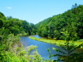
The two Ourthes – the Eastern Ourthe and the Western Ourthe – join at Engreux to form the Ourthe. Slightly downstream from their confluence, man has built the Nisramont dam to create Lake Nisramont.
Walk around Houffalize
 11.24 mi
+1,079 ft
-1,070 ft
6h 05
 Moderate
Departure from Houffalize (Province de Luxembourg)
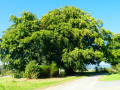
The countryside around Houffalize town centre is open and hilly, offering beautiful views of this lush green region.The eastern Ourthe and its tributaries are (still) fairly wild streams with sometimes rushing waters. The forests are mainly fir forests... there are not many deciduous forests in this area.
Around the Bernistap Canal
 11.96 mi
+860 ft
-886 ft
6h 15
Moderate
Departure from Houffalize (Province de Luxembourg)
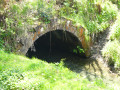
The Bernistap Canal is a section of the canal that the Dutch had planned to build to link the Rhine to the Meuse via the Moselle and the Ourthe. Begun in 1827 during the reign of WilliamI, King of the Netherlands, work was suspended in 1830 during the Belgian revolution and finally abandoned when the Grand Duchy of Luxembourg gained independence. This canal has an underground section, the entrance to which on the Belgian side is still visible at km 1, if you are feeling adventurous. A few information panels are located along the canal between km 1 and km 2, as well as on the Luxembourg side (except for the section leading to the village of Hoffelt).
In the Two Ourthes Nature Park, starting from Compogne
 10.28 mi
+1,168 ft
-1,145 ft
5h 45
Moderate
Departure from Bertogne (Province de Luxembourg)
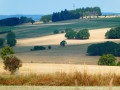
Alternating between countryside and woodland sections, this circular route starting from Compogne allows you to discover a small part of the magnificent landscapes of the Two Ourthes Nature Park. There’s no Ourthe here, just the Cornaille stream and two of its tributaries. To see both Ourthes at a glance, the easiest way is to head to Engreux and walk down to the Adeps Centre at their confluence.
The Eastern Ourthe between Taverneux and Cetturu
 10.10 mi
+1,079 ft
-1,066 ft
5h 35
Moderate
Departure from Houffalize (Province de Luxembourg)
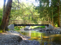
Starting from the viewpoint overlooking the village of Tarverneux, the route heads east at first, then north-east as far as the Sommerain stream.After crossing it, the route heads out into the countryside on the heights of Brisy. A long descent towards the Ourthe follows… here it is the river’s eastern branch; the western branch flows successively through the communes of Libramont-Chevigny, Sainte-Ode, Tenneville and Bertogne before joining the main river at the Nisramont dam. The long climb that follows reaches the outskirts of Cetturu before descending again towards the Tavigny Stream. The next highest point of the walk is at a place known as ‘Les Deux Hêtres’. From there, the route descends towards the Ourthe, passing the Blancs Bois picnic shelter and barbecue area. Near the confluence of the Eastern Ourthe and the Cowan Stream, a little further upstream along the latter, stands the Moulin de l’Ermitage, which gave its name to the locality known as l’Hermitage. All that remains is to head back up to the starting point.
Between two Ourthes
 8.59 mi
+1,191 ft
-1,191 ft
5h 00
Moderate
Departure from Houffalize (Province de Luxembourg)
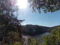
A waterside route passing several viewpoints, notably the confluence of the two Ourthes. The Nisramont Dam and two footbridges are essential for crossing from one bank to the other.Please note: this is a challenging walk (see practical information)
Achouffe and the Martin Moulin Stream
 5.44 mi
+604 ft
-597 ft
3h 00
Moderate
Departure from Houffalize (Province de Luxembourg)
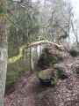
Starting from Achouffe, discover the valley of the Ruisseau de Martin Moulin. The route follows forest paths and trails, ending with your feet in the water, and sometimes mud, on the path along the stream at the Moulin de Wihogne.
Around the eastern Ourthe and a few of its tributaries from Sommerain onwards
 13.55 mi
+1,152 ft
-1,165 ft
7h 15
Difficult
Departure from Houffalize (Province de Luxembourg)
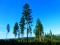
Running through woodland on both the northern and southern sides, this long walk on the heights of the eastern Ourthe is predominantly rural and offers lovely views of the surrounding countryside as well as, in the distance, the villages of the Gouvy area.
For more walks, use our search engine .
The GPS track and description are the property of this route's author. Please do not copy them without permission.

