From Goebelsmühle station to Michelau station via Bourscheid Castle

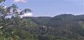
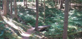
This walk takes us up above the meanders of the Sûre into the heart of the Éislek, following part of the Escapardenne Lee Trail, a hiking trail linking Ettelbruck to Kautenbach. Once we’ve reached Luxembourg’s largest fortified castle, we can walk around the next bend and head uphill to reach a remarkable viewpoint before descending towards Michelau station. If you’re short on time or energy, you can reach the station more directly by taking the Haute Sûre path down from the castle.

It was designed to be accessible by train (free in Luxembourg since March 2020).

Details

72849173
Creation:
Last update:
Last review:
  • Walking
    Activity: Walking
  • ↔
    Distance: 9.05 mi
  • ◔
    Average duration: 6h 00 
  • ▲
    Difficulty: Moderate

  • ⚐
    Back to start: No
  • ↗
    Ascent: + 2,096 ft
  • ↘
    Descent: - 2,175 ft

  • ▲
    Highest point: 1,654 ft
  • ▼
    Lowest point: 715 ft

Description of the walk

(S) On leaving the station, follow the N27 to the left. Cross a canal and you’ll soon reach the bridge over the Sûre.

(1) Cross the Sûre and head uphill along the road to Goebelsmühle.

(2) At a hairpin bend to the left, take a path that branches off to the right.

(3) The path crosses a rocky outcrop.

(4) Further on, veer to the left. After about a hundred metres, turn left again onto a path.

(5) You’ll come out onto a wider track; follow it to the left. Continue to the right for about 25 metres, ignoring the path leading to a chalet.

(6) Head uphill to the right, following the Escapardenne Lee Trail.

(7) Cross the junction of paths and head straight on (east).

(8) Join Route de Goebelsmühle and follow it to the right for about fifty metres. Then turn sharply right and take a path.

(9) In front of some transmission pylons, turn right, temporarily leaving the Escapardenne. After about 250 m, turn left towards the centre of the village of Bourscheid. Pass a car park on your right and, at the corner, turn right. Then turn right again and cross another car park. You’ll come out onto a main road; follow it to the left.

(10) Just before the church, turn right onto path BS6.

(11) You’ll come out onto a main road; follow it to the left. After about 150 m, turn right, walk past a campsite on your right and head for the Schleedbësch viewpoint.

(12) Continue along the main path. Further on, rejoin the CR308 and follow it to the left until you reach the entrance to the castle.

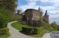
(13) Enter the grounds and walk around the ruins of the medieval castle (the castle is open to visitors).

(14) Retrace your steps back to the entrance.

(13) Turn right onto the AK2 path, heading north-west then north.

(15) Join the Escapardenne Lee Trail and follow it to the right. Then turn right and walk alongside the railway line on your left.

(16) Turn left onto a footbridge crossing the railway line. Then walk alongside the Sûre on your left. Further on, pass a campsite on your left. Join the CR308, follow it to the left and cross the bridge over the Sûre.

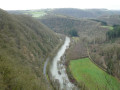
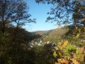
(17) On the other side, cross the N27 and take a path that leads diagonally to the right. Climb the numerous hairpin bends to reach the Gringlee viewpoint.

(18) Continue along the path, then head down towards Michelau. Walk through the village and cross over the railway line to reach the station (E).

Waypoints

  1. S : mi 0 - alt. 797 ft - Gare de Goebelsmühle
  2. 1 : mi 0.31 - alt. 771 ft - Sûre ou Sauer (rivière)
  3. 2 : mi 0.76 - alt. 968 ft - Start of the footpath
  4. 3 : mi 0.97 - alt. 965 ft - Rouschteschleen and Doigt de Dieu
  5. 4 : mi 1.11 - alt. 958 ft - Éislek Pad Bourscheid
  6. 5 : mi 1.29 - alt. 1,145 ft - Fensterdelt
  7. 6 : mi 1.44 - alt. 1,181 ft - Escapardenne Lee Trail
  8. 7 : mi 2 - alt. 1,437 ft - Crossroads
  9. 8 : mi 2.43 - alt. 1,516 ft - Route de Goebelsmühle
  10. 9 : mi 3.09 - alt. 1,634 ft - T-junction – pylon, aerials
  11. 10 : mi 3.55 - alt. 1,578 ft - Start of the footpath - Église Saint-Michel (Bourscheid)
  12. 11 : mi 3.9 - alt. 1,368 ft - Schlasswee (CR308)
  13. 12 : mi 4.04 - alt. 1,358 ft - Viewpoint - Schleedbësch
  14. 13 : mi 4.31 - alt. 1,171 ft - Access to the castle
  15. 14 : mi 4.47 - alt. 1,201 ft - Château de Bourscheid
  16. 15 : mi 5.15 - alt. 1,086 ft - Escapardenne Lee Trail
  17. 16 : mi 5.83 - alt. 922 ft - Railway crossing
  18. 17 : mi 6.51 - alt. 774 ft - Crossing the N27
  19. 18 : mi 7.09 - alt. 1,460 ft - Viewpoint - Gringlee
  20. E : mi 9.05 - alt. 715 ft - Gare de Michelau

Notes

(S) (E) Goebelsmühle station is served by the CFL’s “Rodange – Troisvierges” and “Luxembourg – Gouvy – Liège (Belgium)” lines. Trains run every 30 minutes. Not all trains stop here, but there are buses connecting to Michelau station; the bus stop, ‘Op der Gafel’, is 150 metres away. And since March 2020, public transport has been free for everyone!

(14) Bourscheid Castle is open every day and can be visited from 9.30 am to 6.00 pm.

(14) Picnic tables in front of the castle entrance

(18) Benches and a table, perfect for a break

Worth a visit

Other walks in the area

For more walks, use our search engine .

The GPS track and description are the property of this route's author. Please do not copy them without permission.