Via Limerlé from Steinbach

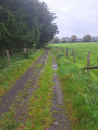
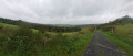
The route passes through the Ourthe Orientale nature reserve. Here, in particular, you can admire the typical flora and fauna.
Steinbach is a charming Ardennes village with an agricultural heritage, featuring numerous farms and small farmhouses built of schist stone and roofed with slate (cherbins = local slate). Its historical past is evident in the presence of castle-like farms and enclosed farmsteads dating back to the 17th and 18th centuries, which have been carefully restored.

Details

22794555
Creation:
Last update:
Last review:
  • Walking
    Activity: Walking
  • ↔
    Distance: 4.53 mi
  • ◔
    Average duration: 2h 25 
  • ▲
    Difficulty: Easy

  • ⚐
    Back to start: Yes
  • ↗
    Ascent: + 394 ft
  • ↘
    Descent: - 420 ft

  • ▲
    Highest point: 1,591 ft
  • ▼
    Lowest point: 1,302 ft

Photos

Description of the walk

Park to the left of Saint-Paul’s Church in Steinbach, where there are a few parking spaces.

(S/E) Walk round the church and take Rue du Centre until you reach the first road on the right.

(1) Turn right at the Fork in the road and follow the tarmac road to the entrance to Limerlé.

(2) At number 8 Rue de Bru, ‘A mon Nini’, turn left twice straight away and then immediately right, skirting the Clos du Bru, and continue along the path to a private pond.

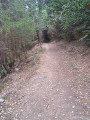
(3) On your right, you’ll see the pond. If you look closely, you may spot carp, salmon and trout. Continue down the path – which is tricky due to the many stones – until you reach the stream. There is a picnic area with benches and a table.

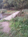
(4) Cross the wooden bridge over the Ourthe Orientale. Walk up the path keeping the stream on your left, then head back down towards another wooden bridge.

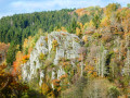
(5) Cross the wooden bridge to continue along the other bank, skirting a rock face, and follow the path to a wide stony track.

(6) Turn left, head uphill to join Rue du Vieux Triangle and reach a crossroads.

(7) Head back down towards the village by turning right and continue along the path which will take you to Rue de Liherin. Turn left to return to Steinbach Church (S/E).

Waypoints

  1. S/E : mi 0 - alt. 1,591 ft - Église Saint-Paul (Steinbach, Wallonie)
  2. 1 : mi 0.28 - alt. 1,549 ft - Junction towards Limerlé
  3. 2 : mi 1.63 - alt. 1,526 ft - Limerlé, 8 Rue du Bru
  4. 3 : mi 2.21 - alt. 1,450 ft - Small private pond
  5. 4 : mi 2.52 - alt. 1,339 ft - Bridge and picnic area - Ourthe orientale (rivière) - Affluent de l'Ourthe
  6. 5 : mi 3.35 - alt. 1,306 ft - Wooden bridge
  7. 6 : mi 3.42 - alt. 1,335 ft - Junction with wide stony path
  8. 7 : mi 4.07 - alt. 1,558 ft - Crossroads
  9. S/E : mi 4.53 - alt. 1,591 ft - Église Saint-Paul (Steinbach, Wallonie)

Other walks in the area

For more walks, use our search engine .

The GPS track and description are the property of this route's author. Please do not copy them without permission.