


The Eastern Ourthe between Taverneux and Cetturu


Starting from the viewpoint overlooking the village of Tarverneux, the route heads east at first, then north-east as far as the Sommerain stream.
After crossing it, the route heads out into the countryside on the heights of Brisy. A long descent towards the Ourthe follows… here it is the river’s eastern branch; the western branch flows successively through the communes of Libramont-Chevigny, Sainte-Ode, Tenneville and Bertogne before joining the main river at the Nisramont dam. The long climb that follows reaches the outskirts of Cetturu before descending again towards the Tavigny Stream. The next highest point of the walk is at a place known as ‘Les Deux Hêtres’. From there, the route descends towards the Ourthe, passing the Blancs Bois picnic shelter and barbecue area. Near the confluence of the Eastern Ourthe and the Cowan Stream, a little further upstream along the latter, stands the Moulin de l’Ermitage, which gave its name to the locality known as l’Hermitage. All that remains is to head back up to the starting point.
Details
–
-
 Activity: Walking
 -
 Distance: 10.10 mi
 -
 Average duration: 5h 35
 -
 Difficulty: Moderate
 -
-
 Back to start: Yes
 -
 Ascent: + 1,079 ft
 -
 Descent: - 1,066 ft
 -
-
 Highest point: 1,549 ft
 -
 Lowest point: 1,135 ft
-
 Country:
Belgium
Country:
Belgium
-
 Area: Massif des Ardennes
 -
 City:
Houffalize
City:
Houffalize -
 Start/End: N 50.142592° / E 5.80093°
 -


 Hour-by-hour weather


Photos
Waypoints
- S/E : mi 0 - alt. 1,335 ft - Viewpoint over Taverneux
- 1 : mi 1.41 - alt. 1,237 ft - Pont à l’Âme on the Sommerain Stream
- 2 : mi 2.35 - alt. 1,339 ft - Fork in the road on the outskirts of Brisy
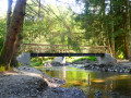
- 3 : mi 3.39 - alt. 1,178 ft - Footbridge over the - Ourthe orientale (rivière) - Affluent de l'Ourthe
- 4 : mi 4.61 - alt. 1,549 ft - Bench opposite
- 5 : mi 4.89 - alt. 1,532 ft - Grassy path on the outskirts of Cetturu
- 6 : mi 5.23 - alt. 1,493 ft - Horse breeding
- 7 : mi 6.01 - alt. 1,283 ft - Tavigny Stream
- 8 : mi 7.34 - alt. 1,503 ft - Aux Deux Chênes
- 9 : mi 8.17 - alt. 1,421 ft - Blancs Bois picnic shelter and barbecue area
- 10 : mi 8.65 - alt. 1,138 ft - Ermitage Footbridge - Ourthe orientale (rivière) - Affluent de l'Ourthe
- 11 : mi 9.03 - alt. 1,224 ft - Bench and viewpoint
- S/E : mi 10.1 - alt. 1,335 ft - Viewpoint over Taverneux
Other walks in the area
Around the eastern Ourthe and a few of its tributaries from Sommerain onwards
 Visorando Member
 13.55 mi
+1,152 ft
-1,165 ft
7h 15
13.55 mi
+1,152 ft
-1,165 ft
7h 15
 Difficult
 Departure from Houffalize (Province de Luxembourg)
Walk around Houffalize
 11.24 mi
+1,079 ft
-1,070 ft
6h 05
Moderate
Departure from Houffalize (Province de Luxembourg)
11.24 mi
+1,079 ft
-1,070 ft
6h 05
Moderate
Departure from Houffalize (Province de Luxembourg)
Circular Ardennes route between Brisy, Taverneux, Alhoumont and Cetturu
 10.85 mi
+1,227 ft
-1,257 ft
6h 05
Moderate
Departure from Gouvy (Province de Luxembourg)
10.85 mi
+1,227 ft
-1,257 ft
6h 05
Moderate
Departure from Gouvy (Province de Luxembourg)
Achouffe and the Martin Moulin Stream
 5.44 mi
+604 ft
-597 ft
3h 00
Moderate
Departure from Houffalize (Province de Luxembourg)
5.44 mi
+604 ft
-597 ft
3h 00
Moderate
Departure from Houffalize (Province de Luxembourg)
In the heart of one of our Ardennes forests around Montleban
6.40 mi
+564 ft
-564 ft
3h 25
Moderate
Departure from Gouvy (Province de Luxembourg)
Cherain - Rettigny et la vallée de l' Ourthe
8.46 mi
+846 ft
-827 ft
4h 40
Moderate
Departure from Gouvy (Province de Luxembourg)
Between the two Ourthes from Mabompré
 14.51 mi
+1,837 ft
-1,847 ft
8h 15
Difficult
Departure from Houffalize (Province de Luxembourg)
14.51 mi
+1,837 ft
-1,847 ft
8h 15
Difficult
Departure from Houffalize (Province de Luxembourg)
 Easy
Easy For more walks, use our search engine .
The GPS track and description are the property of this route's author. Please do not copy them without permission.

