Starting from Kautenbach, a village in the canton of Wiltz

Explore the Wiltz Valley via a section of the Escapardenne Lee Trail.

Details

856872
Creation:
Last update:
Last review:
  • Walking
    Activity: Walking
  • ↔
    Distance: 10.20 mi
  • ◔
    Average duration: 6h 30 
  • ▲
    Difficulty: Difficult

  • ⚐
    Back to start: Yes
  • ↗
    Ascent: + 2,034 ft
  • ↘
    Descent: - 2,044 ft

  • ▲
    Highest point: 1,562 ft
  • ▼
    Lowest point: 820 ft

Photos

Description of the walk

Car park on the square, below Saint Bernard’s Church in Kautenbach. Parkplaz.

(DA) With your back to the car park entrance, head towards the river and follow the Clerve to the left as far as the bridge.
Cross the bridge, continue to the right and head uphill to the CR322 road.

(1) Cross the road, head up to the left and follow the road until you reach the bend.
Take the path leading uphill on your right; at the top, there’s a viewpoint over Kautenbach. Cross the road and head right until you reach the path.

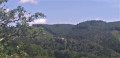
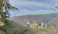
(2) At the fork in the road, turn left. Climb this steep slope to the Bomm viewpoint. View of Schuttburg Castle on the other side of the valley. Continue towards the Ueweschleid viewpoint. Pass the paragliding launch site and continue uphill.

(3) At the viewpoint, climb up to enjoy a 360° view with signposts indicating the directions to the surrounding villages. Head back down and continue along the path to the road. Turn left towards the woodland on the right-hand side of the road.

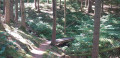
(4) Take the forest track heading straight into the woods. At the junction, turn right, go down the track, enter the forest and keep to your right. The track then bends sharply to the left. After 1 km from the junction, take the path on your left leading up to the bunker.

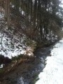
(5) Cross the bunker and turn right behind the building, go down the path and cross the stream via the logs on your left. Continue along the path. Join a forest track and follow it as the main route until you reach the road.

(6) Head left, then turn immediately right, next to the house. Follow the main track down to a Fork in the road.

(7) Turn left. 350 metres further on, take the path up to your left to the chapel, then continue along the path. At the bottom, turn right and head down to the bridge.

(8) Cross the bridge and head right; the path climbs, with the river below. Continue along Hoscheid’s “Chemin du Son”, explore the sound installations and ignore the paths branching off to your left.

(9) At the multi-way junction, turn right, cross the bridge and take the path immediately on your right. Walk uphill until you join a path on your left.

(10) Carry on straight ahead. At the multi-way junction, take the path leading slightly to the left directly ahead of you. Head uphill.

(11) At the bend, keep to your left. Leave the woods and continue across open ground, enjoying a 360° view, until you reach the road. Turn right and ignore the first path on your left.

(12) Take the next path on your left. Cross the meadows; the path curves to the right. Ignore the path on your right and head downhill. Pass the path coming from the left. Carry on; the path becomes a ridge trail, then enters the forest. Join a path on your left (closed in October 2017 following rockfalls) and carry on straight ahead. When you reach a ruined building, keep to the right to continue along the ascending path. Carry on to the bridge.

(13) Cross the bridge and continue to the right. Climb up to a junction.

(14) Turn left and follow the path, which curves sharply further on.

(15) At the fork in the road, take the right-hand path and pass a clear-cut area.

(16) At the junction, ignore the path leading uphill to your right and carry on towards the Hockslay viewpoint. View of Kautenbach and its station. Retrace your steps and continue along the path branching off to the left until you reach the road. Head uphill to the right until you reach a path on your left; take this and head downhill to the road.

(2) Cross the road and head back down the path you took on the way up to the CR322 road.

(1) Carry on straight ahead. Walk past the church and, at the junction, turn right towards the car park (S/E).


Waypoints

  1. S/E : mi 0 - alt. 830 ft - Parkplaz. Walk back up along the - Clerve (rivière) - Luxembourg - Affluent de la Wiltz
  2. 1 : mi 0.35 - alt. 850 ft - Crossing the CR322
  3. 2 : mi 0.56 - alt. 1,004 ft - Fork in the road
  4. 3 : mi 1.14 - alt. 1,545 ft - Viewpoint
  5. 4 : mi 1.49 - alt. 1,532 ft - Path through the woods
  6. 5 : mi 2.16 - alt. 1,293 ft - Bunker
  7. 6 : mi 2.64 - alt. 1,450 ft - Turn left onto the road
  8. 7 : mi 3.41 - alt. 1,217 ft - To the left
  9. 8 : mi 3.75 - alt. 1,040 ft - Bridge
  10. 9 : mi 4.94 - alt. 906 ft - Multiple junctions
  11. 10 : mi 5.3 - alt. 1,132 ft - Straight ahead
  12. 11 : mi 5.68 - alt. 1,302 ft - To the left
  13. 12 : mi 6.3 - alt. 1,440 ft - Turn left towards the - Wiltz (rivière) - Belgique
  14. 13 : mi 7.38 - alt. 899 ft - Bridge
  15. 14 : mi 7.82 - alt. 1,037 ft - To the left
  16. 15 : mi 8.37 - alt. 1,158 ft - Fork in the road
  17. 16 : mi 8.82 - alt. 1,312 ft - Junction
  18. S/E : mi 10.2 - alt. 830 ft - Car park

Notes

Bench at the Bomm viewpoint after (2), at Saint-Michel Chapel after (7), at (11), before (15), and at the Hockslay viewpoint

Picnic table at (3) and at the first sound installation after (8)

No drinking water along the route.

During the high season, you can eat and drink at (S/E)

Worth a visit

Rocky ridges (“lee” in Luxembourgish)

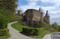
View of Schuttbourg Castle: the castle is first mentioned in a document from 1404 under the name ‘Schudeburg’. There has never been a noble family bearing the name Schuttbourg, as was the case with the far more important castles of Clervaux, Vianden or Bourscheid.

Three viewpoints in succession: ‘Bomm’, a paragliding launch site, and ‘Ueweschleid’

The Doosbach bunker, a place of remembrance

We follow part of the ‘Sound Trail’ themed path, which features several installations.

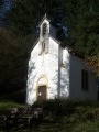
St Michael’s Chapel, built in 1874.

A beautiful descent via the ‘Hoflay’ rocky ridge into the inaccessible valley of the ‘Gëischelterbaach’ stream

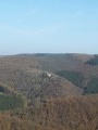
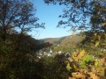
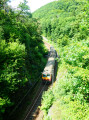
Hockslay, a viewpoint situated on a rocky outcrop overlooking the Wiltz valley from a height of nearly 200 metres, offering a fine view of the railway station and the village of Kautenbach.

Reviews and comments

5 / 5
Based on 2 reviews

Reliability of the description
5 / 5
Ease of following the route
5 / 5
Route interest
5 / 5
bxdeltou
bxdeltou

Overall rating : 5 / 5

Date of your route : Jul 22, 2024
Reliability of the description : ★★★★★ Very good
Ease of following the route : ★★★★★ Very good
Route interest : ★★★★★ Very good
Very busy route : No

It’s true that the walk is challenging, and the terrain sometimes requires the utmost care, but it’s a superb walk. The scenery is breathtaking, and with no sound of cars, it’s such a luxury! Some sections may be difficult for those who are prone to vertigo...

Machine-translated

lazzerini
lazzerini

Hello Sev1978,

I love it too – it’s quite a physical hike and makes a nice change from the Mullerthal, which is so well known in Luxembourg.
As for the elevation gains, I’m not sure how to answer that as it’s Visorando that calculates them.
I hope it will be as successful as it deserves to be now that you’ve officially opened it...

I look forward to hearing from you

Machine-translated

Sev1978
Sev1978

Overall rating : 5 / 5

Date of your route : Aug 06, 2022
Reliability of the description : ★★★★★ Very good
Ease of following the route : ★★★★★ Very good
Route interest : ★★★★★ Very good
Very busy route : No

My favourite hike
It was brilliant: stunning views, beautiful scenery, lovely paths through the woods or across fields, along the ridges – with just a bit of road walking, but really only a little.
Hiking boots are essential and walking poles are recommended
However, in terms of elevation gain, I clocked up 755m on Strava (which usually gives the expected elevation gain)

Machine-translated

Other walks in the area

For more walks, use our search engine .

The GPS track and description are the property of this route's author. Please do not copy them without permission.