


Refine your search for walks in Verdun
Verdun walks
 Circular loop above Les Cabannes
 Visorando Member
 5.71 mi
 +1,759 ft
 -1,759 ft
 4h 10
4h 10
 Moderate
 Departure from Les Cabannes (Ariège)
Circular route from Les Cabannes station. Beautiful views of the valley and varied surroundings.
The Hermitage of Saint-Pierre from Les Cabannes
 3.08 mi
+984 ft
-984 ft
2h 15
3.08 mi
+984 ft
-984 ft
2h 15
 Easy
Departure from Les Cabannes (Ariège)
Easy
Departure from Les Cabannes (Ariège)
Round trip to reach the Hermitage of Saint-Pierre and its view of the Ariège valley from the Cabannes railway station.
Climb up the slopes of the Tabe massif from Les Cabannes
 8.43 mi
+3,366 ft
-3,369 ft
6h 50
8.43 mi
+3,366 ft
-3,369 ft
6h 50
 Difficult
Departure from Les Cabannes (Ariège)
Difficult
Departure from Les Cabannes (Ariège)
A beautiful but challenging hike in the mid-mountain range, along little-used paths through unspoilt countryside, offering lovely views over the Ariège Valley and the surrounding mountains. Directly accessible by TER from Toulouse.
Pic de Saint-Barthélémy: South-West circular loop from Appy
8.70 mi
+4,990 ft
-4,977 ft
7 hrs
 Very difficult
Departure from Appy (Ariège)
Very difficult
Departure from Appy (Ariège)
From the Appy car park, climb the peak but follow an anti-clockwise circular loop, which is much less common.
That is to say, ascend via the Jasse de Sédars then the Sarrat de Bertenac, and return via the Col de Girabal, the Col d'Appy and then the Étang d'Appy.
Appy Pond
 5.32 mi
+2,598 ft
-2,589 ft
4h 45
Moderate
Departure from Appy (Ariège)
5.32 mi
+2,598 ft
-2,589 ft
4h 45
Moderate
Departure from Appy (Ariège)
A short, pleasant half-day hike in spring to the Étang d'Appy and its cirque.
Pic de Saint-Barthélemy and Étang d'Appy from Appy
 7.81 mi
+4,987 ft
-4,970 ft
7h 55
Difficult
Departure from Appy (Ariège)
7.81 mi
+4,987 ft
-4,970 ft
7h 55
Difficult
Departure from Appy (Ariège)
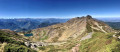
Undoubtedly one of the most beautiful viewpoints in the Pyrenees. From Canigou to Mont Valier, the summit of Pic de Saint-Barthélemy offers breathtaking views of the entire eastern Pyrenees and the Ariège plain.
The ridge path and the pretty Étang d'Appy lake are a pleasant addition to this beautiful route.
The significant elevation gain and length of this route are its main difficulties (²).
See practical information (¹).
Col de Larnat and Col Doulent
 9.20 mi
+2,051 ft
-2,028 ft
6h 00
Moderate
Departure from Larnat (Ariège)
9.20 mi
+2,051 ft
-2,028 ft
6h 00
Moderate
Departure from Larnat (Ariège)
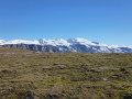
A beautiful nature hike in the mid-mountains, starting from the small village of Larnat. The ridge passages and side traverses offer extensive panoramic views of the surrounding peaks and the Ariège valley. The entire route is on wide stony or partially grassy paths and ends on the Doulent forest road through a beautiful forest of beech and spruce trees.
This hike can be done on snowshoes, in which case it is rated as difficult.
Col d'Ussat via Clot de la Carbonnière
 5.87 mi
+2,484 ft
-2,464 ft
4h 50
Moderate
Departure from Ornolac-Ussat-les-Bains (Ariège)
5.87 mi
+2,484 ft
-2,464 ft
4h 50
Moderate
Departure from Ornolac-Ussat-les-Bains (Ariège)
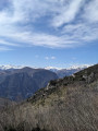
Located on the outskirts of Tarascon-sur-Ariège, this hike gradually takes you up the slopes where you can admire the Ariège, Tarascon and several peaks of the Pyrenees!
Circular of the six villages around the Rocher du Courbas
 7.97 mi
+1,539 ft
-1,535 ft
5h 00
Moderate
Departure from Lordat (Ariège)
7.97 mi
+1,539 ft
-1,535 ft
5h 00
Moderate
Departure from Lordat (Ariège)
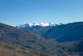
Starting from Lordat, this route takes you through six small mountain villages, all well exposed and offering beautiful views of the surrounding peaks and the Ariège valley. Alternating between small sunken paths, stream crossings and balcony trails, the route is not difficult, but you will need to save your strength for the last part, which involves a steep climb of a few hundred metres.
Around Lordat Castle
 5.04 mi
+1,286 ft
-1,289 ft
3h 25
Moderate
Departure from Lordat (Ariège)
5.04 mi
+1,286 ft
-1,289 ft
3h 25
Moderate
Departure from Lordat (Ariège)
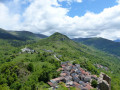
Perched on a rocky promontory, Lordat Castle guards and dominates the Ariège valley. This hike takes you around it, offering panoramic views and typical mountain villages.
Yellow markings. Be careful as the markings are sometimes difficult to see.
The church at Axiat and Lordat Castle as seen from Luzenac Garanou station
 6.47 mi
+1,516 ft
-1,506 ft
4h 20
Moderate
Departure from Garanou (Ariège)
6.47 mi
+1,516 ft
-1,506 ft
4h 20
Moderate
Departure from Garanou (Ariège)
From the railway tracks to the peaks of the Ariège! Setting off from Luzenac station, escape on a unique trail amidst the cool mountain streams, shady forests and the majestic ruins of Lordat Castle. A circular route combining nature and history, accessible by train.
The Cabane de Sauzet as seen from Luzenac-Garanou station
8.73 mi
+2,497 ft
-2,497 ft
6h 10
Difficult
Departure from Garanou (Ariège)
This forest path follows the course of the Ruisseau de Lavail. It is a very shaded round-trip walk, right in the heart of the forest, which leads out onto the large plain where the Cabane de Sauzet is situated. The cool air and the murmur of the stream will ensure you have a pleasant time, despite the constant effort required as the route has virtually no flat sections. You should plan for several breaks, but you’ll easily find plenty of places to access the river to cool off.
The Col d’Ussat and the Clot de la Carbonnière as seen from Ussat-les-Bains
6.31 mi
+1,634 ft
-1,631 ft
4h 20
Moderate
Departure from Ornolac-Ussat-les-Bains (Ariège)
The Clot de la Carbonnière crowns the glacial gorge that constricts the Ariège valley just upstream of Tarascon-sur-Ariège. To reach this viewpoint above the narrowest point of the valley, you must first make your way up the charming little valley which, from Ussat, leads to the pass of the same name, then follow the ridge separating this valley from that of Ornolac. On the ascent, you have your back to the Pic de Montcalm, which peeks out through the gap in the neighbouring mountain. And the Clot de la Carbonnière offers a superb view over Tarascon and the Ariège valley.
 Fage Belle lake
 Association / Club / Walk leader
 2.81 mi
+892 ft
-892 ft
3 hrs
Easy
Departure from Montferrier (Ariège)
2.81 mi
+892 ft
-892 ft
3 hrs
Easy
Departure from Montferrier (Ariège)
Snowshoe hike from the Monts d'Olmes resort.
We did this hike on a Friday in January, outside of school holidays, which was great. It's likely to be a bit busier during school holidays or at weekends! If possible, choose a day with clear weather. It would be a shame to miss the view.
Pic Saint-Barthélémy as seen from the Monts d’Olmes resort
6.19 mi
+3,133 ft
-3,133 ft
5h 35
Moderate
Departure from Montferrier (Ariège)
There are several ways to reach the Pic de Saint-Barthélémy. This seems to me to be the simplest. Starting from the Monts d’Olmes resort, which is easily accessible by car, you’ll first climb up to the Étang de Fage Belle, then on to the Col de Girabal, before finally reaching the summit where an exceptional view awaits you. The more adventurous can continue on to Soularac and back, which adds a total of 300 metres of elevation gain.
Circular Pics Girabal and Galinat
6.43 mi
+2,854 ft
-2,841 ft
0h 00
Difficult
Departure from Montferrier (Ariège)
Circular starting from the Monts d'Olmes resort, passing through the Pics de Girabal and Galinat via the Col de Girabal, the Col de l'Étang d'Appy (with a beautiful view of the lake) and finally the Col de Cadène. Some sections require the use of your hands but are not particularly dangerous (in the absence of snow). You can also make a round trip to Pic du Han (from Col de Cadène) or Saint-Barthélémy (from Col de Girabal), but the additional elevation gains are not included in this technical data sheet.
Route of the four passes in Arnave
 8.60 mi
+2,431 ft
-2,457 ft
6h 05
Difficult
Departure from Arnave (Ariège)
8.60 mi
+2,431 ft
-2,457 ft
6h 05
Difficult
Departure from Arnave (Ariège)
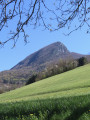
This varied hike around the village of Arnave takes you over four mountain passes in a landscape dominated by the lofty silhouette of the Teste de Cuing. Alternating between woodland trails, forest tracks and balcony paths, it offers beautiful views of the Ariège Pyrenees and the Tarascon-sur-Ariège basin. There are a few sections on roads that are generally quiet outside the summer season.
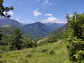
The Saint-Paul Chapel in Arnave
 Tourist office
 3.20 mi
+1,217 ft
-1,191 ft
2h 30
Moderate
Departure from Arnave (Ariège)
3.20 mi
+1,217 ft
-1,191 ft
2h 30
Moderate
Departure from Arnave (Ariège)
This route, which circles the village of Arnave, is particularly dedicated to visiting the Romanesque chapel of Saint-Paul, a jewel of tranquillity in a rural setting. From its promontory, it invites you to take your time and enjoy the peace and quiet.
Loop from Arnave via the Col d'Ijou
 3.37 mi
+1,243 ft
-1,247 ft
2h 40
Moderate
Departure from Arnave (Ariège)
3.37 mi
+1,243 ft
-1,247 ft
2h 40
Moderate
Departure from Arnave (Ariège)
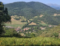
This loop takes you from the village of Arnave up to the Col d'Ijou, where you can see the village of Croquié before starting the descent via the village of Serres. You can also admire the beautiful view of the Pyrenees at various points along the walk.
Tour of the Beille Plateau
 4.87 mi
+860 ft
-853 ft
3h 00
Easy
Departure from Albiès (Ariège)
4.87 mi
+860 ft
-853 ft
3h 00
Easy
Departure from Albiès (Ariège)
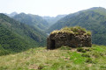
This circular hike will take you across the Plateau de Beille, offering beautiful views of the eastern Ariège Pyrenees throughout the hike.
When you reach the top of the plateau, you may encounter a few herds grazing (goats, cows or Mérens horses).
From Tarascon-sur-Ariège to Junac and back
 7.60 mi
+912 ft
-935 ft
4h 15
Moderate
Departure from Tarascon-sur-Ariège (Ariège)
7.60 mi
+912 ft
-935 ft
4h 15
Moderate
Departure from Tarascon-sur-Ariège (Ariège)
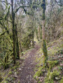
A walk starting from Tarascon-sur-Ariège that will take you to Junac, passing through the small village of Alliat and overlooking the village of Niaux.
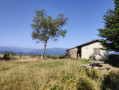
The Cabane des Carmilles from Les Brougues
 2.88 mi
+689 ft
-705 ft
1h 55
Easy
Departure from Mercus-Garrabet (Ariège)
2.88 mi
+689 ft
-705 ft
1h 55
Easy
Departure from Mercus-Garrabet (Ariège)
Most of the hike takes place in the forest on easy trails. At Les Brougues, and especially at the Cabane de Carmilles, you have a beautiful view of the Pyrenees. A beautiful hike for a very hot day!
The starting point for this hike is not accessible in snowy conditions.
Mont Fourcat via Croquié
 5.88 mi
+2,598 ft
-2,618 ft
5h 00
Moderate
Departure from Mercus-Garrabet (Ariège)
5.88 mi
+2,598 ft
-2,618 ft
5h 00
Moderate
Departure from Mercus-Garrabet (Ariège)
At an altitude of 2,000 metres, Mont Fourcat is the northernmost peak of the Cirque des Monts d'Olmes. It offers a vast view of the plain to the north and a view of the entire Ariège mountain range to the south and west. Beyond that, on a clear day, you can even see the Maladetta glacier in the distance. To the east, the view plunges into the Cirque des Monts d'Olmes, dominated by the imposing Saint-Barthélemy.
You first climb through a beautiful forest and as soon as you reach the open space among the ferns and heather, which then give way to rhododendrons, broom and gispet, you can enjoy a beautiful view as you walk along a ridge formed by continuous grassy hillocks leading to the summit.
This outing is quite challenging (800 m elevation gain), but the route is entirely on very comfortable trails and tracks, hence its "medium" rating.
Aynat Route
 3.80 mi
+1,158 ft
-1,132 ft
2h 45
Moderate
Departure from Mercus-Garrabet (Ariège)
3.80 mi
+1,158 ft
-1,132 ft
2h 45
Moderate
Departure from Mercus-Garrabet (Ariège)
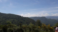
A short outing for an afternoon of snowshoeing in the woods with magnificent views of the Ariège Pyrenees towards Andorra.
Quioulès Hut and return via the Orri des Ludines
 9.18 mi
+2,933 ft
-2,913 ft
6h 45
Difficult
Departure from Ariège
9.18 mi
+2,933 ft
-2,913 ft
6h 45
Difficult
Departure from Ariège
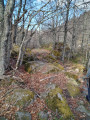
Circular route to the Quioules hut, returning via the Rieufort de Gascous and Ludines huts.
No technical difficulties (a bit steep at times – this is the Ariège, after all), but the second part of the route is mainly off-track, sometimes a faint track, sometimes nothing at all, and therefore requires good sense of direction or careful following of your GPS track.Classified as difficult due to the unmarked route and the steep gradients in places.
Stunning views of the Aston massif, the Pic de l’Homme Mort, the beautiful huts and, on the return journey, the Soularac, Saint Barthélémy and Pic du Han. The outward leg along the Ruisseau de Quioulès offers the chance to discover some lovely pools.
This walk can be done in the opposite direction, which would certainly offer a fine view of the Aston massif, but the ascent would then be concentrated in the first section.
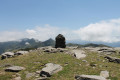
Le Fourcat from La Peyregade
 7.32 mi
+3,514 ft
-3,501 ft
6h 25
Difficult
Departure from Montferrier (Ariège)
7.32 mi
+3,514 ft
-3,501 ft
6h 25
Difficult
Departure from Montferrier (Ariège)
This hike takes you to the first peak over 2,000 metres from Toulouse, with magnificent views from the summit.
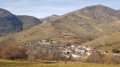
Marmare Pass, starting from Caussou
 6.07 mi
+1,752 ft
-1,742 ft
4h 20
Moderate
Departure from Caussou (Ariège)
6.07 mi
+1,752 ft
-1,742 ft
4h 20
Moderate
Departure from Caussou (Ariège)
Caussou, a small, typical mountain village, is the starting point for this hike to the Col de Marmare.
Yellow markings, a lovely path. No difficulties apart from the fairly steep climb to the pass.
Col de Campels via Chemin de la Teillette
3.44 mi
+741 ft
-725 ft
2h 15
Easy
Departure from Génat (Ariège)
A lovely off-trail walk through the forest and boxwood trees.
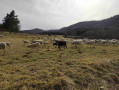
The Génat Plateau
 3.35 mi
+472 ft
-456 ft
1h 55
Easy
Departure from Génat (Ariège)
3.35 mi
+472 ft
-456 ft
1h 55
Easy
Departure from Génat (Ariège)
A lovely viewpoint, a dolmen and a rural plateau.
Génat Forest - Route No. 2
 4.06 mi
+961 ft
-961 ft
2h 40
Easy
Departure from Génat (Ariège)
4.06 mi
+961 ft
-961 ft
2h 40
Easy
Departure from Génat (Ariège)
A pleasant family walk in a beech forest, interesting in all seasons, including for snowshoeing.
La Peyregade to Martinat circular route
 4.09 mi
+869 ft
-896 ft
2h 40
Easy
Departure from Montferrier (Ariège)
4.09 mi
+869 ft
-896 ft
2h 40
Easy
Departure from Montferrier (Ariège)
A short circular walk for the whole family, from the hamlet of La Peyregade to Martinat and back along the Touyre stream.
Le Roc du Querquéou via the three passes
 9.31 mi
+3,291 ft
-3,320 ft
7h 10
Difficult
Departure from Génat (Ariège)
9.31 mi
+3,291 ft
-3,320 ft
7h 10
Difficult
Departure from Génat (Ariège)
Despite its modest altitude (1,840 m), Roc de Querquéou offers a superb view of the many peaks of the Haute Ariège. After the beautiful climb through the woods to Col du Pla de Faradu and then Col de Lastris, you will need to redouble your efforts to climb the extremely steep ridge that leads to the summit. The return journey takes you via the Col de la Bène and the pretty pastoral site of La Grangette d'en Bas before returning to Génat.
A circular walk starting from Mercus-Garrabet
 5.34 mi
+509 ft
-492 ft
2h 55
Easy
Departure from Mercus-Garrabet (Ariège)
5.34 mi
+509 ft
-492 ft
2h 55
Easy
Departure from Mercus-Garrabet (Ariège)
An easy circular walk starting from Mercus-Garrabet and leading to the Pont du Diable.
Les Monts d'Olmes - Moulzoune and Taula circular aerial
 4.72 mi
+1,247 ft
-1,250 ft
3h 15
Moderate
Departure from Montferrier (Ariège)
4.72 mi
+1,247 ft
-1,250 ft
3h 15
Moderate
Departure from Montferrier (Ariège)
Wide open spaces with aerial views of the Monts d'Olmes massif; reminders of an industrial past with old quarries; paths through the forest, then along ridges offering magnificent panoramic views, a small lake, two huts... Simply bliss for a family walk that everyone can enjoy!
Étang des Truites and Étang du Diable
 9.16 mi
+2,733 ft
-2,713 ft
6h 35
Difficult
Departure from Montferrier (Ariège)
9.16 mi
+2,733 ft
-2,713 ft
6h 35
Difficult
Departure from Montferrier (Ariège)
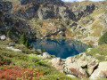
This hike in the Tabe Massif leads to the Étang des Truites and then the Étang du Diable, both nestled beneath the Pic de Soularac and the Pic de Saint-Barthélemy, which they form part of the ascent routes for. The passage through the old talc quarries of La Porteille and Fangas adds a moving historical touch. Finally, on the way back, the Étang de Moulzoune offers a peaceful break in a magnificent setting.
Pic de Saint-Barthélemy via Moulzoune
 8.37 mi
+3,432 ft
-3,432 ft
6h 50
Difficult
Departure from Montferrier (Ariège)
8.37 mi
+3,432 ft
-3,432 ft
6h 50
Difficult
Departure from Montferrier (Ariège)
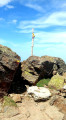
Superb viewpoint over the entire eastern part of the Pyrenees. The Pic de Saint-Barthélemy also offers an exceptional view of the plain to the north. It is easily identifiable on a clear day from the motorway...
The route combines beech forest, where the small Lac de Moulzoune nestles, two old quarries, grassy hilltops overlooking two high-altitude lakes, a small forest of mountain pines and ends with a stony ridge covered with rhododendrons.
Étang de Moulzoune - Pic de Soularac - Pic de Saint-Barthélémy
 9.73 mi
+4,144 ft
-4,134 ft
8h 05
Very difficult
Departure from Montferrier (Ariège)
9.73 mi
+4,144 ft
-4,134 ft
8h 05
Very difficult
Departure from Montferrier (Ariège)
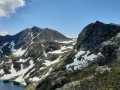
Loop starting from the Étang de Moulzoune via the peaks of Soularac and Saint-Barthélémy. To be done between June and November, checking that there is no snow on the north side (visible from Lavelanet), as access would be difficult.
The Roc de la Gourgue
 8.92 mi
+1,959 ft
-1,962 ft
5h 50
Moderate
Departure from Montferrier (Ariège)
8.92 mi
+1,959 ft
-1,962 ft
5h 50
Moderate
Departure from Montferrier (Ariège)
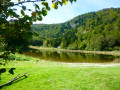
Despite its modest altitude (1,618 m), this peak, well known to paragliders, offers a 360° panorama including the Cathar fortress of Montségur and the Montagne de Tabe. The circuit begins with a steady climb through the Bois de Montminier and continues over wide, grassy ridges that present no difficulty. On the way back, the Lac de Moulzoune and its picnic area offer a very pleasant place to stop.
Circular in the Touyre Valley from Montferrier to La Peyregade
 6.23 mi
+1,440 ft
-1,411 ft
4h 05
Moderate
Departure from Montferrier (Ariège)
6.23 mi
+1,440 ft
-1,411 ft
4h 05
Moderate
Departure from Montferrier (Ariège)
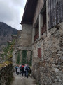
A short hike in the Touyre Valley, starting from Monferrier, passing in front of the entrance to an old mine, and returning via the hamlet of La Peyregade. There are no difficulties or steep slopes. It can sometimes be muddy due to the proximity of the stream.
Circular Montferrier via the Freychinadel stream
6.56 mi
+1,509 ft
-1,535 ft
4h 20
Moderate
Departure from Montferrier (Ariège)
A circular route starting from Montferrier, mainly through woods, with a section near the Château de Montségur and a return along the Ruisseau de Freychinadel. The route is not always well marked, so follow the trail and instructions carefully at junctions.
The Embizon Pond
 10.48 mi
+3,402 ft
-3,383 ft
7h 45
Difficult
Departure from Savignac-les-Ormeaux (Ariège)
10.48 mi
+3,402 ft
-3,383 ft
7h 45
Difficult
Departure from Savignac-les-Ormeaux (Ariège)
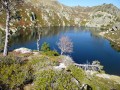
The Étang d’Embizon, well known to anglers, is much less frequented by hikers. It is true that the steep gradient at the end of the route, combined with long stretches without any signposting, may discourage some. And that is a great pity because, after the effort involved, this magnificent high-altitude lake is truly a reward of the highest order.
Circular des Tisserants, from Montferrier to Pog de Montségur
 8.17 mi
+2,359 ft
-2,336 ft
5h 50
Moderate
Departure from Montferrier (Ariège)
8.17 mi
+2,359 ft
-2,336 ft
5h 50
Moderate
Departure from Montferrier (Ariège)
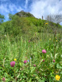
A short walk in the Ariège following the routes of the Cathar Trail and the Weavers’ Trail, first heading to the Pog de Monstégur and then venturing into the hills at the foot of the Madoual!