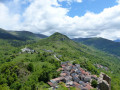
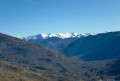
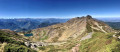
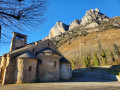
The church at Axiat and Lordat Castle as seen from Luzenac Garanou station

From the railway tracks to the peaks of the Ariège! Setting off from Luzenac station, escape on a unique trail amidst the cool mountain streams, shady forests and the majestic ruins of Lordat Castle. A circular route combining nature and history, accessible by train.

Details

98367200
Creation:
Last update:
Last review:
  • Walking
    Activity: Walking
  • ↔
    Distance: 6.47 mi
  • ◔
    Average duration: 4h 20 
  • ▲
    Difficulty: Moderate

  • ⚐
    Back to start: Yes
  • ↗
    Ascent: + 1,516 ft
  • ↘
    Descent: - 1,506 ft

  • ▲
    Highest point: 3,064 ft
  • ▼
    Lowest point: 1,903 ft

Photos

Description of the walk

Start from Luzenac Garanou station; you can park there or on the main street in Garanou

(S/E) With your back to the railway tracks, head left then turn right onto the D420 towards Garanou. Cross the road bridge over the Ariège then follow the narrow lane that climbs up opposite.

(1) At the junction, turn left towards the church and, at the next junction, opposite the fountain, turn left onto the main street. Ignore the church on your left and continue along the road to the right until you reach the cemetery.

(2) Carry on along the path that continues from the road until you reach a fork.

(3) Carry on to the left until you reach the next fork.

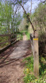
(4) Take a hairpin bend to the right and climb up to the bridge over a stream.

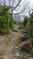
(5) Cross the bridge and continue through the woodland. After a series of wide hairpin bends, continue along the hillside, pass the base of the telecoms pylon and carry on straight ahead. At the track, turn right and head for No. 20 in the hamlet of Axiat.

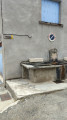
(6) Continue along the road, pass the wash house (drinking water) and head for the church.

(7) After taking in the surroundings, return along the same route as on the way out to No. 20.

(6) Leave the tarmac and take the path on the left down to a three-way junction.

(8) Keep to the left and you’ll reach a car park in Lordat. Turn right and you’ll soon reach the path leading to the castle.

(9) Follow this path to reach the castle ruins.

(10) After taking in the views, head back down to the bottom of the access path.

(9) Turn right, then left, and carry on straight ahead until you reach Lordat church.

(11) Continue downhill towards the Town Hall, walk alongside it and follow the D55 until you come to a path on the right.

(12) Take a sharp right onto this path and, at the second hairpin bend, continue along the path opposite. At the road, make the first turn right then left and follow the track down to the tarmac.

(13) Cross the road and take the narrow lane running alongside it. Then keep to the left, take the steps and make a first turn left then right to join the footpath towards the Town Hall. Walk past the Town Hall on your left and continue downhill. Cross the departmental road and take the path at the end of the wall, opposite, on the left.

(14) At the road, continue downhill, walk past the church, then take the path that starts with a sharp bend to the right. At the road, turn right uphill slightly, then left downhill, and reach a four-way junction. Take a sharp left-hand bend and rejoin the route you took earlier at the bottom of Rue de la Mairie.

(1) Take the narrow lane leading down to the left and, following the route in reverse to the one taken on the way there, arrive at Luzenac Garanou station (S/E).

Waypoints

  1. S/E : mi 0 - alt. 1,913 ft - Gare de Luzenac-Garanou
  2. 1 : mi 0.24 - alt. 1,959 ft - Junction of the circular loop
  3. 2 : mi 0.6 - alt. 2,090 ft - Cemetery
  4. 3 : mi 1.1 - alt. 2,110 ft - Junction
  5. 4 : mi 1.37 - alt. 1,975 ft - Junction
  6. 5 : mi 1.93 - alt. 2,431 ft - Cassagne Bridge
  7. 6 : mi 3.28 - alt. 2,867 ft - Crossroads – Access to Axiat Church
  8. 7 : mi 3.48 - alt. 2,897 ft - Église Saint-Julien (Axiat)
  9. 8 : mi 4.16 - alt. 2,776 ft - Junction
  10. 9 : mi 4.43 - alt. 2,943 ft - Path leading to the château
  11. 10 : mi 4.52 - alt. 3,064 ft - Chateau de Lordat
  12. 11 : mi 4.71 - alt. 2,904 ft - Église Notre-Dame de l'Assomption (Lordat)
  13. 12 : mi 4.95 - alt. 2,838 ft - Path on the right
  14. 13 : mi 5.26 - alt. 2,566 ft - Route
  15. 14 : mi 5.57 - alt. 2,290 ft - Route
  16. S/E : mi 6.47 - alt. 1,913 ft - Luzenac Garanou station - Ariège (rivière)

Notes

(3) You can turn right to reach the ruined castle (10).

The Axiat wash house has a tap with drinking water.

A route accessible without a car from Luzenac station (Toulouse–Latour-de-Carol line).
This magnificent route takes you on a journey through unspoilt countryside, picturesque villages and medieval heritage as you pass through Luzenac, Garanou, Axiat and Lordat. It’s a real delight to stroll along these paths: the route initially climbs alongside the water, lulled by a pleasant breeze and the poetic murmur of the Axiat and Cassagne streams.

As for the effort involved, expect a few steep climbs, but there are far more gentle sections where you can catch your breath. The trail alternates perfectly between the full sunshine of the hills, offering splendid views of the mountains, and the cool shade of the forest.

A handy bonus: you’ll regularly walk alongside the water to cool off, and you’ll find drinking water points to fill your water bottles at the Axiat washhouse and in Luzenac-Haut. After admiring the superb Romanesque church at Axiat, the route climbs towards the highlight of the walk: the majestic Château de Lordat and its breathtaking panorama of the Pyrenees, before descending through its authentic village.

The walk takes 4 hours.

Worth a visit

Other walks in the area

For more walks, use our search engine .

The GPS track and description are the property of this route's author. Please do not copy them without permission.