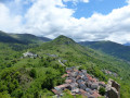
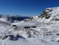
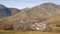
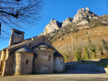
The Cabane de Sauzet as seen from Luzenac-Garanou station

This forest path follows the course of the Ruisseau de Lavail. It is a very shaded round-trip walk, right in the heart of the forest, which leads out onto the large plain where the Cabane de Sauzet is situated. The cool air and the murmur of the stream will ensure you have a pleasant time, despite the constant effort required as the route has virtually no flat sections. You should plan for several breaks, but you’ll easily find plenty of places to access the river to cool off.

Details

101353988
Creation:
Last update:
Last review:
  • Walking
    Activity: Walking
  • ↔
    Distance: 8.73 mi
  • ◔
    Average duration: 6h 10 
  • ▲
    Difficulty: Moderate

  • ⚐
    Back to start: Yes
  • ↗
    Ascent: + 2,497 ft
  • ↘
    Descent: - 2,497 ft

  • ▲
    Highest point: 4,413 ft
  • ▼
    Lowest point: 1,913 ft

Description of the walk

Starting point at Luzenac SNCF station. If you’re travelling by car, you can park there or at various points in the village; otherwise, take the forest road from (5) to (6).

(S/E) With your back to the station, turn right onto Rue Principale D2 and follow it to the Coccimarket supermarket.

(1) Turn right, cross the road bridge over the railway line, and carefully cross the N20 by taking a right-left turn.

(2) Take the first path on your left. You’ll come to a road; follow it to the left; the path on the right, which goes uphill, is not maintained.

(3) There is a well-maintained path on the right leading uphill. You can also follow the road.

(4) There is a well-maintained path on the left. You can also follow the road.

(5) Leave the tarmac road and take a forest track.

(6) Pass the car park.

(7) Ignore the path on the left that crosses the stream, and carry on straight ahead, staying on the same bank; then, at the bend in the forest track, head straight ahead.

(8) Pass the EDF facility (aqueduct).

(9) Cross the bridge over the Ruisseau de Lavail, and continue along the track on your right on the other bank.

(10) At the junction with another track, carry straight on.

(11) You’ll come to a fork in the path; both lead to the same place, but I recommend the one on the left, as it’s more direct.

(12) You’ll reach the plain and the Cabane de Sauzet (alt. 1,341 m) on your right . You can stay overnight at the Cabane de Sauzet.
Turn back and, following the same route as on the way there, head back to Luzenac railway station (S/E).

Waypoints

  1. S/E : mi 0 - alt. 1,916 ft - Gare de Luzenac-Garanou
  2. 1 : mi 0.48 - alt. 1,942 ft - Coccimarket
  3. 2 : mi 0.54 - alt. 1,978 ft - Dirt track
  4. 3 : mi 1.09 - alt. 2,287 ft - Dirt track
  5. 4 : mi 1.34 - alt. 2,418 ft - Dirt track
  6. 5 : mi 1.67 - alt. 2,513 ft - Forest track
  7. 6 : mi 2.34 - alt. 2,900 ft - Car park
  8. 7 : mi 2.39 - alt. 2,923 ft - Crossroads
  9. 8 : mi 3.28 - alt. 3,461 ft - EDF installation
  10. 9 : mi 3.36 - alt. 3,550 ft - Bridge
  11. 10 : mi 3.59 - alt. 3,750 ft - Crossroads
  12. 11 : mi 3.66 - alt. 3,816 ft - Two trails
  13. 12 : mi 4.31 - alt. 4,409 ft - Cabane de Sauzet
  14. S/E : mi 8.73 - alt. 1,916 ft - Gare de Luzenac-Garanou

Notes

Coccimarket in Luzenac

Spend the night in a tent or at the Cabane de Sauzet at the top.

Personal walking time: 2 hours 30 minutes uphill and 2 hours downhill (not including short breaks).

Including breaks along the way to drink and rest: 2 hours 45 minutes’ ascent and 2 hours 10 minutes’ descent.

Worth a visit

Waterfall and pools.

Other walks in the area

For more walks, use our search engine .

The GPS track and description are the property of this route's author. Please do not copy them without permission.