Climb up the slopes of the Tabe massif from Les Cabannes

A beautiful but challenging hike in the mid-mountain range, along little-used paths through unspoilt countryside, offering lovely views over the Ariège Valley and the surrounding mountains. Directly accessible by TER from Toulouse.

Details

68917293
Creation:
Last update:
Last review:
  • Walking
    Activity: Walking
  • ↔
    Distance: 8.43 mi
  • ◔
    Average duration: 6h 50 
  • ▲
    Difficulty: Difficult

  • ⚐
    Back to start: Yes
  • ↗
    Ascent: + 3,366 ft
  • ↘
    Descent: - 3,369 ft

  • ▲
    Highest point: 4,475 ft
  • ▼
    Lowest point: 1,729 ft

Photos

Description of the walk

Start from Les Cabannes railway station.

(S/E) Set off with your back to the station and turn left onto the main road (D522A). Very soon, turn left again onto the Route de Verdun (D120). Cross the level crossing, then take the bridge over the Ariège and the RN20.

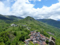
(1) At the end of the bridge, head straight up into the village of Verdun, taking the small street on the right which leads to a wash house. Continue straight on along the Chemin de Peyret, which bends to the left. Just after this bend, take a track on the right which climbs due east into the mountains, running alongside a farm. Continue to the four-way crossroads.

(2) Ignore the track you come across and carry on straight ahead along the path (markedPR®), which gradually gains altitude through the forest. Continue climbing along this hillside path, which eventually heads due north towards the Pas de Toulzan.

(3) From the Pas de Toulzan, carry on in the same direction, following the signs for Verdun. The path winds downhill through the trees in a small, damp valley before emerging onto a track with information boards and a dam.

(4) Head up this track to the right, then very soon you’ll come across a small path on the right through the forest. This path climbs alongside a stream until it joins a tarmac road (D20) near a bridge over the Ruisseau des Moulines.

(5) Cross the road to take another path opposite, continuing in the same direction. Cross a small bridge; the path continues to climb and crosses another bridge. The hairpin bends become increasingly tight and steep beneath the fir trees, before opening out onto the clearing at the Cabane des Gardes.

You can stop the climb here and consider turning back. See practical information.

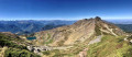
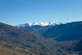
(6) Continue the climb by following the hairpin bends heading due north behind the hut on the left. Ignore a path branching off to the right and carry on along the hairpin bends until they end. Do not head down to the valley floor on the right, but turn left to leave the forest and come out onto a wide, open track. A beautiful panorama of the valley and the surrounding mountains then opens up.

(7) From there, head back down the same path in the opposite direction to the way you came, until you reach the junction with the track near the dam.

(4) Leave the path you took on the way up and turn right onto the downhill track, which joins a tarmac road at a hairpin bend on the D120. Continue downhill along the road towards the village of Verdun. A small path on the left allows you to cut across the hairpin bends. Enter Verdun via the Route des Côtes, which leads to a junction with several streets at a place called Barry-d’en-haut.

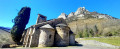
(8) Take a short detour to the right along Rue du Rempart to visit the magnificent Romanesque church of Saint-Blaise. Take the first street on the left to return to the Route des Côtes, which passes in front of the town hall before turning left, then right, to return to the bridge over the Ariège that you crossed on the way out.

(1) Follow the outward route in the opposite direction to return to the station (S/E).

Waypoints

  1. S/E : mi 0 - alt. 1,755 ft - Gare de Les Cabannes
  2. 1 : mi 0.46 - alt. 1,749 ft - Junction of the lower circular loop - Ariège (rivière)
  3. 2 : mi 0.74 - alt. 1,929 ft - Trail junction
  4. 3 : mi 1.71 - alt. 3,150 ft - Pas de Toulzan
  5. 4 : mi 2.51 - alt. 2,493 ft - Dam
  6. 5 : mi 3.03 - alt. 2,910 ft - Tarmac road (D20)
  7. 6 : mi 3.65 - alt. 3,625 ft - The flat stretch at the Cabane des Gardes
  8. 7 : mi 4.37 - alt. 4,475 ft - Panoramic view of the valley
  9. 8 : mi 7.26 - alt. 1,926 ft - Le Barry-d’en-haut - Église Saint-Blaise de Verdun (Ariège)
  10. S/E : mi 8.43 - alt. 1,755 ft - Gare de Les Cabannes

Notes

Alternatives at (6).
- If you do not climb up to point (7), this reduces the elevation gain of the walk by around 250 m by descending directly to point (5) on the D20 via the same route as on the way up,
- Or, better still, continue along the nature trail which runs horizontally to the right of the hut (IGN route) and descends via a circular route.

Duration: between 4 and 7 hours depending on your fitness level and the breaks you take.
A good level of fitness is required: there are no particular difficulties, but the elevation gain is significant and the switchbacks between points (5) and (7) are quite steep.

Always be cautious and plan ahead when you're outdoors. Visorando and the author of this route cannot be held responsible for any accidents occurring on this route.

The GR® and PR® markings are the intellectual property of the Fédération Française de Randonnée Pédestre.

Reviews and comments

4.3 / 5
Based on 3 reviews

Reliability of the description
4.3 / 5
Ease of following the route
4.3 / 5
Route interest
4.3 / 5
Fargote
Fargote

Overall rating : 4 / 5

Date of your route : May 23, 2026
Reliability of the description : ★★★★☆ Good
Ease of following the route : ★★★★☆ Good
Route interest : ★★★★☆ Good
Very busy route : No

Hello, a lovely walk in the shade for most of the day – which is lovely in summer
We didn’t see a soul; lovely scenery
The route is very well signposted
If you’re up for it, there are plenty more walks to do in the area

Machine-translated

User 26536181

Overall rating : 5 / 5

Date of your route : Jul 21, 2025
Reliability of the description : ★★★★★ Very good
Ease of following the route : ★★★★★ Very good
Route interest : ★★★★★ Very good
Very busy route : Yes

Great circuit. The Visorando route is the opposite of the map at the car park. The Visorando route is shorter, through forest and grass until the main peak, then long and rocky all the way back.... So it depends on what you prefer to do. I was running on flat ground and downhill, so a rocky return was much better for me (the route suggested by Visorando).
Great loop but could definitely become wet and muddy after heavy rain. The route matched the map perfectly.

Machine-translated

Marie-therese arsuffi

Overall rating : 4 / 5

Date of your route : Apr 02, 2025
Reliability of the description : ★★★★☆ Good
Ease of following the route : ★★★★☆ Good
Route interest : ★★★★☆ Good
Very busy route : No

It’s a pleasant walk along the path – not too many stones
We arrived at the hut just a little way above the end of the walk
Perfect weather for this walk on 29 March 2025
The elevation gain is approximately 2 x 500 metres

Machine-translated

Other walks in the area

For more walks, use our search engine .

The GPS track and description are the property of this route's author. Please do not copy them without permission.